Category:Broad Street (Pennsylvania Route 611, Philadelphia)
Jump to navigation
Jump to search
street in Philadelphia, Pennsylvania, USA  | |||||
| Upload media | |||||
| Instance of | |||||
|---|---|---|---|---|---|
| Location | Philadelphia, Philadelphia County, Pennsylvania | ||||
| Length |
| ||||
 | |||||
Broad Street in Philadelphia is the main north-south street in Center City, going through (as a pedestrian walk) City Hall. Dozens of National Register of Historic Places sites line the street, as do the famous shipyard, football and baseball stadiums, PMHC historic plaques, etc. All but the northern 0.6 mile is part of Pennsylvania Route 611.
Subcategories
This category has the following 7 subcategories, out of 7 total.
B
N
P
S
Media in category "Broad Street (Pennsylvania Route 611, Philadelphia)"
The following 27 files are in this category, out of 27 total.
-
 1894FOREPAUGH.jpg 1,576 × 1,462; 378 KB
-
 20220714StationWarehouse.jpg 2,002 × 1,209; 1.6 MB
-

-
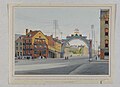
 Broad Street, North from City Hall (NBY 9348).jpg 824 × 515; 103 KB
-
 Broad Street, Philadelphia, PA (9302088804).jpg 2,356 × 1,200; 348 KB
-
-
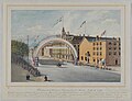 Centennial Grand Triumphal Arch Philadelphia HSP.jpg 700 × 534; 74 KB
-
-

-

-
 Gulf Gasoline Service station 1922 newspaper.png 1,832 × 2,284; 92 KB
-
 Hearse philadelphia.jpg 1,330 × 648; 152 KB
-
 Ki on broad 1905.jpeg 250 × 325; 44 KB
-
 Kiralfy's Alhambra Palace, Philadelphia, the Illuminated Gardens (9299329849).jpg 2,102 × 1,200; 406 KB
-
 Laying the Corner Stone of the Public Building, Philadelphia (9299330135).jpg 1,863 × 1,200; 279 KB
-
 Looking North on Broad S(tree)t, City Hall in Distance, Philadia, Penna (9299330499).jpg 2,413 × 1,200; 480 KB
-
 Looking up Broad Street from Spruce Street LCCN2007666534.jpg 6,616 × 8,656; 11.72 MB
-

-
 Philadelphia Liberty Loan's Parade.jpg 974 × 547; 98 KB
-
 Roman Catholic High School Philly.jpg 2,462 × 1,846; 2.02 MB
-
 RS18661928Furness.jpg 587 × 748; 43 KB
-

-

-

-

-
 View of Construction of New City Building, Philadelphia (9302116992).jpg 1,866 × 1,200; 406 KB
-
 Cor. Broad and Arch Sts., Philadelphia. Building the Masonic Temple, by S. R. Morse.jpg 2,737 × 1,429; 1.41 MB


.jpg)
.jpg)
.jpg)


.jpg)


.jpg)
.jpg)
t,_City_Hall_in_Distance,_Philadia,_Penna_(9299330499).jpg)


.jpg)

.jpg)
.jpg)
