Category:Brinkhill
Jump to navigation
Jump to search
village in the United Kingdom  | |||||
| Upload media | |||||
| Instance of | |||||
|---|---|---|---|---|---|
| Location | East Lindsey, Lincolnshire, East Midlands, England | ||||
 | |||||
Subcategories
This category has the following 2 subcategories, out of 2 total.
Media in category "Brinkhill"
The following 49 files are in this category, out of 49 total.
-
 Autumn Colours near Brinkhill - geograph.org.uk - 2673577.jpg 1,280 × 960; 475 KB
-
 Bridleway at Brinkhill - geograph.org.uk - 4150076.jpg 1,600 × 1,200; 523 KB
-
 Bridleway to Belmont Plantation - geograph.org.uk - 3546038.jpg 640 × 427; 79 KB
-
 Brinkhill - geograph.org.uk - 3451396.jpg 640 × 427; 69 KB
-

-
 Brinkhill, aerial 2017 - geograph.org.uk - 5391173.jpg 1,024 × 683; 118 KB
-
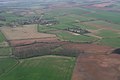 Brinkhill, aerial, 2013 - geograph.org.uk - 3451418.jpg 640 × 427; 45 KB
-
 Brinkhill, medieval moat - geograph.org.uk - 3451408.jpg 640 × 427; 54 KB
-

-
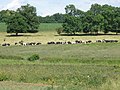 Dairy cattle by Red Hill - geograph.org.uk - 1932700.jpg 3,648 × 2,736; 2.08 MB
-
 Down the hill to Brinkhill - geograph.org.uk - 4045040.jpg 640 × 427; 47 KB
-

-
 Entering Brinkhill - geograph.org.uk - 6101138.jpg 3,648 × 2,736; 5.12 MB
-
 Entrance to Public footpath at Harrington Hill - geograph.org.uk - 2910119.jpg 682 × 1,024; 366 KB
-
 Farmland near Brinkhill - geograph.org.uk - 4150084.jpg 1,600 × 1,200; 386 KB
-
 Fields towards Brinkhill - geograph.org.uk - 3537755.jpg 2,256 × 1,504; 2.05 MB
-
 Footpath to Driby from Brinkhill - geograph.org.uk - 3544597.jpg 640 × 427; 52 KB
-
 Ford and Footbridge on Bridleway to Driby - geograph.org.uk - 1883613.jpg 3,872 × 2,592; 2.39 MB
-
 Green Lane to Brinkhill - geograph.org.uk - 3546030.jpg 640 × 427; 89 KB
-

-
 Green Lane, Brinkhill - geograph.org.uk - 3544605.jpg 640 × 427; 76 KB
-
 Harrington Carr, aerial 2019 - geograph.org.uk - 6334023.jpg 800 × 533; 79 KB
-
 Harrington Hill, aerial 2016 - geograph.org.uk - 5229042.jpg 640 × 427; 58 KB
-
 Harrington Hill, aerial 2017 - geograph.org.uk - 5471056.jpg 427 × 640; 52 KB
-
 Icy track east of Fox Covert - geograph.org.uk - 4831557.jpg 3,888 × 5,184; 6.17 MB
-
 Moated site at Brinkhill, aerial 2018 - geograph.org.uk - 5846678.jpg 1,024 × 683; 134 KB
-
 Moated site in the centre of Brinkhill - geograph.org.uk - 3544599.jpg 800 × 533; 154 KB
-
 Old track west of Brinkhill - geograph.org.uk - 482702.jpg 640 × 482; 102 KB
-
 Ordnance Survey Cut Mark - geograph.org.uk - 5481725.jpg 640 × 328; 88 KB
-
 Path north of Fox Covert - geograph.org.uk - 4831555.jpg 5,184 × 3,888; 6.42 MB
-
 Pathway through crops east of Brinkhill - geograph.org.uk - 2150602.jpg 1,024 × 768; 267 KB
-

-
 Road Junction near Brinkhill - geograph.org.uk - 2675283.jpg 1,280 × 960; 278 KB
-
 Road towards Harrington Hill - geograph.org.uk - 4150088.jpg 1,600 × 1,200; 419 KB
-
 Sharp bend at Red Hill - geograph.org.uk - 482687.jpg 640 × 482; 80 KB
-
 South Ormsby, aerial September 2018 - geograph.org.uk - 5964996.jpg 640 × 427; 61 KB
-
 The start of a footpath that descends to Brinkhill - geograph.org.uk - 5755896.jpg 4,000 × 3,000; 3.62 MB
-
 Track to Green Lane cottage - geograph.org.uk - 2673271.jpg 1,280 × 960; 230 KB
-

-

-
 Attractive approach to Harrington Hill - geograph.org.uk - 482709.jpg 640 × 482; 157 KB
-
 Cattle grid at Driby - geograph.org.uk - 581299.jpg 640 × 480; 79 KB
-
 Country lane to Driby - geograph.org.uk - 581306.jpg 640 × 480; 81 KB
-
 Countryside view at Driby - geograph.org.uk - 581289.jpg 640 × 480; 110 KB
-
 Farm road near Driby - geograph.org.uk - 581370.jpg 640 × 480; 128 KB
-
 Farm road near Driby - geograph.org.uk - 581378.jpg 640 × 480; 107 KB
-
 Farm road near Driby - geograph.org.uk - 581382.jpg 640 × 480; 90 KB
-
 Lane junction to Brinkfield - geograph.org.uk - 482810.jpg 640 × 482; 83 KB
-
 Sutterby Holt - geograph.org.uk - 112911.jpg 640 × 427; 91 KB


