Category:Bridleways in Northumberland
Jump to navigation
Jump to search
Ceremonial counties of England: Bedfordshire · Berkshire · Buckinghamshire · Cambridgeshire · Cheshire · Cornwall · Cumbria · Derbyshire · Devon · Dorset · Durham · East Riding of Yorkshire · East Sussex · Essex · Gloucestershire · Greater London · Greater Manchester · Hampshire · Herefordshire · Hertfordshire · Kent · Lancashire · Leicestershire · Lincolnshire · Merseyside · Norfolk · North Yorkshire · Northamptonshire · Northumberland · Nottinghamshire · Oxfordshire · Rutland · Shropshire · Somerset · South Yorkshire · Staffordshire · Suffolk · Surrey · Tyne and Wear · Warwickshire · West Midlands · West Sussex · West Yorkshire · Wiltshire · Worcestershire
City-counties:
Former historic counties:
Other former counties:
City-counties:
Former historic counties:
Other former counties:
Subcategories
This category has the following 4 subcategories, out of 4 total.
Media in category "Bridleways in Northumberland"
The following 46 files are in this category, out of 46 total.
-
 Apple blossom - geograph.org.uk - 467588.jpg 480 × 640; 168 KB
-
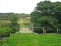 Bridge and bridleway over the Crane Burn - geograph.org.uk - 1501697.jpg 600 × 450; 109 KB
-

-
 Bridlepath - geograph.org.uk - 960214.jpg 640 × 480; 102 KB
-
 Bridlepath at Chirdon Head - geograph.org.uk - 535351.jpg 480 × 640; 98 KB
-
 Bridleway - geograph.org.uk - 1104528.jpg 640 × 389; 113 KB
-
 Bridleway - geograph.org.uk - 1104542.jpg 640 × 384; 105 KB
-
 Bridleway - geograph.org.uk - 912630.jpg 600 × 450; 102 KB
-
 Bridleway above Harehope Farm - geograph.org.uk - 1501672.jpg 600 × 450; 92 KB
-
 Bridleway above Shellbraes - geograph.org.uk - 1535631.jpg 600 × 450; 78 KB
-
 Bridleway alongside West Moor Wood - geograph.org.uk - 1753374.jpg 1,024 × 768; 250 KB
-
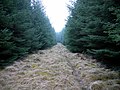
 Bridleway and Forest Ride - geograph.org.uk - 1753300.jpg 600 × 450; 308 KB
-
-
 Bridleway and the Crook Burn - geograph.org.uk - 1119962.jpg 640 × 480; 96 KB
-

-

-
 Bridleway at Farrickhill - geograph.org.uk - 1181533.jpg 640 × 360; 56 KB
-
-
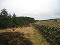
 Bridleway below Byerhope Bank (2) - geograph.org.uk - 1334648.jpg 640 × 480; 80 KB
-
 Bridleway below Byerhope Bank - geograph.org.uk - 1334638.jpg 640 × 480; 76 KB
-
 Bridleway crossing on Hangman Hill - geograph.org.uk - 882153.jpg 640 × 480; 74 KB
-

-

-
 Bridleway near Brocolitia - geograph.org.uk - 1119929.jpg 640 × 480; 134 KB
-
 Bridleway near Lees Hall - geograph.org.uk - 846684.jpg 640 × 480; 69 KB
-
 Bridleway north of Walwick - geograph.org.uk - 526572.jpg 640 × 480; 111 KB
-
 Bridleway on Anchey Rigg - geograph.org.uk - 1704509.jpg 640 × 480; 111 KB
-
 Bridleway on Anchey Rigg - geograph.org.uk - 1704512.jpg 640 × 480; 105 KB
-
 Bridleway on Anchey Rigg - geograph.org.uk - 1704514.jpg 640 × 480; 118 KB
-
 Bridleway on Anchey Rigg - geograph.org.uk - 1704516.jpg 640 × 480; 107 KB
-
 Bridleway Sign - geograph.org.uk - 888403.jpg 640 × 427; 84 KB
-
 Bridleway to A.1068 - geograph.org.uk - 1201500.jpg 640 × 480; 104 KB
-
 Bridleway to West Greenridge - geograph.org.uk - 1135753.jpg 640 × 480; 80 KB
-
 Bridleway towards Kimmer Crags and Lough - geograph.org.uk - 1438213.jpg 600 × 450; 102 KB
-
 Bridleway west of Crescent Farm - geograph.org.uk - 1174218.jpg 640 × 360; 52 KB
-
 Clennell Street - geograph.org.uk - 65145.jpg 640 × 480; 88 KB
-

-
 End of the tarmac - geograph.org.uk - 1135742.jpg 640 × 480; 93 KB
-
 Farm track, Kypie - geograph.org.uk - 12707.jpg 640 × 480; 81 KB
-
 Kink in Public Bridleway - geograph.org.uk - 1030994.jpg 640 × 480; 66 KB
-
 Public Bridleway to Lesbury - geograph.org.uk - 1030979.jpg 640 × 480; 79 KB
-
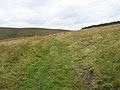
 Start of bridleway across Dryburn Moor - geograph.org.uk - 400123.jpg 640 × 480; 109 KB
-
 Tree by the Bridleway - geograph.org.uk - 1031012.jpg 640 × 480; 49 KB
-
 Watch the bog^ - geograph.org.uk - 158652.jpg 640 × 480; 117 KB
-
 Watson's Walls - geograph.org.uk - 888399.jpg 427 × 640; 76 KB
-
 A public bridleway in the Cheviot Hills - geograph.org.uk - 1021071.jpg 427 × 640; 131 KB


_-_geograph.org.uk_-_1334648.jpg)


