Category:Bridleways in Gwynedd
Jump to navigation
Jump to search
Subcategories
This category has the following 2 subcategories, out of 2 total.
P
- Pont Scethin (8 F)
T
- The Pony Path, Cadair Idris (20 F)
Media in category "Bridleways in Gwynedd"
The following 55 files are in this category, out of 55 total.
-
 A whin bordered bridle path - geograph.org.uk - 407230.jpg 640 × 480; 82 KB
-
 Bridle Path - geograph.org.uk - 547607.jpg 640 × 480; 101 KB
-
 Bridleway above Llwyngwril - geograph.org.uk - 1311431.jpg 640 × 480; 96 KB
-
 Bridleway above Tynyraelgerth - geograph.org.uk - 1012270.jpg 640 × 480; 55 KB
-

-

-
 Bridleway crossing the Mawddach Trail - geograph.org.uk - 1103561.jpg 640 × 480; 334 KB
-

-
 Bridleway through trees, Llwyngwril - geograph.org.uk - 1312686.jpg 480 × 640; 100 KB
-
 Bridleway to Graigddu-isaf - geograph.org.uk - 1613807.jpg 640 × 428; 93 KB
-
 Bridleway to Maes y pandy and Rhiwogof - geograph.org.uk - 1382994.jpg 640 × 480; 148 KB
-
 Bwlch y Rhiwgyr - geograph.org.uk - 1753039.jpg 1,024 × 768; 311 KB
-

-
 Checking the route on the Pony Path - geograph.org.uk - 1618267.jpg 640 × 428; 69 KB
-

-
 Dry stone walls, Llwyngwril - geograph.org.uk - 1312750.jpg 640 × 480; 102 KB
-
 Grazing land near Tal-y-garreg farm - geograph.org.uk - 1736079.jpg 640 × 428; 142 KB
-

-
 Joining the Coed Maes y Pandy - geograph.org.uk - 1383017.jpg 640 × 480; 156 KB
-
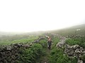 Misty bridleway below Craig-y-garn - geograph.org.uk - 1583569.jpg 640 × 480; 55 KB
-
 On the Pony Path - geograph.org.uk - 1313568.jpg 640 × 480; 94 KB
-
 Rhiw Goch - geograph.org.uk - 133059.jpg 428 × 640; 78 KB
-
 Stone by the Pony Path - geograph.org.uk - 1101358.jpg 640 × 480; 92 KB
-
 The Afon Cywarch near Penrhyn - geograph.org.uk - 716020.jpg 640 × 428; 86 KB
-
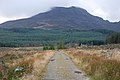
 The bridlepath and the valley - geograph.org.uk - 485450.jpg 640 × 427; 48 KB
-
 The Bwlch y Cribwr bridleway - geograph.org.uk - 468577.jpg 640 × 480; 163 KB
-
 The end of the Pony Path - geograph.org.uk - 1426927.jpg 640 × 425; 78 KB
-
 The Pony Path - 2 - geograph.org.uk - 1201369.jpg 640 × 400; 70 KB
-
 The Pony Path - geograph.org.uk - 1197491.jpg 640 × 417; 98 KB
-
 The Pony Path - geograph.org.uk - 1201354.jpg 640 × 417; 108 KB
-
 The Pony Path - geograph.org.uk - 1426871.jpg 640 × 425; 61 KB
-
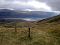
 Upper Valley path and bridleway - geograph.org.uk - 645493.jpg 640 × 480; 61 KB
-

-

-

-
 A Gateway - geograph.org.uk - 547624.jpg 640 × 480; 163 KB
-
 Bridleway - geograph.org.uk - 1439197.jpg 640 × 480; 97 KB
-
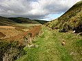 Bridleway along valley - geograph.org.uk - 601062.jpg 640 × 480; 107 KB
-
 Bridleway at Llanfihangel-y-pennant - geograph.org.uk - 429970.jpg 640 × 480; 91 KB
-
 Bridleway signpost - geograph.org.uk - 541860.jpg 428 × 640; 86 KB
-
 Bridleway through the woodland - geograph.org.uk - 442461.jpg 640 × 480; 182 KB
-
 Bridleway to Morfa Nefyn - geograph.org.uk - 1472193.jpg 640 × 428; 108 KB
-

-

-
 Gate across bridleway - geograph.org.uk - 601123.jpg 640 × 480; 83 KB
-
 Gate on the Pony Path - geograph.org.uk - 1426859.jpg 640 × 425; 80 KB
-

-
 New bridge - geograph.org.uk - 559919.jpg 640 × 480; 93 KB
-
 On the Pony Path - geograph.org.uk - 520483.jpg 800 × 600; 230 KB
-
 Rutted bridleway through clear fell - geograph.org.uk - 353150.jpg 640 × 480; 92 KB
-

-
 The bridle path towards Dolfrwynog - geograph.org.uk - 501792.jpg 640 × 497; 90 KB
-

-
 The descent towards the Mawddach - geograph.org.uk - 495462.jpg 640 × 480; 110 KB
-


