Category:Brenzett
Jump to navigation
Jump to search
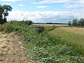
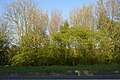
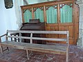
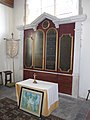
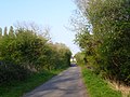
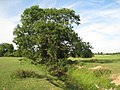
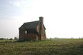
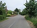
English: Brenzett is a village and civil parish in the Folkestone and Hythe District of Kent, England. The village lies on the Romney Marsh, three miles (4.8km) west of New Romney.
village and civil parish in Kent, UK  | |||||
| Upload media | |||||
| Instance of | |||||
|---|---|---|---|---|---|
| Location | Folkestone and Hythe, Kent, South East England, England | ||||
| Said to be the same as | Brenzett (Wikimedia duplicated page, civil parish) | ||||
 | |||||
Subcategories
This category has the following 5 subcategories, out of 5 total.
Media in category "Brenzett"
The following 200 files are in this category, out of 296 total.
(previous page) (next page)-
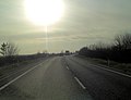 A2070 northeast of Brenzett Green - geograph.org.uk - 2788231.jpg 3,388 × 2,588; 1.04 MB
-
 A2070 south of Snave - geograph.org.uk - 2787685.jpg 3,404 × 2,405; 1,019 KB
-
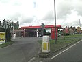 A259 Brenzett Roundabout Total Service Station - geograph.org.uk - 2590752.jpg 3,648 × 2,736; 1.1 MB
-
 Abbatridge Sewer on a dull day - geograph.org.uk - 4414206.jpg 4,368 × 2,648; 5.55 MB
-
 Another footbridge near Court-at-Wick - geograph.org.uk - 2046346.jpg 3,072 × 2,304; 2.29 MB
-
 Approaching Brenzett church through a cornfield - geograph.org.uk - 5843827.jpg 768 × 1,024; 292 KB
-
 B2080 northwest of Brenzett - geograph.org.uk - 2590772.jpg 3,454 × 2,201; 912 KB
-
 Bainbridge Farm - geograph.org.uk - 2151517.jpg 3,072 × 2,304; 2.03 MB
-
 Bowdell House - geograph.org.uk - 2044514.jpg 3,072 × 2,304; 2.73 MB
-
 Bowdell Level Crossing - geograph.org.uk - 4002458.jpg 640 × 480; 179 KB
-
 Brenzett Aeronautical Museum Caravan Park - geograph.org.uk - 2046181.jpg 3,072 × 2,304; 1.98 MB
-
 Brenzett church from the north-east - geograph.org.uk - 5138484.jpg 768 × 1,024; 189 KB
-
 Brenzett church from the north-east, July 2018 - geograph.org.uk - 5843992.jpg 1,024 × 775; 237 KB
-
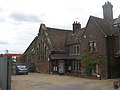 Brenzett Old School - geograph.org.uk - 2046173.jpg 3,072 × 2,304; 1.5 MB
-
 Brenzett Place farmhouse, Ivychurch Road - geograph.org.uk - 4748110.jpg 3,264 × 2,448; 2.64 MB
-
 Brenzett Roundabout - geograph.org.uk - 2046155.jpg 3,072 × 2,304; 1.68 MB
-
 Brenzett Sewer - geograph.org.uk - 3190059.jpg 2,256 × 1,496; 932 KB
-
 Brenzett Sewer - geograph.org.uk - 451502.jpg 640 × 427; 87 KB
-
 Brenzett Sewer - looking east - geograph.org.uk - 2046295.jpg 3,072 × 1,728; 1.62 MB
-
 Brenzett Sewer - looking westwards - geograph.org.uk - 2046291.jpg 3,072 × 2,304; 2.14 MB
-
 Brenzett Sewer towards Manor Farm - geograph.org.uk - 2151649.jpg 3,072 × 2,304; 1.89 MB
-
 Brenzett Village sign - geograph.org.uk - 5467105.jpg 640 × 426; 89 KB
-
 Bridge over Brenzett Sewer - geograph.org.uk - 2151692.jpg 3,072 × 2,304; 1.77 MB
-
 Bridge over Brenzett Sewer - geograph.org.uk - 2573821.jpg 1,496 × 2,256; 872 KB
-
 Bridge over the Brenzett Sewer - geograph.org.uk - 2046280.jpg 3,072 × 2,304; 1.5 MB
-
 Bridleway in a willow grove - geograph.org.uk - 2044448.jpg 3,072 × 2,304; 3.24 MB
-
 Bridleway to Misleham - geograph.org.uk - 2046145.jpg 3,072 × 2,304; 2.56 MB
-
 By the A2070 - geograph.org.uk - 5503057.jpg 640 × 426; 104 KB
-
 By the A2070 - geograph.org.uk - 5503331.jpg 640 × 426; 74 KB
-
 Cattle grazing by Abbatridge Sewer, Brenzett - geograph.org.uk - 3561958.jpg 1,024 × 768; 138 KB
-
 Churches in the Romney Marsh area (Q) - geograph.org.uk - 3926279.jpg 640 × 480; 110 KB
-
 Churches in the Romney Marsh area (T) - geograph.org.uk - 3926460.jpg 640 × 480; 144 KB
-
 Closed Little Chef - geograph.org.uk - 3058962.jpg 800 × 600; 328 KB
-
 Crop fields near Snave - geograph.org.uk - 3237735.jpg 2,256 × 1,496; 905 KB
-
 Dambuster model and Mine - geograph.org.uk - 2046189.jpg 3,072 × 2,304; 1.88 MB
-
 Derelict Greenhouses - geograph.org.uk - 456563.jpg 640 × 361; 48 KB
-
 Derelict greenhouses - geograph.org.uk - 4977929.jpg 3,264 × 2,448; 3.97 MB
-
 Detail of Fagge Memorial, Brenzett church - geograph.org.uk - 3190000.jpg 2,256 × 1,496; 856 KB
-
 Detail, Fagge Tomb, Brenzett church - geograph.org.uk - 3190006.jpg 2,256 × 1,496; 867 KB
-
 Drain in Romney Marshes - geograph.org.uk - 2046369.jpg 3,072 × 2,304; 2.85 MB
-
 Drain near Court-at-Wick - geograph.org.uk - 2046344.jpg 3,072 × 2,304; 2.73 MB
-
 Drainage channel in Romney Marshes - geograph.org.uk - 2151581.jpg 3,072 × 2,304; 2.38 MB
-
 Drainage Channel leading from the Brenzett Sewer - geograph.org.uk - 2151658.jpg 3,072 × 2,304; 2.16 MB
-
 Drainage Channel to Abbatridge Sewer - geograph.org.uk - 1945546.jpg 1,024 × 768; 292 KB
-
 Drainage Channels - geograph.org.uk - 1944470.jpg 1,024 × 768; 280 KB
-
 Fagge Memorial, St Eanswith's church, Brenzett - geograph.org.uk - 3190024.jpg 1,636 × 1,398; 1.28 MB
-
 Fallow field - geograph.org.uk - 3262006.jpg 640 × 430; 80 KB
-
 Farm bridge over Brenzett Sewer - geograph.org.uk - 2151641.jpg 3,072 × 2,304; 1.89 MB
-
 Farmed marshland - geograph.org.uk - 5503361.jpg 640 × 426; 42 KB
-
 Farmland west of Brenzett church, late September - geograph.org.uk - 5138485.jpg 1,024 × 753; 145 KB
-
 Farmland, Ham Mill Lane - geograph.org.uk - 3262032.jpg 640 × 430; 80 KB
-
 Field by A2070 - geograph.org.uk - 5503332.jpg 640 × 426; 67 KB
-
 Field by A2070 - geograph.org.uk - 5503335.jpg 640 × 426; 44 KB
-
 Field by B2080 - geograph.org.uk - 5467098.jpg 640 × 426; 56 KB
-
 Field near Brenzett - geograph.org.uk - 5467096.jpg 640 × 426; 59 KB
-
 Field north of Snave - geograph.org.uk - 4057738.jpg 4,000 × 3,000; 4.26 MB
-
 Field, Brenzett - geograph.org.uk - 5467101.jpg 640 × 426; 49 KB
-
 Fields at Bowdell Bank - geograph.org.uk - 2485163.jpg 640 × 424; 86 KB
-
 Fields near Wick Bridge - geograph.org.uk - 3237675.jpg 2,256 × 1,496; 912 KB
-
 Fields off Wey Street - geograph.org.uk - 3196838.jpg 2,256 × 1,496; 943 KB
-
 Filling Station, Brenzett - geograph.org.uk - 5503027.jpg 640 × 426; 45 KB
-
 Fireplace, St Augustine's church, Snave - geograph.org.uk - 3191011.jpg 2,256 × 1,496; 849 KB
-
 Flat farmland - geograph.org.uk - 3262016.jpg 640 × 430; 65 KB
-
 Fleur de Lis Inn - geograph.org.uk - 4696989.jpg 3,264 × 2,448; 2.17 MB
-
 Fleur-de-Lis House, Rhee Wall Road - geograph.org.uk - 6134283.jpg 3,264 × 2,448; 2.49 MB
-
 Footbridge - geograph.org.uk - 419480.jpg 640 × 480; 377 KB
-
 Footbridge in Romney Marshes - geograph.org.uk - 2151707.jpg 3,072 × 2,304; 1.83 MB
-
 Footbridge near Bowdell Lane - geograph.org.uk - 2044505.jpg 3,072 × 2,304; 2.67 MB
-
 Footbridge near Ham Mill Lane - geograph.org.uk - 2046392.jpg 3,072 × 2,304; 2.94 MB
-
 Footbridge near the B2080 Rhee Wall - geograph.org.uk - 2044496.jpg 3,072 × 2,304; 1.71 MB
-
 Footbridge near the B2080 Rhee Wall - geograph.org.uk - 2044500.jpg 3,072 × 2,304; 2.7 MB
-
 Footbridge on Abbatridge Sewer - geograph.org.uk - 2046331.jpg 3,072 × 2,304; 2.45 MB
-
 Footbridge over Brenzett Sewer - geograph.org.uk - 2151654.jpg 3,072 × 2,304; 1.93 MB
-
 Footbridge over Ditch - geograph.org.uk - 1945550.jpg 1,024 × 768; 292 KB
-
 Footbridge over the Sedbrook Sewer - geograph.org.uk - 2151569.jpg 3,072 × 2,304; 2.56 MB
-
 Footbridge over the Sedbrook Sewer - geograph.org.uk - 3629733.jpg 3,696 × 2,448; 2.41 MB
-
 Footbridge towards Court-at-Wick - geograph.org.uk - 2046336.jpg 3,072 × 2,304; 2.47 MB
-
 Footpath across a field from Wey Street - geograph.org.uk - 4057748.jpg 4,000 × 3,000; 4.26 MB
-
 Footpath across a stubble field - geograph.org.uk - 3629742.jpg 3,696 × 2,448; 2.38 MB
-
 Footpath at Brenzett - geograph.org.uk - 4057458.jpg 4,000 × 3,000; 4.12 MB
-
 Footpath crossing Church Lane - geograph.org.uk - 2044458.jpg 3,072 × 2,304; 1.89 MB
-
 Footpath sign next to Wey Street - geograph.org.uk - 4057745.jpg 4,000 × 3,000; 4.06 MB
-
 Footpath through a cornfield, July 2018 - geograph.org.uk - 5843444.jpg 755 × 1,024; 205 KB
-
 Footpath to Grove Lane - geograph.org.uk - 2044518.jpg 3,072 × 2,304; 2.1 MB
-
 Footpath to Snargate, off Bowdell Lane - geograph.org.uk - 2485161.jpg 2,256 × 1,496; 920 KB
-
 Footpath towards Brenzett - geograph.org.uk - 2044510.jpg 3,072 × 2,304; 2.26 MB
-
 Footpath towards Millbank Farm - geograph.org.uk - 2151762.jpg 3,072 × 2,304; 2.45 MB
-
 Footpath towards Snave - geograph.org.uk - 2151760.jpg 3,072 × 2,304; 2.41 MB
-
 Former coach depot, King Street - geograph.org.uk - 4696960.jpg 3,264 × 2,448; 3.95 MB
-
 Gate and drain on Kitsbridge Lane - geograph.org.uk - 2084942.jpg 3,072 × 2,304; 2.19 MB
-
 Gate by A2070 - geograph.org.uk - 5503327.jpg 640 × 426; 62 KB
-
 Gate by A2070 - geograph.org.uk - 5503334.jpg 640 × 426; 42 KB
-
 Gate on Kitsbridge Lane - geograph.org.uk - 2084936.jpg 3,072 × 2,304; 1.56 MB
-

-
 Gribble House - geograph.org.uk - 2151537.jpg 3,072 × 2,304; 1.54 MB
-
 Grove Lane Level Crossing - geograph.org.uk - 2044539.jpg 3,072 × 2,304; 2.12 MB
-
 Half a Spitfire - geograph.org.uk - 5843443.jpg 1,024 × 792; 126 KB
-
 Ham Mill Lane - geograph.org.uk - 3259734.jpg 640 × 430; 68 KB
-
 Ham Mill Lane - geograph.org.uk - 3261999.jpg 640 × 430; 64 KB
-
 Ham Mill Lane - geograph.org.uk - 3262003.jpg 640 × 430; 61 KB
-
 Hangman's Toll Bridge - geograph.org.uk - 2046308.jpg 3,072 × 2,304; 1.68 MB
-
 Hangman's Toll Bridge and drain - geograph.org.uk - 2046305.jpg 3,072 × 2,304; 2.71 MB
-
 Harvested crop field near Ham Farm - geograph.org.uk - 3237703.jpg 2,256 × 1,496; 948 KB
-
 Hedge by A2070 - geograph.org.uk - 5503337.jpg 640 × 426; 93 KB
-
 Hedge by A2070 - geograph.org.uk - 5503339.jpg 640 × 426; 113 KB
-
 Hedge by A2070 - geograph.org.uk - 5503349.jpg 640 × 426; 93 KB
-
 Hedge by A2070 - geograph.org.uk - 5503351.jpg 640 × 426; 94 KB
-
 Hedge by A2070 - geograph.org.uk - 5503353.jpg 640 × 426; 76 KB
-
 Hoarding, King Street - geograph.org.uk - 5235835.jpg 3,264 × 2,357; 2.02 MB
-
 Hoarding, King Street - geograph.org.uk - 6133333.jpg 3,264 × 2,448; 1.61 MB
-
 In Brenzett churchyard - geograph.org.uk - 5843839.jpg 761 × 1,024; 176 KB
-
 In Snave churchyard - geograph.org.uk - 5137917.jpg 1,024 × 786; 338 KB
-
 Inside Church of St Augustine - geograph.org.uk - 1944454.jpg 768 × 1,024; 181 KB
-
 Inside St Augustine, Snave (A) - geograph.org.uk - 3932033.jpg 480 × 640; 75 KB
-
 Inside St Augustine, Snave (B) - geograph.org.uk - 3932035.jpg 480 × 640; 44 KB
-
 Inside St Augustine, Snave (D) - geograph.org.uk - 3932043.jpg 480 × 640; 53 KB
-
 Inside St Augustine, Snave (E) - geograph.org.uk - 3932045.jpg 480 × 640; 46 KB
-
 Inside St Augustine, Snave (F) - geograph.org.uk - 3932047.jpg 640 × 480; 45 KB
-
 Inside St Augustine, Snave (G) - geograph.org.uk - 3932048.jpg 640 × 480; 73 KB
-
 Inside St Augustine, Snave (H) - geograph.org.uk - 3932055.jpg 640 × 480; 58 KB
-
 Inside St Augustine, Snave (I) - geograph.org.uk - 3932057.jpg 480 × 640; 62 KB
-
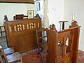
 Inside St Eanswith, Brenzett (A) - geograph.org.uk - 3997819.jpg 480 × 640; 59 KB
-
 Inside St Eanswith, Brenzett (B) - geograph.org.uk - 3997820.jpg 640 × 458; 65 KB
-
 Inside St Eanswith, Brenzett (C) - geograph.org.uk - 3997822.jpg 640 × 480; 49 KB
-
 Inside St Eanswith, Brenzett (D) - geograph.org.uk - 3997824.jpg 480 × 640; 57 KB
-
 Inside St Eanswith, Brenzett (E) - geograph.org.uk - 3997825.jpg 640 × 480; 38 KB
-
 Inside St Eanswith, Brenzett (F) - geograph.org.uk - 3997827.jpg 480 × 640; 50 KB
-
 Inside St Eanswith, Brenzett (G) - geograph.org.uk - 3997868.jpg 640 × 480; 35 KB
-
 Inside St Eanswith, Brenzett (H) - geograph.org.uk - 3998948.jpg 640 × 480; 87 KB
-
 Inside St Eanswith, Brenzett (I) - geograph.org.uk - 3998957.jpg 640 × 480; 43 KB
-
 Inside St Eanswith, Brenzett (J) - geograph.org.uk - 3998966.jpg 480 × 640; 50 KB
-
 Inside St Eanswith, Brenzett (K) - geograph.org.uk - 3998969.jpg 640 × 480; 61 KB
-
 Inside St Eanswith, Brenzett (L) - geograph.org.uk - 3998971.jpg 480 × 640; 54 KB
-
 Inside St Eanswith, Brenzett (M) - geograph.org.uk - 3998975.jpg 480 × 640; 38 KB
-
 Inside St Eanswith, Brenzett (N) - geograph.org.uk - 3998979.jpg 480 × 640; 73 KB
-
 Interior, St Augustine's church, Snave - geograph.org.uk - 3191000.jpg 2,256 × 1,496; 862 KB
-
 Interior, St Augustine's church, Snave - geograph.org.uk - 3191004.jpg 2,256 × 1,496; 879 KB
-
 Ivychurch Rd - geograph.org.uk - 5503033.jpg 640 × 426; 69 KB
-
 Ivychurch Road - geograph.org.uk - 4751264.jpg 640 × 480; 64 KB
-
 Ivychurch Road - geograph.org.uk - 4751281.jpg 640 × 480; 52 KB
-
 John Fagge Jnr, Memorial, Brenzett church - geograph.org.uk - 3190013.jpg 2,256 × 1,496; 867 KB
-
 King Street, Brenzett - geograph.org.uk - 3939784.jpg 4,000 × 3,000; 4.06 MB
-
 Kitsbridge Lane to Stockbridge - geograph.org.uk - 2084933.jpg 3,072 × 2,304; 1.73 MB
-
 Lane near Brenzett Green - geograph.org.uk - 2046316.jpg 2,304 × 3,072; 2.62 MB
-
 Lane towards Whitehall Farm - geograph.org.uk - 2046320.jpg 3,072 × 2,304; 2.28 MB
-
 Large field - geograph.org.uk - 5467077.jpg 640 × 425; 47 KB
-
 Large Tree - geograph.org.uk - 1944672.jpg 1,024 × 768; 273 KB
-
 Large tree beside footpath to Court-at-Wick - geograph.org.uk - 2046326.jpg 3,072 × 2,304; 2.8 MB
-
 Little Chef, Brenzett - geograph.org.uk - 1274715.jpg 640 × 480; 103 KB
-
 Looker's Hut - geograph.org.uk - 442307.jpg 640 × 427; 50 KB
-
 Looker’s hut - geograph.org.uk - 5237131.jpg 3,264 × 2,448; 3.46 MB
-
 Looking west along Ivychurch Road - geograph.org.uk - 4749747.jpg 3,264 × 2,448; 1.98 MB
-
 Marsh ditch and bridge at Stock Bridge - geograph.org.uk - 5137725.jpg 1,024 × 807; 368 KB
-
 Marshscape north of Snave - geograph.org.uk - 5137704.jpg 1,024 × 779; 197 KB
-
 Memorial to John Fagge and Son, Brenzett church - geograph.org.uk - 3189982.jpg 1,693 × 1,374; 1.24 MB
-
 Moor Lane - geograph.org.uk - 2046223.jpg 3,072 × 2,304; 2.01 MB
-
 Moor Lane bridge over the Brenzett Sewer - geograph.org.uk - 2046205.jpg 3,072 × 2,304; 2.53 MB
-
 Moor Lane crosses Brenzett Sewer - geograph.org.uk - 4057684.jpg 4,000 × 3,000; 4.15 MB
-
 Moor Lane near Ivychurch Road - geograph.org.uk - 4057675.jpg 4,000 × 3,000; 4.35 MB
-
 Moor Lane, near Brenzett Place - geograph.org.uk - 2573819.jpg 2,256 × 1,496; 889 KB
-
 Muddy Autumn Fields near Brenzett - geograph.org.uk - 3190069.jpg 2,256 × 1,496; 899 KB
-
 Near Romney Marsh Wartime Collection - geograph.org.uk - 5503065.jpg 640 × 426; 56 KB
-
 North Aisle, St Eanswith's church, Brenzett - geograph.org.uk - 3190398.jpg 2,256 × 1,496; 866 KB
-
 North of Snave - geograph.org.uk - 4057742.jpg 4,000 × 3,000; 4.01 MB
-
 North side of St Eanswith's church, Brenzett - geograph.org.uk - 3561953.jpg 1,024 × 768; 175 KB
-
 Old Ashford road at Brenzett - geograph.org.uk - 2419193.jpg 1,600 × 1,200; 503 KB
-
 Old route of Ivychurch Rd - geograph.org.uk - 5467080.jpg 640 × 426; 83 KB
-
 Outbuilding, Brenzett Place Farm, Ivychurch Road - geograph.org.uk - 4749757.jpg 3,264 × 2,448; 1.89 MB
-
 Plane trees in Snave churchyard - geograph.org.uk - 5138481.jpg 1,024 × 768; 321 KB
-
 Poplar Farm - geograph.org.uk - 2046313.jpg 3,072 × 2,304; 2.36 MB
-
 Railway to Dungeness - geograph.org.uk - 2044601.jpg 3,072 × 2,304; 1.83 MB
-
 Rape field by Bowdell Lane - geograph.org.uk - 4941585.jpg 4,000 × 3,000; 3.56 MB
-
 Re-roofing the former Fleur de Lis Inn - geograph.org.uk - 5237086.jpg 3,264 × 2,448; 3.63 MB
-
 Red berry hedge in Romney Marsh - geograph.org.uk - 2151725.jpg 3,072 × 2,304; 2.48 MB
-
 Ripening wheat - geograph.org.uk - 3259671.jpg 640 × 408; 72 KB
-
 Ripening wheat - geograph.org.uk - 3259675.jpg 640 × 430; 82 KB
-
 Road Junction of Moor Lane and Ivychurch Road - geograph.org.uk - 3190029.jpg 2,256 × 1,496; 900 KB
-
 Road signs, A2070 - geograph.org.uk - 5503343.jpg 640 × 426; 104 KB
-
 Road to Ivychurch - geograph.org.uk - 5503347.jpg 640 × 426; 52 KB
-
 Road to Snave - geograph.org.uk - 1944432.jpg 1,024 × 768; 209 KB
-
 Romney Marsh scene near Brenzett - geograph.org.uk - 3939795.jpg 4,000 × 3,000; 3.79 MB
-
 Romney Marsh Wartime Collection - geograph.org.uk - 5503069.jpg 640 × 290; 61 KB
-
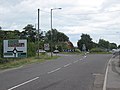
 Roundabout, Brenzett - geograph.org.uk - 5467083.jpg 640 × 418; 69 KB
-
 Sedbrook Drain - geograph.org.uk - 2151559.jpg 3,072 × 2,304; 1.89 MB
-
 Sedbrook Sewer - geograph.org.uk - 2151575.jpg 3,072 × 2,304; 1.97 MB
-
 Sedbrook Sewer - geograph.org.uk - 3259698.jpg 640 × 430; 77 KB
-
 Sedbrook Sewer flowing Southwards - geograph.org.uk - 2046510.jpg 3,072 × 2,304; 2.69 MB
-
 Sedile and Piscina, St Augustine's church, Snave - geograph.org.uk - 3191008.jpg 1,496 × 2,256; 797 KB
-
 Sheep near Abbatridge Sewer - geograph.org.uk - 1944667.jpg 1,024 × 683; 180 KB
-
 Sheepfold near Codhall - geograph.org.uk - 393910.jpg 640 × 506; 185 KB
-

-
 Snave church from the east - geograph.org.uk - 5137946.jpg 1,024 × 796; 298 KB
-
 St Augustine's church, Snave - geograph.org.uk - 3190999.jpg 2,256 × 1,496; 932 KB
-
 St Augustine's Church, Snave - geograph.org.uk - 6164211.jpg 3,869 × 2,901; 3.82 MB
-
 St Augustine's Church, Snave - geograph.org.uk - 6164693.jpg 4,000 × 3,000; 4.88 MB
-
 St Augustine, Snave - geograph.org.uk - 4057722.jpg 4,000 × 3,000; 4.33 MB
-
 St Augustine, Snave, altar - geograph.org.uk - 3932037.jpg 480 × 640; 62 KB
-
 St Augustine, Snave, churchyard (1) - geograph.org.uk - 3932019.jpg 640 × 480; 151 KB
-
 St Augustine, Snave, churchyard (2) - geograph.org.uk - 3932020.jpg 640 × 480; 123 KB
-
 St Augustine, Snave, churchyard (3) - geograph.org.uk - 3932021.jpg 640 × 480; 126 KB


_-_geograph.org.uk_-_3926279.jpg)
_-_geograph.org.uk_-_3926460.jpg)


_-_geograph.org.uk_-_3932033.jpg)
_-_geograph.org.uk_-_3932035.jpg)
_-_geograph.org.uk_-_3932043.jpg)
_-_geograph.org.uk_-_3932045.jpg)
_-_geograph.org.uk_-_3932047.jpg)
_-_geograph.org.uk_-_3932048.jpg)
_-_geograph.org.uk_-_3932055.jpg)
_-_geograph.org.uk_-_3932057.jpg)
_-_geograph.org.uk_-_3997819.jpg)
_-_geograph.org.uk_-_3997820.jpg)
_-_geograph.org.uk_-_3997822.jpg)
_-_geograph.org.uk_-_3997824.jpg)
_-_geograph.org.uk_-_3997825.jpg)
_-_geograph.org.uk_-_3997827.jpg)
_-_geograph.org.uk_-_3997868.jpg)
_-_geograph.org.uk_-_3998948.jpg)
_-_geograph.org.uk_-_3998957.jpg)
_-_geograph.org.uk_-_3998966.jpg)
_-_geograph.org.uk_-_3998969.jpg)
_-_geograph.org.uk_-_3998971.jpg)
_-_geograph.org.uk_-_3998975.jpg)
_-_geograph.org.uk_-_3998979.jpg)


_-_geograph.org.uk_-_3932019.jpg)
_-_geograph.org.uk_-_3932020.jpg)
_-_geograph.org.uk_-_3932021.jpg)