Category:Bradford-Leeds boundary
Jump to navigation
Jump to search
Subcategories
This category has the following 5 subcategories, out of 5 total.
Media in category "Bradford-Leeds boundary"
The following 40 files are in this category, out of 40 total.
-
 A developing meander - geograph.org.uk - 4852452.jpg 1,024 × 768; 410 KB
-
 Bingley Moor, High Two Stoops - geograph.org.uk - 3543192.jpg 4,320 × 3,240; 7.4 MB
-
 Bingley Moor, High Two Stoops - geograph.org.uk - 3543206.jpg 4,320 × 3,240; 5.85 MB
-
 Bingley Moor, Low Two Stoops - geograph.org.uk - 3543213.jpg 4,320 × 3,240; 5.57 MB
-
 Bingley Moor, Low Two Stoops - geograph.org.uk - 3543216.jpg 4,320 × 3,240; 5.47 MB
-
-
 Bingley Road - viewed from Main Street - geograph.org.uk - 3416180.jpg 640 × 480; 104 KB
-

-
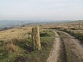 Boundary Stone on Craven Hall Hill - geograph.org.uk - 4874500.jpg 1,024 × 768; 202 KB
-
 BPL House, Apperley Bridge, Bradford - geograph.org.uk - 5011840.jpg 1,280 × 853; 688 KB
-
 Carr Beck, Tyersal - geograph.org.uk - 111777.jpg 640 × 480; 174 KB
-
 Cold in them thar hills - geograph.org.uk - 4334109.jpg 4,320 × 3,240; 5.88 MB
-
 Confluence of becks below Fulneck - geograph.org.uk - 4852470.jpg 1,024 × 768; 378 KB
-
 Dismantled Bridge on Woodhall Lane (2) - geograph.org.uk - 4792226.jpg 1,600 × 1,067; 594 KB
-
 Erosion prevention - geograph.org.uk - 4852805.jpg 1,024 × 768; 362 KB
-
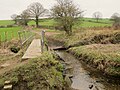 Footbridge and ford - geograph.org.uk - 4852428.jpg 1,024 × 768; 328 KB
-
 Footbridge over the Tyersal Beck - geograph.org.uk - 4852373.jpg 1,024 × 768; 385 KB
-
 Ford on the Carr Beck - geograph.org.uk - 3819030.jpg 3,872 × 2,592; 4.69 MB
-
 Ford on the Tyersal Beck - geograph.org.uk - 4852361.jpg 1,024 × 768; 390 KB
-
 Former railway bridge on Woodhall Road - geograph.org.uk - 5957562.jpg 1,024 × 768; 216 KB
-
 Former railway bridge over Woodhall Road - geograph.org.uk - 4772453.jpg 1,024 × 768; 236 KB
-
 Gain Lane at Thornbury dividing Bradford from Leeds - geograph.org.uk - 5719385.jpg 4,000 × 3,000; 2.62 MB
-
 Gain Lane Farm - geograph.org.uk - 5418290.jpg 1,024 × 768; 614 KB
-

-
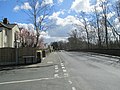
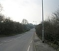
 Leeds Road, Thornbury - geograph.org.uk - 4062841.jpg 640 × 481; 77 KB
-
 Meanders of the Tyersal Beck - geograph.org.uk - 4852404.jpg 1,024 × 768; 426 KB
-
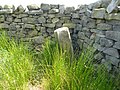
 Old Boundary Marker - geograph.org.uk - 6035733.jpg 384 × 640; 280 KB
-

-

-
 Pudsey Beck, downstream from the bridge - geograph.org.uk - 5459970.jpg 640 × 480; 152 KB
-
 Ramsons by the Pudsey Beck - geograph.org.uk - 4852783.jpg 1,024 × 767; 416 KB
-
 Remains of old railway line at Dick Lane - geograph.org.uk - 4768843.jpg 2,592 × 1,944; 1.39 MB
-
 Steep stream bank - geograph.org.uk - 4852417.jpg 1,024 × 768; 384 KB
-
 The Tyersal Beck in Black Carr Wood - geograph.org.uk - 4852380.jpg 1,024 × 768; 397 KB
-
 Tong (or Ringshaw) Beck - geograph.org.uk - 5371005.jpg 1,024 × 768; 445 KB
-
 Tong Lane - viewed from Roker Lane - geograph.org.uk - 2323840.jpg 640 × 547; 61 KB
-
 Two footbridges - geograph.org.uk - 4852467.jpg 1,024 × 768; 372 KB
-
 Tyersal Beck - geograph.org.uk - 4852430.jpg 1,024 × 768; 208 KB
-
 View towards Fagley - geograph.org.uk - 4772455.jpg 1,024 × 768; 190 KB
-
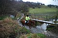
 Ways to cross a stream - geograph.org.uk - 5370770.jpg 1,024 × 768; 231 KB


_-_geograph.org.uk_-_4792226.jpg)


_Beck_-_geograph.org.uk_-_5371005.jpg)


