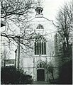
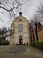
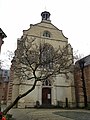
Category:Brabantsche Olijfberg
Jump to navigation
Jump to search
| Object location | | View all coordinates using: OpenStreetMap |
|---|
church in Antwerp, Belgium  | |||||
| Upload media | |||||
| Instance of | |||||
|---|---|---|---|---|---|
| Location | Antwerp, Arrondissement of Antwerp, Province of Antwerp, Flemish Region, Belgium | ||||
| Street address |
| ||||
 | |||||
|
This is a category about Beschermd erfgoed number 5029
|
|
This is a category about onroerend erfgoed number 5416
|
Subcategories
This category has only the following subcategory.
I
Media in category "Brabantsche Olijfberg"
The following 24 files are in this category, out of 24 total.
-
 Antwerpen Lange Winkelstraat - 217155 - onroerenderfgoed.jpg 995 × 1,168; 237 KB
-
 Antwerpen Lange Winkelstraat 5 - 217142 - onroerenderfgoed.jpg 1,001 × 1,401; 274 KB
-
 Antwerpen Lange Winkelstraat 5 - 217143 - onroerenderfgoed.jpg 1,411 × 999; 410 KB
-
 Antwerpen Lange Winkelstraat 5 - 217144 - onroerenderfgoed.jpg 1,000 × 1,168; 380 KB
-
 Antwerpen Lange Winkelstraat 5 - 217145 - onroerenderfgoed.jpg 992 × 1,168; 244 KB
-
 Antwerpen Lange Winkelstraat 5 - 217146 - onroerenderfgoed.jpg 1,393 × 1,004; 260 KB
-
 Antwerpen Lange Winkelstraat 5 - 217147 - onroerenderfgoed.jpg 997 × 1,168; 255 KB
-
 Antwerpen Lange Winkelstraat 5 - 217148 - onroerenderfgoed.jpg 1,168 × 999; 269 KB
-
 Antwerpen Lange Winkelstraat 5 - 217149 - onroerenderfgoed.jpg 1,168 × 999; 300 KB
-
 Antwerpen Lange Winkelstraat 5 - 217150 - onroerenderfgoed.jpg 1,168 × 990; 298 KB
-
 Antwerpen Lange Winkelstraat 5 - 217151 - onroerenderfgoed.jpg 993 × 1,168; 209 KB
-
 Antwerpen Lange Winkelstraat 5 - 217152 - onroerenderfgoed.jpg 1,168 × 996; 262 KB
-
 Antwerpen Lange Winkelstraat 5 - 217154 - onroerenderfgoed.jpg 1,168 × 993; 295 KB
-
 Antwerpen Lange Winkelstraat 5 - 35029 - onroerenderfgoed.jpg 591 × 423; 114 KB
-
 Antwerpen Lange Winkelstraat 5 1 - 217153 - onroerenderfgoed.jpg 996 × 1,168; 275 KB
-

-
 Antwerpen Lange Winkelstraat 5 pastorie - 240150 - onroerenderfgoed.jpg 648 × 480; 124 KB
-
 Antwerpen Lange Winkelstraat 5 westgevel - 240151 - onroerenderfgoed.jpg 480 × 648; 117 KB
-
 Antwerpen, Protestantse Kerk (1).jpg 3,463 × 2,984; 3.01 MB
-
 Antwerpen, Protestantse Kerk (2).jpg 3,000 × 4,000; 3.87 MB
-
 Antwerpen-Protestantse kerk Lange Winkelstraat (2).jpg 3,024 × 4,032; 6.46 MB
-
 Antwerpen-Protestantse kerk Lange Winkelstraat.jpg 3,024 × 4,032; 4.07 MB
-
 Exterieur kerk Brabantse Olijfberg (toestand voor 1910).jpg 998 × 1,274; 192 KB
-
 Glas-in-loodraam in de Brabantse Olijfberg.jpg 3,713 × 1,436; 1.38 MB


.jpg)
.jpg)
.jpg)
.jpg)