Category:Boxley
Jump to navigation
Jump to search
English: The large village and civil parish of Boxley in the Maidstone District of Kent, England lies below the slope of the North Downs, four miles (6.4 km) NE of Maidstone town. The parish has a population of 7144 (2001 census), and includes the settlements of Boxley itself, Grove Green, most of Weavering Street, Sandling, and the southern extremities of Walderslade and Lordswood at the top of Blue Bell Hill.
village and civil parish in Maidstone District, Kent, England, UK  | |||||
| Upload media | |||||
| Instance of | |||||
|---|---|---|---|---|---|
| Location | Maidstone, Kent, South East England, England | ||||
| Area |
| ||||
 | |||||
Subcategories
This category has the following 16 subcategories, out of 16 total.
A
- Abbey Gate, Kent (19 F)
B
C
- Boxley Church Hall (3 F)
G
- Grove Green (13 F)
H
- Boxley House, Kent (2 F)
K
- KIMS Hospital, Maidstone (1 F)
- King's Arms, Boxley (6 F)
L
M
- Malta Inn, Boxley (11 F)
O
S
T
- Tyland Barn (3 F)
V
W
- Boxley Warren (10 F)
- Westfield Wood (4 F)
Media in category "Boxley"
The following 200 files are in this category, out of 649 total.
(previous page) (next page)-
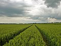 'Tramlines' in the wheat - geograph.org.uk - 3010560.jpg 640 × 480; 93 KB
-
 A close up of the sign at Grove Green - geograph.org.uk - 3746884.jpg 4,000 × 3,000; 3.71 MB
-
 A Eurostar heads for the Channel Tunnel - geograph.org.uk - 1844215.jpg 2,560 × 1,920; 2.32 MB
-
 A field of Winter Wheat - geograph.org.uk - 2273493.jpg 640 × 430; 62 KB
-
 A languages lesson by the road - geograph.org.uk - 3043800.jpg 428 × 640; 90 KB
-
 A track through The Larches, Boxley - geograph.org.uk - 870691.jpg 640 × 480; 142 KB
-
 A249 northbound - geograph.org.uk - 3043056.jpg 640 × 428; 69 KB
-
 Abbeygate Cottages, near Sandling - geograph.org.uk - 3570330.jpg 2,325 × 1,907; 2.5 MB
-
 Abigail Crescent, Walderslade Woods - geograph.org.uk - 2069693.jpg 3,488 × 2,616; 2.26 MB
-

-
 Accident at the foot of Boxley Hill - geograph.org.uk - 2075655.jpg 3,488 × 2,616; 3.17 MB
-

-

-
 Allington Belle - geograph.org.uk - 2784226.jpg 640 × 430; 84 KB
-
 Allington Belle, River Medway - geograph.org.uk - 2232964.jpg 640 × 430; 186 KB
-
 Allington Castle - geograph.org.uk - 2784202.jpg 640 × 430; 118 KB
-
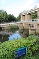
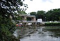
 Allington Lock - geograph.org.uk - 3470186.jpg 640 × 481; 595 KB
-
 Allington Lock - geograph.org.uk - 3590400.jpg 3,488 × 2,616; 2.26 MB
-
 Allington Lock - geograph.org.uk - 4334033.jpg 640 × 480; 56 KB
-
 Allington Lock, River Medway, Kent - geograph.org.uk - 2596391.jpg 683 × 1,024; 311 KB
-
 Allington Marina - geograph.org.uk - 4023943.jpg 4,000 × 3,000; 4.26 MB
-
 Allington Sluice - geograph.org.uk - 2231507.jpg 640 × 430; 131 KB
-
 Allington Sluice - geograph.org.uk - 2784233.jpg 640 × 430; 58 KB
-
 Allington Sluice - geograph.org.uk - 2784238.jpg 640 × 430; 91 KB
-
 Ancient yew woodland in Boxley Warren - geograph.org.uk - 2594796.jpg 4,000 × 3,000; 4.09 MB
-
 Ancient yews in Boxley Warren - geograph.org.uk - 2594775.jpg 4,000 × 3,000; 4 MB
-
 Ancient yews in Boxley Warren - geograph.org.uk - 2594792.jpg 3,000 × 4,000; 4.14 MB
-
 Ashford Rd (A20) - geograph.org.uk - 2277708.jpg 640 × 430; 63 KB
-
 Aston Close, Walderslade - geograph.org.uk - 4282705.jpg 2,272 × 1,704; 942 KB
-
 Autumn Glade, Lordswood - geograph.org.uk - 4267858.jpg 3,264 × 2,448; 1.65 MB
-
 Averenches Road South, Grove Green - geograph.org.uk - 3572511.jpg 3,488 × 2,616; 2.48 MB
-
 Badger Road, Lordswood - geograph.org.uk - 4267851.jpg 3,264 × 2,448; 1.38 MB
-
 Badger Road, Lordswood - geograph.org.uk - 4267865.jpg 3,264 × 2,448; 2.01 MB
-
 Barge on the Medway - geograph.org.uk - 2738551.jpg 640 × 480; 112 KB
-
 Barge on the River Medway - geograph.org.uk - 2232879.jpg 640 × 430; 140 KB
-
 Barge on the River Medway - geograph.org.uk - 2232893.jpg 640 × 430; 156 KB
-
 Barge on the River Medway - geograph.org.uk - 2232900.jpg 640 × 430; 136 KB
-
 Bargrove Road, Vinters Park - geograph.org.uk - 3572614.jpg 3,488 × 2,616; 2.41 MB
-
 Barley, pylon, wood - geograph.org.uk - 3007922.jpg 640 × 480; 75 KB
-
 Barn, Street Farm - geograph.org.uk - 2274211.jpg 640 × 430; 54 KB
-
 Barrier by the Pilgrims' Way - geograph.org.uk - 2273046.jpg 640 × 430; 97 KB
-
 Bearsted Road, Grove Green - geograph.org.uk - 5041723.jpg 2,296 × 1,718; 1.72 MB
-

-
 Beechen Bank Road, Walderslade - geograph.org.uk - 4282670.jpg 2,272 × 1,704; 1.46 MB
-
 Beechen Bank Road, Walderslade - geograph.org.uk - 4282671.jpg 2,272 × 1,704; 1.19 MB
-
 Beechmore Drive, Walderslade - geograph.org.uk - 4282698.jpg 2,272 × 1,704; 807 KB
-
 Bell Lane - geograph.org.uk - 3064327.jpg 480 × 640; 104 KB
-
 Bell Lane, Cossington - geograph.org.uk - 1743251.jpg 3,488 × 2,616; 2.23 MB
-
 Bell Lane, near Blue Bell Hill - geograph.org.uk - 2894215.jpg 2,896 × 1,944; 1.88 MB
-
 Bell Lane, near Blue Bell Hill - geograph.org.uk - 5359425.jpg 3,264 × 2,448; 1.75 MB
-
 Bell Lane, near Blue Bell Hill - geograph.org.uk - 5359435.jpg 3,264 × 2,448; 2.29 MB
-
 Birch Drive, Lordswood - geograph.org.uk - 4267823.jpg 3,264 × 2,448; 1.56 MB
-
 Black Cottages, near Maidstone - geograph.org.uk - 3728138.jpg 640 × 360; 57 KB
-
 Boarley Farm - geograph.org.uk - 1354096.jpg 640 × 320; 86 KB
-

-
 Boarley Lane over CTRL - geograph.org.uk - 1088181.jpg 640 × 481; 60 KB
-
 Boarley Lane, Boarley - geograph.org.uk - 3570318.jpg 3,488 × 2,616; 5.2 MB
-
 Boarley Lane, Boarley - geograph.org.uk - 3570321.jpg 3,488 × 2,616; 4.36 MB
-
 Boarley Lane, Sandling - geograph.org.uk - 3570338.jpg 3,488 × 2,616; 2.09 MB
-

-

-
 Boats on the Medway - geograph.org.uk - 2738552.jpg 640 × 480; 117 KB
-
 Boats on the River Medway - geograph.org.uk - 4023901.jpg 4,000 × 3,000; 4.35 MB
-
 Boatyard on the River Medway - geograph.org.uk - 3590398.jpg 3,488 × 2,616; 2.13 MB
-
 Boxley Hill - geograph.org.uk - 2037099.jpg 1,471 × 2,010; 1.28 MB
-
 Boxley mill pond - geograph.org.uk - 101877.jpg 640 × 480; 133 KB
-
 Boxley Pumping Station - geograph.org.uk - 3727018.jpg 640 × 360; 54 KB
-
 Boxley Rd - geograph.org.uk - 2274218.jpg 640 × 430; 41 KB
-
 Boxley Rd - geograph.org.uk - 2274221.jpg 640 × 430; 40 KB
-
 Boxley Rd - geograph.org.uk - 2274236.jpg 640 × 430; 39 KB
-
 Boxley Road Bridge, M20 - geograph.org.uk - 4569986.jpg 640 × 409; 48 KB
-
 Boxley Road near Maidstone - geograph.org.uk - 3726943.jpg 640 × 360; 71 KB
-
 Boxley Road, Boxley - geograph.org.uk - 3726971.jpg 640 × 360; 54 KB
-
 Boxley Road, Harbourland - geograph.org.uk - 3571459.jpg 3,488 × 2,616; 2.55 MB
-
 Boxley Road, near Maidstone - geograph.org.uk - 3726977.jpg 640 × 360; 56 KB
-
 Boxley Road, Walderslade - geograph.org.uk - 2080676.jpg 3,488 × 2,616; 2.23 MB
-
 Boxley Road, Walderslade - geograph.org.uk - 4282689.jpg 2,272 × 1,704; 723 KB
-
 Boxley Road, Walderslade - geograph.org.uk - 4282696.jpg 2,272 × 1,704; 1.01 MB
-
 Boxley Road, Walderslade - geograph.org.uk - 5413515.jpg 3,264 × 2,448; 2.01 MB
-
 Boxley Road, Walderslade - geograph.org.uk - 5413518.jpg 3,264 × 2,448; 1.88 MB
-
 Boxley Road, Walderslade - geograph.org.uk - 5413519.jpg 3,264 × 2,448; 2.38 MB
-
 Boxley Road, Walderslade - geograph.org.uk - 5413522.jpg 3,264 × 2,448; 2.09 MB
-
 Boxley Village - geograph.org.uk - 3726983.jpg 640 × 360; 75 KB
-
 Boxley Village Sign - geograph.org.uk - 3587987.jpg 3,488 × 2,616; 2.27 MB
-
 Boxley War Memorial - geograph.org.uk - 2274035.jpg 640 × 430; 93 KB
-
 Boxley Warren Valley - geograph.org.uk - 1033116.jpg 640 × 481; 47 KB
-
 Boxley, seen from Boxley Hill - geograph.org.uk - 2209840.jpg 1,164 × 794; 564 KB
-
 Bracken Hill, Walderslade Woods - geograph.org.uk - 2069684.jpg 3,488 × 2,616; 4.72 MB
-
 Bredhurst Business Park - geograph.org.uk - 3728392.jpg 640 × 360; 59 KB
-

-
 Bridleway in Monkdown Wood - geograph.org.uk - 3007995.jpg 640 × 480; 178 KB
-
 Bridleway off Westfield Sole Road - geograph.org.uk - 2528405.jpg 640 × 480; 93 KB
-
 Brownelow Copse, Walderslade - geograph.org.uk - 4282688.jpg 2,272 × 1,704; 1.1 MB
-
 Building, Allington Lock - geograph.org.uk - 2784241.jpg 640 × 430; 100 KB
-

-
 Byway across wheat - geograph.org.uk - 2959045.jpg 640 × 389; 58 KB
-
 Byway near Lidsing - geograph.org.uk - 4075965.jpg 3,488 × 2,616; 3.54 MB
-
 Byway off Lidsing Rd - geograph.org.uk - 2956190.jpg 640 × 385; 62 KB
-
 Byway off Lidsing Rd - geograph.org.uk - 2956220.jpg 640 × 430; 64 KB
-
 Byway to Lords Wood - geograph.org.uk - 2956232.jpg 640 × 430; 70 KB
-
 Carpinus Close, Walderslade - geograph.org.uk - 4282655.jpg 2,272 × 1,704; 915 KB
-
 Carved wood feature, Cobtree Manor Park - geograph.org.uk - 3035388.jpg 640 × 480; 129 KB
-
 Chalk Bank, Tyland Barn - geograph.org.uk - 3066793.jpg 4,000 × 3,000; 4.14 MB
-
 Chalk Mound, Tyland Barn - geograph.org.uk - 3066803.jpg 4,000 × 3,000; 4.3 MB
-
-
 Channel Tunnel Rail Link, near Boxley - geograph.org.uk - 3570323.jpg 3,488 × 2,616; 2.22 MB
-
 Chapel Lane - geograph.org.uk - 2956213.jpg 640 × 430; 66 KB
-
 Chapel Lane closed from 12 Jan 1987 - geograph.org.uk - 902660.jpg 640 × 480; 72 KB
-
 Chapel Lane closed since 12-01-1987 - geograph.org.uk - 2752156.jpg 640 × 480; 83 KB
-
 Chapel Lane off Forge Lane - geograph.org.uk - 2956203.jpg 640 × 430; 90 KB
-
 Chapel Lane, Hempstead - geograph.org.uk - 2729927.jpg 3,488 × 2,616; 3.37 MB
-
 Chapel Lane, Hempstead - geograph.org.uk - 5476812.jpg 3,264 × 2,448; 3.54 MB
-
 Chapel Lane, Lidsing - geograph.org.uk - 4075977.jpg 3,488 × 2,616; 2.82 MB
-
 Chequers Close, Walderslade - geograph.org.uk - 4282636.jpg 2,272 × 1,704; 683 KB
-
 Clear path across wheat - geograph.org.uk - 2959059.jpg 640 × 430; 80 KB
-
 Close up of a garden next to a narrow boat - geograph.org.uk - 4069996.jpg 4,000 × 3,000; 4.5 MB
-
 Close-up of Boxley Village Sign - geograph.org.uk - 2074822.jpg 2,304 × 3,072; 2.13 MB
-
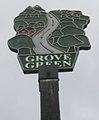 Close-up of Grove Green Village Sign - geograph.org.uk - 2512654.jpg 1,460 × 1,770; 498 KB
-
 Cobtree Manor Park Golf Club House - geograph.org.uk - 1088170.jpg 640 × 481; 58 KB
-
 Cobtree Manor Park Golf Course - geograph.org.uk - 1088136.jpg 640 × 481; 68 KB
-
 Coltsfoot Drive, Grove Green - geograph.org.uk - 3572516.jpg 3,488 × 2,616; 2.55 MB
-
 Conifer Drive, Lordswood - geograph.org.uk - 4267868.jpg 3,264 × 2,448; 2.06 MB
-
 Conifer Drive, Lordswood - geograph.org.uk - 4270698.jpg 3,264 × 2,448; 1.69 MB
-
 Cornelia, moored on the River Medway - geograph.org.uk - 2232890.jpg 640 × 430; 158 KB
-
 Cossington Farm, near Blue Bell Hill - geograph.org.uk - 2894189.jpg 2,896 × 1,944; 2.05 MB
-
 Cossington Fields, near Blue Bell Hill - geograph.org.uk - 2894183.jpg 2,896 × 1,944; 2 MB
-
 Cossington Road, Walderslade - geograph.org.uk - 4282662.jpg 2,272 × 1,704; 1.49 MB
-
 Cossington Road, Walderslade - geograph.org.uk - 4282664.jpg 2,272 × 1,704; 1.39 MB
-
 Cossington Road, Walderslade - geograph.org.uk - 4282672.jpg 2,272 × 1,704; 994 KB
-
 Country crossroads - geograph.org.uk - 3007954.jpg 640 × 480; 92 KB
-
 Country road junction near Bredhurst - geograph.org.uk - 3728172.jpg 640 × 360; 55 KB
-
 Court Lodge - geograph.org.uk - 2274038.jpg 640 × 430; 71 KB
-
 Cows grazing by the M20 - geograph.org.uk - 3590397.jpg 3,488 × 2,616; 2.11 MB
-
 Crop field off Lidsing Road - geograph.org.uk - 2528431.jpg 640 × 480; 130 KB
-
 Cuckoo Wood, Sandling - geograph.org.uk - 3570340.jpg 3,402 × 2,496; 4.85 MB
-
 Cycle route near Maidstone - geograph.org.uk - 3727034.jpg 640 × 360; 85 KB
-
 Dogwood Close, Lordswood - geograph.org.uk - 4267820.jpg 3,264 × 2,448; 2.44 MB
-
 Dunn Street Road - geograph.org.uk - 2528421.jpg 640 × 480; 158 KB
-
 Dunn Street Road, Bredhurst - geograph.org.uk - 3728190.jpg 640 × 360; 57 KB
-
 Dunn Street Road, near Bredhurst - geograph.org.uk - 3728229.jpg 640 × 360; 63 KB
-
 Dutch barges on the Medway - geograph.org.uk - 3043278.jpg 640 × 480; 130 KB
-
 Earthbank by Lidsing Rd - geograph.org.uk - 2956187.jpg 640 × 430; 58 KB
-
 East Lodge, Vinters Park Maidstone - geograph.org.uk - 2512647.jpg 3,072 × 2,304; 2.64 MB
-

-
 Eight Acre Wood - geograph.org.uk - 1076593.jpg 640 × 481; 123 KB
-
 Elm Tree Cottages - geograph.org.uk - 2956219.jpg 640 × 430; 66 KB
-
 Elm Tree Cottages, Lidsing - geograph.org.uk - 2077578.jpg 2,772 × 1,429; 1.48 MB
-
 Entrance to Boxley Tunnel on CTRL - geograph.org.uk - 1101954.jpg 640 × 481; 74 KB
-
 Entrance to building site, New Cut Road - geograph.org.uk - 6062551.jpg 3,264 × 2,448; 3.74 MB
-
 Entrance to Cobtree Manor Park - geograph.org.uk - 1088074.jpg 640 × 481; 67 KB
-
 Entrance to Monkdown Wood - geograph.org.uk - 1076595.jpg 640 × 481; 164 KB
-
 Entrance to The Larches, near Detling - geograph.org.uk - 3078214.jpg 640 × 480; 135 KB
-

-
 Entrance to Vinters Valley Nature Reserve - geograph.org.uk - 3746927.jpg 4,000 × 3,000; 4.34 MB
-
 Exit slip road at Junction 7 - geograph.org.uk - 2422156.jpg 640 × 481; 86 KB
-
 Exit Sliproad, M20 Junction 7 - geograph.org.uk - 3709827.jpg 640 × 480; 252 KB
-
 Exposed Tree Roots - geograph.org.uk - 1088740.jpg 481 × 640; 89 KB
-
 Extensive wheat - geograph.org.uk - 2956182.jpg 640 × 430; 61 KB
-
 Extensive wheat on the Downs - geograph.org.uk - 2955300.jpg 640 × 430; 69 KB
-
 Fagus Close, Walderslade - geograph.org.uk - 4282650.jpg 2,272 × 1,704; 911 KB
-
 Farm gate off the Pilgrims Way - geograph.org.uk - 3570309.jpg 3,488 × 2,616; 2.18 MB
-

-
 Farmhouse, Warren Farm - geograph.org.uk - 2273510.jpg 640 × 430; 74 KB
-
 Farmland south of Lidsing Rd - geograph.org.uk - 2956201.jpg 640 × 385; 43 KB
-
 Farthings Cottages, Sandling - geograph.org.uk - 3570332.jpg 3,488 × 2,616; 2.17 MB
-
 Festive reindeer at Notcutts Garden Centre - geograph.org.uk - 5973941.jpg 4,000 × 3,000; 5.02 MB
-
 Field north of North Downs Way - geograph.org.uk - 3043110.jpg 640 × 480; 91 KB
-
 Field south of Lidsing Rd - geograph.org.uk - 2955299.jpg 640 × 430; 79 KB
-
 Field west of Lidsing Road - geograph.org.uk - 2752141.jpg 640 × 480; 47 KB
-
 Fields by Harp Farm Road - geograph.org.uk - 2528399.jpg 640 × 480; 79 KB
-
 Fields near Petts Farm - geograph.org.uk - 6030616.jpg 5,184 × 3,456; 1.73 MB
-
 Fir Tree Grove, Lordswood - geograph.org.uk - 4267873.jpg 3,264 × 2,448; 2.74 MB
-
 Fishing the Buffalo (3461923171).jpg 1,600 × 1,200; 379 KB
-
 Foot tunnel under the M20 - geograph.org.uk - 2274520.jpg 640 × 430; 97 KB
-

-
 Footbridge over the M2 - geograph.org.uk - 3381583.jpg 640 × 430; 42 KB
-
 Footpath becomes Bridleway - geograph.org.uk - 1088772.jpg 640 × 481; 57 KB
-
 Footpath beside Vinters Park - geograph.org.uk - 2512643.jpg 3,072 × 2,304; 3.09 MB
-

-
 Footpath by Lower Fullingpits Wood - geograph.org.uk - 2277011.jpg 640 × 430; 56 KB
-
 Footpath by Lower Fullingpits Wood - geograph.org.uk - 2277023.jpg 640 × 430; 74 KB
-
 Footpath by the River Medway - geograph.org.uk - 2785663.jpg 640 × 430; 113 KB
-
 Footpath by Valley Park School - geograph.org.uk - 2277607.jpg 640 × 430; 111 KB
-
 Footpath crosses the Pilgrims Way - geograph.org.uk - 1088779.jpg 481 × 640; 98 KB
-
 Footpath down the North Downs near Boxley - geograph.org.uk - 3587924.jpg 3,488 × 2,616; 2.21 MB
-
 Footpath from Grange Lane - geograph.org.uk - 4024021.jpg 4,000 × 3,000; 4.27 MB
-
 Footpath from Grange Lane - geograph.org.uk - 4024149.jpg 4,000 × 3,000; 4.2 MB
-
 Footpath into The Larches - geograph.org.uk - 2273051.jpg 640 × 430; 139 KB
-
 Footpath into Westfield Wood - geograph.org.uk - 3064334.jpg 640 × 480; 123 KB
-
 Footpath leading to Boxley - geograph.org.uk - 4818170.jpg 640 × 465; 145 KB
-

-
 Footpath off Grange Lane - geograph.org.uk - 4024004.jpg 4,000 × 3,000; 4.14 MB
-
 Footpath Sign near Boxley - geograph.org.uk - 3587928.jpg 3,488 × 2,616; 2.24 MB
-
 Footpath signpost, Pilgrims' Way - geograph.org.uk - 2273534.jpg 640 × 430; 140 KB
-
 Footpath to Boxley - geograph.org.uk - 2273552.jpg 640 × 430; 60 KB
-
 Footpath to Boxley - geograph.org.uk - 4818157.jpg 640 × 480; 151 KB
-
 Footpath to Boxley - geograph.org.uk - 4818177.jpg 640 × 462; 147 KB
-
 Footpath towards Grange Farm, Boxley - geograph.org.uk - 3587919.jpg 3,488 × 2,616; 2.28 MB
-
 Forestdale Road, Walderslade - geograph.org.uk - 4282627.jpg 640 × 480; 97 KB
-
 Forestdale Road, Walderslade - geograph.org.uk - 4282641.jpg 2,272 × 1,704; 815 KB


_-_geograph.org.uk_-_2277708.jpg)


.jpg)


