Category:Bow Street, Ceredigion
Jump to navigation
Jump to search
village in Wales  | |||||
| Upload media | |||||
| Instance of | |||||
|---|---|---|---|---|---|
| Location | Ceredigion, Wales | ||||
 | |||||
Cymraeg: Pentref yng Ngheredigion yw Bow Street. Mae'n ymestyn yn stribed hirgul o bobtu i lôn yr A487 tua 3 milltir i'r gogledd-ddwyrain o Aberystwyth. Ar un adeg roedd gan y pentref orsaf ar Reilffordd y Cambrian. Mae yn ardal Genau'r Glyn.
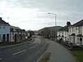
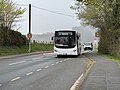
English: Bow Street is a large village in the Tirymynach district of Ceredigion, Wales, approximately north-east of Aberystwyth. As well as Bow Street itself, it is now often considered to include the neighbouring smaller village of Pen-y-garn and the hamlet of Rhydypennau. All three places stretch in a long narrow strip along the main Aberystwyth to Machynlleth road, the (A487).
Subcategories
This category has the following 2 subcategories, out of 2 total.
B
- Bow Street railway station (22 F)
C
- Capel Noddfa, Bow Street (3 F)
Media in category "Bow Street, Ceredigion"
The following 20 files are in this category, out of 20 total.
-
 A487(T) near Ffynnon Caradog - geograph.org.uk - 23376.jpg 640 × 480; 160 KB
-
 Bow Street - 2008-03-01.jpg 2,592 × 1,944; 1.9 MB
-
 Bow Street - panoramio.jpg 3,210 × 2,305; 1.98 MB
-
 Bow Street Station - First Day of Service 2.jpg 4,000 × 2,672; 5.98 MB
-
 Bow Street Station - First day of Service.jpg 4,000 × 2,672; 6.14 MB
-
 Bow Street, Ceredigion - geograph.org.uk - 19629.jpg 640 × 480; 132 KB
-
 BV73 MMK on T2 duties approaching Jewson stop, near Bow Street station 2024-04-13 12.jpg 4,032 × 3,024; 4.13 MB
-
 Fields and housing, nr. Bow Street - geograph.org.uk - 19632.jpg 640 × 480; 130 KB
-
 Frongoch Farm - geograph.org.uk - 19683.jpg 640 × 480; 155 KB
-
 Pasture and woodland, nr. Clarach - geograph.org.uk - 19675.jpg 640 × 480; 155 KB
-
 Quarry, Ffosygrafel-isaf - geograph.org.uk - 23360.jpg 640 × 480; 121 KB
-
 Railway, Bow Street - geograph.org.uk - 19631.jpg 640 × 480; 178 KB
-
 Rhydypennau 2.jpg 4,608 × 2,592; 4.38 MB
-
 Rhydypennau.jpg 4,608 × 2,592; 3.92 MB
-
 Tafarn y Welsh Black, Bow Street.JPG 3,648 × 2,048; 1.42 MB
-
 The Clarach road leaving Bow Street - geograph.org.uk - 1624245.jpg 640 × 442; 118 KB
-
 The Welsh Black Inn, Bow Street - geograph.org.uk - 2404874.jpg 3,872 × 2,592; 3.03 MB
-
 Upland, near Bow Street - geograph.org.uk - 19671.jpg 640 × 480; 149 KB
-
 Wileiriog-Uchaf - geograph.org.uk - 23362.jpg 640 × 480; 115 KB
-
 Woodland, Cribin Llwyd - geograph.org.uk - 23375.jpg 640 × 480; 115 KB
_near_Ffynnon_Caradog_-_geograph.org.uk_-_23376.jpg)


