Category:Boundary Channel (Potomac River)
Jump to navigation
Jump to search
channel in Washington, D.C., United States  Looking south from Boundary Channel Bridge at Boundary Channel. Columbia Island is on the left, the Virginia shoreline is on the right.  | |||||
| Upload media | |||||
| Instance of | |||||
|---|---|---|---|---|---|
| Location | Washington, D.C., District of Columbia | ||||
| Elevation above sea level |
| ||||
 | |||||
This category is for pictures of the Boundary Channel and its Pentagon Lagoon, which form the western and southern border of Columbia Island in the Potomac River in Washington, D.C., in the United States.
Subcategories
This category has the following 2 subcategories, out of 2 total.
G
M
Media in category "Boundary Channel (Potomac River)"
The following 25 files are in this category, out of 25 total.
-
 "The Island" (5497587675) (3).jpg 1,420 × 678; 491 KB
-

-
 Arlington Boulevard Boundary Channel crossing 2020a.jpg 4,608 × 3,456; 3.25 MB
-
 Arlington Boulevard Boundary Channel crossing 2020b.jpg 6,240 × 4,160; 13.29 MB
-
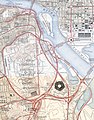
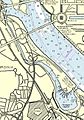 Boundary Channel - Potomac River - US Coastal Pilot 2013.jpg 905 × 1,289; 1.03 MB
-
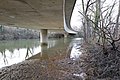
 Bridge across the Boundary Channel (d3ce1a86-9ca2-46c4-8ffd-5184807d5e59).jpg 4,946 × 3,039; 2.37 MB
-
 CH-3E over the Pentagon DC 1979.JPEG 2,780 × 1,870; 1.88 MB
-
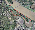 Columbia Island - aerial view 2005.jpg 473 × 406; 240 KB
-
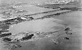 Dredging operations in Potomac River - 1930.jpg 3,656 × 2,267; 6.17 MB
-
 George Washington Parkway northbound Boundary Channel crossing 2020.jpg 4,608 × 3,456; 4.33 MB
-
 George Washington Parkway southbound Boundary Channel crossing 2020a.jpg 6,240 × 4,160; 10.35 MB
-
 George Washington Parkway southbound Boundary Channel crossing 2020b.jpg 6,240 × 4,160; 11.53 MB
-
 Lyndon Johnson Grove footbridge 2020.jpg 6,240 × 4,160; 10.71 MB
-

-
 Pentagon road network map 1945.jpg 1,020 × 1,300; 535 KB
-
 Teddy Roosevelt Island Bridge.jpg 1,280 × 851; 584 KB
-
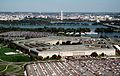 The Pentagon US Department of Defense building.jpg 2,734 × 1,726; 964 KB
-

-

-

-

-

-
 USSAkronOverWashingtonDC.jpg 740 × 555; 142 KB
-
 Washington 77.04477W 38.88819N.jpg 1,280 × 958; 252 KB
-
 Washington Boulevard Boundary Channel crossing 2020.jpg 6,240 × 4,160; 13.06 MB
_(3).jpg)


.jpg)


.jpg)


.jpg)
.jpg)