Category:Boughton, Cheshire
Jump to navigation
Jump to search
English: Boughton is a neighbourhood to the east of Chester city centre, part of the unitary authority of Cheshire West and Chester and the ceremonial county of Cheshire, England. It is located atop the steep banks of the River Dee as it turns the meadows bend for the last time around the 'Earls Eye' before flowing into Chester.
neighbourhood in Chester, Cheshire, UK  | |||||
| Upload media | |||||
| Instance of | |||||
|---|---|---|---|---|---|
| Location | Cheshire West and Chester, Cheshire, North West England, England | ||||
 | |||||
Subcategories
This category has the following 4 subcategories, out of 4 total.
B
- Boughton Water Tower (11 F)
C
P
- St Paul's Church, Boughton (7 F)
S
- Sandy Lane Park, Chester (3 F)
Media in category "Boughton, Cheshire"
The following 200 files are in this category, out of 756 total.
(previous page) (next page)-
 "Lady Diana", Chester - geograph.org.uk - 2974361.jpg 640 × 480; 71 KB
-
 "Look at me, I can stand on one leg" - geograph.org.uk - 5258524.jpg 1,024 × 769; 78 KB
-
 "Mark Twain Showboat", Chester - geograph.org.uk - 2974366.jpg 640 × 480; 65 KB
-
 'Love-Lock' on Queen's Park Suspension Bridge - geograph.org.uk - 3683389.jpg 6,000 × 4,500; 3.14 MB
-
 'Mark Twain' pleasure boat at the quay - geograph.org.uk - 5093259.jpg 3,648 × 2,432; 4.55 MB
-
 125-133 Boughton, Chester.jpg 1,600 × 1,228; 316 KB
-
 13a Lower Bridge Street and St Olave's Church, Chester - geograph.org.uk - 5468306.jpg 4,184 × 2,789; 2.65 MB
-
 1GL benchmark ^ bolt on cathedral, Chester - geograph.org.uk - 6303585.jpg 1,536 × 2,048; 808 KB
-
 22a The Groves Chester - geograph.org.uk - 3338480.jpg 6,892 × 4,852; 6.52 MB
-

-
 A Christmas Robin in Chester - geograph.org.uk - 4773069.jpg 800 × 596; 98 KB
-

-
 A fallen Chester Waterworks Company marker post - geograph.org.uk - 5261572.jpg 768 × 1,024; 345 KB
-

-
 A Goosander fishing below Chester's weir - geograph.org.uk - 5737073.jpg 1,024 × 769; 155 KB
-
 A lone tree in the River Dee - geograph.org.uk - 2201796.jpg 640 × 480; 148 KB
-

-
 A mossy Chester Waterworks Company marker post - geograph.org.uk - 5261463.jpg 768 × 1,024; 293 KB
-
 A pair of red telephone kiosks on Northgate Street, Chester - geograph.org.uk - 6312729.jpg 4,160 × 3,120; 4.19 MB
-
 A pair of red telephone kiosks on Northgate Street, Chester - geograph.org.uk - 6312733.jpg 4,160 × 3,120; 4.11 MB
-
 A quiet day in the Groves - geograph.org.uk - 4797877.jpg 4,608 × 3,456; 6.03 MB
-

-
 A view from Queen's Park Bridge, Chester - geograph.org.uk - 3672603.jpg 3,648 × 2,736; 3.97 MB
-
 A waterwheel on the Dee - geograph.org.uk - 2399656.jpg 800 × 600; 340 KB
-
 A51 road, Boughton.JPG 3,648 × 2,736; 3.62 MB
-
 Abbey Gateway blue plaque, Chester - geograph.org.uk - 6330540.jpg 2,135 × 1,602; 425 KB
-
 Abbey Green, Chester - geograph.org.uk - 6173037.jpg 1,024 × 768; 138 KB
-
 Abbey Square sign, Chester - geograph.org.uk - 6317584.jpg 4,160 × 3,120; 2.73 MB
-
 Abbey St (unadopted) sign, Chester - geograph.org.uk - 6317579.jpg 983 × 710; 182 KB
-
 Abbey Street, Chester - geograph.org.uk - 6173021.jpg 1,024 × 768; 265 KB
-
 Across the River Dee at Earl's Eye - geograph.org.uk - 2115859.jpg 640 × 480; 178 KB
-
 Albion Place - geograph.org.uk - 3642060.jpg 1,600 × 1,028; 265 KB
-
 Albion Place, Chester - geograph.org.uk - 3817583.jpg 4,000 × 3,000; 1.78 MB
-

-

-
 Albion Street from Chester's ancient walls - geograph.org.uk - 1983509.jpg 3,008 × 2,000; 1.68 MB
-
 Albion Street in the Evening - geograph.org.uk - 2749517.jpg 640 × 480; 92 KB
-
 Albion Street, Chester - geograph.org.uk - 3227686.jpg 640 × 480; 93 KB
-
 Albion Street, Chester - geograph.org.uk - 3656940.jpg 856 × 1,280; 224 KB
-
 Albion Street, Chester - geograph.org.uk - 3817254.jpg 4,000 × 3,000; 1.91 MB
-
 Almshouses in Lumley Place, Chester - geograph.org.uk - 5389887.jpg 4,184 × 2,789; 2.54 MB
-
 Alongside the Old Dee Bridge - geograph.org.uk - 2201834.jpg 480 × 640; 118 KB
-
 Amphitheatre and Dee House, Chester - geograph.org.uk - 5217702.jpg 3,392 × 2,248; 1.63 MB
-
 Amphitheatre model, Chester - geograph.org.uk - 3228769.jpg 640 × 480; 96 KB
-
 An anchor ^ 692 Ft carved into city wall, Chester - geograph.org.uk - 6316817.jpg 2,048 × 1,536; 567 KB
-
 Anchorite's Cell, Chester - geograph.org.uk - 4985409.jpg 5,100 × 3,400; 6.22 MB
-
 Ancient tree stump by the River Dee - geograph.org.uk - 6046709.jpg 1,600 × 1,200; 869 KB
-
 Approaching Newgate, Chester - geograph.org.uk - 5723146.jpg 3,456 × 5,184; 2.79 MB
-
 Archaeological Dig in Grosvenor Park, Chester - geograph.org.uk - 5802708.jpg 4,000 × 3,000; 2.78 MB
-
 Archaeological Dig in Grosvenor Park, Chester - geograph.org.uk - 5802713.jpg 4,000 × 3,000; 2.76 MB
-
 Back alley - geograph.org.uk - 4536862.jpg 4,320 × 3,240; 5.07 MB
-
 Back of the Penri Chapel - geograph.org.uk - 6173048.jpg 1,024 × 768; 152 KB
-
 Bahai garden, Grosvenor Park - geograph.org.uk - 6060029.jpg 3,986 × 2,860; 5.56 MB
-

-
 Bandstand - geograph.org.uk - 3537087.jpg 3,264 × 1,840; 3.71 MB
-
 Bandstand beside the river, Chester - geograph.org.uk - 6285798.jpg 1,024 × 683; 228 KB
-
 Bath Street - Union Street - geograph.org.uk - 3454237.jpg 640 × 480; 67 KB
-
 Beaconsfield Street, Chester - geograph.org.uk - 3579723.jpg 1,600 × 1,200; 490 KB
-
 Bear And Billet - geograph.org.uk - 2155784.jpg 800 × 600; 271 KB
-
 Below the suspension bridge - geograph.org.uk - 4797855.jpg 4,608 × 3,456; 4.91 MB
-
 Bench mark at the eastern end of Bottoms Lane - geograph.org.uk - 5258689.jpg 770 × 1,024; 315 KB
-

-

-
 Bench mark in St Georges Crescent, Handbridge - geograph.org.uk - 4700134.jpg 4,608 × 3,456; 6.6 MB
-
 Bench mark on a fallen CWC marker post - geograph.org.uk - 5261534.jpg 1,024 × 769; 441 KB
-
 Bench mark on St Mary's Hill, Chester - geograph.org.uk - 5407043.jpg 768 × 1,024; 373 KB
-

-

-
 Bench mark on the city walls in The Groves - geograph.org.uk - 4773086.jpg 4,608 × 3,456; 5.49 MB
-
 Benchmark on cathedral, Chester - geograph.org.uk - 6306110.jpg 3,120 × 4,160; 5.75 MB
-
 Benchmark on the Town Hall - geograph.org.uk - 6353986.jpg 763 × 1,024; 173 KB
-
 Benchmark on town hall building, Chester - geograph.org.uk - 6303357.jpg 1,536 × 2,048; 909 KB
-
 Benchmark, Abbey Street, Chester - geograph.org.uk - 6173024.jpg 1,024 × 768; 160 KB
-
 Billy Hobbie's Well, Grosvenor Park - geograph.org.uk - 3899925.jpg 3,000 × 4,000; 3.63 MB
-
 Black and white shops in Handbridge (road) - geograph.org.uk - 3092361.jpg 3,648 × 2,736; 2.46 MB
-
 Blackbird on the Newgate - geograph.org.uk - 5621079.jpg 1,024 × 773; 96 KB
-
 Blockbuster (closed), Boughton, Chester - geograph.org.uk - 3788725.jpg 4,000 × 3,000; 2.33 MB
-
 Boats on the River Dee - geograph.org.uk - 2190639.jpg 640 × 480; 125 KB
-
 Boot scraper on Abbey Square, Chester - geograph.org.uk - 6319067.jpg 4,160 × 3,120; 2.81 MB
-
 Boot scraper on Abbey Square, Chester - geograph.org.uk - 6319073.jpg 3,120 × 4,160; 3.03 MB
-

-
 Boughton - geograph.org.uk - 1336844.jpg 640 × 457; 294 KB
-
 Boughton across the River Dee - geograph.org.uk - 1125723.jpg 640 × 480; 136 KB
-
 Boughton Hall Avenue, Chester.JPG 4,320 × 3,240; 3.01 MB
-
 Boughton Post Office, Christleton Road, Chester - DSC07972.JPG 3,648 × 2,736; 3.48 MB
-
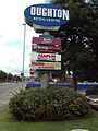 Boughton Retail Centre sign.JPG 2,736 × 3,648; 3.55 MB
-
 Boughton Retail Centre, Chester.JPG 4,608 × 3,456; 3.44 MB
-
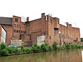 Brick buildings by the canal - geograph.org.uk - 6173063.jpg 1,024 × 768; 190 KB
-
 Bridge Gate - geograph.org.uk - 2155978.jpg 800 × 600; 283 KB
-
 Bridge Gate in August 2005 - geograph.org.uk - 3021778.jpg 1,024 × 769; 256 KB
-
 Bridge Gate in Chester - geograph.org.uk - 2166378.jpg 1,500 × 976; 210 KB
-
 Bridge Gate, Chester - geograph.org.uk - 2155982.jpg 800 × 600; 326 KB
-
 Bridge Gate, Chester - geograph.org.uk - 4855424.jpg 1,024 × 768; 221 KB
-
 Bridge Inn, Chester (1).JPG 4,320 × 3,240; 2.68 MB
-
 Bridge Inn, Chester (2).JPG 4,320 × 3,240; 2.7 MB
-
 Bridge over the canal - geograph.org.uk - 5172538.jpg 640 × 427; 101 KB
-
 Bridge over the River Dee - geograph.org.uk - 3642086.jpg 1,600 × 1,200; 342 KB
-

-
 Bridge Street and St Peter's Church - geograph.org.uk - 6364281.jpg 2,592 × 1,944; 1.39 MB
-
 Bridgegate - geograph.org.uk - 3602091.jpg 1,142 × 857; 392 KB
-
 Bridgegate Vicinity, Chester - geograph.org.uk - 6012126.jpg 2,811 × 3,614; 2.12 MB
-
 Bridgegate Vicinity, Chester - geograph.org.uk - 6012425.jpg 2,875 × 2,686; 2.16 MB
-
 Busker, Chester underpass - geograph.org.uk - 5453644.jpg 4,782 × 2,897; 1.09 MB
-
 Canal bridge, Chester - geograph.org.uk - 4138583.jpg 800 × 717; 206 KB
-
 Canal east of City Road - geograph.org.uk - 6173085.jpg 1,024 × 768; 180 KB
-
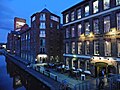 Canal-side restaurants, Chester - geograph.org.uk - 5521200.jpg 1,024 × 768; 182 KB
-
 Canalside Inn, Eaton Hotel, Chester - geograph.org.uk - 1828910.jpg 2,048 × 1,536; 654 KB
-
 Canoes on the River Dee - geograph.org.uk - 4815427.jpg 1,616 × 1,066; 680 KB
-
 Castle Drive from The Bridgegate, Chester - geograph.org.uk - 4319280.jpg 4,000 × 3,000; 2.54 MB
-
 Castle Drive, Chester - geograph.org.uk - 4466233.jpg 3,184 × 2,123; 1.7 MB
-
 Castle Street - Lower Bridge Street - geograph.org.uk - 3454260.jpg 480 × 640; 72 KB
-
 Castle Street outside ^17 - geograph.org.uk - 4866361.jpg 3,456 × 4,608; 2.88 MB
-
 Cathedral buildings frontage on St Werburgh Street, Chester - geograph.org.uk - 6325531.jpg 4,160 × 3,120; 2.42 MB
-
 Cherry Orchard pub, Chapel Lane, Chester - DSC07971.JPG 3,648 × 2,736; 3.6 MB
-
 Cheshire Cat on Chester City Walls - geograph.org.uk - 4319288.jpg 4,000 × 3,000; 2.65 MB
-

-
 Chester - houses on Albion Place - geograph.org.uk - 5232569.jpg 5,184 × 2,920; 6.56 MB
-
 Chester - R Dee at The Groves ^ paddle boats - geograph.org.uk - 6330924.jpg 5,184 × 2,920; 5.5 MB
-
 Chester - Riverside at The Groves - geograph.org.uk - 4756074.jpg 1,024 × 768; 177 KB
-
 Chester - The R Dee from Queens Park Bridge - geograph.org.uk - 5232561.jpg 5,184 × 2,920; 5.62 MB
-

-
 Chester Amphitheatre - geograph.org.uk - 6332701.jpg 2,000 × 1,037; 1.99 MB
-
 Chester Amphitheatre - geograph.org.uk - 6332714.jpg 2,000 × 1,331; 2.7 MB
-
 Chester Castle and University of Chester Riverside Campus - geograph.org.uk - 4841716.jpg 3,184 × 2,123; 2.25 MB
-

-
 Chester Cathedral - geograph.org.uk - 6339454.jpg 1,024 × 763; 226 KB
-
 Chester Cathedral - geograph.org.uk - 6363685.jpg 2,592 × 1,944; 1.45 MB
-
 Chester Cathedral Bell Tower - geograph.org.uk - 6358176.jpg 3,456 × 4,608; 3.84 MB
-
 Chester Cathedral, West front - geograph.org.uk - 6363370.jpg 2,592 × 1,944; 1.43 MB
-
 Chester Central Telephone Exchange (1) - geograph.org.uk - 5325701.jpg 2,592 × 1,944; 1.36 MB
-
 Chester Central Telephone Exchange (2) - geograph.org.uk - 5325708.jpg 2,592 × 1,944; 1.36 MB
-
 Chester Christmas Market 2019 - geograph.org.uk - 6347612.jpg 6,000 × 4,000; 3.32 MB
-
 Chester City Wall - geograph.org.uk - 3642046.jpg 1,600 × 1,196; 391 KB
-
 Chester city wall at the Eastgate - geograph.org.uk - 6173017.jpg 1,024 × 768; 226 KB
-
 Chester city walls - geograph.org.uk - 3602059.jpg 857 × 1,142; 394 KB
-
 Chester City Walls - geograph.org.uk - 5723153.jpg 5,184 × 3,456; 3.58 MB
-
 Chester City Walls and Drum Tower - geograph.org.uk - 4897690.jpg 3,184 × 2,123; 2.27 MB
-
 Chester City Walls and Drum Tower - geograph.org.uk - 4897704.jpg 3,184 × 2,123; 3.37 MB
-
 Chester City Walls and the River Dee - geograph.org.uk - 4897744.jpg 3,184 × 2,123; 1.68 MB
-
 Chester city walls on the south side of town - geograph.org.uk - 3602053.jpg 1,142 × 857; 522 KB
-
 Chester Dental Clinic, Volunteer Street, Chester - geograph.org.uk - 3817246.jpg 3,865 × 2,875; 1.69 MB
-
 Chester Half Marathon 1997 - geograph.org.uk - 5250817.jpg 2,392 × 1,580; 1.27 MB
-
 Chester High Cross - geograph.org.uk - 6339406.jpg 1,024 × 768; 179 KB
-
 Chester Public Baths, Union Street - geograph.org.uk - 3576819.jpg 1,562 × 1,600; 525 KB
-
 Chester Roman Festival 2011 - geograph.org.uk - 2443870.jpg 3,888 × 2,592; 4.71 MB
-
 Chester Roman Festival 2011 - geograph.org.uk - 2443894.jpg 3,888 × 2,592; 4.71 MB
-
 Chester Roman Festival 2011 - geograph.org.uk - 2443924.jpg 3,888 × 2,592; 4.97 MB
-
 Chester Sailing and Canoeing Club - geograph.org.uk - 4846175.jpg 640 × 480; 71 KB
-
 Chester Sailing and Canoeing Club.JPG 4,608 × 3,456; 3.57 MB
-
 Chester Weir - geograph.org.uk - 2156630.jpg 800 × 600; 236 KB
-
 Chester Weir - geograph.org.uk - 2228233.jpg 2,592 × 1,944; 2.78 MB
-
 Chester Weir - geograph.org.uk - 3744004.jpg 4,932 × 3,384; 2.6 MB
-
 Chester Weir - geograph.org.uk - 4845717.jpg 4,184 × 2,789; 3.23 MB
-
 Chester Weir - geograph.org.uk - 4850560.jpg 4,184 × 2,789; 3.49 MB
-
 Chester weir and salmon steps - geograph.org.uk - 6046676.jpg 1,600 × 1,200; 510 KB
-
 Chester Weir and the River Dee - geograph.org.uk - 4861811.jpg 3,184 × 2,123; 2.07 MB
-
 Chester Weir and the River Dee - geograph.org.uk - 5001183.jpg 3,184 × 2,123; 2.11 MB
-
 Chester, Bakers' Row. - geograph.org.uk - 6339389.jpg 1,024 × 768; 205 KB
-
 Chester, bell tower - geograph.org.uk - 6339468.jpg 764 × 1,024; 218 KB
-
 Chester, Christmas Market - geograph.org.uk - 6339414.jpg 1,024 × 768; 174 KB
-
 Chester, city wall - geograph.org.uk - 6339589.jpg 1,024 × 768; 197 KB
-
 Chester, Eastgate - geograph.org.uk - 6339375.jpg 1,024 × 768; 215 KB
-
 Chester, Hickory's Smokehouse - geograph.org.uk - 4755687.jpg 3,264 × 2,448; 3.01 MB
-
 Chester, looking up the Dee from the city walls - geograph.org.uk - 3241061.jpg 1,600 × 1,064; 472 KB
-
 Chester, Northgate - geograph.org.uk - 6340429.jpg 1,024 × 768; 166 KB
-
 Chester, Off The Wall - geograph.org.uk - 4755637.jpg 3,264 × 2,448; 2.18 MB
-
 Chester, Old Dee Bridge - geograph.org.uk - 4755698.jpg 3,264 × 2,137; 1.5 MB
-

-
 Chester, Pepper Street car park - geograph.org.uk - 4755645.jpg 3,264 × 2,448; 1.98 MB
-
 Chester, Square Bottle - geograph.org.uk - 6339365.jpg 1,024 × 768; 161 KB
-
 Chester, Steam Mill - geograph.org.uk - 6339292.jpg 1,024 × 769; 161 KB
-
 Chester-Bath Street - geograph.org.uk - 2342163.jpg 640 × 480; 72 KB
-
 Chester-Forest Street - geograph.org.uk - 2340003.jpg 640 × 480; 57 KB
-
 Chester-The Boathouse - geograph.org.uk - 2344156.jpg 640 × 480; 69 KB
-
 Chester-The Groves - geograph.org.uk - 2344168.jpg 640 × 480; 76 KB
-
 Children's Play Area at Grosvenor Park - geograph.org.uk - 3899806.jpg 4,000 × 3,000; 3.82 MB
-
 Christian Science Church in St Olave's Street - geograph.org.uk - 4767808.jpg 3,456 × 4,608; 3.58 MB
-

-
 City Road, Chester - geograph.org.uk - 3307706.jpg 4,000 × 3,000; 1.66 MB
-
 City Road, Chester - geograph.org.uk - 3589720.jpg 1,600 × 1,199; 442 KB
-
 Clock, Chester - geograph.org.uk - 2974407.jpg 640 × 480; 57 KB
-
 Closed for Business in Boughton - geograph.org.uk - 3726767.jpg 4,820 × 3,777; 2.21 MB
-
 Cobbled path and steps near The Groves - geograph.org.uk - 2738525.jpg 4,000 × 3,000; 4.06 MB
-
 Colourful planting in Grosvenor Park - geograph.org.uk - 6284551.jpg 1,024 × 683; 263 KB
-
 Colourful Rhino - geograph.org.uk - 1996965.jpg 640 × 545; 230 KB
-
 Commit No Nuisance in Chester - geograph.org.uk - 4073920.jpg 3,460 × 2,430; 1.19 MB
-
 Cormorant below the Old Dee Bridge - geograph.org.uk - 5700552.jpg 1,024 × 769; 86 KB
-
 Cormorant on a log in the River Dee - geograph.org.uk - 5490326.jpg 766 × 1,024; 141 KB
-
 Cormorants below the Old Dee Bridge - geograph.org.uk - 3683267.jpg 480 × 640; 144 KB
-
 Corner House, Albion Street - geograph.org.uk - 2749204.jpg 1,600 × 1,230; 299 KB
-
 Cottages, Bath Street, Chester - geograph.org.uk - 3576536.jpg 1,600 × 1,338; 533 KB
-
 Cow Lane Bridge, Chester - geograph.org.uk - 6173055.jpg 1,024 × 768; 157 KB
-
 Cow on the Earl's Eye - geograph.org.uk - 3683360.jpg 4,000 × 3,000; 3.14 MB
-
 Cows on the Earl's Eye - geograph.org.uk - 3730879.jpg 3,720 × 2,820; 2.18 MB
-
 Cross Hey, Handbridge - geograph.org.uk - 3731079.jpg 5,184 × 3,456; 3.13 MB
-
 Damaged bench mark on ^17 Castle Street - geograph.org.uk - 4866350.jpg 3,456 × 4,608; 3.23 MB
-

-
 Dee Autumn Head 2013 - geograph.org.uk - 3726633.jpg 3,560 × 2,710; 2.38 MB
-
 Dee Autumn Head 2013 - geograph.org.uk - 3726648.jpg 4,000 × 3,000; 3.08 MB
-
 Dee Autumn Head 2013 - geograph.org.uk - 3726658.jpg 4,000 × 3,000; 2.88 MB


_sign,_Chester_-_geograph.org.uk_-_6317579.jpg)


_-_geograph.org.uk_-_3092361.jpg)

,_Boughton,_Chester_-_geograph.org.uk_-_3788725.jpg)


.JPG)
.JPG)


_-_geograph.org.uk_-_4756078.jpg)


_-_geograph.org.uk_-_5325701.jpg)
_-_geograph.org.uk_-_5325708.jpg)


