Category:Botanic Road, Liverpool
Jump to navigation
Jump to search
| Object location | | View all coordinates using: OpenStreetMap |
|---|
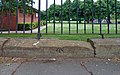
Botanic Road runs north to south between Edge Lane and Wavertree Road, forming the western boundary of Wavertree Botanic Park.
Media in category "Botanic Road, Liverpool"
The following 8 files are in this category, out of 8 total.
-
 Benchmark opposite 113 Botanic Road.jpg 4,728 × 3,608; 3.88 MB
-
 Benchmark opposite 15 Botanic Road.jpg 4,560 × 2,857; 3.18 MB
-
 Benchmark opposite 47 Botanic Road.jpg 4,668 × 3,378; 3.24 MB
-
 Botanic Road - geograph.org.uk - 1737167.jpg 640 × 480; 85 KB
-
 Botanic Road.jpg 1,920 × 2,560; 910 KB
-
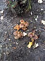 Fungi, Botanic Road.jpg 1,920 × 2,560; 840 KB
-
 Littlewoods Pools building 2.jpg 3,000 × 4,000; 1.87 MB
-
 Northwest entrance to Wavertree Botanic Park.jpg 4,770 × 3,426; 4.23 MB


