Category:Borregas (VTA)
Jump to navigation
Jump to search
English: Media pertaining to the Borregas (VTA) light rail and bus station on East Java Drive in Sunnyvale, California, USA.
| Object location | | View all coordinates using: OpenStreetMap |
|---|
VTA light rail station in Sunnyvale, California  | |||||
| Upload media | |||||
| Instance of | |||||
|---|---|---|---|---|---|
| Location | Sunnyvale, Santa Clara County, California, Pacific States Region | ||||
| Transport network | |||||
| Owned by | |||||
| Inception |
| ||||
| Date of official opening |
| ||||
| Connecting line |
| ||||
| Adjacent station |
| ||||
 | |||||
Media in category "Borregas (VTA)"
The following 12 files are in this category, out of 12 total.
-
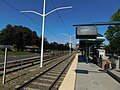 Borregas Station.jpg 4,608 × 3,456; 3.59 MB
-
 Borregas VTA station 1095 01.JPG 2,048 × 1,536; 1.06 MB
-
 Borregas VTA station 1096 02.JPG 2,048 × 1,536; 857 KB
-
 Borregas VTA station 1097 03.JPG 2,048 × 1,536; 1.01 MB
-
 Borregas VTA station 1098 04.JPG 2,048 × 1,536; 1.25 MB
-
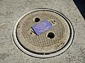 Reclaimed water street hole cover at Borregas station in Sunnyvale.jpg 4,032 × 3,024; 6.18 MB
-
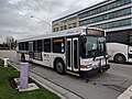
 VTA 120 bus at Borregas station.jpg 2,496 × 1,875; 1.32 MB
-
 VTA 120 Express bus at Borregas, rear view.jpg 4,048 × 3,036; 3.25 MB
-
 VTA 120 Express bus at Borregas.jpg 3,164 × 1,607; 1.12 MB
-
 VTA 26 bus at Borregas.jpg 4,048 × 3,036; 3.76 MB
-
 VTA light rail pulling into Borregas station at sunset.jpg 4,032 × 3,024; 4.15 MB
-
 VTA light rail tracks at Borregas station.jpg 4,032 × 3,024; 5.98 MB


