Category:Boothstraat 15, Utrecht
Jump to navigation
Jump to search
| Object location | | View all coordinates using: OpenStreetMap |
|---|
 | |||||
| Upload media | |||||
| Instance of | |||||
|---|---|---|---|---|---|
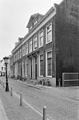
| Location | Utrecht, Netherlands | ||||
| Street address |
| ||||
| Heritage designation |
| ||||
 | |||||
|
This is a category about rijksmonument number 36019
|
| Address |
|
Media in category "Boothstraat 15, Utrecht"
The following 8 files are in this category, out of 8 total.
-
 Boothstraat.13-15.Utrecht.jpg 2,826 × 3,768; 4.68 MB
-
 Exterieur DAKKAPEL - Utrecht - 20314790 - RCE.jpg 1,195 × 1,200; 207 KB
-
 Exterieur INGANGSPARTIJ - Utrecht - 20314789 - RCE.jpg 1,200 × 1,195; 288 KB
-
 Exterieur OVERZICHT VOORGEVELS - Utrecht - 20314786 - RCE.jpg 788 × 1,200; 201 KB
-
 Exterieur VOORGEVEL - Utrecht - 20314791 - RCE.jpg 788 × 1,200; 202 KB
-
 Exterieur VOORGEVELS - Utrecht - 20314787 - RCE.jpg 788 × 1,200; 209 KB
-
 Exterieur VOORGEVELS - Utrecht - 20314788 - RCE.jpg 960 × 1,200; 277 KB
-
 Voorgevels - Utrecht - 20235487 - RCE.jpg 805 × 1,200; 179 KB


