Category:Bontnewydd, Gwynedd
Jump to navigation
Jump to search
village and community in Gwynedd, Wales   | |||||
| Upload media | |||||
| Pronunciation audio | |||||
|---|---|---|---|---|---|
| Instance of | |||||
| Location | Gwynedd, Wales | ||||
| Population |
| ||||
| Area |
| ||||
 | |||||
Cymraeg: Mae Bontnewydd yn bentref gweddol fawr ar y briffordd A487 fymryn i'r de o Gaernarfon; Cyfeirnod OS: SH 48300 60061. Daw'r enw o'r bont dros Afon Gwyrfai a adeiladwyd yn y 18fed ganrif, er bod pont arall wedi cymeryd ei lle erbyn hyn.
Subcategories
This category has the following 3 subcategories, out of 3 total.
Media in category "Bontnewydd, Gwynedd"
The following 200 files are in this category, out of 225 total.
(previous page) (next page)-
 "Now it comes out here" - geograph.org.uk - 4121653.jpg 640 × 480; 84 KB
-
 "Now listen here" - geograph.org.uk - 4121153.jpg 640 × 480; 119 KB
-
 'Top O' The Morning To Ya' - geograph.org.uk - 4121696.jpg 640 × 480; 100 KB
-
 'Umm which way to go^' - geograph.org.uk - 4121716.jpg 640 × 480; 105 KB
-

-
 A dragon for tea^ - geograph.org.uk - 4115617.jpg 640 × 480; 127 KB
-
 A whimsical weather vane - geograph.org.uk - 4992387.jpg 4,896 × 3,672; 5.63 MB
-
 A487 at Bontnewydd - geograph.org.uk - 6108288.jpg 1,024 × 770; 123 KB
-
 Aber Foreshore - geograph.org.uk - 4876259.jpg 640 × 473; 74 KB
-
 Across the mouth of Foryd Bay - geograph.org.uk - 5559254.jpg 4,000 × 2,359; 1.97 MB
-
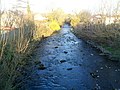
 Afon Gwyrfai - geograph.org.uk - 4877107.jpg 640 × 480; 126 KB
-
 Afon Gwyrfai, Bontnewydd - geograph.org.uk - 2872392.jpg 640 × 480; 101 KB
-
 Agricultural Buildings, Reiniast - geograph.org.uk - 4602571.jpg 1,600 × 1,200; 289 KB
-

-
 Berllan barn - geograph.org.uk - 4992372.jpg 3,358 × 2,304; 2.39 MB
-
 Boats beside the Wales Coast Path - geograph.org.uk - 5475471.jpg 3,184 × 2,123; 1.48 MB
-
 Bontnewydd - 2013 - geograph.org.uk - 4090834.jpg 3,648 × 2,736; 1,017 KB
-
 Bontnewydd - 2013 - geograph.org.uk - 4090838.jpg 3,648 × 2,736; 3.07 MB
-
 Bontnewydd - 2013 - geograph.org.uk - 4093887.jpg 3,648 × 2,736; 3.95 MB
-
 Bontnewydd - 2013 - geograph.org.uk - 4093889.jpg 3,648 × 2,736; 3.49 MB
-
 Bontnewydd Railway Station - geograph.org.uk - 3816069.jpg 4,000 × 3,000; 3.73 MB
-
 Bontnewydd roundabout - geograph.org.uk - 5506382.jpg 640 × 427; 55 KB
-
 Bontnewydd Station - geograph.org.uk - 3111068.jpg 640 × 427; 108 KB
-
 Bontnewydd station - geograph.org.uk - 3914445.jpg 640 × 360; 112 KB
-
 Bontnewydd.png 5,500 × 5,000; 1.39 MB
-
 Bronant farmyard, eastern wing - geograph.org.uk - 3240280.jpg 1,024 × 768; 154 KB
-
 Bronant farmyard, northern wing - geograph.org.uk - 3240282.jpg 1,024 × 768; 190 KB
-
 Bronant farmyard, southern wing - geograph.org.uk - 3240276.jpg 1,024 × 768; 163 KB
-
 Bryn Hyfryd Cottage - geograph.org.uk - 830891.jpg 640 × 480; 78 KB
-
 Bus stop at Cartreff - geograph.org.uk - 5506185.jpg 640 × 378; 53 KB
-
 Caernarfon golf course - geograph.org.uk - 4992390.jpg 4,896 × 3,672; 6.67 MB
-
 Caffi y ddraig - Dragon's cafe - geograph.org.uk - 5520514.jpg 640 × 427; 115 KB
-
 Capel Libanus, Bontnewydd - geograph.org.uk - 5786343.jpg 640 × 480; 62 KB
-
 Capel Siloam at Bontnewydd - geograph.org.uk - 6278457.jpg 640 × 431; 60 KB
-
 Cartref Bontnewydd - geograph.org.uk - 5786353.jpg 640 × 480; 65 KB
-
 Cartref Bontnewydd Family Support Centre - geograph.org.uk - 959599.jpg 640 × 480; 115 KB
-

-
 Castellmai manor from the main road - geograph.org.uk - 830954.jpg 640 × 326; 49 KB
-
 Castellmai manor house - geograph.org.uk - 830924.jpg 640 × 410; 71 KB
-
 Ceriw, Bontnewydd - geograph.org.uk - 1776435.jpg 1,024 × 881; 266 KB
-
 Ceunant, Plas Glan-yr-Afon - geograph.org.uk - 830849.jpg 640 × 469; 77 KB
-
 Chapel at Bontnewydd in 2005.jpg 640 × 586; 156 KB
-
 Church for sale - geograph.org.uk - 4992341.jpg 4,896 × 3,672; 7.28 MB
-
 Close to high tide at the mouth of the Foryd - geograph.org.uk - 4259933.jpg 1,024 × 768; 177 KB
-
 Clwb Golff Caernarfon - geograph.org.uk - 4876265.jpg 640 × 480; 58 KB
-
 Coastline at Ty Calch - geograph.org.uk - 6197742.jpg 1,600 × 1,200; 618 KB
-
 Coastline west of Caernarfon - geograph.org.uk - 4876623.jpg 640 × 471; 54 KB
-

-
 Cora at Gypsy Wood Park - geograph.org.uk - 4115507.jpg 640 × 480; 129 KB
-
 Cottages in Llanfaglan - geograph.org.uk - 4992332.jpg 4,896 × 3,672; 6.67 MB
-
 Country Lane at Tan-y-graig - geograph.org.uk - 5809719.jpg 5,184 × 3,456; 4.67 MB
-
 Cows crossing the Cycle Path - geograph.org.uk - 2574491.jpg 640 × 480; 104 KB
-
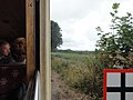
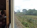
 Crossing the Gwyrfai on the Welsh Highland Railway - geograph.org.uk - 2598247.jpg 2,816 × 2,112; 1.92 MB
-
 Cyclist on Lon Eifion - geograph.org.uk - 3835948.jpg 4,000 × 3,000; 2.98 MB
-
 Dinas - geograph.org.uk - 3743984.jpg 800 × 530; 377 KB
-
 Dragons be about - geograph.org.uk - 5523802.jpg 640 × 481; 119 KB
-
 Duck at Gypsy Wood Park - geograph.org.uk - 4123838.jpg 640 × 480; 137 KB
-

-
 Eglwys St Baglan - geograph.org.uk - 4877080.jpg 640 × 472; 70 KB
-

-
-
 Entrance to Caernarfon Golf Club - geograph.org.uk - 5472809.jpg 3,184 × 2,123; 1.93 MB
-
 Entrance to Plas y Bryn Chalet Park - geograph.org.uk - 5786338.jpg 640 × 480; 75 KB
-
 Entrance to the driveway of Bronant - geograph.org.uk - 560419.jpg 640 × 480; 121 KB
-

-
 Fairy bearing gifts - geograph.org.uk - 4115651.jpg 640 × 480; 65 KB
-
 Farm road to Cae Mawr - geograph.org.uk - 5786331.jpg 640 × 480; 86 KB
-
 Farm track and mountains - geograph.org.uk - 4992384.jpg 4,896 × 3,672; 6.77 MB
-
 Farmland at Bronant - geograph.org.uk - 3240302.jpg 1,024 × 768; 167 KB
-
 Farmland on the east side of the Foryd - geograph.org.uk - 3750720.jpg 1,024 × 768; 158 KB
-
 Ffrwd Cae Du bus stop - geograph.org.uk - 5506178.jpg 640 × 503; 126 KB
-
 Footpath to St Baglan's Church - geograph.org.uk - 5480151.jpg 5,184 × 3,456; 5.88 MB
-
 Former walled garden - geograph.org.uk - 3697501.jpg 800 × 530; 507 KB
-
 Foryd Bay - geograph.org.uk - 4876722.jpg 640 × 480; 72 KB
-
 Foryd Bay - geograph.org.uk - 4877083.jpg 640 × 472; 48 KB
-
 Foryd Bay - geograph.org.uk - 4877092.jpg 640 × 472; 52 KB
-
 Foryd Bay - geograph.org.uk - 4877096.jpg 640 × 476; 80 KB
-
 Foryd Bay - geograph.org.uk - 5559261.jpg 4,000 × 2,505; 2.44 MB
-
 Goat at rest - geograph.org.uk - 4115671.jpg 640 × 480; 103 KB
-
 Golden dragon - geograph.org.uk - 5522944.jpg 427 × 640; 113 KB
-

-

-
 Graves at the east end of St Baglan's churchyard - geograph.org.uk - 6260022.jpg 1,916 × 1,277; 1,012 KB
-
 Graves at the west end of St Baglan's churchyard - geograph.org.uk - 6260017.jpg 1,845 × 1,230; 743 KB
-
 Graves on the south side of St Baglan's churchyard - geograph.org.uk - 6260020.jpg 1,916 × 1,277; 997 KB
-
 Grim day on Menai Straits - geograph.org.uk - 3826498.jpg 1,600 × 1,200; 303 KB
-
 Gwesty y bwg or Bug's Motel - geograph.org.uk - 4121150.jpg 640 × 480; 128 KB
-
 Gypsy Wood Park activities - geograph.org.uk - 4121560.jpg 640 × 480; 99 KB
-
 Harvested field near Llanfaglan - geograph.org.uk - 4876632.jpg 640 × 480; 77 KB
-
 High tide - geograph.org.uk - 3277985.jpg 640 × 480; 102 KB
-
 High tide 2 - geograph.org.uk - 3278020.jpg 640 × 480; 94 KB
-
 Horse stall and weather forecaster - geograph.org.uk - 4121751.jpg 640 × 409; 58 KB
-
 Horse swings - geograph.org.uk - 4121143.jpg 640 × 480; 81 KB
-
 Houses on the eastern edge of Bontnewydd - geograph.org.uk - 3240288.jpg 1,024 × 768; 167 KB
-
 Interior of St Baglan's Church, Llanfaglan - geograph.org.uk - 5480163.jpg 3,184 × 2,123; 1.6 MB
-
 Interior of St Baglan's Church, Llanfaglan - geograph.org.uk - 5480170.jpg 3,184 × 2,123; 1.54 MB
-
 Just in case a fairy falls in - geograph.org.uk - 4121189.jpg 640 × 480; 128 KB
-
 Lane along the seashore - geograph.org.uk - 2189087.jpg 1,024 × 768; 85 KB
-
 Less water, fewer leaves than in August - geograph.org.uk - 4992310.jpg 4,896 × 3,672; 6.36 MB
-
 Llanfaglan's Church - geograph.org.uk - 5813122.jpg 5,184 × 3,456; 3.6 MB
-
 Llanfaglan's Church - geograph.org.uk - 5813127.jpg 5,184 × 3,456; 3.91 MB
-
 Llangadfan Church - geograph.org.uk - 4992346.jpg 4,896 × 3,672; 6.68 MB
-
 Lleyn Coastal Path 01 - geograph.org.uk - 4168531.jpg 640 × 427; 47 KB
-
 Lleyn Coastal Path 02 - geograph.org.uk - 4168537.jpg 640 × 427; 77 KB
-
 Lleyn Coastal Path 03 - geograph.org.uk - 4168540.jpg 640 × 427; 82 KB
-
 Lleyn Coastal Path 04 - geograph.org.uk - 4168550.jpg 640 × 427; 67 KB
-
 Lleyn coastal Path 05 - geograph.org.uk - 4168555.jpg 640 × 427; 70 KB
-
 Lleyn countryside - geograph.org.uk - 1248623.jpg 640 × 480; 79 KB
-
 Lodge Bronant - geograph.org.uk - 3697437.jpg 800 × 530; 444 KB
-
 Lon Gwyrfai - geograph.org.uk - 5964498.jpg 640 × 481; 134 KB
-
 Lon Gwyrfai - geograph.org.uk - 831068.jpg 640 × 480; 89 KB
-
 Lon Gwyrfai signpost - geograph.org.uk - 152965.jpg 480 × 640; 200 KB
-
 Looking south across Y Foryd - geograph.org.uk - 5993611.jpg 4,032 × 3,024; 2.23 MB
-
 Low tide at the entrance to Y Foryd - geograph.org.uk - 5993606.jpg 4,032 × 3,024; 2.26 MB
-
 Low tide on the Menai Strait - geograph.org.uk - 5993609.jpg 4,032 × 3,024; 2.23 MB
-
 Lychgate at St Baglan's Church - geograph.org.uk - 6260014.jpg 1,916 × 1,277; 936 KB
-
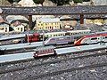
 Main station on model railway - geograph.org.uk - 4121583.jpg 640 × 480; 109 KB
-
 Make-shift fencing on the bank of the Afon Gwyrfai - geograph.org.uk - 4992275.jpg 1,600 × 1,200; 729 KB
-

-
 Milestone with benchmark, Bontnewydd - geograph.org.uk - 6190696.jpg 1,200 × 1,600; 518 KB
-
 Model railway - geograph.org.uk - 4121569.jpg 640 × 480; 132 KB
-
 Model railway at Gypsy Wood Park (2) - geograph.org.uk - 5522934.jpg 640 × 427; 109 KB
-
 Model railway at Gypsy Wood Park - geograph.org.uk - 5522914.jpg 640 × 427; 92 KB
-
 Model tram - geograph.org.uk - 4115576.jpg 640 × 480; 140 KB
-
 Money tree - geograph.org.uk - 4121165.jpg 640 × 480; 121 KB
-
 Mossy wall near Bryn Beddau farm - geograph.org.uk - 5786327.jpg 640 × 480; 165 KB
-
 Mr Mole has been to Specsavers - geograph.org.uk - 4121821.jpg 640 × 480; 130 KB
-
 Mynydd Bach - geograph.org.uk - 1184729.jpg 640 × 480; 83 KB
-
 Northwest from Plas Dinas - geograph.org.uk - 3697548.jpg 800 × 530; 411 KB
-
 Pen y Graig chapel-house - geograph.org.uk - 4992357.jpg 4,896 × 3,672; 7.09 MB
-
 Picnic Spot, the Foryd - geograph.org.uk - 4877089.jpg 640 × 480; 64 KB
-
 Pixie on the ball - geograph.org.uk - 4121722.jpg 640 × 480; 90 KB
-
 Plas Dinas Bridge - geograph.org.uk - 3111064.jpg 640 × 427; 112 KB
-
 Plas Dinas bridge - geograph.org.uk - 3914519.jpg 640 × 360; 86 KB
-
 Plas Dinas Lodge - geograph.org.uk - 3697420.jpg 800 × 530; 497 KB
-
 Plas Dinas Lodge, Bontnewydd - geograph.org.uk - 2872200.jpg 640 × 464; 78 KB
-
 Plenty of activity at the main station - geograph.org.uk - 4121627.jpg 640 × 480; 132 KB
-
 Pond at Cynifryn - geograph.org.uk - 6259907.jpg 1,916 × 1,277; 914 KB
-

-

-

-
 Public footpath passing the churchyard at St Baglan's - geograph.org.uk - 6260013.jpg 1,916 × 1,277; 1.03 MB
-
 Public footpath to St Baglan's Church and Tan y Graig - geograph.org.uk - 6260011.jpg 1,916 × 1,277; 1.17 MB
-
 Puff the magic dragon - geograph.org.uk - 4121682.jpg 640 × 480; 80 KB
-
 Pulled ashore - geograph.org.uk - 4168525.jpg 640 × 427; 57 KB
-
 Pygmy goat (Capra aegagrus hircus) - geograph.org.uk - 4121673.jpg 640 × 480; 140 KB
-
 Racing The Train - geograph.org.uk - 4303486.jpg 683 × 1,024; 265 KB
-
-
 Railway Bridge near Bontnewydd - geograph.org.uk - 5813084.jpg 5,184 × 3,456; 4.12 MB
-
 Railway Bridge near Bontnewydd - geograph.org.uk - 5813098.jpg 5,184 × 3,456; 3.37 MB
-
 Ready for the off - geograph.org.uk - 4121832.jpg 640 × 480; 117 KB
-
 Rhos Bach Cottages - geograph.org.uk - 830964.jpg 640 × 480; 78 KB
-
 Rivet benchmark on seawall opposite Ty-calch, Llanfaglan - geograph.org.uk - 2176417.jpg 4,000 × 3,000; 6.67 MB
-
 Roundabout at Bontnewydd - geograph.org.uk - 153158.jpg 640 × 440; 86 KB
-
 Rows of concrete pillars east of Porth Leidiog Uchaf - geograph.org.uk - 6259900.jpg 1,864 × 1,243; 977 KB
-
 Sandy shore - geograph.org.uk - 6304813.jpg 800 × 600; 109 KB
-
 Sea wall - geograph.org.uk - 6304817.jpg 800 × 600; 122 KB
-
 Sea wall near Porth Leidiog Uchaf - geograph.org.uk - 6259898.jpg 1,916 × 1,277; 938 KB
-
 Seashore at high tide, Foryd Bay - geograph.org.uk - 2189095.jpg 1,024 × 768; 109 KB
-
 Seat on Lôn Eifion, Bontnewydd - geograph.org.uk - 5531330.jpg 1,600 × 1,200; 656 KB
-
 Seaweed strand line - geograph.org.uk - 3278033.jpg 640 × 480; 109 KB
-
 Sheep pasture alongside Foryd Bay - geograph.org.uk - 2189083.jpg 1,024 × 768; 102 KB
-
 Sheep pasture, north of Bronant Farm - geograph.org.uk - 3240296.jpg 1,024 × 768; 114 KB
-
 Shoreline at Ty-calch - geograph.org.uk - 5559272.jpg 4,000 × 2,774; 2.3 MB
-

-
 Slipway Near Ysgubor Isaf - geograph.org.uk - 6197736.jpg 1,600 × 1,200; 394 KB
-
 Small shingle spit at the mouth of the Foryd - geograph.org.uk - 3750714.jpg 1,024 × 768; 106 KB
-
 Southern boundary of Bontnewydd - geograph.org.uk - 2872241.jpg 640 × 446; 75 KB
-
 Spiders web - geograph.org.uk - 4121137.jpg 640 × 480; 122 KB
-
 St Baglan's Church - geograph.org.uk - 4876962.jpg 640 × 479; 44 KB
-
 St Baglan's Church - geograph.org.uk - 4877078.jpg 640 × 480; 63 KB
-
 St Baglan's Church - geograph.org.uk - 4992408.jpg 4,896 × 3,672; 6.4 MB
-
 St Baglan's Church, Llanfaglan - geograph.org.uk - 4602566.jpg 1,600 × 1,200; 619 KB
-
 St Baglan's Church, Llanfaglan - geograph.org.uk - 5482036.jpg 5,184 × 3,456; 6.07 MB
-
 St. Baglan's Church - geograph.org.uk - 4168547.jpg 640 × 427; 82 KB
-

-
 The A487 at Bontnewydd - geograph.org.uk - 5821966.jpg 5,184 × 3,456; 3.23 MB
-
 The A487 in Bontnewydd - geograph.org.uk - 5404859.jpg 1,500 × 983; 162 KB
-
 The A487 in Bontnewydd - geograph.org.uk - 5404862.jpg 1,500 × 977; 143 KB
-
 The Afon Gwyrfai at Cae Samuel - geograph.org.uk - 5829488.jpg 5,184 × 3,456; 4.03 MB
-
 The Club House - geograph.org.uk - 4992394.jpg 4,738 × 3,033; 4.24 MB
-
 The Coast along Aber Foreshore Road - geograph.org.uk - 5472794.jpg 3,184 × 2,123; 2.29 MB
-
 The coast near Ysgubor Isaf - geograph.org.uk - 5474948.jpg 5,184 × 3,456; 4.73 MB
-
 The coast near Ysgubor Isaf - geograph.org.uk - 5474953.jpg 5,184 × 3,456; 4.18 MB
-
 The east shore of Y Foryd - geograph.org.uk - 6260010.jpg 1,916 × 1,277; 974 KB
-
 The entrance to Llanfaglan Water Works - geograph.org.uk - 4992316.jpg 4,896 × 3,672; 6.96 MB
-
 The foreshore near Cynifryn - geograph.org.uk - 4992405.jpg 4,896 × 3,672; 6.94 MB
-

-
 The Golden Cod, Bontnewydd - geograph.org.uk - 2871782.jpg 640 × 507; 59 KB
-
 The Golden Cod, Bontnewydd - geograph.org.uk - 5825856.jpg 5,184 × 3,456; 2.72 MB
-
 The Lychgate of St Baglan's Church - geograph.org.uk - 5480195.jpg 5,184 × 3,456; 4.91 MB
-
 The Newborough Arms Public House - geograph.org.uk - 3951632.jpg 4,309 × 2,600; 4.37 MB
-
 The porch of St Baglan's Church - geograph.org.uk - 5480186.jpg 3,184 × 2,123; 2.26 MB
-

-
 The sylvan Lon Gwyrfai lane - geograph.org.uk - 830945.jpg 640 × 480; 168 KB
-
 The Wales Coast Path at Ty-calch - geograph.org.uk - 5477727.jpg 3,184 × 2,123; 1.79 MB
-
 The Wales Coast Path near Foryd Bay - geograph.org.uk - 5803345.jpg 5,184 × 3,456; 3.29 MB
-
 The Wales Coast Path near Llanfaglan - geograph.org.uk - 5806432.jpg 5,184 × 3,456; 3.61 MB
-
 The Wales Coast Path near Llanfaglan - geograph.org.uk - 5806439.jpg 5,184 × 3,456; 3.47 MB
-
 The Wales Coast Path south of Caernarfon - geograph.org.uk - 5803338.jpg 5,184 × 3,456; 2.94 MB


_-_geograph.org.uk_-_5522934.jpg)


_-_geograph.org.uk_-_4121673.jpg)


