Category:Boda kyrka, Värmland
Jump to navigation
Jump to search
| Camera location | | View all coordinates using: OpenStreetMap |
|---|
|
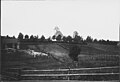
This is a category about an ecclesiastical monument in Sweden, number 21300000004232 in the RAÄ buildings database.
|
|
This is a category about a protected building in Sweden, number 21400000440307 in the RAÄ buildings database.
|
Church of Sweden church building in Kil Municipality, Sweden  | |||||
| Upload media | |||||
| Instance of | |||||
|---|---|---|---|---|---|
| Location | Kil Municipality, Värmland County, Sweden | ||||
| Diocese | |||||
| Has use |
| ||||
| Occupant |
| ||||
| Heritage designation |
| ||||
| Inception |
| ||||
 | |||||
Media in category "Boda kyrka, Värmland"
The following 48 files are in this category, out of 48 total.
-
 Boda kyrka - KMB - 16000200144600.jpg 874 × 600; 71 KB
-
 Boda kyrka - KMB - 16000200144601.jpg 769 × 600; 49 KB
-
 Boda kyrka - KMB - 16000200144602.jpg 878 × 600; 62 KB
-
 Boda kyrka - KMB - 16000200144603.jpg 410 × 600; 35 KB
-
 Boda kyrka - KMB - 16000200144604.jpg 870 × 600; 107 KB
-
 Boda kyrka - KMB - 16000200144605.jpg 861 × 600; 79 KB
-
 Boda kyrka - KMB - 16000200144606.jpg 910 × 600; 62 KB
-
 Boda kyrka - KMB - 16000200144607.jpg 862 × 600; 56 KB
-
 Boda kyrka - KMB - 16000200144608.jpg 836 × 600; 84 KB
-
 Boda kyrka - KMB - 16000200144609.jpg 488 × 600; 88 KB
-
 Boda kyrka - KMB - 16000200144610.jpg 612 × 600; 56 KB
-
 Boda kyrka - KMB - 16000200144611.jpg 1,005 × 600; 78 KB
-
 Boda kyrka - KMB - 16000200144612.jpg 819 × 600; 72 KB
-
 Boda kyrka - KMB - 16000200144613.jpg 605 × 600; 53 KB
-
 Boda kyrka - KMB - 16000200144614.jpg 616 × 600; 54 KB
-
 Boda kyrka - KMB - 16000200144615.jpg 720 × 600; 65 KB
-
 Boda kyrka - KMB - 16000200144616.jpg 864 × 600; 83 KB
-
 Boda kyrka - KMB - 16000200144617.jpg 825 × 600; 67 KB
-
 Boda kyrka - KMB - 16000200144618.jpg 843 × 600; 77 KB
-
 Boda kyrka - KMB - 16000200144619.jpg 869 × 600; 112 KB
-
 Boda kyrka - KMB - 16000200144620.jpg 825 × 600; 85 KB
-
 Boda kyrka - KMB - 16000200144621.jpg 864 × 600; 119 KB
-
 Boda kyrka - KMB - 16000200144622.jpg 790 × 600; 67 KB
-
 Boda kyrka - KMB - 16000200144623.jpg 449 × 600; 50 KB
-
 Boda kyrka - KMB - 16000200144624.jpg 804 × 600; 68 KB
-
 Boda kyrka - KMB - 16000200144625.jpg 422 × 600; 41 KB
-
 Boda kyrka - KMB - 16000200144637.jpg 456 × 600; 45 KB
-
 Boda kyrka - KMB - 16000200144638.jpg 462 × 600; 58 KB
-
 Boda kyrka - KMB - 16000200144639.jpg 792 × 600; 98 KB
-
 Boda kyrka - KMB - 16000200144640.jpg 454 × 600; 58 KB
-
 Boda kyrka - KMB - 16000200144641.jpg 819 × 600; 93 KB
-
 Boda kyrka - KMB - 16000200144646.jpg 450 × 600; 48 KB
-
 Boda kyrka - KMB - 16000200144647.jpg 816 × 600; 70 KB
-
 Boda kyrka - KMB - 16000200144648.jpg 440 × 600; 49 KB
-
 Boda kyrka - KMB - 16000200144649.jpg 814 × 600; 103 KB
-
 Boda kyrka - KMB - 16000200144650.jpg 806 × 600; 104 KB
-
 Boda kyrka - KMB - 16000200144651.jpg 403 × 600; 42 KB
-
 Boda kyrka - KMB - 16000200144652.jpg 814 × 600; 87 KB
-
 Boda kyrka - KMB - 16000200144653.jpg 912 × 600; 66 KB
-
 Boda kyrka - KMB - 16000200144654.jpg 790 × 600; 81 KB
-
 Boda kyrka - KMB - 16000200144655.jpg 427 × 600; 30 KB
-
 Boda kyrka - KMB - 16000200144656.jpg 429 × 600; 41 KB
-
 Boda kyrka - KMB - 16000200144657.jpg 391 × 600; 29 KB
-
 Boda kyrka - KMB - 16000200144658.jpg 398 × 600; 32 KB
-
 Boda kyrka - KMB - 16000200144659.jpg 432 × 600; 28 KB
-
 Boda kyrka - KMB - 16000200144661.jpg 592 × 600; 104 KB
-
 Boda kyrka - KMB - 16000200144662.jpg 676 × 600; 136 KB
-
 Boda kyrka - KMB - 16000200144664.jpg 465 × 600; 48 KB


