Category:Bobbington
Jump to navigation
Jump to search
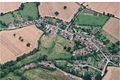
English: Bobbington is a village and civil parish in the South Staffordshire district of Staffordshire, England, about five miles west of Wombourne. According to the 2001 census it had a population of 506.
village in Staffordshire, England, United Kingdom  | |||||
| Upload media | |||||
| Instance of | |||||
|---|---|---|---|---|---|
| Location | South Staffordshire, Staffordshire, West Midlands, England | ||||
| Said to be the same as | Bobbington (Wikimedia duplicated page, civil parish) | ||||
 | |||||
Subcategories
This category has the following 2 subcategories, out of 2 total.
H
- Holy Cross church, Bobbington (17 F)
Media in category "Bobbington"
The following 200 files are in this category, out of 214 total.
(previous page) (next page)-
 A runway at Wolverhampton Airport - geograph.org.uk - 5502849.jpg 1,024 × 768; 230 KB
-
 A458 west of Four Ashes - geograph.org.uk - 2772976.jpg 640 × 480; 62 KB
-
 Abbots Castle Hill View - geograph.org.uk - 2769218.jpg 800 × 600; 98 KB
-
 Access road to Rickthorn Farm - geograph.org.uk - 1223372.jpg 600 × 450; 368 KB
-
 Airport Antiques - geograph.org.uk - 5526114.jpg 800 × 563; 52 KB
-
 Alders Farm, Bobbington. - geograph.org.uk - 2437341.jpg 640 × 428; 69 KB
-
 B4176 View - geograph.org.uk - 2769076.jpg 800 × 600; 153 KB
-
 Barley, Four Ashes - geograph.org.uk - 6317249.jpg 1,024 × 1,024; 342 KB
-
 Biplane View - geograph.org.uk - 5526025.jpg 800 × 600; 69 KB
-
 Blocked Track - geograph.org.uk - 6039505.jpg 800 × 600; 161 KB
-
 Bobbington church - geograph.org.uk - 5502886.jpg 1,024 × 768; 265 KB
-
 Bobbington church - geograph.org.uk - 5502890.jpg 768 × 1,024; 240 KB
-
 Bobbington Horses - geograph.org.uk - 5400708.jpg 800 × 516; 104 KB
-

-
 Bobbington Road - geograph.org.uk - 1021737.jpg 640 × 480; 71 KB
-
 Bobbington Sunset - geograph.org.uk - 6039444.jpg 800 × 600; 106 KB
-

-
 Bobbington, Staffordshire, 'Bannockburn' - geograph.org.uk - 4560478.jpg 4,608 × 3,456; 6.59 MB
-
 Bobbington, Staffordshire, Holy Cross Church - geograph.org.uk - 4560464.jpg 4,608 × 3,456; 6.26 MB
-

-
 Bobbington, Staffordshire. Aerial. 1992 (geograph 1938591).jpg 640 × 425; 78 KB
-
 Bridgnorth Road (A458), Six Ashes - geograph.org.uk - 3365695.jpg 1,024 × 671; 201 KB
-

-

-

-
 Broadfields Farm - geograph.org.uk - 653138.jpg 640 × 480; 56 KB
-
 Church Gate - geograph.org.uk - 5400686.jpg 600 × 800; 125 KB
-
 Church Scene - geograph.org.uk - 6036362.jpg 800 × 600; 136 KB
-

-

-

-

-
 Crab Lane Junction - geograph.org.uk - 1600703.jpg 640 × 480; 62 KB
-
 Craft Cabins - geograph.org.uk - 5536540.jpg 800 × 600; 105 KB
-
 Craft Village Path - geograph.org.uk - 3912876.jpg 800 × 600; 67 KB
-
 Crash Gate View - geograph.org.uk - 2409168.jpg 800 × 600; 134 KB
-

-

-

-
 Crop field near Halfpenny Green, Staffordshire - geograph.org.uk - 3226468.jpg 1,024 × 667; 384 KB
-
 Crop field near Halfpenny Green, Staffordshire - geograph.org.uk - 3226597.jpg 1,024 × 616; 360 KB
-

-
 Crop Path - geograph.org.uk - 2409143.jpg 600 × 800; 115 KB
-

-

-
 Dandelion Rows - geograph.org.uk - 5357728.jpg 601 × 800; 199 KB
-

-
 Dilapidated glasshouses - geograph.org.uk - 5502883.jpg 1,024 × 683; 185 KB
-

-
 Disused runway - a wartime relic - geograph.org.uk - 810784.jpg 640 × 480; 53 KB
-
 Donkey Field - geograph.org.uk - 6039486.jpg 800 × 600; 176 KB
-
 Down the hill and around the corner - geograph.org.uk - 776818.jpg 640 × 480; 125 KB
-

-
 Farm Track - geograph.org.uk - 6039489.jpg 800 × 600; 181 KB
-
 Farmland and baled straw - geograph.org.uk - 2634518.jpg 1,142 × 857; 328 KB
-

-

-

-

-

-

-

-

-

-

-
 Field Footpath - geograph.org.uk - 653133.jpg 640 × 480; 70 KB
-
 Football Sheep - geograph.org.uk - 2409150.jpg 800 × 600; 169 KB
-

-
 Footpath near Tuckhill, Shropshire - geograph.org.uk - 2212695.jpg 480 × 640; 178 KB
-
 Footpath towards Upper Whittimere - geograph.org.uk - 4040139.jpg 857 × 1,142; 590 KB
-
 Footpath View - geograph.org.uk - 6064549.jpg 800 × 600; 158 KB
-
 Forest Lane - geograph.org.uk - 4869623.jpg 800 × 600; 168 KB
-
 Forest Lane 2016 - geograph.org.uk - 4871303.jpg 800 × 600; 84 KB
-
 Former perimeter, Halfpenny Green - geograph.org.uk - 6318035.jpg 1,024 × 683; 214 KB
-
 Gated entrance - geograph.org.uk - 810810.jpg 640 × 480; 116 KB
-
 Golf Course View - geograph.org.uk - 4526836.jpg 800 × 600; 85 KB
-

-

-

-
 Gospel Ash Road, Gospel Ash - geograph.org.uk - 3217671.jpg 1,024 × 683; 206 KB
-
 Grazing near Halfpenny Green, Staffordshire - geograph.org.uk - 2118250.jpg 1,280 × 910; 1.5 MB
-

-

-

-

-

-
 Grazing, Gatacre Park, Shropshire - geograph.org.uk - 381882.jpg 640 × 387; 112 KB
-
 Halfpenny Green - geograph.org.uk - 4875370.jpg 800 × 600; 86 KB
-
 Halfpenny Green airfield - geograph.org.uk - 6318037.jpg 1,024 × 683; 239 KB
-
 Halfpenny Green Airfield, Staffordshire - geograph.org.uk - 2113352.jpg 1,024 × 587; 359 KB
-
 Halfpenny Green Airfield, Staffordshire - geograph.org.uk - 2113557.jpg 1,024 × 564; 298 KB
-
 Halfpenny Vines - geograph.org.uk - 1021724.jpg 640 × 480; 105 KB
-
 Hall View - geograph.org.uk - 6039453.jpg 800 × 600; 161 KB
-
 Hangar View - geograph.org.uk - 5526122.jpg 800 × 600; 50 KB
-
 Hay Farm - geograph.org.uk - 653127.jpg 640 × 480; 47 KB
-
 Hay Farm Track - geograph.org.uk - 6039496.jpg 800 × 600; 128 KB
-
 Horses Grazing, Gatacre Green, Shropshire - geograph.org.uk - 403965.jpg 640 × 420; 122 KB
-
 Interior of Boddington church - geograph.org.uk - 5502893.jpg 600 × 800; 88 KB
-
 Interior of Boddington church - geograph.org.uk - 5502896.jpg 768 × 1,024; 197 KB
-

-

-

-
 Lane between two golf courses - geograph.org.uk - 783478.jpg 640 × 480; 81 KB
-
 Lane past Mere Copse - geograph.org.uk - 810803.jpg 640 × 480; 103 KB
-
 Leaton Grange - geograph.org.uk - 810808.jpg 640 × 480; 71 KB
-
 Leaton Hall, Bobbington - geograph.org.uk - 3443652.jpg 640 × 467; 187 KB
-
 Lutley Footpath - geograph.org.uk - 653125.jpg 640 × 480; 124 KB
-
 Lutley Lane - geograph.org.uk - 4869703.jpg 800 × 600; 175 KB
-
 Marked Path - geograph.org.uk - 6039512.jpg 800 × 600; 131 KB
-

-
 Memorial to Prince William of Gloucester - geograph.org.uk - 5502898.jpg 1,024 × 768; 254 KB
-
-
 New Fence - geograph.org.uk - 6064558.jpg 800 × 600; 239 KB
-
 New Road View - geograph.org.uk - 4515521.jpg 800 × 600; 115 KB
-
 No Flying Today - geograph.org.uk - 4869628.jpg 800 × 600; 81 KB
-
 Path to Mere Farm - geograph.org.uk - 653110.jpg 640 × 480; 63 KB
-
 Path View - geograph.org.uk - 5268947.jpg 800 × 600; 125 KB
-
 Phone and Bus Stop - geograph.org.uk - 4875384.jpg 800 × 600; 169 KB
-
-

-
 Post Office View - geograph.org.uk - 6039477.jpg 800 × 600; 116 KB
-

-

-

-
-
 Red lion Inn - geograph.org.uk - 1021740.jpg 640 × 480; 73 KB
-
 Refuelling the Biplane - geograph.org.uk - 5526038.jpg 800 × 600; 72 KB
-
 Rhea Grazing, Mere Hall, Staffordshire - geograph.org.uk - 367789.jpg 640 × 512; 155 KB
-
 Ridge Path - geograph.org.uk - 5633779.jpg 800 × 600; 177 KB
-
 Ridge View - geograph.org.uk - 1021728.jpg 640 × 480; 102 KB
-
 Road junction near the War Stone - geograph.org.uk - 2634523.jpg 1,142 × 857; 316 KB
-
 Runway Landing - geograph.org.uk - 4397641.jpg 800 × 600; 55 KB
-
 Runway View - geograph.org.uk - 4397640.jpg 800 × 600; 66 KB
-
 Sand Pit - geograph.org.uk - 1021717.jpg 640 × 480; 64 KB
-
 Sand Pit Pool - geograph.org.uk - 1021719.jpg 640 × 480; 111 KB
-
 Sand quarry near Halfpenny Green, Staffordshire - geograph.org.uk - 3227145.jpg 1,024 × 768; 427 KB
-

-

-
 Sarcophagus in Boddington churchyard - geograph.org.uk - 5502903.jpg 768 × 1,024; 419 KB
-
 Seat and noticeboard, Six Ashes Road, Bobbington - geograph.org.uk - 3313760.jpg 1,024 × 674; 280 KB
-
 September Vines - geograph.org.uk - 5525963.jpg 800 × 600; 115 KB
-
 Sheep Field - geograph.org.uk - 4869635.jpg 800 × 600; 137 KB
-
 Sheep Field - geograph.org.uk - 6039484.jpg 800 × 600; 150 KB
-
 Six Ashes crossroads, A458 - geograph.org.uk - 2772980.jpg 640 × 480; 51 KB
-
 Six Ashes Road, Bobbington - geograph.org.uk - 3312410.jpg 1,024 × 669; 204 KB
-
 Six Ashes Road, looking east, Six Ashes - geograph.org.uk - 3365685.jpg 1,024 × 683; 259 KB
-
 Staffs Way Junction - geograph.org.uk - 4428641.jpg 800 × 600; 145 KB
-
 Staffs Way Ridge - geograph.org.uk - 4428652.jpg 800 × 600; 159 KB
-

-
 Stile View - geograph.org.uk - 6039437.jpg 800 × 600; 208 KB
-
 Stone effigy in Bobbington church - geograph.org.uk - 5502912.jpg 683 × 1,024; 151 KB
-
 Swindon Golf Course View - geograph.org.uk - 1021754.jpg 640 × 480; 137 KB
-
 Temporary drive to Bobbington Hall - geograph.org.uk - 1223382.jpg 600 × 450; 317 KB
-
 The bridleway at New Lodge - geograph.org.uk - 2634526.jpg 734 × 979; 468 KB
-
 The Red Lion - geograph.org.uk - 6039434.jpg 600 × 800; 131 KB
-
 The Red Lion Inn (1), Six Ashes Road, Bobbington (geograph 3360910).jpg 1,024 × 683; 189 KB
-
 The Red Lion Inn (2), Six Ashes Road, Bobbington (geograph 3360940).jpg 1,024 × 676; 205 KB
-

-
 The Red Lion Inn at Bobbington, Staffordshire (geograph 2108767).jpg 800 × 539; 264 KB
-
 The Red Lion Inn at Bobbington, Staffordshire (geograph 2111509).jpg 800 × 506; 330 KB
-
 The Red Lion Inn, Bobbington - geograph.org.uk - 810766.jpg 640 × 480; 81 KB
-

-

-
 The Royal Oak, Six Ashes Road, Halfpenny Green - geograph.org.uk - 2491293.jpg 1,024 × 661; 168 KB
-
 The Six Ashes (1), Six Ashes Road, Six Ashes - geograph.org.uk - 3361478.jpg 1,024 × 657; 193 KB
-
 The Six Ashes (2), Six Ashes Road, Six Ashes - geograph.org.uk - 3364906.jpg 1,024 × 647; 240 KB
-

-

-

-
 The Six Ashes pub - geograph.org.uk - 5502940.jpg 1,024 × 768; 228 KB
-
 The Six Ashes Public House. - geograph.org.uk - 2437353.jpg 640 × 428; 60 KB
-

-
 The tower of Bobbington church - geograph.org.uk - 5502892.jpg 768 × 1,024; 225 KB
-
 Track junction on Abbot's Castle Hill - geograph.org.uk - 2634510.jpg 734 × 979; 419 KB
-
 Track, Halfpenny Green airfield - geograph.org.uk - 6318039.jpg 1,024 × 683; 278 KB
-
 Tractor Path - geograph.org.uk - 5400696.jpg 800 × 515; 147 KB
-

-
 Tuscano Six Ashes - geograph.org.uk - 5502947.jpg 1,024 × 768; 226 KB
-
 Tuscano Six Ashes Italian Restaurant, Six Ashes - geograph.org.uk - 3361433.jpg 1,024 × 650; 201 KB
-
 Upper Aston Lane - geograph.org.uk - 4876990.jpg 800 × 600; 116 KB
-
 Upper Whittimere - geograph.org.uk - 4040395.jpg 1,142 × 857; 393 KB
-
 Victorian barn at Whittimere Farm - geograph.org.uk - 4040396.jpg 1,142 × 857; 382 KB
-
 Vine Path - geograph.org.uk - 4087643.jpg 800 × 600; 106 KB
-
 Vine Rows - geograph.org.uk - 4087654.jpg 600 × 800; 102 KB
-
 Vine Scene - geograph.org.uk - 3986838.jpg 800 × 600; 96 KB
-
 Vine View - geograph.org.uk - 4087603.jpg 800 × 600; 123 KB
-
 Vines View - geograph.org.uk - 6270122.jpg 800 × 600; 140 KB
-
 Vineyard Scene - geograph.org.uk - 5357731.jpg 800 × 600; 118 KB
-
 Vineyard View - geograph.org.uk - 4526854.jpg 800 × 600; 111 KB
-
 Waiting for Takeoff - geograph.org.uk - 5526133.jpg 800 × 600; 52 KB
-
 War memorial in Bobbington church - geograph.org.uk - 5502919.jpg 1,024 × 768; 174 KB
-

-
 Way Signpost - geograph.org.uk - 2769230.jpg 800 × 600; 244 KB
-
 Way View - geograph.org.uk - 2769196.jpg 800 × 600; 212 KB
-
 White Cross - geograph.org.uk - 1600710.jpg 640 × 480; 73 KB
-
 Whittimere Farm - geograph.org.uk - 4877470.jpg 800 × 600; 136 KB
-
 Wine House - geograph.org.uk - 5536538.jpg 800 × 600; 91 KB
-
 Wolverhampton Halfpenny Green Airport - geograph.org.uk - 5502854.jpg 1,024 × 768; 205 KB
-
 Wolverhampton Halfpenny Green Airport - geograph.org.uk - 5502856.jpg 1,024 × 768; 265 KB
-
 Bobbington Footpath - geograph.org.uk - 653142.jpg 640 × 480; 96 KB


.jpg)
,_Six_Ashes_-_geograph.org.uk_-_3365695.jpg)


,_Six_Ashes_Road,_Bobbington_-_geograph.org.uk_-_3312461.jpg)
,_Six_Ashes_Road,_Bobbington_-_geograph.org.uk_-_3312474.jpg)
_-_sign,_Six_Ashes_Road,_Bobbington_-_geograph.org.uk_-_3312478.jpg)


,_Gospel_Ash_Road,_Gospel_Ash_-_geograph.org.uk_-_3217608.jpg)
,_Gospel_Ash_Road,_Gospel_Ash_-_geograph.org.uk_-_3217641.jpg)


,_Six_Ashes_Road,_Bobbington_(geograph_3360910).jpg)
,_Six_Ashes_Road,_Bobbington_(geograph_3360940).jpg)
_-_sign,_Six_Ashes_Road,_Bobbington_-_geograph.org.uk_-_3360964.jpg)
.jpg)
.jpg)


,_Six_Ashes_Road,_Six_Ashes_-_geograph.org.uk_-_3361478.jpg)
,_Six_Ashes_Road,_Six_Ashes_-_geograph.org.uk_-_3364906.jpg)
_-_sign,_Six_Ashes_Road,_Six_Ashes_-_geograph.org.uk_-_3364931.jpg)


