Category:Blue Hill, Saint Helena
Jump to navigation
Jump to search
place in Saint Helena   | |||||
| Upload media | |||||
| Instance of | |||||
|---|---|---|---|---|---|
| Location | Saint Helena, Saint Helena, Ascension and Tristan da Cunha, UK | ||||
| Population |
| ||||
| Area |
| ||||
 | |||||
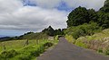
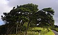
Blue Hill is the largest (36.8 km2) and most sparsely populated district of Saint Helena. It occupies the western part of the island, bordering Saint Paul's and Sandy Bay.
Subcategories
This category has the following 2 subcategories, out of 2 total.
L
S
- St Helena and the Cross (3 F)
Media in category "Blue Hill, Saint Helena"
The following 38 files are in this category, out of 38 total.
-
 A view near Egg Island by William John Burchell.jpg 4,000 × 2,444; 913 KB
-
 Abundance (39305980790).jpg 5,568 × 3,712; 11.91 MB
-
 Beginning of High Peak trail.jpg 2,988 × 5,312; 8.87 MB
-
 Blue Hill 1 (26246225577).jpg 5,568 × 3,712; 9.65 MB
-
 Blue Hill 2 (39308213210).jpg 5,518 × 3,577; 8.44 MB
-
 Blue Hill 3 (40222773365).jpg 5,568 × 3,712; 12.77 MB
-
 Blue Hill 4 (41074318432).jpg 5,568 × 3,712; 10.04 MB
-
 Blue Hill 5 (41117425591).jpg 5,568 × 3,712; 10.2 MB
-
 Blue Hill St Helena Island.jpg 5,332 × 3,377; 6.65 MB
-
 Botley's Point (40406765544).jpg 5,568 × 3,712; 9.4 MB
-
 Cattle on the hillside (41117285641).jpg 5,568 × 3,712; 11.11 MB
-
 Egg Island by William John Burchell.jpg 4,000 × 2,550; 824 KB
-
 Fairyland (41071369722).jpg 5,568 × 3,712; 9.48 MB
-
 Flax in Blue Hill.jpg 3,168 × 4,752; 8.62 MB
-
 High Peak (27241400328).jpg 5,568 × 3,712; 10.01 MB
-
 High Peak seen from the west.jpg 5,312 × 2,988; 6.99 MB
-
 Hillside trees (26245981047).jpg 5,568 × 3,712; 9.66 MB
-
 Home and the world (40406652454).jpg 5,568 × 3,712; 13.07 MB
-
 Houses to the south of High Peak.jpg 3,168 × 4,752; 6.37 MB
-
 Information sign on High Peak trail.jpg 2,988 × 5,312; 7.26 MB
-
 Information sign on High Peak.jpg 5,312 × 2,988; 7.94 MB
-
 Joan Hill (40222517835).jpg 5,568 × 3,712; 10.18 MB
-
 On to Swanley Valley (40403459174).jpg 5,568 × 3,712; 10.46 MB
-
 Pasture and High Peak (40403426224).jpg 5,568 × 3,712; 9.52 MB
-
 Post Box (41074069982).jpg 5,568 × 3,712; 9.66 MB
-
 Rocky road (40222138455).jpg 3,712 × 5,568; 11.25 MB
-
 Shadow and its tree (40222099415).jpg 4,444 × 2,901; 7 MB
-
 South West Point (39307943800).jpg 5,568 × 3,712; 8.67 MB
-
 Speery Island 1 (26245721647).jpg 5,568 × 3,712; 9.69 MB
-
 Speery Island 2 (26245637637).jpg 5,568 × 3,712; 10.14 MB
-
 The way the wind blows (40403039174).jpg 4,190 × 2,535; 4.9 MB
-
 Tree trail (27240962238).jpg 5,568 × 3,712; 9.53 MB
-
 Trees in the valley (40403142824).jpg 5,568 × 3,712; 9.8 MB
-
 Verdant green (40222060215).jpg 5,103 × 3,577; 7.65 MB
-
 View from High Peak in Blue Hill.jpg 5,312 × 2,988; 6.38 MB
-
 View to the east from High Peak.jpg 5,312 × 2,988; 6.18 MB
-
 Water tanks below High Peak.jpg 2,988 × 5,312; 7.3 MB
-
 Windblown (40406156704).jpg 4,507 × 2,170; 5.05 MB

.jpg)

.jpg)
.jpg)
.jpg)
.jpg)
.jpg)
.jpg)
.jpg)

.jpg)

.jpg)

.jpg)
.jpg)


.jpg)
.jpg)
.jpg)
.jpg)
.jpg)
.jpg)
.jpg)
.jpg)
.jpg)
.jpg)
.jpg)
.jpg)
.jpg)


.jpg)