Category:Blind summit warning road signs
Jump to navigation
Jump to search
Subcategories
This category has only the following subcategory.
Media in category "Blind summit warning road signs"
The following 21 files are in this category, out of 21 total.
-
 17-08-05-Tangufell-RalfR-DSC 2926.jpg 6,000 × 4,000; 12.78 MB
-

-

-
 Blind hill warning sign.jpg 604 × 600; 117 KB
-
 Blind summit - geograph.org.uk - 187356.jpg 640 × 480; 94 KB
-
 Blind summit - geograph.org.uk - 465307.jpg 640 × 507; 42 KB
-
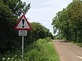
 Blind summit on Wells Road, Healing - geograph.org.uk - 4278645.jpg 640 × 427; 76 KB
-
 Blind Summit Warning - geograph.org.uk - 4756297.jpg 4,000 × 2,464; 3.02 MB
-
 Blind summit... - geograph.org.uk - 2032815.jpg 1,600 × 1,200; 194 KB
-
 Bridge over the River Doon - geograph.org.uk - 1311355.jpg 640 × 480; 78 KB
-
 Crossroads near Cold Ashby - geograph.org.uk - 184118.jpg 640 × 480; 104 KB
-

-
 Macclesfield Road at blind summit - geograph.org.uk - 2571985.jpg 640 × 481; 60 KB
-
 MS26 East - Over Hill Sign (42180865801).jpg 2,400 × 1,600; 1.81 MB
-
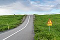
 Road signs in Iceland 06.JPG 3,008 × 2,000; 4.6 MB
-
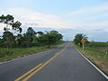 Rutanacional36-2.JPG 4,000 × 3,000; 1.91 MB
-
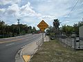 SB US BUS 41 Bridge; Hill Blocks View.JPG 4,000 × 3,000; 2.64 MB
-
 Vallon à Saint-Claude - Normand Lemieux.jpg 3,984 × 2,656; 4.14 MB
-
 Warning sign Blind Summit - geograph.org.uk - 3314455.jpg 1,024 × 715; 106 KB
-
 WarningSigns HatleyQC 20150119.jpg 3,672 × 4,896; 4.5 MB
-
 Cattle Grid, Danby Road - geograph.org.uk - 121033.jpg 640 × 384; 37 KB

_at_the_exit_for_the_Garden_State_Parkway_SOUTH_in_Washington_Township,_Bergen_County,_New_Jersey.jpg)


.jpg)

.jpg)


