Category:Bletsoe
Jump to navigation
Jump to search
village and civil parish in Bedfordshire, UK  | |||||
| Upload media | |||||
| Instance of | |||||
|---|---|---|---|---|---|
| Location | Bedford, Bedfordshire, East of England, England | ||||
 | |||||
English: Bletsoe is a small village and civil parish in Bedfordshire, England. It is on the A6, and about eight miles north of Bedford. The village has a small park, and a church. Nearby places are Sharnbrook, Milton Ernest, Riseley, Thurleigh, Odell, Souldrop, and Swineshead. The nearest town to Bletsoe is Rushden, over the border in Northamptonshire.
Subcategories
This category has the following 2 subcategories, out of 2 total.
B
- Bourne End, Bletsoe (2 F)
Media in category "Bletsoe"
The following 67 files are in this category, out of 67 total.
-
 "Strictly No Horses" sign - geograph.org.uk - 519389.jpg 640 × 480; 94 KB
-
 306th Bombardment Group Museum - geograph.org.uk - 1832127.jpg 1,024 × 768; 93 KB
-
 46-52, The Avenue (geograph.org.uk 5713925).jpg 7,360 × 4,912; 6.15 MB
-
 A6 towards Bedford - geograph.org.uk - 3133153.jpg 640 × 480; 62 KB
-
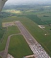 Bedford Aerodrome, aerial 2015 - geograph.org.uk - 4527584.jpg 566 × 640; 67 KB
-
 Bedford Autodrome at Thurleigh Airfield - geograph.org.uk - 1832086.jpg 1,024 × 768; 135 KB
-
 Bedford Autodrome at Thurleigh Airfield - geograph.org.uk - 1832120.jpg 1,024 × 768; 100 KB
-
 Biodiesel plant - geograph.org.uk - 79528.jpg 640 × 409; 73 KB
-
 Bletsoe - geograph.org.uk - 88332.jpg 640 × 480; 128 KB
-
 Bletsoe Castle, Bedfordshire, drawn by Thomas Fisher, 1817.png 770 × 605; 787 KB
-
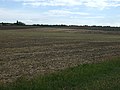
 Bletsoe parish field - geograph.org.uk - 6267856.jpg 1,600 × 1,066; 344 KB
-
 Bletsoe Village Sign - geograph.org.uk - 5713910.jpg 7,016 × 4,681; 7.47 MB
-
 Bletsoe Village Water Pillar - geograph.org.uk - 5713919.jpg 6,701 × 4,473; 7.54 MB
-
 Bletsoe, St Mary - geograph.org.uk - 5472750.jpg 4,608 × 3,456; 5.38 MB
-
 Bletsoe, St. Mary's Church - geograph.org.uk - 5713890.jpg 5,594 × 3,733; 4.18 MB
-

-

-
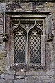 Bletsoe, St. Mary's Church, Small east window 1 - geograph.org.uk - 5713892.jpg 4,265 × 6,391; 7.39 MB
-
 Bletsoe, St. Mary's Church, Small east window 2 (detail) - geograph.org.uk - 5713896.jpg 7,360 × 4,912; 7.31 MB
-
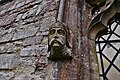
 Bletsoe, St. Mary's Church, Small east window 3 (detail) - geograph.org.uk - 5713898.jpg 5,136 × 3,428; 4.78 MB
-
 Bourne End - geograph.org.uk - 3133155.jpg 640 × 480; 68 KB
-
 Cabbage field near Crossways Farm - geograph.org.uk - 3133152.jpg 640 × 442; 125 KB
-
 Church from the village park - geograph.org.uk - 6267863.jpg 1,600 × 1,066; 439 KB
-
 Farm buildings near North End - geograph.org.uk - 3133156.jpg 640 × 480; 59 KB
-
 Farmland east of Bletsoe - geograph.org.uk - 3133176.jpg 640 × 480; 89 KB
-
 Farmland east of Bourne End - geograph.org.uk - 3133166.jpg 640 × 480; 62 KB
-
 Farmland near Bletsoe - geograph.org.uk - 3133161.jpg 640 × 480; 80 KB
-
 Farmland near Bourne End - geograph.org.uk - 3131732.jpg 640 × 480; 99 KB
-
 Farmland near North End - geograph.org.uk - 3133158.jpg 640 × 480; 76 KB
-
 Farmland, Park Farm - geograph.org.uk - 3133169.jpg 640 × 480; 89 KB
-
 Footpath down to Bletsoe - geograph.org.uk - 6267851.jpg 1,600 × 1,066; 440 KB
-
 Galsey Wood Nature Reserve - geograph.org.uk - 1832129.jpg 1,024 × 768; 258 KB
-
 Hedgerow down to Coplowe Lane - geograph.org.uk - 6267853.jpg 1,600 × 1,066; 502 KB
-
 Hedgerow near Thurleigh Business Park - geograph.org.uk - 1832113.jpg 1,024 × 768; 235 KB
-
 Junction looking towards North End - geograph.org.uk - 1806785.jpg 3,648 × 2,736; 2.16 MB
-
 Milton Road towards Thurleigh - geograph.org.uk - 3133182.jpg 640 × 480; 65 KB
-
 Minor road towards Bletsoe - geograph.org.uk - 3133164.jpg 640 × 480; 54 KB
-
 Old airfield buildings at Thurleigh - geograph.org.uk - 1832122.jpg 1,024 × 768; 118 KB
-
 Poppies and wheat - geograph.org.uk - 472671.jpg 640 × 480; 128 KB
-
 Public footpath along Old Way - geograph.org.uk - 6267865.jpg 1,600 × 1,066; 598 KB
-
 Riseley Road - geograph.org.uk - 1551515.jpg 640 × 480; 63 KB
-
 Road heading west towards the A6 - geograph.org.uk - 3133175.jpg 640 × 480; 71 KB
-

-
 Road towards Bourne End and the A6 - geograph.org.uk - 3131734.jpg 640 × 480; 76 KB
-
 Road towards Milton Ernest - geograph.org.uk - 3133159.jpg 640 × 480; 60 KB
-
 Road towards Milton Ernest - geograph.org.uk - 3133178.jpg 640 × 480; 70 KB
-
 Road towards Riseley - geograph.org.uk - 3133167.jpg 640 × 480; 94 KB
-
 Roadside trees - geograph.org.uk - 1832115.jpg 1,024 × 768; 207 KB
-
 Spring blossom by the roadside - geograph.org.uk - 1832112.jpg 1,024 × 768; 164 KB
-
 The A6, Bletsoe - geograph.org.uk - 5428726.jpg 2,048 × 1,536; 1.2 MB
-
 The A6, Bletsoe - geograph.org.uk - 6275415.jpg 1,872 × 1,204; 1.45 MB
-
 The Falcon on the A6 near Bletsoe - geograph.org.uk - 498888.jpg 640 × 425; 87 KB
-
 The Falcon on the A6 near Bletsoe - geograph.org.uk - 5428727.jpg 2,044 × 1,530; 1.02 MB
-

-
 Twisty road towards Riseley - geograph.org.uk - 3133171.jpg 640 × 480; 105 KB
-
 Yarlswood IDC - geograph.org.uk - 78530.jpg 640 × 480; 66 KB
-
 Buildings on wind tunnel site - geograph.org.uk - 78537.jpg 480 × 640; 65 KB
-
 Coplowe road - geograph.org.uk - 88330.jpg 640 × 480; 148 KB
-
 Crops on the hill - geograph.org.uk - 79526.jpg 640 × 408; 70 KB
-

-
 Lone tree - geograph.org.uk - 227426.jpg 640 × 480; 52 KB
-
 Old farm equipment - geograph.org.uk - 406140.jpg 640 × 480; 76 KB
-
 Ripening wheat by Thurleigh airfield - geograph.org.uk - 472677.jpg 640 × 480; 89 KB
-
 Riseley Road - geograph.org.uk - 472666.jpg 640 × 480; 92 KB
-
 Road near Thurleigh - geograph.org.uk - 406074.jpg 640 × 480; 83 KB
-
 Stile - geograph.org.uk - 503325.jpg 640 × 480; 47 KB
-
 View towards Northend - geograph.org.uk - 406028.jpg 640 × 480; 90 KB


.jpg)


_-_geograph.org.uk_-_5713896.jpg)
_-_geograph.org.uk_-_5713898.jpg)


