Category:Black Water (Conon)
Jump to navigation
Jump to search

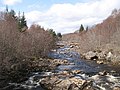
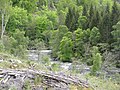
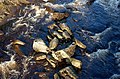
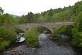
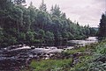
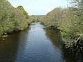
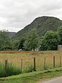
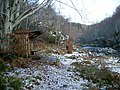
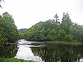
The Black Water is a river in the north of Scotland. It begins at the confluence of the Glascarnoch River with the Abhainn Srath a' Bhàthaich, and flows into the River Conon near Contin.
river in Highland, Scotland, UK, tributary of the River Conon  | |||||
| Upload media | |||||
| Instance of | |||||
|---|---|---|---|---|---|
| Location | Highland, Scottish Highlands, Scotland | ||||
| Elevation above sea level |
| ||||
| Mouth of the watercourse |
| ||||
| Lake on watercourse |
| ||||
 | |||||
Subcategories
This category has the following 2 subcategories, out of 2 total.
B
R
- Rogie Falls (59 F)
Media in category "Black Water (Conon)"
The following 44 files are in this category, out of 44 total.
-
 A fall on the Black Water, Little Garve - geograph.org.uk - 1575176.jpg 640 × 424; 149 KB
-
 A quieter stretch of the Black Water - geograph.org.uk - 1575383.jpg 640 × 424; 178 KB
-
 A white Black Water - geograph.org.uk - 1653094.jpg 640 × 480; 70 KB
-
 A835 - geograph.org.uk - 903443.jpg 640 × 480; 95 KB
-
 Black Water - geograph.org.uk - 1266215.jpg 640 × 480; 88 KB
-
 Black Water - geograph.org.uk - 1267923.jpg 640 × 480; 104 KB
-
 Black Water - geograph.org.uk - 1348235.jpg 640 × 480; 121 KB
-
 Black Water - geograph.org.uk - 446539.jpg 640 × 480; 157 KB
-
 Black Water - geograph.org.uk - 7210.jpg 421 × 640; 212 KB
-
 Black Water against the tide - geograph.org.uk - 388575.jpg 640 × 451; 96 KB
-
 Black Water bridge (7955463376).jpg 1,280 × 960; 964 KB
-
 Black Water flows into Loch na Croic - geograph.org.uk - 388579.jpg 640 × 434; 66 KB
-
 Black Water from old bridge. - geograph.org.uk - 1039494.jpg 426 × 640; 87 KB
-
 Black Water River from Black Bridge. - geograph.org.uk - 1389537.jpg 640 × 480; 99 KB
-
 Black Water river towards southeast - geograph.org.uk - 1039479.jpg 456 × 640; 80 KB
-
 Black Water, Rogie - geograph.org.uk - 448832.jpg 640 × 480; 139 KB
-
 Blackwater - geograph.org.uk - 165529.jpg 640 × 480; 150 KB
-
 Blackwater River, Longart Forest across - geograph.org.uk - 619789.jpg 640 × 480; 543 KB
-
 Boulders in the Black Water - geograph.org.uk - 1575168.jpg 640 × 424; 158 KB
-
 Bridge over the Black Water River - geograph.org.uk - 1191368.jpg 640 × 480; 113 KB
-

-
 Contin Church.jpg 4,000 × 3,000; 2.1 MB
-
 Contin Manse.jpg 4,000 × 3,000; 2.68 MB
-
 First snow, Blackwater River - geograph.org.uk - 619794.jpg 640 × 480; 499 KB
-
 Frozen fall on the Black Water - geograph.org.uk - 1654484.jpg 640 × 480; 156 KB
-
 Looking Downstream from Black Bridge - geograph.org.uk - 823015.jpg 640 × 427; 236 KB
-
 Old Contin Bridge, over the Black Water (geograph 4000616).jpg 2,750 × 1,858; 1.78 MB
-
 On the bank of Black Water - geograph.org.uk - 388574.jpg 640 × 433; 98 KB
-
 Parliamentary bridge over the Black Water (geograph 5794148).jpg 1,024 × 768; 271 KB
-
 Rogie Sluice - geograph.org.uk - 1062716.jpg 640 × 427; 131 KB
-
 Sluice at Rogie Falls - geograph.org.uk - 1716.jpg 548 × 396; 191 KB
-
 Snow on the Blackwater River - geograph.org.uk - 1150004.jpg 640 × 480; 224 KB
-
 The Black Water - geograph.org.uk - 2965973.jpg 640 × 480; 88 KB
-
 The Black Water at Kinnahaird - geograph.org.uk - 3518911.jpg 3,264 × 2,448; 5.57 MB
-
 The Black Water near Lubfearn - geograph.org.uk - 1653603.jpg 640 × 481; 189 KB
-
 The Blackwater , Contin - geograph.org.uk - 446532.jpg 640 × 480; 91 KB
-
 The Blackwater River - geograph.org.uk - 1150007.jpg 640 × 480; 146 KB
-
 Torr Achilty.jpg 3,000 × 4,000; 2.4 MB
-
 View across Black Water - geograph.org.uk - 807313.jpg 640 × 480; 105 KB
-
 Allt Dubh bridge - geograph.org.uk - 135748.jpg 640 × 480; 363 KB
-
 Fishermen's hut by the Black Water, Contin - geograph.org.uk - 84681.jpg 640 × 480; 171 KB
-
 River - geograph.org.uk - 165079.jpg 640 × 480; 133 KB
-
 The Blackwater , Contin - geograph.org.uk - 36243.jpg 640 × 480; 69 KB
-
 The Blackwater - geograph.org.uk - 165479.jpg 640 × 480; 121 KB


.jpg)


.jpg)

.jpg)


