Category:Black Hill (Pennines)
Jump to navigation
Jump to search
hill on the boundary of Derbyshire and West Yorkshire, England, UK .jpg) | |||||
| Upload media | |||||
| Instance of | |||||
|---|---|---|---|---|---|
| Made from material | |||||
| Located in protected area |
| ||||
| Location |
| ||||
| Mountain range | |||||
| Topographic prominence |
| ||||
| Elevation above sea level |
| ||||
| Parent peak | |||||
 | |||||
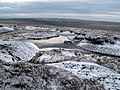
English: Black Hill, is moorland rising to about 570m in the Pennine chain in Northern England. The highest point, Soldier's Lump is the highest point in West Yorkshire but on the borders of Derbyshire and West Yorkshire. It is only 1.6km from the Metropolitan borough of Oldham. The hill staddles three counties. Historically, this area was in the county of Cheshire, Yorkshire and Lancashire. The Pennine Way passes over the hill.
Subcategories
This category has the following 2 subcategories, out of 2 total.
C
- Crowden Little Brook (23 F)
Media in category "Black Hill (Pennines)"
The following 50 files are in this category, out of 50 total.
-
 'The path beyond the stream is still obvious' - geograph.org.uk - 2838782.jpg 1,024 × 768; 216 KB
-
 'The track appears to be heading for Black Hill' - geograph.org.uk - 2838669.jpg 1,024 × 768; 147 KB
-
 'The track appears to be heading to Black Hill' - geograph.org.uk - 2838763.jpg 1,024 × 768; 113 KB
-
 'The track is well defined' - geograph.org.uk - 2838650.jpg 1,024 × 768; 148 KB
-
 'This shoulder is steep but not very long.' - geograph.org.uk - 2838635.jpg 1,024 × 768; 160 KB
-
 20200902 Black Hill pool.jpg 6,000 × 4,000; 9.01 MB
-
 20200902 Black Hill trig point.jpg 6,016 × 4,012; 9.86 MB
-
 20200904 Black Hill from south.jpg 6,016 × 4,012; 7.35 MB
-
 541 Trig Pillar on the skyline - geograph.org.uk - 1718643.jpg 2,560 × 1,920; 666 KB
-
 A memorial cross to W Belfield 1972 - geograph.org.uk - 763372.jpg 640 × 480; 65 KB
-

-
 A Water Course on Near Broadslate - geograph.org.uk - 375752.jpg 640 × 480; 113 KB
-
 Bareholme Moss - geograph.org.uk - 402085.jpg 640 × 480; 95 KB
-
 Black Hill (Peak District).jpg 2,048 × 1,536; 1.16 MB
-
 Black Hill - geograph.org.uk - 861210.jpg 640 × 480; 90 KB
-
 Black Hill trig point in the snow - geograph.org.uk - 2791530.jpg 3,072 × 2,304; 1.12 MB
-
 Blanket Bog Crowden Meadows - geograph.org.uk - 365731.jpg 640 × 480; 111 KB
-
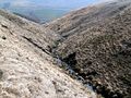
 Crowden Brook towards Black Hill - geograph.org.uk - 616919.jpg 640 × 480; 120 KB
-
 Crowden Great Brook from Crowden Castles - geograph.org.uk - 469393.jpg 640 × 480; 113 KB
-
 Crowden Great Brook through the rocks. - geograph.org.uk - 426565.jpg 640 × 480; 131 KB
-
 Crowden Great Brook Valley. - geograph.org.uk - 351876.jpg 640 × 480; 109 KB
-
 Crowden Meadows - geograph.org.uk - 426110.jpg 640 × 480; 84 KB
-
 Descending Black Hill on the Pennine Way - geograph.org.uk - 3593404.jpg 4,320 × 3,240; 4.77 MB
-
 Hey Clough - geograph.org.uk - 386351.jpg 640 × 480; 110 KB
-
 Hey Clough Top - geograph.org.uk - 383502.jpg 640 × 480; 116 KB
-
 Hey Edge looking to Westend Moss - geograph.org.uk - 383230.jpg 640 × 480; 79 KB
-

-
 Laddow Moss looking to Chew Reservoir - geograph.org.uk - 702967.jpg 640 × 480; 65 KB
-

-
 Oaksike Clough - geograph.org.uk - 383511.jpg 640 × 480; 113 KB
-
 Oaksike Clough - geograph.org.uk - 383516.jpg 640 × 480; 114 KB
-
 Old tree stumps - geograph.org.uk - 67212.jpg 640 × 480; 150 KB
-
 On the way to Black Hill - geograph.org.uk - 2791444.jpg 3,072 × 2,304; 1.28 MB
-
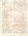 Ordnance Survey Outdoor Leisure Map of the Dark Peak, Published 1972.jpg 14,334 × 18,498; 76.32 MB
-
 Path junction on the Pennine Way - geograph.org.uk - 5503227.jpg 2,000 × 1,483; 1.14 MB
-
 Peat Haggs and Groughs - geograph.org.uk - 365587.jpg 640 × 480; 114 KB
-
 Pennine Way - geograph.org.uk - 382139.jpg 480 × 640; 146 KB
-
 Pennine Way across Grains Moss - geograph.org.uk - 947515.jpg 640 × 480; 125 KB
-

-
 Pennine Way north of Black Dike - geograph.org.uk - 3551204.jpg 750 × 563; 114 KB
-
 Rocks - geograph.org.uk - 48487.jpg 640 × 480; 134 KB
-
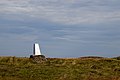
 Soldiers Lump, Black Hill - geograph.org.uk - 131693.jpg 640 × 480; 73 KB
-
 The long climb.jpg 2,448 × 1,632; 1.31 MB
-
 The Pennine Way below Grains Moss - geograph.org.uk - 2791705.jpg 3,072 × 2,304; 1.11 MB
-

-
 Westend Moss - geograph.org.uk - 75015.jpg 640 × 480; 166 KB
-
 Westend Moss Pool - geograph.org.uk - 373682.jpg 640 × 353; 59 KB
-

-
 Former Pennine Way route - geograph.org.uk - 209473.jpg 640 × 468; 150 KB
-


_Ordnance_Survey_Triangulation_Pillar_-_geograph.org.uk_-_521090.jpg)

