Category:Black Combe
Jump to navigation
Jump to search
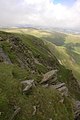
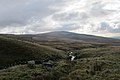
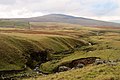
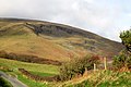
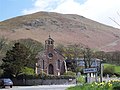
English: Black Combe is a fell in the south-west corner of the Lake District National Park, just four miles from the Irish Sea. It lies near the west coast of Cumbria in the borough of Copeland and more specifically, an area known as South Copeland. It is 1970 feet (600m) high and stands in isolation, some 10 miles away from any higher ground; this factor offers an excellent all-round panoramic view of land and sea; weather permitting.
mountain in United Kingdom  | |||||
| Upload media | |||||
| Instance of | |||||
|---|---|---|---|---|---|
| Located in protected area | |||||
| Location | Lake District, North Yorkshire, Yorkshire and the Humber, England | ||||
| Topographic prominence |
| ||||
| Elevation above sea level |
| ||||
| Parent peak | |||||
 | |||||
Subcategories
This category has the following 2 subcategories, out of 2 total.
S
- Stoneside Hill, Cumbria (6 F)
Media in category "Black Combe"
The following 21 files are in this category, out of 21 total.
-
 Anna Crags - geograph.org.uk - 493684.jpg 426 × 640; 98 KB
-
 Black Combe Beck - geograph.org.uk - 1529476.jpg 640 × 480; 52 KB
-
 Black Combe Corrie - geograph.org.uk - 3221280.jpg 4,000 × 2,664; 990 KB
-
 Black Combe from Buckbarrow Beck - geograph.org.uk - 3221427.jpg 4,000 × 2,664; 1.61 MB
-
 Black Combe from Buckbarrow Beck - geograph.org.uk - 3221441.jpg 4,000 × 2,664; 1.02 MB
-
 Black combe from foxfield.JPG 1,024 × 637; 287 KB
-
 Black Combe Screes - geograph.org.uk - 796474.jpg 640 × 480; 53 KB
-
 Black Combe Screes - geograph.org.uk - 796475.jpg 640 × 480; 72 KB
-
 Black Combe View.JPG 1,600 × 1,200; 139 KB
-
 Black Combe.jpg 640 × 413; 54 KB
-
 Cairn, Black Combe - geograph.org.uk - 797955.jpg 640 × 480; 60 KB
-
 Hall Gill - geograph.org.uk - 3221231.jpg 4,000 × 2,664; 2.46 MB
-
 Hall Gill on the edge of Parsonage Breast - geograph.org.uk - 3221226.jpg 4,000 × 2,664; 2.52 MB
-
 Level Crossing Foxfield - geograph.org.uk - 181129.jpg 640 × 480; 76 KB
-
 Parsonage Breast from Po House Road - geograph.org.uk - 3221217.jpg 4,000 × 2,664; 1.31 MB
-
 Pen End - geograph.org.uk - 3221250.jpg 4,000 × 2,664; 1.35 MB
-
 Return to broadleaf woodland - geograph.org.uk - 3211141.jpg 2,592 × 1,944; 931 KB
-
 The Corrie on Black Combe - geograph.org.uk - 3221261.jpg 4,000 × 2,664; 1.58 MB
-
 The northern slopes of Black Combe - geograph.org.uk - 493722.jpg 640 × 426; 103 KB
-
 Whitbeck Church. - geograph.org.uk - 160397.jpg 640 × 480; 65 KB
-
 Black Combe - geograph.org.uk - 467572.jpg 640 × 480; 44 KB


