Category:Bilsdale Midcable
Jump to navigation
Jump to search

civil parish in North Yorkshire, UK | |||||
| Upload media | |||||
| Instance of | |||||
|---|---|---|---|---|---|
| Location | Hambleton, North Yorkshire, Yorkshire and the Humber, England | ||||
| Population |
| ||||
| Area |
| ||||
 | |||||
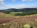
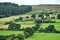
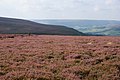
English: Bilsdale Midcable is a geographically large civil parish in North Yorkshire, England and situated in the North York Moors National Park. According to the 2001 census it had a population of 293. Settlements in the parish are The Grange, Chop Gate, Seave Green and Urra. The parish also contains Bilsdale Moor, East and West.
Subcategories
This category has the following 14 subcategories, out of 14 total.
B
- Bilsdale Transmitting Station (26 F)
- Bilsdale War Memorial (1 F)
C
- Cold Moor, North Yorkshire (35 F)
F
- Fangdale Beck (12 F)
H
S
- Seave Green, North Yorkshire (9 F)
- Spout House, Hambleton (9 F)
- St John's Church, Bilsdale (4 F)
- Stingamires (1 F)
U
- Urra, North Yorkshire (13 F)
Media in category "Bilsdale Midcable"
The following 200 files are in this category, out of 440 total.
(previous page) (next page)-

-
 A minor road towards Urra - geograph.org.uk - 3533573.jpg 1,024 × 768; 244 KB
-
 A murky descent to Clay Bank - geograph.org.uk - 2008219.jpg 640 × 480; 215 KB
-
 A.A. Milne was born this day in 1882 - geograph.org.uk - 4796982.jpg 640 × 480; 43 KB
-
 Abandoned excavation in moorland on Nab Ridge - geograph.org.uk - 2812741.jpg 3,648 × 2,736; 3.42 MB
-
 Abandoned Gateway, East Bank Plantation - geograph.org.uk - 2228580.jpg 640 × 427; 276 KB
-
 Above Bilsdale - geograph.org.uk - 4403872.jpg 640 × 360; 81 KB
-
 Access track to William Beck Farm - geograph.org.uk - 1825095.jpg 2,048 × 1,536; 1.76 MB
-
 Across Bilsdale Midcable - geograph.org.uk - 2170618.jpg 640 × 480; 188 KB
-
 Across Raisdale - geograph.org.uk - 3810755.jpg 3,240 × 4,320; 1.98 MB
-
 Adjuster.observer.notched - geograph.org.uk - 5979552.jpg 640 × 427; 92 KB
-
 Along the Cleveland Way - geograph.org.uk - 6234942.jpg 1,600 × 1,024; 447 KB
-
 And this side - geograph.org.uk - 5722215.jpg 1,024 × 683; 144 KB
-
 Approaching High Cowhelm - geograph.org.uk - 2222211.jpg 4,000 × 3,000; 3.58 MB
-
 Approaching High Crookleith Farm - geograph.org.uk - 2221537.jpg 4,000 × 3,000; 2.83 MB
-
 Ascending Carr Ridge - geograph.org.uk - 1822659.jpg 640 × 480; 73 KB
-
 Ascending Kirby Bank - geograph.org.uk - 1823235.jpg 480 × 640; 66 KB
-
 At Stump Cross - geograph.org.uk - 4659068.jpg 1,600 × 1,200; 644 KB
-
 At the end of the moor - geograph.org.uk - 3810718.jpg 3,240 × 4,320; 1.86 MB
-
 B1257 heading north - geograph.org.uk - 2690291.jpg 1,024 × 601; 78 KB
-
 B1257 heading north - geograph.org.uk - 2690328.jpg 800 × 502; 33 KB
-
 B1257 heading north - geograph.org.uk - 2690554.jpg 800 × 485; 35 KB
-
 B1257 heading north - geograph.org.uk - 2690920.jpg 800 × 528; 74 KB
-
 B1257 heading north at Bilsdale - geograph.org.uk - 2690914.jpg 800 × 544; 79 KB
-
 B1257 through Kirkhill Plantation - geograph.org.uk - 2690303.jpg 800 × 513; 140 KB
-
 B1257 towards Stokesley - geograph.org.uk - 2690195.jpg 640 × 480; 46 KB
-
 B1257 towards Stokesley - geograph.org.uk - 2690313.jpg 800 × 484; 35 KB
-
 B1257 towards Stokesley - geograph.org.uk - 2690550.jpg 800 × 511; 51 KB
-
 B1257 towards Stokesley - geograph.org.uk - 2690562.jpg 640 × 370; 27 KB
-
 B1257 towards Stokesley - geograph.org.uk - 2690910.jpg 1,024 × 567; 175 KB
-
 B1257 towards Stokesley - geograph.org.uk - 2690945.jpg 640 × 488; 67 KB
-
 Back of Cringley - geograph.org.uk - 6062395.jpg 640 × 360; 86 KB
-
 Back of the Cleveland Hills - geograph.org.uk - 6089858.jpg 640 × 360; 90 KB
-
 Badger Gill - geograph.org.uk - 4659064.jpg 1,600 × 1,200; 568 KB
-
 Badger Stone - geograph.org.uk - 2605903.jpg 1,024 × 768; 109 KB
-
 Barker's Ridge - geograph.org.uk - 5517671.jpg 2,048 × 1,536; 1.21 MB
-
 Beacon Guest - geograph.org.uk - 2170744.jpg 640 × 480; 257 KB
-
 Beak Hills - geograph.org.uk - 2719029.jpg 2,710 × 1,608; 610 KB
-
 Between Bilsdale Moors - geograph.org.uk - 2170709.jpg 640 × 480; 170 KB
-
 Bils Dale Beck - geograph.org.uk - 4774067.jpg 768 × 1,024; 241 KB
-
 Bilsdale - geograph.org.uk - 2228589.jpg 640 × 427; 263 KB
-
 Bilsdale East Moor - geograph.org.uk - 4102423.jpg 1,600 × 1,200; 657 KB
-
 Bilsdale East Moor 2 - geograph.org.uk - 4102426.jpg 1,600 × 1,200; 772 KB
-
 Bilsdale East Moor 3 - geograph.org.uk - 4102430.jpg 1,600 × 1,200; 658 KB
-
 Bilsdale in all its Glory - geograph.org.uk - 2222279.jpg 4,000 × 3,000; 3.3 MB
-
 Bilsdale near Holme Farm - geograph.org.uk - 2627170.jpg 800 × 600; 169 KB
-
 Bilsdale TV Transmitter - geograph.org.uk - 5700784.jpg 2,592 × 3,872; 2.71 MB
-
 Bilsdale TV transmitter from Black Hambleton - geograph.org.uk - 5700786.jpg 1,600 × 1,067; 80 KB
-
 Bilsdale West Moor - geograph.org.uk - 2718764.jpg 3,875 × 2,573; 1,020 KB
-
 Bilsdale West Moor - geograph.org.uk - 2718766.jpg 3,888 × 2,387; 912 KB
-
 Bilsdale West Moor - geograph.org.uk - 2718773.jpg 3,888 × 2,592; 872 KB
-
 Black-painted barns - geograph.org.uk - 5595239.jpg 1,500 × 866; 1.25 MB
-
 Bluebells in Raisdale - geograph.org.uk - 2957815.jpg 800 × 600; 237 KB
-
 Boundary Stone - geograph.org.uk - 5613597.jpg 306 × 640; 64 KB
-
 Boundary Stone - geograph.org.uk - 5613598.jpg 395 × 640; 84 KB
-
 Boundary Stone - geograph.org.uk - 5613599.jpg 356 × 640; 52 KB
-
 Boundary Stone - geograph.org.uk - 5613606.jpg 310 × 640; 39 KB
-
 Boundary Stone - geograph.org.uk - 5613608.jpg 640 × 426; 92 KB
-
 Boundary Stone - geograph.org.uk - 5613611.jpg 402 × 640; 78 KB
-
 Boundary Stone - geograph.org.uk - 5613616.jpg 327 × 640; 52 KB
-
 Boundary Stone - geograph.org.uk - 5613618.jpg 332 × 640; 69 KB
-
 Boundary stone above Broughton Bank - geograph.org.uk - 3810809.jpg 3,176 × 4,272; 2.22 MB
-
 Boundary Stone and Green Howe - geograph.org.uk - 1836601.jpg 4,000 × 3,000; 2.77 MB
-
 Boundary stone beside Cleveland Way - geograph.org.uk - 2466534.jpg 1,125 × 1,500; 1.42 MB
-
 Boundary stone beside footpath - geograph.org.uk - 6229555.jpg 1,600 × 977; 528 KB
-
 Boundary stone by Round Hill - geograph.org.uk - 4163644.jpg 3,872 × 2,592; 5.47 MB
-
 Boundary stone by the Cleveland Way - geograph.org.uk - 4163620.jpg 3,872 × 2,592; 2.17 MB
-
 Boundary Stone, Clough Gill Top - geograph.org.uk - 1749194.jpg 640 × 427; 283 KB
-
 Boundary Stone, Stoney Wicks - geograph.org.uk - 1749191.jpg 640 × 427; 287 KB
-
 Bride Stones - geograph.org.uk - 5150098.jpg 640 × 480; 197 KB
-
 Bridge over the River Seph - geograph.org.uk - 836359.jpg 427 × 640; 84 KB
-
 Bridge over Tripsdale Beck - geograph.org.uk - 2222175.jpg 4,000 × 3,000; 5.04 MB
-
 Bridleway over Carr Ridge - geograph.org.uk - 2008269.jpg 640 × 480; 218 KB
-
 Buckingham Stone - geograph.org.uk - 5246082.jpg 640 × 427; 143 KB
-
 Buildings at Urra Farm - geograph.org.uk - 3533577.jpg 1,024 × 768; 278 KB
-
 Cairn on Broughton Bank - geograph.org.uk - 1823124.jpg 480 × 640; 65 KB
-
 Cairn on Cold moor. - geograph.org.uk - 5950565.jpg 1,024 × 683; 168 KB
-
 Cairn on Collar Ridge - geograph.org.uk - 2707541.jpg 1,500 × 825; 1.15 MB
-
 Car Park - geograph.org.uk - 2718994.jpg 3,871 × 2,291; 1.1 MB
-
 Carlton Moor Gliding Club - geograph.org.uk - 54663.jpg 640 × 480; 65 KB
-
 Carlton Moor, with Roseberry Topping in distance - geograph.org.uk - 4137472.jpg 4,000 × 2,248; 5.3 MB
-
 Carr Ridge and Hasty Bank - geograph.org.uk - 5996759.jpg 640 × 427; 105 KB
-
 Chop Gate - geograph.org.uk - 4774002.jpg 1,024 × 768; 173 KB
-
 Chop Gate - geograph.org.uk - 5942995.jpg 640 × 360; 118 KB
-
 Chop Gate village hall - geograph.org.uk - 5722219.jpg 1,024 × 683; 165 KB
-
 Church at Chop Gate - geograph.org.uk - 5732892.jpg 1,600 × 1,067; 379 KB
-
 Church in the trees - geograph.org.uk - 6162488.jpg 4,320 × 3,240; 2.64 MB
-
 Clay Bank East Fell Race - geograph.org.uk - 2225044.jpg 640 × 480; 120 KB
-
 Cleared forest above Clay Bank - geograph.org.uk - 4163092.jpg 3,872 × 2,592; 1.78 MB
-
 Cleveland Way on White Hill - geograph.org.uk - 3604057.jpg 640 × 480; 167 KB
-
 Cleveland Way view - geograph.org.uk - 5668167.jpg 640 × 480; 141 KB
-
 Climbers on Sphinx Rock - geograph.org.uk - 6229791.jpg 1,600 × 1,200; 575 KB
-
 Close up of lintel - geograph.org.uk - 5732921.jpg 1,024 × 683; 161 KB
-
 Cock Flat farm - geograph.org.uk - 3810730.jpg 3,771 × 2,160; 1.11 MB
-
 Cock Howe round barrow (geograph 6866750).jpg 1,024 × 683; 368 KB
-
 Cold Moor - geograph.org.uk - 4774025.jpg 1,024 × 768; 184 KB
-
 Cold Moor - geograph.org.uk - 6007789.jpg 640 × 427; 101 KB
-
 Cold Moor from The Wainstones - geograph.org.uk - 6175572.jpg 640 × 360; 91 KB
-
 Collecting the Hay - geograph.org.uk - 973501.jpg 640 × 427; 278 KB
-
 Country near The Grange - geograph.org.uk - 5783156.jpg 2,592 × 1,944; 1.71 MB
-
 Cringle Moor - geograph.org.uk - 5931745.jpg 1,024 × 768; 893 KB
-
 Cringle Moor summit - geograph.org.uk - 5668158.jpg 640 × 480; 141 KB
-
 Cringle Moor view - geograph.org.uk - 5668160.jpg 640 × 480; 114 KB
-
 Crookleith Farms - geograph.org.uk - 1475203.jpg 528 × 640; 383 KB
-
 Crossletts Farm - geograph.org.uk - 1112058.jpg 640 × 427; 75 KB
-
 Descending Broughton Bank - geograph.org.uk - 1823133.jpg 640 × 480; 64 KB
-
 Donna Cross - geograph.org.uk - 5595235.jpg 1,500 × 1,125; 1.53 MB
-
 Donna Cross Col - geograph.org.uk - 4905910.jpg 640 × 384; 26 KB
-
 Drake Howe - geograph.org.uk - 6173013.jpg 640 × 360; 83 KB
-
 Drive down from Cam House - geograph.org.uk - 2823242.jpg 3,648 × 2,736; 2.92 MB
-
 Drive to William Beck Farm - geograph.org.uk - 2823179.jpg 3,648 × 2,736; 3.21 MB
-
 Dry stone wall above Low Crossett Farm - geograph.org.uk - 2247451.jpg 2,000 × 1,124; 2.03 MB
-
 Enclosed Path near High Crossett Farm - geograph.org.uk - 4639683.jpg 4,000 × 3,000; 2.9 MB
-
 End of the road, Fangdale Beck - geograph.org.uk - 4647965.jpg 1,741 × 974; 388 KB
-
 Fallen tree on slope of dead bracken - geograph.org.uk - 5595194.jpg 1,500 × 1,125; 1.91 MB
-
 Fangdale Beck - geograph.org.uk - 4647953.jpg 1,747 × 1,172; 486 KB
-
 Fangdale Beck hamlet - geograph.org.uk - 6161785.jpg 4,287 × 2,836; 2.28 MB
-
 Farm buildings at Bilsdale Hall - geograph.org.uk - 3533524.jpg 1,024 × 768; 238 KB
-
 Farm buildings at Cross Holme Farm - geograph.org.uk - 2824694.jpg 2,933 × 2,189; 1.02 MB
-
 Farm buildings, Fangdale Beck - geograph.org.uk - 4647962.jpg 1,691 × 1,077; 393 KB
-
 Farm in Chop Gate - geograph.org.uk - 5732916.jpg 1,600 × 1,067; 351 KB
-
 Farm track towards Trennet - geograph.org.uk - 1615882.jpg 640 × 480; 93 KB
-
 Farmhouse in Chop Gate - geograph.org.uk - 5737202.jpg 1,024 × 683; 170 KB
-
 Farmland north of Beak Hills - geograph.org.uk - 5595256.jpg 1,500 × 785; 1.07 MB
-
 Farmland off the B1257 - geograph.org.uk - 2690190.jpg 640 × 480; 70 KB
-
 Farmland, Raisdale - geograph.org.uk - 2638310.jpg 640 × 360; 198 KB
-
 Field at top of Cold Moor Lane - geograph.org.uk - 2707681.jpg 1,500 × 1,125; 1.44 MB
-
 Field off the Raisedale Road - geograph.org.uk - 2641253.jpg 640 × 360; 188 KB
-
 Field Path from Chop Gate to Orterley - geograph.org.uk - 4639751.jpg 4,000 × 3,000; 5.01 MB
-
 Field Path from Chop Gate to Orterley - geograph.org.uk - 4639756.jpg 4,000 × 3,000; 3.93 MB
-
 Field Path from Orterley to Crookleith - geograph.org.uk - 4639766.jpg 4,000 × 3,000; 3.32 MB
-
 Field Path from Stable Holme to Low Mill - geograph.org.uk - 4639784.jpg 4,000 × 3,000; 3.47 MB
-
 Field Path to Road and Chop Gate - geograph.org.uk - 4639737.jpg 4,000 × 3,000; 3.67 MB
-
 Fields near Orterley Farms - geograph.org.uk - 3359340.jpg 1,600 × 1,200; 527 KB
-
 Finger Post on Cleveland Way Footpath - geograph.org.uk - 3757260.jpg 2,288 × 1,712; 729 KB
-

-
 Flock of Geese Blocking the Footpath to Ellermire - geograph.org.uk - 4639732.jpg 4,000 × 3,000; 1.99 MB
-
 Footbridge over Kyloe Cow Beck - geograph.org.uk - 2222258.jpg 4,000 × 3,000; 3.41 MB
-
 Footbridge over the River Seph - geograph.org.uk - 1762557.jpg 2,048 × 1,536; 2.47 MB
-
 Footpath down from Nab End Moor - geograph.org.uk - 2823207.jpg 3,648 × 2,736; 3.12 MB
-
 Footpath from Crossholme to Stable Holme - geograph.org.uk - 4639781.jpg 4,000 × 3,000; 4.67 MB
-
 Footpath into Raisdale - geograph.org.uk - 6165490.jpg 3,240 × 4,320; 2.21 MB
-
 Footpath Marker - geograph.org.uk - 4774072.jpg 1,024 × 768; 244 KB
-
 Footpath on Carr Ridge - geograph.org.uk - 5917382.jpg 1,024 × 768; 762 KB
-
 Footpath on the Cleveland Way - geograph.org.uk - 2392586.jpg 3,968 × 2,976; 2.79 MB
-
 Footpath or Cattle Trod^ - geograph.org.uk - 4639774.jpg 4,000 × 3,000; 3.66 MB
-

-
 Footpath to High Crookleith Farm - geograph.org.uk - 2221541.jpg 4,000 × 3,000; 3.74 MB
-
 Footpath towards Clay Bank Top - geograph.org.uk - 5917378.jpg 1,024 × 768; 592 KB
-
 Footpath up to Nab Ridge - geograph.org.uk - 2823217.jpg 3,648 × 2,736; 2 MB
-
 Former Jet Workings, Tripsdale - geograph.org.uk - 670670.jpg 427 × 640; 87 KB
-
 Frozen Puddle - geograph.org.uk - 1120118.jpg 427 × 640; 67 KB
-
 Gap in the Forestry - geograph.org.uk - 2222060.jpg 4,000 × 3,000; 5.24 MB
-
 Garfit Gap - geograph.org.uk - 1823101.jpg 640 × 480; 81 KB
-
 Garfit Gap - geograph.org.uk - 6243276.jpg 640 × 360; 98 KB
-
 Garfitt Gap - geograph.org.uk - 4693141.jpg 640 × 480; 110 KB
-
 Gate, Near High Cowhelm Farm - geograph.org.uk - 670639.jpg 640 × 427; 77 KB
-
 Gated section of the Cleveland Way - geograph.org.uk - 2095342.jpg 2,048 × 1,536; 1,001 KB
-
 Grazing Cattle, Hallgarth Farm, Raisdale - geograph.org.uk - 2545524.jpg 1,024 × 768; 369 KB
-
 Green Howe - geograph.org.uk - 6291160.jpg 640 × 360; 82 KB
-
 Green Howe round barrow (geograph 6867052).jpg 1,024 × 683; 458 KB
-
 Green telephone box - geograph.org.uk - 3604020.jpg 640 × 480; 162 KB
-
 Green Track - geograph.org.uk - 4774080.jpg 1,024 × 768; 277 KB
-
 Greene Howe - geograph.org.uk - 2718987.jpg 3,888 × 2,361; 1.35 MB
-
 Grouse on a wall - geograph.org.uk - 1630176.jpg 640 × 428; 40 KB
-

-
 Hagg House and Tripsdale Beck - geograph.org.uk - 2222163.jpg 4,000 × 3,000; 3.7 MB
-
 Hasty Bank - geograph.org.uk - 5668151.jpg 640 × 480; 125 KB
-
 Head House - geograph.org.uk - 2718989.jpg 3,344 × 1,340; 418 KB
-

-
 Heather moorland with grouse butt - geograph.org.uk - 6229626.jpg 1,600 × 998; 491 KB
-
 Hedgerow, Raisedale - geograph.org.uk - 2638286.jpg 640 × 360; 205 KB
-
 Helmsley Moor - geograph.org.uk - 3188656.jpg 1,024 × 768; 277 KB
-
 High Bracken Hill - geograph.org.uk - 2222229.jpg 4,000 × 3,000; 3.25 MB
-
 High Cable Stones - geograph.org.uk - 2228571.jpg 640 × 427; 254 KB
-
 High Clay House - geograph.org.uk - 1120125.jpg 640 × 427; 52 KB
-
 High Cowhelm - geograph.org.uk - 4203824.jpg 1,600 × 1,200; 658 KB
-
 High Crosslets Farm, Raisdale - geograph.org.uk - 5877056.jpg 640 × 427; 109 KB
-
 High West Cote - geograph.org.uk - 2718818.jpg 3,744 × 2,320; 1.12 MB
-
 Hill End Farm - geograph.org.uk - 2824682.jpg 3,648 × 2,736; 2.65 MB
-
 Hill End Farm access - geograph.org.uk - 5525553.jpg 2,048 × 1,536; 1.19 MB
-
 Hill road heading south on Cold Moor - geograph.org.uk - 6229627.jpg 1,600 × 936; 506 KB
-
 Impassable route - geograph.org.uk - 3359321.jpg 1,600 × 1,200; 1.03 MB
-
 Inside the disabled toilets at Chop Gate - geograph.org.uk - 5722192.jpg 6,000 × 4,000; 6.9 MB
-
 Inside the men's toilets at Chop Gate - geograph.org.uk - 5722172.jpg 6,000 × 4,000; 6.08 MB
-
 Inside the women's toilet at Chop Gate - geograph.org.uk - 5722112.jpg 6,000 × 4,000; 5.82 MB
-
 Irrigation-Drainage ditch on moorland - geograph.org.uk - 2222304.jpg 4,000 × 3,000; 4.08 MB
-
 It wer reet parky on’t moor this morning - geograph.org.uk - 4838949.jpg 640 × 384; 103 KB
-
 Kyloe Cow Beck - geograph.org.uk - 2222246.jpg 4,000 × 3,000; 5.04 MB
-
 Limestone Ridge - geograph.org.uk - 4102421.jpg 1,600 × 1,200; 691 KB
-
 Line of boundary stones on Carr Ridge - geograph.org.uk - 4163557.jpg 3,872 × 2,592; 2.29 MB
-
 Livestock by street - geograph.org.uk - 5737182.jpg 1,024 × 683; 117 KB
-
 Long barn. - geograph.org.uk - 2202880.jpg 640 × 320; 37 KB
-

-

-
 Looking down on Raisdale - geograph.org.uk - 2201589.jpg 640 × 480; 53 KB
-

-
 Looking into Bilsdale - geograph.org.uk - 2699600.jpg 1,024 × 768; 246 KB
-
 Looking north east from the Raisdale Road - geograph.org.uk - 3810751.jpg 4,320 × 2,477; 1.52 MB
-
 Looking North up Raisdale - geograph.org.uk - 2627038.jpg 800 × 600; 109 KB


.jpg)


.jpg)


