Category:Billington, Bedfordshire (civil parish)
Jump to navigation
Jump to search
English: Billington, previously Great Billington (the name probably means hill with a sharp ridge), is a parish in Bedfordshire about three miles south of Leighton Buzzard. As well as the settlement of Billington/Great Billington, straddling the busy A4146, the parish also contains the hamlet of Little Billington in the west of the parish.
civil parish in Central Bedfordshire, Bedfordshire, England | |||||
| Upload media | |||||
| Instance of | |||||
|---|---|---|---|---|---|
| Location | Central Bedfordshire, Bedfordshire, East of England, England | ||||
 | |||||
Subcategories
This category has the following 2 subcategories, out of 2 total.
L
- Little Billington (2 F)
Media in category "Billington, Bedfordshire (civil parish)"
The following 41 files are in this category, out of 41 total.
-
 A505 heading east - geograph.org.uk - 6340800.jpg 1,024 × 684; 211 KB
-
 Billington Manor UK.png 507 × 332; 69 KB
-
 Billington Public Footpath.png 112 × 112; 37 KB
-
 Brown field near Mayflower Farm - geograph.org.uk - 3995256.jpg 640 × 480; 128 KB
-
 Central Bedfordshire , Leighton Road B440 - geograph.org.uk - 5732710.jpg 6,000 × 4,000; 7.74 MB
-
 Drainage ditch by Home Farm - geograph.org.uk - 6237758.jpg 1,600 × 1,066; 356 KB
-
 Entrance to caravan park on Leighton Road - geograph.org.uk - 5279469.jpg 2,264 × 1,672; 998 KB
-
 Farm buildings, The Rye - geograph.org.uk - 3109429.jpg 4,000 × 3,000; 4.64 MB
-
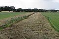
 Field by the A505 with Leighton Buzzard in the distance - geograph.org.uk - 4940681.jpg 1,600 × 1,066; 510 KB
-
 Field by the church - geograph.org.uk - 6237768.jpg 1,600 × 1,066; 406 KB
-
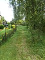
 Footpath to Little Billington - geograph.org.uk - 6237742.jpg 1,600 × 1,066; 437 KB
-
 Footpath to Slapton - geograph.org.uk - 6237769.jpg 1,600 × 1,066; 432 KB
-
 Footpath to the pond - geograph.org.uk - 6237736.jpg 1,600 × 1,066; 465 KB
-
 Great Billington , Choakes Yard - geograph.org.uk - 5732715.jpg 6,000 × 4,000; 5.39 MB
-
 Great Billington , Church Turn - geograph.org.uk - 5732718.jpg 6,000 × 4,000; 6.11 MB
-
 Great Billington , Leighton Road B440 - geograph.org.uk - 5732713.jpg 5,623 × 3,749; 6.09 MB
-
 Great Billington , Leighton Road B440 - geograph.org.uk - 5732723.jpg 6,000 × 4,000; 7.05 MB
-
 Great Billington , Leighton Road B440 - geograph.org.uk - 5732725.jpg 6,000 × 4,000; 7.59 MB
-
 Great Billington , Mill Road - geograph.org.uk - 5732733.jpg 6,000 × 4,000; 5.4 MB
-
 Great Billington , St Michael's Place - geograph.org.uk - 5732728.jpg 6,000 × 4,000; 5.81 MB
-
 Hard to use footpath to Leighton Buzzard - geograph.org.uk - 6237732.jpg 1,600 × 1,066; 672 KB
-
 House on Leighton Road, Billington - geograph.org.uk - 5279442.jpg 2,053 × 1,474; 827 KB
-
 House on Leighton Road, Billington - geograph.org.uk - 5279445.jpg 2,101 × 1,531; 887 KB
-
 Leighton Buzzard , The A505 - geograph.org.uk - 5732737.jpg 6,000 × 4,000; 6.05 MB
-
 Leighton Road, Billington - geograph.org.uk - 5279436.jpg 2,304 × 1,728; 978 KB
-
 Mobile home settlement by Slapton - geograph.org.uk - 6237730.jpg 1,600 × 1,066; 414 KB
-
 Ouzel Brook - geograph.org.uk - 3109423.jpg 4,000 × 3,000; 4.84 MB
-
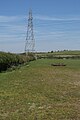
 Powerlines over the pasture - geograph.org.uk - 6237738.jpg 1,600 × 1,066; 373 KB
-
 Public Footpath - geograph.org.uk - 3109453.jpg 4,000 × 3,000; 4.78 MB
-
 Public Footpath - geograph.org.uk - 3109622.jpg 3,000 × 4,000; 4.85 MB
-
 Pylon straddling a hedge - geograph.org.uk - 4940673.jpg 1,066 × 1,600; 363 KB
-
 Pylons by a farm track - geograph.org.uk - 4940677.jpg 1,066 × 1,600; 351 KB
-
 River Ouzel & pollarded trees - geograph.org.uk - 325763.jpg 640 × 480; 86 KB
-
 River Ouzel near Northall - geograph.org.uk - 325765.jpg 480 × 640; 80 KB
-
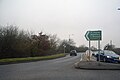
 Roundabout on Leighton Road, Leighton Buzzard - geograph.org.uk - 5279410.jpg 2,301 × 1,690; 933 KB
-
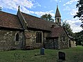
 St Michael and all Angels Great Billington - geograph.org.uk - 6237763.jpg 1,600 × 1,066; 480 KB
-
 St Michael and all Angels Great Billington - geograph.org.uk - 6237766.jpg 1,600 × 1,200; 535 KB
-
 St. Michael's Place - geograph.org.uk - 3995245.jpg 640 × 428; 92 KB
-
 Stanbridge Road at the junction of Leighton Road - geograph.org.uk - 5279401.jpg 2,304 × 1,728; 1.01 MB
-
 Stream by the A505 - geograph.org.uk - 3511769.jpg 1,600 × 1,068; 710 KB
-
 View from Billington Hill UK.gif 676 × 507; 79 KB


