Category:Billingshurst
Jump to navigation
Jump to search
Billingshurst is a village in the Horsham District of West Sussex, England. Billingshurst lies 8 miles (13 km) south-west from the town of Horsham, and 5.6 miles (9 km) north-east from the village of Pulborough.

village in the United Kingdom  Vue de Billingshurst depuis le sud | |||||
| Upload media | |||||
| Instance of | |||||
|---|---|---|---|---|---|
| Location | Billingshurst, Horsham, West Sussex, South East England, England | ||||
| Area |
| ||||
| official website | |||||
 | |||||
Subcategories
This category has the following 5 subcategories, out of 5 total.
Media in category "Billingshurst"
The following 200 files are in this category, out of 260 total.
(previous page) (next page)-

-
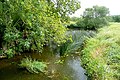
 A gentle flowing River Arun by the Wey-South Path - geograph.org.uk - 1829316.jpg 1,600 × 1,200; 676 KB
-
 A row of houses, Station Rd - geograph.org.uk - 1296313.jpg 640 × 430; 57 KB
-
 AgeUK in Jengers Mead - geograph.org.uk - 2278665.jpg 640 × 480; 78 KB
-
 Along the Wey and Arun Canal - geograph.org.uk - 2013386.jpg 640 × 427; 225 KB
-
 Am I to be on Ewe Tube^ - geograph.org.uk - 2149029.jpg 2,560 × 1,920; 2.22 MB
-

-
 Arun Canal near Shipbourne Farm - geograph.org.uk - 1893345.jpg 1,600 × 1,200; 824 KB
-
 Arun floodplain - geograph.org.uk - 2013472.jpg 640 × 426; 242 KB
-
 Arun Valley at Guildenhurst - geograph.org.uk - 2151017.jpg 2,560 × 1,920; 2.24 MB
-
 At first I misread it - geograph.org.uk - 2281345.jpg 480 × 640; 85 KB
-
 Avenue to Guildenhurst Manor - geograph.org.uk - 2151031.jpg 2,560 × 1,920; 2.32 MB
-
 B2133 nearing Adversane from the east - geograph.org.uk - 2230111.jpg 3,577 × 2,565; 2.65 MB
-
 Bank near Bramley Farm - geograph.org.uk - 2011238.jpg 640 × 426; 253 KB
-
 Barn conversion at Northwood Farm - geograph.org.uk - 2228702.jpg 4,000 × 3,000; 3.55 MB
-
 Barn, Rowner Farm - geograph.org.uk - 2189285.jpg 640 × 480; 105 KB
-
 Barns at Hampshires - geograph.org.uk - 2149009.jpg 2,560 × 1,920; 2.3 MB
-
 Billingshurst - geograph.org.uk - 2148885.jpg 2,560 × 1,920; 1.7 MB
-
 Billingshurst Bypass - geograph.org.uk - 2148930.jpg 2,560 × 1,920; 2.4 MB
-
 Billingshurst Bypass - geograph.org.uk - 2152070.jpg 2,560 × 1,920; 1.64 MB
-
 Billingshurst Library.JPG 1,280 × 960; 446 KB
-
 Billingshurst Lions, Jengers Mead - geograph.org.uk - 2278695.jpg 640 × 480; 93 KB
-
 Billingshurst near church.JPG 1,280 × 960; 461 KB
-
 Billingshurst Post Office - geograph.org.uk - 2148026.jpg 2,560 × 1,920; 1.81 MB
-

-
 Billingshurst Post Office.JPG 1,280 × 960; 446 KB
-
 Billingshurst Village Hall - geograph.org.uk - 2148901.jpg 2,560 × 1,920; 2.03 MB
-
 Billingshurst Village Sign - geograph.org.uk - 891944.jpg 3,072 × 2,304; 1.31 MB
-

-
 Billingshurst Womens Hall.JPG 1,280 × 960; 483 KB
-
 Billingshurst.JPG 1,280 × 960; 466 KB
-
 Billingshurstfrom south.JPG 1,280 × 960; 459 KB
-

-
 Boathouse at Brockhurst Pond - geograph.org.uk - 2011198.jpg 640 × 426; 222 KB
-
 Bridge carrying bridleway north to Wisborough Green - geograph.org.uk - 1892280.jpg 1,600 × 1,200; 722 KB
-
 Bridleway and footpath junction at Westlands Farm - geograph.org.uk - 2229943.jpg 4,000 × 3,000; 3.35 MB
-
 Bridleway approaching Juppland Farm at Adversane - geograph.org.uk - 2229961.jpg 4,000 × 3,000; 3.52 MB
-
 Bridleway Junction by Leyhold Hanger - geograph.org.uk - 2148989.jpg 2,560 × 1,920; 2.46 MB
-

-
 Bridleway to Hampshires - geograph.org.uk - 2149042.jpg 2,560 × 1,920; 2.26 MB
-
 Bridleway to Lee Place - geograph.org.uk - 2013379.jpg 640 × 428; 242 KB
-
 Bridleway to Lee Place Lodge - geograph.org.uk - 1826907.jpg 1,600 × 1,200; 646 KB
-
 Bridleway towards Lee Place - geograph.org.uk - 2011216.jpg 640 × 426; 227 KB
-
 Brockhurst Pond - geograph.org.uk - 2011203.jpg 640 × 426; 250 KB
-
 Brooker's Rd, Station Rd junction - geograph.org.uk - 1296300.jpg 640 × 430; 61 KB
-
 Broomfield Drive - geograph.org.uk - 1296233.jpg 640 × 430; 71 KB
-

-
 Broomfield Drive, looking south - geograph.org.uk - 1296237.jpg 640 × 430; 63 KB
-
 Budgens, car park entrance - geograph.org.uk - 1911329.jpg 640 × 480; 120 KB
-
 Bugdens in the High Street - geograph.org.uk - 2278527.jpg 640 × 480; 65 KB
-
 Bus shelter in the High Street - geograph.org.uk - 2287790.jpg 640 × 480; 74 KB
-
 C ^ B Wilson in Jengers Mead - geograph.org.uk - 2278687.jpg 480 × 640; 72 KB
-
 Café in Jengers Mead - geograph.org.uk - 2278650.jpg 480 × 640; 71 KB
-
 Caravan Park by The Limeburners - geograph.org.uk - 2152059.jpg 2,560 × 1,920; 2.25 MB
-
 Causeway footbridge near Lording's Lock - geograph.org.uk - 1828173.jpg 1,600 × 1,200; 829 KB
-
 Cezala in the High Street - geograph.org.uk - 2278661.jpg 640 × 480; 60 KB
-
 Chain link shutter style stile on the Wey-South Path - geograph.org.uk - 1828080.jpg 1,600 × 1,200; 777 KB
-

-
 China Brasserie in the High Street - geograph.org.uk - 2281258.jpg 480 × 640; 74 KB
-
 Chinese Bridge over the River Arun at Haybarn - geograph.org.uk - 1893382.jpg 1,600 × 1,200; 418 KB
-
 Clock above Truffles - geograph.org.uk - 2287838.jpg 640 × 480; 59 KB
-
 Close up of swing bridge mechanism - geograph.org.uk - 1893398.jpg 1,600 × 1,200; 449 KB
-
 CoCo's Billingshurst High Street - geograph.org.uk - 2281309.jpg 480 × 640; 62 KB
-

-
 Coral in Jengers Mead - geograph.org.uk - 2278492.jpg 480 × 640; 68 KB
-
 Cottage on Rowner Road - geograph.org.uk - 2149062.jpg 2,560 × 1,920; 2.09 MB
-
 Cottage on Rowner Road - geograph.org.uk - 2149085.jpg 2,560 × 1,920; 2.31 MB
-
 Cottages in Billingshurst - geograph.org.uk - 1541493.jpg 640 × 360; 51 KB
-
 Cottages in Billingshurst, West Sussex, England.jpg 640 × 482; 89 KB
-
 Cottages on the Green, Billingshurst - geograph.org.uk - 2147983.jpg 2,560 × 1,920; 1.78 MB
-

-
 Cows by the Arun - geograph.org.uk - 2150979.jpg 2,560 × 1,920; 2.16 MB
-
 Crafty Snippets in Jengers Mead - geograph.org.uk - 2278497.jpg 480 × 640; 91 KB
-
 Curious cattle by canal - geograph.org.uk - 1828099.jpg 1,600 × 1,200; 679 KB
-
 Dam on disused Arun Canal - geograph.org.uk - 1827974.jpg 1,600 × 1,200; 764 KB
-
 Delicatessen in the High Street - geograph.org.uk - 2281361.jpg 480 × 640; 72 KB
-
 Disused pigsties at Westlands Farm - geograph.org.uk - 2228860.jpg 4,000 × 3,000; 3.36 MB
-
 East Street on a Sunday afternoon - geograph.org.uk - 2287866.jpg 640 × 480; 62 KB
-

-

-
 Entrance to Guildenhurst - geograph.org.uk - 2010042.jpg 640 × 427; 217 KB
-
 Essences of Asia in Jengers Mead - geograph.org.uk - 2278633.jpg 480 × 640; 73 KB
-
 Fallen tree on footpath bend south of Westlands farm - geograph.org.uk - 2228889.jpg 4,000 × 3,000; 3.56 MB
-
 Farm bridge over the River Arun near Guildenhurst Manor - geograph.org.uk - 1829076.jpg 1,600 × 1,200; 681 KB
-
 Field by Rowner Road - geograph.org.uk - 2149071.jpg 2,560 × 1,920; 2.17 MB
-
 Fields by Rowner Road - geograph.org.uk - 2149054.jpg 2,560 × 1,920; 2.02 MB
-
 Flawless Beauty in Jengers Mead - geograph.org.uk - 2278656.jpg 480 × 640; 73 KB
-
 Floodgates on Floodgate Bridge - geograph.org.uk - 1828160.jpg 1,600 × 1,200; 658 KB
-
 Floodgates open at Lording's Bridge on the Arun Canal - geograph.org.uk - 1828118.jpg 1,600 × 1,200; 856 KB
-

-
 Flower Box in the High Street - geograph.org.uk - 2281330.jpg 480 × 640; 69 KB
-
 Flush Bracket 10016, Billingshurst - geograph.org.uk - 2204579.jpg 480 × 640; 91 KB
-
 Footbridge at Billingshurst - geograph.org.uk - 2148914.jpg 2,560 × 1,920; 1.96 MB
-
 Footpath from A29 - geograph.org.uk - 2011255.jpg 427 × 640; 249 KB
-
 Footpath near Streele Farm - geograph.org.uk - 2010059.jpg 640 × 426; 256 KB
-
 Footpath towards Guildenhurst - geograph.org.uk - 2010052.jpg 640 × 426; 196 KB
-
 Footpath towards Streele Farm - geograph.org.uk - 2010049.jpg 640 × 427; 180 KB
-
 Go Zone in Billingshurst High Street - geograph.org.uk - 2281353.jpg 640 × 480; 78 KB
-
 Guildenhurst Bridge - geograph.org.uk - 2013463.jpg 640 × 427; 239 KB
-
 Guildenhurst Bridge - geograph.org.uk - 2151000.jpg 2,560 × 1,920; 2.21 MB
-
 Guildenhurst Manor west of Billingshurst - geograph.org.uk - 1828368.jpg 1,600 × 1,200; 459 KB
-
 Guildenhurst Skyline - geograph.org.uk - 2151008.jpg 2,560 × 1,920; 2.39 MB
-
 Hampshires - geograph.org.uk - 2149048.jpg 2,560 × 1,920; 2.36 MB
-
 Harvesting near the canal - geograph.org.uk - 2013393.jpg 640 × 426; 251 KB
-
 Haybarn - geograph.org.uk - 2011762.jpg 640 × 426; 181 KB
-
 Haybarn Bridge - geograph.org.uk - 2011767.jpg 640 × 427; 230 KB
-
 Haybarn Bridge - geograph.org.uk - 2011768.jpg 640 × 427; 207 KB
-
 Haybarn Bridge - geograph.org.uk - 2011770.jpg 640 × 427; 197 KB
-
 Henry Adams in the High Street - geograph.org.uk - 2281369.jpg 480 × 640; 63 KB
-
 High Street - geograph.org.uk - 951563.jpg 640 × 480; 75 KB
-
 Hole Farm - geograph.org.uk - 2189302.jpg 640 × 428; 93 KB
-
 Hurst Cleaners in Jengers Mead - geograph.org.uk - 2278643.jpg 480 × 640; 74 KB
-

-
 Information post for Haybarn Swing Bridge - geograph.org.uk - 1893407.jpg 1,600 × 1,200; 432 KB
-
 Interpretation panel at Haybarn - geograph.org.uk - 2011774.jpg 427 × 640; 254 KB
-
 Jack Fuller's in Jengers Mead - geograph.org.uk - 2278637.jpg 480 × 640; 79 KB
-
 Jamdani in Jengers Mead - geograph.org.uk - 2278690.jpg 640 × 480; 87 KB
-

-
 Jengers Mead - geograph.org.uk - 531698.jpg 640 × 482; 78 KB
-
 Jengers Mead- carpet outlet - geograph.org.uk - 2278682.jpg 480 × 640; 82 KB
-

-
 Joining the River Arun - geograph.org.uk - 2011211.jpg 640 × 427; 264 KB
-
 KG haircare in Jengers Mead - geograph.org.uk - 2281328.jpg 480 × 640; 73 KB
-
 Knobs Crook cottage - geograph.org.uk - 2228849.jpg 4,000 × 3,000; 3.07 MB
-
 Large house, Brooker's Rd - geograph.org.uk - 1296295.jpg 640 × 430; 64 KB
-
 Level crossing at Adversane - geograph.org.uk - 2230100.jpg 3,172 × 2,168; 1.8 MB
-

-

-

-
 Lloyds pharmacy in the High Street - geograph.org.uk - 2278528.jpg 640 × 480; 69 KB
-
 Lloyds TSB in the High Street - geograph.org.uk - 2281262.jpg 640 × 480; 58 KB
-

-

-

-
 Looking north along Station Rd - geograph.org.uk - 1296350.jpg 640 × 430; 68 KB
-
 Looking south down Station Rd - geograph.org.uk - 1296339.jpg 640 × 430; 71 KB
-

-

-
 Looking west along Brooker's Rd - geograph.org.uk - 1296278.jpg 640 × 418; 54 KB
-
 Lording's Lock Aqueduct - geograph.org.uk - 1828263.jpg 1,600 × 1,200; 720 KB
-
 Lordings Flood Gates - geograph.org.uk - 2013397.jpg 640 × 426; 251 KB
-
 Lordings Flood Gates - geograph.org.uk - 2013401.jpg 640 × 426; 226 KB
-
 Lordings Lock - geograph.org.uk - 2013420.jpg 640 × 427; 229 KB
-
 Lordings water wheel - geograph.org.uk - 2013426.jpg 640 × 427; 265 KB
-
 Lordings waterwheel - geograph.org.uk - 2013434.jpg 640 × 427; 251 KB
-
 Lordings waterwheel - geograph.org.uk - 2013442.jpg 640 × 427; 161 KB
-

-
 Milestone on the Arun Canal - geograph.org.uk - 1828091.jpg 1,600 × 1,200; 628 KB
-
 NatWest in Billingshurst town centre - geograph.org.uk - 2278523.jpg 640 × 480; 65 KB
-
 Near Lordings Lock - geograph.org.uk - 2013410.jpg 640 × 427; 187 KB
-
 Neatly trimmed hedge around house at Adversane - geograph.org.uk - 2230095.jpg 4,000 × 3,000; 3.12 MB
-
 New barn at Haybarn - geograph.org.uk - 1826792.jpg 1,600 × 1,200; 396 KB
-
 New Bridge by Billingshurst - geograph.org.uk - 2150966.jpg 2,560 × 1,920; 2.33 MB
-
 New Bridge near Guildenhurst Farm - geograph.org.uk - 1829200.jpg 1,600 × 1,200; 546 KB
-
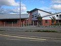 New Buildings At Weald School - geograph.org.uk - 565150.jpg 640 × 480; 222 KB
-
 New Development - geograph.org.uk - 531692.jpg 640 × 482; 107 KB
-
 North from Haybarn - geograph.org.uk - 2013352.jpg 640 × 427; 248 KB
-
 North of Haybarn - geograph.org.uk - 2013356.jpg 640 × 426; 234 KB
-
 Now a postal delivery office - geograph.org.uk - 2278507.jpg 480 × 640; 63 KB
-
 Offset crossroads between the A29 and B2133 at Adversane - geograph.org.uk - 2230089.jpg 4,000 × 3,000; 2.96 MB
-
 Parbrook, Billingshurst - geograph.org.uk - 2152090.jpg 2,560 × 1,920; 1.83 MB
-
 Pet shop in Jengers Mead - geograph.org.uk - 2278512.jpg 640 × 480; 76 KB
-

-

-
 Pipe-laying at Tedfold - geograph.org.uk - 2148944.jpg 2,560 × 1,920; 2.48 MB
-
 Postbox, Billingshurst - geograph.org.uk - 2210018.jpg 480 × 640; 79 KB
-
 Public Library - geograph.org.uk - 842510.jpg 640 × 480; 83 KB
-
 Pylon Chain at Tedfold - geograph.org.uk - 2148998.jpg 2,560 × 1,920; 1.75 MB
-
 R.Rhodes ^ Sons - geograph.org.uk - 1911409.jpg 640 × 480; 95 KB
-

-
 Rear of The Hogshead and Monsoon - geograph.org.uk - 2281261.jpg 640 × 480; 66 KB
-
 Residential Billingshurst - geograph.org.uk - 2152101.jpg 2,560 × 1,920; 1.99 MB
-
 River Arun - confluence of branches - geograph.org.uk - 2189239.jpg 640 × 480; 118 KB
-
 River Arun - geograph.org.uk - 2011748.jpg 640 × 426; 261 KB
-
 River Arun - geograph.org.uk - 2011751.jpg 640 × 427; 239 KB
-
 River Arun - geograph.org.uk - 2013416.jpg 640 × 427; 241 KB
-
 River Arun - geograph.org.uk - 2013456.jpg 640 × 427; 251 KB
-
 River Arun - geograph.org.uk - 2013460.jpg 640 × 428; 220 KB
-
 River Arun at Lording's Lock - geograph.org.uk - 1828192.jpg 1,600 × 1,200; 369 KB
-
 River Arun by Rowner Farm - geograph.org.uk - 2150928.jpg 2,560 × 1,920; 2.21 MB
-
 River Arun by Rowner Lock - geograph.org.uk - 2149134.jpg 2,560 × 1,920; 2.38 MB
-
 River Arun near Harsfold - geograph.org.uk - 2013368.jpg 640 × 427; 229 KB
-
 River Arun near Shipbourne Farm - geograph.org.uk - 1893364.jpg 1,600 × 1,200; 821 KB
-
 River Arun south of Harsfold Farm - geograph.org.uk - 1892273.jpg 1,600 × 1,200; 675 KB
-
 River Arun viewed from Chinese Bridge at Haybarn - geograph.org.uk - 1893417.jpg 1,600 × 1,200; 544 KB
-
 Road and bridleway to Lee Place House - geograph.org.uk - 1826815.jpg 1,600 × 1,200; 604 KB
-
 Rooftops at Frithwood Farm - geograph.org.uk - 2228718.jpg 4,000 × 3,000; 3.38 MB
-
 Rowner Farm - geograph.org.uk - 2149095.jpg 2,560 × 1,920; 2.18 MB
-
 Rowner Road - geograph.org.uk - 1931457.jpg 640 × 480; 91 KB
-

-
 Security gate to Muddles scrapyard - geograph.org.uk - 2230116.jpg 4,000 × 3,000; 3.38 MB
-
 Sharp turn on the Wey and Arun Canal - geograph.org.uk - 1893356.jpg 1,600 × 1,200; 828 KB
-
 Shop to let in Jengers Mead - geograph.org.uk - 2281356.jpg 640 × 480; 75 KB
-
 Sign at The Limeburners - geograph.org.uk - 2151048.jpg 1,920 × 2,560; 1.54 MB
-
 Sign for the Limeburners - geograph.org.uk - 2210028.jpg 479 × 640; 80 KB
-
 Silos at Wabblegate Farm - geograph.org.uk - 2228713.jpg 4,000 × 3,000; 3.42 MB
-
 Site of a winding hole on the Arun Canal - geograph.org.uk - 1828012.jpg 1,600 × 1,200; 779 KB
-
 Site of Harsfold Bridge - geograph.org.uk - 2013376.jpg 428 × 640; 257 KB
-
 Sluice near Rowner Lock - geograph.org.uk - 2149115.jpg 2,560 × 1,920; 2.4 MB
-


_side_at_the_entrance.jpg)


