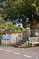
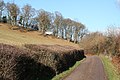
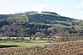
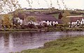
Category:Bickleigh, Mid Devon
Jump to navigation
Jump to search
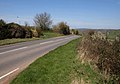
English: Bickleigh is a village and civil parish in the Mid Devon district of Devon, England, about four miles south of Tiverton. It is in the former hundred of Hayridge. According to the 2001 census it had a population of 239. It should not be confused with Bickleigh, a village near Plymouth, also in Devon.
village and civil parish in the Mid Devon district of Devon, England .jpg) | |||||
| Upload media | |||||
| Instance of | |||||
|---|---|---|---|---|---|
| Location | Mid Devon, Devon, South West England, England | ||||
 | |||||
Subcategories
This category has the following 7 subcategories, out of 7 total.
B
- Bickleigh Bridge, Mid Devon (14 F)
- Bickleigh Castle (17 F)
- Bickleigh Mill, Mid Devon (10 F)
C
- Bickleigh Castle Chapel (2 F)
D
F
- The Fisherman's Cot, Tiverton (15 F)
Media in category "Bickleigh, Mid Devon"
The following 200 files are in this category, out of 399 total.
(previous page) (next page)-
 A patch of scrub in a field of grass - geograph.org.uk - 5500859.jpg 1,600 × 1,200; 757 KB
-

-
 A small green valley - geograph.org.uk - 5500631.jpg 1,200 × 1,600; 812 KB
-
 A view of Bickleigh Bridge - geograph.org.uk - 4549379.jpg 4,989 × 3,563; 4.22 MB
-
 A3072 at Pound Cottage - geograph.org.uk - 1973888.jpg 640 × 446; 78 KB
-

-
 A396 to Tiverton approaching Chitterley - geograph.org.uk - 1280643.jpg 640 × 480; 200 KB
-

-
 Access road to Exeland Farm - geograph.org.uk - 2759246.jpg 800 × 600; 362 KB
-
 Access road to Henbere Farm - geograph.org.uk - 2759244.jpg 640 × 480; 57 KB
-
 Access road to Higher Brithayes farm - geograph.org.uk - 5500657.jpg 1,200 × 1,600; 789 KB
-
 At the entrance to Lower Dorweeke Farms - geograph.org.uk - 2524721.jpg 800 × 600; 545 KB
-
 Barn at Swallowhayes Farm - geograph.org.uk - 2759261.jpg 800 × 600; 461 KB
-
 Barn conversion at Little Brithayes - geograph.org.uk - 5500652.jpg 1,600 × 1,200; 814 KB
-
 Barn in the valley of the River Exe - geograph.org.uk - 2452715.jpg 800 × 600; 325 KB
-
 Barn, Lower Brithayes - geograph.org.uk - 1825051.jpg 640 × 480; 77 KB
-
 Bickleigh , A3072 - geograph.org.uk - 6329927.jpg 6,000 × 4,000; 6.55 MB
-
 Bickleigh , A3072 - geograph.org.uk - 6329929.jpg 6,000 × 4,000; 7.28 MB
-
 Bickleigh , A3072 - geograph.org.uk - 6329931.jpg 6,000 × 4,000; 7 MB
-
 Bickleigh , A3072 - geograph.org.uk - 6329934.jpg 6,000 × 4,000; 6.6 MB
-
 Bickleigh , A3072 - geograph.org.uk - 6329936.jpg 6,000 × 4,000; 7.72 MB
-

-
 Bickleigh , Badminton at the Maize Maze - geograph.org.uk - 1224866.jpg 640 × 480; 103 KB
-
 Bickleigh , Bickleigh Bridge - geograph.org.uk - 5648267.jpg 6,000 × 4,000; 6.53 MB
-
 Bickleigh , Bickleigh Bridge - geograph.org.uk - 5648269.jpg 6,000 × 4,000; 5.98 MB
-
 Bickleigh , Bickleigh Bridge Repairs - geograph.org.uk - 2100596.jpg 3,264 × 2,448; 3.75 MB
-
 Bickleigh , Bickleigh Bridge ^ River Exe - geograph.org.uk - 4832521.jpg 6,000 × 4,000; 6.67 MB
-
 Bickleigh , Bickleigh Bridge ^ River Exe - geograph.org.uk - 5648268.jpg 4,000 × 6,000; 7.06 MB
-
 Bickleigh , Bickleigh Castle - geograph.org.uk - 4457952.jpg 2,848 × 4,288; 6.8 MB
-
 Bickleigh , Bickleigh Castle Grounds - geograph.org.uk - 4457941.jpg 4,017 × 2,668; 7.05 MB
-
 Bickleigh , Bickleigh Football Club - geograph.org.uk - 2966073.jpg 4,288 × 2,848; 6.64 MB
-

-
 Bickleigh , Bickleigh Maize Maze - geograph.org.uk - 1223716.jpg 640 × 512; 73 KB
-
 Bickleigh , Bickleigh Maize Maze - geograph.org.uk - 1223813.jpg 640 × 480; 99 KB
-

-

-

-
 Bickleigh , Bickleigh Parish Rooms - geograph.org.uk - 2963690.jpg 4,288 × 2,848; 6.87 MB
-
 Bickleigh , Bickleigh-On-Exe Primary School - geograph.org.uk - 4829993.jpg 6,000 × 4,000; 7.26 MB
-
 Bickleigh , Bridge Under Exeter Road - geograph.org.uk - 1581733.jpg 640 × 480; 93 KB
-
 Bickleigh , Burnt Out Car - geograph.org.uk - 6329922.jpg 6,000 × 4,000; 5.66 MB
-
 Bickleigh , Country Road - geograph.org.uk - 2966011.jpg 4,288 × 2,848; 6.15 MB
-
 Bickleigh , Dried Stream - geograph.org.uk - 5052633.jpg 6,000 × 4,000; 7.52 MB
-
 Bickleigh , Dried Stream - geograph.org.uk - 5052636.jpg 6,000 × 4,000; 7.39 MB
-
 Bickleigh , Dried Stream - geograph.org.uk - 5052639.jpg 6,000 × 4,000; 7.53 MB
-
 Bickleigh , Egg Rolling - geograph.org.uk - 6115705.jpg 6,000 × 4,000; 3.86 MB
-
 Bickleigh , Exeland Cottage - geograph.org.uk - 2963727.jpg 4,288 × 2,848; 6.48 MB
-
 Bickleigh , Exeter Road - geograph.org.uk - 1428723.jpg 640 × 480; 66 KB
-
 Bickleigh , Exeter Road - geograph.org.uk - 1581740.jpg 640 × 480; 96 KB
-

-
 Bickleigh , Flooded Road - geograph.org.uk - 2750555.jpg 4,288 × 2,848; 6.61 MB
-
 Bickleigh , Football Pitch and A3072 - geograph.org.uk - 1581640.jpg 640 × 480; 89 KB
-
 Bickleigh , Footbridge at the Maize Maze - geograph.org.uk - 1224840.jpg 640 × 480; 104 KB
-

-
 Bickleigh , Horethorne House - geograph.org.uk - 2966024.jpg 4,278 × 2,832; 5.16 MB
-
 Bickleigh , Mushroom and Woodland - geograph.org.uk - 1581688.jpg 640 × 480; 130 KB
-
 Bickleigh , Overflow Car Park - geograph.org.uk - 2966100.jpg 4,288 × 2,848; 6.26 MB
-
 Bickleigh , River Exe ^ Cottage - geograph.org.uk - 2231296.jpg 2,848 × 4,288; 5.86 MB
-
 Bickleigh , Signpost on Exeter Road - geograph.org.uk - 1223731.jpg 640 × 480; 111 KB
-
 Bickleigh , Small Lane - geograph.org.uk - 4457944.jpg 4,288 × 2,848; 5.79 MB
-
 Bickleigh , Small Road - geograph.org.uk - 2750558.jpg 4,288 × 2,848; 6.32 MB
-
 Bickleigh , Stream and Bridge - geograph.org.uk - 1581717.jpg 640 × 480; 93 KB
-
 Bickleigh , Stream and Bridges - geograph.org.uk - 1581719.jpg 640 × 480; 115 KB
-
 Bickleigh , Stream and Woodland - geograph.org.uk - 1581735.jpg 640 × 480; 112 KB
-
 Bickleigh , Telephone Box - geograph.org.uk - 5145027.jpg 4,000 × 6,000; 7.47 MB
-
 Bickleigh , The A3072 - geograph.org.uk - 2750538.jpg 4,288 × 2,848; 6.57 MB
-
 Bickleigh , The A3072 - geograph.org.uk - 2750548.jpg 4,288 × 2,848; 6 MB
-
 Bickleigh , The A3072 - geograph.org.uk - 2750560.jpg 4,288 × 2,848; 6.59 MB
-
 Bickleigh , The A3072 - geograph.org.uk - 2966019.jpg 4,246 × 2,784; 6.06 MB
-
 Bickleigh , The A3072 - geograph.org.uk - 2966048.jpg 4,288 × 2,848; 6.32 MB
-
 Bickleigh , The A3072 - geograph.org.uk - 5145129.jpg 6,000 × 4,000; 6.49 MB
-
 Bickleigh , The A3072 - geograph.org.uk - 5196429.jpg 5,312 × 2,988; 2.57 MB
-
 Bickleigh , The A3072 - geograph.org.uk - 5680258.jpg 6,000 × 4,000; 5.39 MB
-
 Bickleigh , The A3072 - geograph.org.uk - 5680259.jpg 4,000 × 6,000; 6.42 MB
-
 Bickleigh , The A3072 - geograph.org.uk - 5680260.jpg 6,000 × 4,000; 5.62 MB
-
 Bickleigh , The A3072 - geograph.org.uk - 5680261.jpg 6,000 × 4,000; 6.37 MB
-
 Bickleigh , The A3072 - geograph.org.uk - 5680262.jpg 6,000 × 4,000; 6.96 MB
-
 Bickleigh , The A3072 - geograph.org.uk - 5680263.jpg 6,000 × 4,000; 6.34 MB
-
 Bickleigh , The A396 - geograph.org.uk - 4624662.jpg 4,288 × 2,848; 6.18 MB
-
 Bickleigh , The A396 - geograph.org.uk - 4666858.jpg 4,288 × 2,848; 5.98 MB
-
 Bickleigh , The A396 - geograph.org.uk - 5570039.jpg 6,000 × 4,000; 6.64 MB
-
 Bickleigh , The A396 - geograph.org.uk - 5570040.jpg 4,000 × 6,000; 6.65 MB
-
 Bickleigh , The A396 - geograph.org.uk - 5570042.jpg 6,000 × 4,000; 5.62 MB
-
 Bickleigh , The A396 ^ Stagecoach Bus - geograph.org.uk - 4666860.jpg 2,848 × 4,288; 4.87 MB
-
 Bickleigh , The A396 ^ Stagecoach Bus - geograph.org.uk - 4666862.jpg 4,288 × 2,848; 4.72 MB
-
 Bickleigh , The Amazing Maze In Maize - geograph.org.uk - 1223742.jpg 640 × 480; 123 KB
-
 Bickleigh , The Amazing Maze in Maize - geograph.org.uk - 1224872.jpg 640 × 480; 129 KB
-
 Bickleigh , The Fisherman's Cot - geograph.org.uk - 4832520.jpg 6,000 × 4,000; 6.02 MB
-
 Bickleigh , The Fisherman's Cot - geograph.org.uk - 4832523.jpg 6,000 × 4,000; 7.29 MB
-
 Bickleigh , The Fisherman's Cot - geograph.org.uk - 5866357.jpg 6,000 × 4,000; 6.16 MB
-
 Bickleigh , The Maize Maze - Flagpole - geograph.org.uk - 1223902.jpg 480 × 640; 119 KB
-
 Bickleigh , The Maize Maze - geograph.org.uk - 1223751.jpg 640 × 480; 72 KB
-
 Bickleigh , The Maize Maze - geograph.org.uk - 1223759.jpg 640 × 480; 96 KB
-
 Bickleigh , The Maize Maze - geograph.org.uk - 1223804.jpg 640 × 480; 113 KB
-
 Bickleigh , The Maize Maze - geograph.org.uk - 1223845.jpg 640 × 480; 104 KB
-
 Bickleigh , The Maize Maze - geograph.org.uk - 1224836.jpg 640 × 480; 124 KB
-
 Bickleigh , The Maize Maze - geograph.org.uk - 1224859.jpg 640 × 480; 122 KB
-
 Bickleigh , The Maze of Maize - geograph.org.uk - 1224827.jpg 640 × 480; 118 KB
-
 Bickleigh , The Old School House - geograph.org.uk - 2963708.jpg 4,288 × 2,848; 6.13 MB
-
 Bickleigh , The River Dart - geograph.org.uk - 2750549.jpg 2,848 × 4,288; 6.49 MB
-
 Bickleigh , The River Exe - geograph.org.uk - 1341794.jpg 640 × 480; 60 KB
-
 Bickleigh , The River Exe - geograph.org.uk - 1581659.jpg 640 × 480; 131 KB
-
 Bickleigh , The River Exe - geograph.org.uk - 1581676.jpg 640 × 480; 135 KB
-
 Bickleigh , The River Exe - geograph.org.uk - 2231292.jpg 4,288 × 2,848; 6.21 MB
-
 Bickleigh , The River Exe - geograph.org.uk - 2231298.jpg 4,288 × 2,848; 6.74 MB
-
 Bickleigh , The River Exe - geograph.org.uk - 2231300.jpg 4,288 × 2,848; 5.22 MB
-
 Bickleigh , The River Exe - geograph.org.uk - 2231306.jpg 4,288 × 2,848; 5.85 MB
-
 Bickleigh , The River Exe - geograph.org.uk - 2750534.jpg 4,288 × 2,848; 5.78 MB
-
 Bickleigh , The River Exe - geograph.org.uk - 2750537.jpg 4,288 × 2,848; 6.21 MB
-
 Bickleigh , The River Exe - geograph.org.uk - 2750544.jpg 4,288 × 2,848; 5.6 MB
-
 Bickleigh , The River Exe - geograph.org.uk - 2750550.jpg 4,288 × 2,848; 6.22 MB
-
 Bickleigh , The River Exe - geograph.org.uk - 2750551.jpg 4,288 × 2,848; 6.33 MB
-
 Bickleigh , The River Exe - geograph.org.uk - 2750557.jpg 4,288 × 2,848; 6.5 MB
-
 Bickleigh , The River Exe - geograph.org.uk - 2750559.jpg 2,848 × 4,288; 4.64 MB
-
 Bickleigh , The River Exe - geograph.org.uk - 3149368.jpg 4,288 × 2,848; 6.04 MB
-
 Bickleigh , The River Exe - geograph.org.uk - 4651447.jpg 4,288 × 2,848; 6.56 MB
-
 Bickleigh , The River Exe in the garden - geograph.org.uk - 2231310.jpg 4,288 × 2,848; 6.67 MB
-
 Bickleigh , The River Exe ^ Bickleigh Bridge - geograph.org.uk - 2750528.jpg 4,288 × 2,848; 6.61 MB
-
 Bickleigh , The River Exe ^ Cottage - geograph.org.uk - 2750530.jpg 4,288 × 2,848; 5.97 MB
-
 Bickleigh , The River Exe ^ Flooded Garden - geograph.org.uk - 2750527.jpg 4,288 × 2,848; 6.58 MB
-

-

-
 Bickleigh , Trout Fishing Lake - geograph.org.uk - 1581725.jpg 640 × 480; 111 KB
-
 Bickleigh , Trout Fishing Lake - geograph.org.uk - 1581728.jpg 640 × 480; 95 KB
-
 Bickleigh , Village Road - geograph.org.uk - 2963699.jpg 4,288 × 2,848; 6.39 MB
-
 Bickleigh , Village Road - geograph.org.uk - 2963706.jpg 4,288 × 2,848; 6.64 MB
-
 Bickleigh , Village Road - geograph.org.uk - 2963716.jpg 4,230 × 2,758; 5.52 MB
-
 Bickleigh , Village Road ^ Green - geograph.org.uk - 2963700.jpg 4,288 × 2,848; 6.31 MB
-
 Bickleigh - Country Road & Old Court Entrance (geograph 2965984).jpg 4,288 × 2,848; 6.36 MB
-
 Bickleigh - Country Road (geograph 2750553).jpg 2,848 × 4,288; 5.56 MB
-
 Bickleigh - Flooded Road (geograph 2750554).jpg 2,848 × 4,288; 5.92 MB
-
 Bickleigh - Flooded Road (geograph 2750556).jpg 4,288 × 2,848; 5.65 MB
-
 Bickleigh - Rose Cottage (geograph 2963694).jpg 4,288 × 2,848; 6.44 MB
-
 Bickleigh - Small Road (geograph 2966017).jpg 4,288 × 2,848; 6.14 MB
-
 Bickleigh Bridge - geograph.org.uk - 5630178.jpg 1,600 × 1,045; 412 KB
-
 Bickleigh Bridge over River Exe - geograph.org.uk - 5504055.jpg 1,600 × 1,200; 792 KB
-
 Bickleigh House - geograph.org.uk - 1072467.jpg 640 × 480; 73 KB
-
 Bickleigh Mill - Devon - geograph.org.uk - 3131227.jpg 640 × 424; 260 KB
-
 Bickleigh Mill - Spur Wheel - geograph.org.uk - 3131216.jpg 640 × 424; 231 KB
-
 Bickleigh Mill - Stones and Crown Wheel - geograph.org.uk - 3131212.jpg 424 × 640; 269 KB
-
 Bickleigh Mill - Waterwheel - geograph.org.uk - 3131223.jpg 640 × 424; 253 KB
-
 Bickleigh Mill - waterwheel - geograph.org.uk - 3341727.jpg 480 × 640; 84 KB
-
 Bickleigh Mill and mill stream - geograph.org.uk - 4734623.jpg 640 × 427; 94 KB
-
 Bickleigh Mill shopping complex - geograph.org.uk - 4733914.jpg 640 × 427; 87 KB
-
 Bickleigh Parish Rooms - geograph.org.uk - 4721447.jpg 4,000 × 3,000; 2.7 MB
-

-
 Bickleigh, Burn valley - geograph.org.uk - 114269.jpg 640 × 427; 160 KB
-
 Bickleigh, Burn valley near Shotash Farm - geograph.org.uk - 105494.jpg 640 × 427; 162 KB
-
 Bickleigh, churchyard entrance - geograph.org.uk - 101118.jpg 427 × 640; 170 KB
-
 Bickleigh, copse near Lower Dorweeke - geograph.org.uk - 105500.jpg 640 × 427; 137 KB
-
 Bickleigh, Devon geograph-4098803-by-Ben-Brooksbank.jpg 2,297 × 1,504; 5.07 MB
-
 Bickleigh, Devon geograph-4099664-by-Ben-Brooksbank.jpg 1,983 × 1,495; 5.36 MB
-

-

-
 Bickleigh, Exe valley near Chitterleigh - geograph.org.uk - 105515.jpg 640 × 427; 130 KB
-
 Bickleigh, near Henbeer - geograph.org.uk - 101120.jpg 640 × 427; 130 KB
-
 Bickleigh, south of Chetterleigh - geograph.org.uk - 105721.jpg 640 × 427; 117 KB
-
-
 Bridge over Burn River at Brithayes - geograph.org.uk - 5500848.jpg 1,600 × 1,200; 842 KB
-
 Bridge over Burn River at Burnhayes - geograph.org.uk - 2524705.jpg 800 × 600; 519 KB
-

-
 Bridge over The Exe near Bickleigh - geograph.org.uk - 2395824.jpg 640 × 426; 78 KB
-
 Brithayes Barn farmyard - geograph.org.uk - 5500643.jpg 1,600 × 1,200; 845 KB
-
 Burn Bridge at Bickleigh - geograph.org.uk - 2611067.jpg 800 × 600; 496 KB
-
 Burn River - geograph.org.uk - 1825022.jpg 640 × 480; 139 KB
-
 Burn Suspension Bridge - geograph.org.uk - 2831659.jpg 423 × 640; 186 KB
-
 Bus shelter at Bickeigh - geograph.org.uk - 2452734.jpg 800 × 600; 502 KB
-
 Car park of Fisherman's Cot, Bickleigh - geograph.org.uk - 5504051.jpg 1,600 × 1,200; 739 KB
-
 Catshill Head, the road west of Shotash - geograph.org.uk - 5500851.jpg 1,200 × 1,600; 838 KB
-
 Chitterley Business Centre - geograph.org.uk - 1071890.jpg 640 × 480; 61 KB
-
 Copenhagen, Exe valley - geograph.org.uk - 196561.jpg 640 × 480; 85 KB
-
 Cottages in Bickleigh - geograph.org.uk - 1826008.jpg 420 × 640; 72 KB
-
 Cottages in Bickleigh - geograph.org.uk - 1826025.jpg 480 × 640; 70 KB
-
 Cottages in Bickleigh village - geograph.org.uk - 4717547.jpg 480 × 640; 69 KB
-
 Cows at Burn - geograph.org.uk - 1434425.jpg 640 × 480; 173 KB
-
 Cyclists on the A396 to Tiverton - geograph.org.uk - 1280648.jpg 640 × 480; 194 KB
-
 Directions at Chitterley - geograph.org.uk - 1584502.jpg 640 × 480; 115 KB
-
 Disused Railway Bridge - geograph.org.uk - 1034682.jpg 640 × 460; 118 KB
-
 Disused railway bridge at Bickleigh - geograph.org.uk - 1625511.jpg 640 × 480; 136 KB
-
 Double bends on A396 - geograph.org.uk - 4734658.jpg 640 × 421; 126 KB
-
 Double decker on Bickleigh Bridge - geograph.org.uk - 4550924.jpg 4,999 × 3,749; 5.42 MB
-
 Entrance gateway, Bickleigh Castle - geograph.org.uk - 5555167.jpg 1,024 × 768; 225 KB
-
 Entrance to Bickleigh Crest - geograph.org.uk - 4733596.jpg 640 × 469; 125 KB
-
 Entrance to Bickleigh village - geograph.org.uk - 5500610.jpg 1,200 × 1,600; 902 KB
-
 Exe and leat, Bickleigh - geograph.org.uk - 1546949.jpg 640 × 480; 131 KB
-
 Exe Bridge, Bickleigh - geograph.org.uk - 4730910.jpg 2,391 × 1,663; 4.08 MB
-
 Exe valley - geograph.org.uk - 2128924.jpg 640 × 363; 63 KB
-
-

-

-
 Field at Burn - geograph.org.uk - 1434432.jpg 640 × 480; 183 KB
-
 Field at Catshill Head - geograph.org.uk - 1825901.jpg 640 × 434; 98 KB
-
 Field at Jenny's Portion - geograph.org.uk - 3183857.jpg 640 × 480; 93 KB
-
 Field near Chitterley - geograph.org.uk - 2128900.jpg 640 × 480; 107 KB
-
 Field near Chitterley - geograph.org.uk - 2128932.jpg 640 × 480; 75 KB
-
 Fields in the Exe Valley - geograph.org.uk - 3191033.jpg 640 × 480; 113 KB
-
 Fields near Jennys Portion - geograph.org.uk - 2524820.jpg 800 × 600; 315 KB
-
 Fields south of Chitterley - geograph.org.uk - 2524806.jpg 800 × 600; 411 KB
-
 Fisherman's Cot across the River Exe - geograph.org.uk - 4734614.jpg 640 × 427; 99 KB
-
 Footbridge on Exe Valley Way - geograph.org.uk - 2451395.jpg 800 × 600; 496 KB


.jpg)
.jpg)
.jpg)
.jpg)
.jpg)
.jpg)


