Category:Bethesda, Gwynedd
Jump to navigation
Jump to search
town and community in Gwynedd, Wales, UK   | |||||
| Upload media | |||||
| Instance of | |||||
|---|---|---|---|---|---|
| Location | Gwynedd, Wales | ||||
| Population |
| ||||
| Area |
| ||||
 | |||||
Cymraeg: Mae Bethesda yn bentref yng Ngwynedd, yn Nyffryn Ogwen, a enwyd ar ôl Capel Bethesda. Y mae ei thrigolion yn aml yn cyfeirio ati fel Pesda. Cyfeirnod OS: SH 62262 66779.
English: Bethesda is a town lying on the River Ogwen and the A5 road on the edge of Snowdonia, in Gwynedd, north-west Wales, colloquially called Pesda by the locals.
Subcategories
This category has the following 10 subcategories, out of 10 total.
A
- Afon Ffrydlas (24 F)
B
- Bethesda railway station (2 F)
C
- Capel Jerusalem, Bethesda (7 F)
- Christ church, Bethesda (10 F)
- Cwm Caseg quarry (1 F)
- Cwm Ffrydlas (33 F)
P
- Pantdreiniog quarry (1 F)
R
- Rachub (112 F)
Media in category "Bethesda, Gwynedd"
The following 200 files are in this category, out of 441 total.
(previous page) (next page)-

-
 A commemorative plaque at the Gorffwysfan, Bethesda. - geograph.org.uk - 6160308.jpg 1,600 × 1,200; 235 KB
-
 A desolate moorland col - geograph.org.uk - 752190.jpg 640 × 480; 57 KB
-
 A less turbulent Afon Idwal - geograph.org.uk - 239349.jpg 640 × 480; 108 KB
-
 A new machine to clear snow in Nant Ffrancon (8231199447).jpg 800 × 612; 117 KB
-
 A pony on the rocky hillside - geograph.org.uk - 1483706.jpg 640 × 426; 105 KB
-

-
 A simple stone bridge over Afon Cenllusg - geograph.org.uk - 1483569.jpg 640 × 426; 159 KB
-

-

-
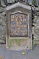
 A Telford milestone (Holyhead 29) on Ffordd Bangor, Bethesda - geograph.org.uk - 2179983.jpg 3,000 × 4,000; 5.08 MB
-
 A Telford milestone (Holyhead 30), Bethesda - geograph.org.uk - 2660330.jpg 3,000 × 4,000; 5.77 MB
-
 A tiled shop doorway on the High Street, Bethesda - geograph.org.uk - 6159727.jpg 1,600 × 1,200; 263 KB
-
 A view of Bethesda (Caern) from Cae Braich NLW3361183.jpg 593 × 452; 56 KB
-
 A view of Bethesda (Caern) from Ogwen Terrace NLW3361185.jpg 577 × 347; 36 KB
-
 A5 into Bethesda from the north - geograph.org.uk - 2640518.jpg 640 × 500; 56 KB
-
 Abandoned slate quarry at Bethesda - geograph.org.uk - 226640.jpg 640 × 480; 80 KB
-
 Afon Ffrydlas and the Caseg Leat - geograph.org.uk - 433863.jpg 640 × 310; 48 KB
-
 Afon Gaseg - geograph.org.uk - 771702.jpg 480 × 640; 138 KB
-
 Afon Idwal - geograph.org.uk - 1058371.jpg 640 × 480; 154 KB
-
 Afon Idwal River - geograph.org.uk - 8189.jpg 640 × 480; 118 KB
-
 Afon Llafar - geograph.org.uk - 1483696.jpg 640 × 426; 130 KB
-
 Afon Llafar - geograph.org.uk - 1484846.jpg 640 × 426; 98 KB
-
 Afon Llafar - geograph.org.uk - 243564.jpg 640 × 480; 82 KB
-
 Afon Llafar from afar - geograph.org.uk - 1495648.jpg 426 × 640; 83 KB
-

-
 Afon Ogwen (river) - geograph.org.uk - 8188.jpg 640 × 480; 157 KB
-
 Afon Ogwen - geograph.org.uk - 1039579.jpg 480 × 640; 80 KB
-
 Afon Ogwen - geograph.org.uk - 4415000.jpg 2,288 × 1,712; 839 KB
-
 Afon Ogwen - geograph.org.uk - 705281.jpg 640 × 385; 84 KB
-
 Afon Ogwen.JPG 1,024 × 683; 194 KB
-
 Another view of the Ogwen Falls - geograph.org.uk - 239321.jpg 480 × 640; 112 KB
-
 Approaching Bethesda - geograph.org.uk - 6186677.jpg 2,048 × 1,536; 937 KB
-
 Approaching the Summit of Y Fronllwyd - geograph.org.uk - 223806.jpg 480 × 640; 70 KB
-
 Arrow stone marks on stepping stone, Gwernydd - geograph.org.uk - 5285077.jpg 1,600 × 1,200; 726 KB
-
 Beginning of Cwm Pen-Llafar - geograph.org.uk - 5159023.jpg 640 × 360; 61 KB
-
 Benchmark at base of milestone, Bethesda - geograph.org.uk - 6156928.jpg 1,200 × 1,600; 412 KB
-
 Benchmark in roadside rock on Ffordd Bangor, Bethesda - geograph.org.uk - 5195877.jpg 1,600 × 1,200; 796 KB
-
 Benchmark in rock outcrop near Ty'n Twr, Bethesda - geograph.org.uk - 2660334.jpg 3,000 × 4,000; 5.99 MB
-
 Benchmark on cottage wall on Glanrafon, Bont Uchaf - geograph.org.uk - 5074626.jpg 1,200 × 1,600; 704 KB
-
 Benchmark on Ffordd Carneddi, Bont Uchaf - geograph.org.uk - 5074634.jpg 1,200 × 1,600; 646 KB
-
 Benchmark on large boulder, Ciltwllan - geograph.org.uk - 5308368.jpg 1,200 × 1,600; 820 KB
-
 Benchmark on old railway bridge, Bethesda - geograph.org.uk - 2179906.jpg 3,000 × 4,000; 5.34 MB
-
 Benchmark on old school house, Rachub - geograph.org.uk - 5286572.jpg 1,200 × 1,600; 429 KB
-
 Benchmark on Well Street (Stryd Y Ffynnon), Gerlan - geograph.org.uk - 5232635.jpg 1,200 × 1,600; 575 KB
-
 Bethania Welsh Independent Chapel.jpg 2,304 × 1,728; 1.01 MB
-
 Glanogwen church - geograph.org.uk - 350613.jpg 640 × 480; 84 KB
-
-

-
 Bethesda (Caern), two churches and six chapels NLW3361186.jpg 589 × 452; 44 KB
-
 Bethesda Chapel, Bethesda - geograph.org.uk - 4671925.jpg 6,000 × 4,000; 4.19 MB
-
 Bethesda night.jpg 600 × 446; 35 KB
-
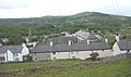
 Bethesda rooftops - geograph.org.uk - 5491681.jpg 1,280 × 851; 441 KB
-
 Bethesda winter.jpg 600 × 446; 67 KB
-
 Bethesda-from-South-facing-North.jpg 5,568 × 3,128; 8.83 MB
-
 Blockfield on Y Fronllwyd - geograph.org.uk - 223805.jpg 640 × 480; 126 KB
-
 Boulder field above Cae-mawr - geograph.org.uk - 554044.jpg 640 × 480; 111 KB
-

-
 Boulder field below Carnedd Fach - geograph.org.uk - 425766.jpg 640 × 480; 110 KB
-

-

-
 Boundary wall - geograph.org.uk - 554067.jpg 640 × 480; 123 KB
-
 Bridge over Ogwen river - geograph.org.uk - 109395.jpg 640 × 480; 140 KB
-
 Bryn Geraint Terrace, St Ann's Hill - geograph.org.uk - 828474.jpg 640 × 480; 77 KB
-
 Capel Bethesda - geograph.org.uk - 5636098.jpg 1,200 × 1,600; 294 KB
-
 Capel Bethesda, Bethesda - geograph.org.uk - 2674103.jpg 4,000 × 3,000; 5.58 MB
-
 Capel Jerusalem, Bethesda - geograph.org.uk - 5636100.jpg 1,600 × 1,200; 540 KB
-
 Carmel Capel, Rachub - geograph.org.uk - 4670776.jpg 6,000 × 4,000; 7.53 MB
-
 Carnedd Dafydd Summit Cairn - geograph.org.uk - 205548.jpg 640 × 427; 71 KB
-
 Carnedd peaks in Snowdonia from Bethesda, 1961 - geograph.org.uk - 4227397.jpg 2,405 × 1,438; 3.2 MB
-
 Carnedd Y Filiast Summit - geograph.org.uk - 580777.jpg 640 × 427; 91 KB
-
 Carneddi Road, Cilfodan - geograph.org.uk - 4670799.jpg 6,000 × 4,000; 4.33 MB
-
 Catchment of Afon Caseg - geograph.org.uk - 135689.jpg 640 × 480; 109 KB
-
 Cemetery. - geograph.org.uk - 348185.jpg 640 × 480; 133 KB
-
 Christ Church Bethesda notice board - geograph.org.uk - 2108097.jpg 480 × 640; 85 KB
-
 Church Path at Christ Church Bethesda - geograph.org.uk - 2108094.jpg 480 × 640; 114 KB
-
 Chwarel Cae-Braich-Y-Cafn, Ger Bethesda.jpeg 900 × 628; 320 KB
-
 Coed Cilgeraint Woods - geograph.org.uk - 829059.jpg 640 × 480; 167 KB
-
 Coetmor Cemetery - geograph.org.uk - 530403.jpg 640 × 466; 92 KB
-
 Colourful terrace - geograph.org.uk - 5701943.jpg 640 × 480; 51 KB
-
 Cottage, Bethesda - geograph.org.uk - 3750233.jpg 1,199 × 1,600; 355 KB
-
 Cwm Ceunant - geograph.org.uk - 239830.jpg 640 × 480; 71 KB
-
 Cwm Ffrydlas from the summit of Gyrn - geograph.org.uk - 430278.jpg 640 × 480; 96 KB
-
 Cwm Lloer - geograph.org.uk - 686140.jpg 1,000 × 663; 415 KB
-
 Damaged Pivot benchmark, Ciltwllan - geograph.org.uk - 5728569.jpg 1,200 × 1,600; 678 KB
-
 Derelict cottages, Rachub - geograph.org.uk - 5360701.jpg 1,600 × 1,200; 686 KB
-
 Derelict farmhouse at Cilfodan - geograph.org.uk - 431535.jpg 640 × 480; 123 KB
-

-
 Derelict, rushy meadow - geograph.org.uk - 5702221.jpg 640 × 480; 73 KB
-
 Douglas Arms Hotel, Bethesda - geograph.org.uk - 5492010.jpg 903 × 1,280; 379 KB
-
 Douglas Arms on the High Street, Bethesda - geograph.org.uk - 2666307.jpg 4,000 × 3,000; 5.09 MB
-
 Elizabeth II pillar box, Bethesda - geograph.org.uk - 6178596.jpg 1,113 × 1,600; 409 KB
-
 Elizabeth II post box, Bethesda - geograph.org.uk - 6181547.jpg 745 × 1,024; 171 KB
-
 Elizabeth II post box, Bethesda - geograph.org.uk - 6217167.jpg 1,234 × 1,600; 402 KB
-
 Elizabeth II post box, Bont Uchaf - geograph.org.uk - 6178601.jpg 763 × 1,024; 207 KB
-
 Elizabeth II post box, Gerlan - geograph.org.uk - 6178607.jpg 1,162 × 1,600; 329 KB
-
 Elizabeth II post box, Rachub - geograph.org.uk - 6193540.jpg 1,200 × 1,600; 296 KB
-

-
 Ffordd Carneddi, Bethesda - geograph.org.uk - 5491426.jpg 851 × 1,280; 364 KB
-
 Ffordd Hen Barc, Bethesda - geograph.org.uk - 5491330.jpg 1,280 × 851; 451 KB
-
 Ffordd Hen Barc, Rachub - geograph.org.uk - 5491292.jpg 1,280 × 851; 464 KB
-
 Ffrydlas Road from the footpath - geograph.org.uk - 432282.jpg 640 × 379; 72 KB
-
 Fields on the edge of Rachub - geograph.org.uk - 4670784.jpg 6,000 × 4,000; 5 MB
-
 Footbridge over Afon Marchlyn Mawr - geograph.org.uk - 390767.jpg 640 × 480; 147 KB
-
 Fork in the road at Cilfodan - geograph.org.uk - 4671878.jpg 6,000 × 4,000; 4.06 MB
-
 Gerlan Road with the Carneddau behind - geograph.org.uk - 4517964.jpg 2,816 × 1,880; 2.1 MB
-
 Gerlan Road with the Carneddu behind - geograph.org.uk - 4517968.jpg 2,816 × 1,880; 2.56 MB
-
 Gerlan Road, Gerlan - geograph.org.uk - 4671905.jpg 6,000 × 4,000; 4.42 MB
-
 Gerlan, Spar - geograph.org.uk - 4207878.jpg 480 × 640; 99 KB
-
 Glan Meurig, Bethesda (Caern) NLW3362837.jpg 595 × 428; 70 KB
-
 Glanrafon road junction - geograph.org.uk - 5701940.jpg 640 × 480; 76 KB
-
 Goronwy Street, Gerlan - geograph.org.uk - 4519624.jpg 2,816 × 1,880; 1.66 MB
-
 GPO cable marker on Bangor Road, Bethesda - geograph.org.uk - 5887803.jpg 1,113 × 1,600; 411 KB
-
 GPO cable marker on Bangor Road, Bethesda - geograph.org.uk - 6053548.jpg 1,200 × 1,600; 543 KB
-
 GPO cable marker on bank of Afon Ogwen, Bethesda - geograph.org.uk - 6092575.jpg 1,200 × 1,600; 566 KB
-
 GPO cable marker, Bethesda - geograph.org.uk - 6205669.jpg 1,200 × 1,600; 530 KB
-
 GPO cable marker, Bethesda - geograph.org.uk - 6206675.jpg 1,077 × 1,600; 433 KB
-
 Grassy hillside above Bethesda - geograph.org.uk - 4671882.jpg 6,000 × 4,000; 4.97 MB
-
 Gwern-Saeson-Fawr - geograph.org.uk - 5702214.jpg 640 × 480; 77 KB
-
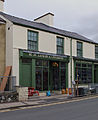 Hardware Shop , Bethesda (6925780090).jpg 2,864 × 3,494; 1.73 MB
-
 Hay Bales, Bethesda - geograph.org.uk - 5499813.jpg 1,600 × 1,200; 369 KB
-
 High Street, Bethesda - geograph.org.uk - 3750203.jpg 1,600 × 1,200; 286 KB
-
 High Street, Bethesda - geograph.org.uk - 5491730.jpg 1,280 × 851; 355 KB
-
 Hillside below Gerlan - geograph.org.uk - 4671902.jpg 6,000 × 4,000; 4.3 MB
-
 HiPoints information QR code at the Bull Inn, Bethesda - geograph.org.uk - 6156045.jpg 1,600 × 1,105; 251 KB
-
 HiPoints information QR code at the cenotaph, Bethesda - geograph.org.uk - 6165275.jpg 1,600 × 1,125; 509 KB
-

-
 HiPoints information QR code at The Llangollen, Bethesda - geograph.org.uk - 6176776.jpg 1,200 × 1,600; 250 KB
-

-

-

-

-

-

-
 Holyhead 29 - geograph.org.uk - 4775102.jpg 1,024 × 683; 176 KB
-
 Holyhead 30 - geograph.org.uk - 4775107.jpg 1,024 × 683; 177 KB
-
 Hynafiaethau Llandegai a Llanllechid.pdf 816 × 1,300, 182 pages; 16.97 MB
-

-
 Inscribed rock in field wall, Gerlan - geograph.org.uk - 5232620.jpg 1,200 × 1,600; 594 KB
-
 Inscribed stone on rocky outcrop, Gerlan - geograph.org.uk - 5268166.jpg 1,600 × 1,200; 787 KB
-
 King George VI pillar box, Bethesda - geograph.org.uk - 6248361.jpg 1,200 × 1,600; 496 KB
-
 Kings Head (Hotel) on the High Street, Bethesda - geograph.org.uk - 2670164.jpg 4,000 × 3,000; 5.34 MB
-
 Kings Head Hotel - geograph.org.uk - 361521.jpg 480 × 640; 76 KB
-
 Kings Head, Bethesda - geograph.org.uk - 2670170.jpg 4,000 × 3,000; 5.75 MB
-
 Kissing gate on public footpath, Rachub - geograph.org.uk - 5450728.jpg 1,600 × 1,200; 386 KB
-
 Kissing gate, Rachub - geograph.org.uk - 5956226.jpg 1,600 × 1,200; 477 KB
-

-
 Large boulder with benchmark, Ciltwllan - geograph.org.uk - 5308370.jpg 1,600 × 1,200; 800 KB
-
 Large clearance cairn in Parc Coetmor, Rachub - geograph.org.uk - 5956207.jpg 1,600 × 1,200; 476 KB
-

-
 Llanllechid, to Snowdonia Mountains, 1993 - geograph.org.uk - 4444744.jpg 2,325 × 1,403; 2.79 MB
-

-
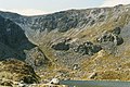
 Llyn Idwal - geograph.org.uk - 173763.jpg 640 × 426; 91 KB
-

-
 Lord Penrhyn's Slate Quarry, near Bangor, N. Wales.jpeg 900 × 700; 530 KB
-
 Mast near Pen-y-Gaer, Bethesda - geograph.org.uk - 5521470.jpg 1,600 × 1,200; 317 KB
-
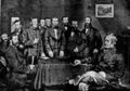
 Memorial to the Great Strike in Penrhyn Slate Quarry - geograph.org.uk - 4673000.jpg 5,601 × 3,734; 3.75 MB
-
 Metal stile on the bank of Afon Ogwen, Bethesda - geograph.org.uk - 6122695.jpg 1,200 × 1,600; 615 KB
-
 Milestone - geograph.org.uk - 4775099.jpg 683 × 1,024; 237 KB
-
 Milestone - geograph.org.uk - 4775106.jpg 683 × 1,024; 225 KB
-
 Mural, Bethesda - geograph.org.uk - 5256210.jpg 1,600 × 1,200; 650 KB
-
 Nant Ffrancon - geograph.org.uk - 238229.jpg 640 × 480; 154 KB
-

-
 Nant Ffrancon View - geograph.org.uk - 222986.jpg 640 × 427; 63 KB
-
 Nant Idwal in Full Flow - geograph.org.uk - 238792.jpg 640 × 480; 112 KB
-
 Naval Air Command Mountain Centre. - geograph.org.uk - 239914.jpg 640 × 480; 71 KB
-
 No phone calls - geograph.org.uk - 232358.jpg 640 × 581; 80 KB
-
 Ogwen Bank, Bethesda.jpeg 372 × 313; 64 KB
-
 Ogwen Cottage - geograph.org.uk - 238044.jpg 640 × 313; 61 KB
-
 Ogwen Valley cycle track - geograph.org.uk - 6186681.jpg 2,180 × 2,908; 1.78 MB
-
 Old coal door, Bethesda - geograph.org.uk - 6063907.jpg 1,600 × 1,200; 665 KB
-

-

-
 Old sluice valve marker, Gerlan - geograph.org.uk - 6179805.jpg 1,600 × 1,200; 457 KB
-
 Old sluice valve marker, Gerlan - geograph.org.uk - 6179814.jpg 1,600 × 1,200; 568 KB
-
 Old sluice valve marker, Gerlan - geograph.org.uk - 6179827.jpg 1,600 × 1,200; 501 KB
-
 Old sluice valve marker, Gwernydd - geograph.org.uk - 6248812.jpg 1,200 × 1,600; 558 KB
-
 Old sluice valve marker, Gwernydd - geograph.org.uk - 6248815.jpg 1,200 × 1,600; 510 KB
-
 On the path to Cwm Pen-Llafar - geograph.org.uk - 4207893.jpg 640 × 427; 125 KB
-
 Ordnance Survey Sheet SH 66 Bethesda, Published 1953.jpg 5,471 × 5,666; 4.37 MB
-
 Panorama of field east of cemetery. - geograph.org.uk - 919137.jpg 640 × 110; 19 KB
-
 Pass of Nantfrangon, Caernarvonshire engraving by William Miller after R K Penson.jpg 3,284 × 2,222; 2.45 MB
-
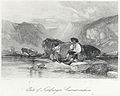 Pass of Nantfrangon, Carnarvonshire.jpeg 900 × 722; 351 KB
-
 Pavement light, Bethesda - geograph.org.uk - 6146714.jpg 1,600 × 1,200; 470 KB
-
 Pen y Benglog - geograph.org.uk - 239379.jpg 640 × 480; 103 KB
-
 Pen y Brenin (Kings Head), Bethesda - geograph.org.uk - 2670175.jpg 3,000 × 4,000; 5.67 MB
-
 Pen y Gaer - geograph.org.uk - 2121568.jpg 1,020 × 1,512; 303 KB
-
 Pen-y-Bryn Road, Bethesda - geograph.org.uk - 5492027.jpg 1,280 × 851; 434 KB
-
 Penrhyn Quarry - geograph.org.uk - 4520935.jpg 2,816 × 1,880; 2.05 MB
-
 Penrhyn Quarry - geograph.org.uk - 4520946.jpg 2,816 × 1,880; 1.72 MB
-
 Penrhyn Quarry workshops - geograph.org.uk - 301025.jpg 639 × 448; 28 KB
-
 Penrhyn Strike, Memorial - geograph.org.uk - 771432.jpg 480 × 640; 109 KB
-
 Penrhyn.JPG 2,683 × 1,884; 2.61 MB
-
 Piles of slate in the quarry near in Bethesda, Gwynedd.jpg 4,608 × 2,128; 2.87 MB
-
 Plaque on former British School, Rachub - geograph.org.uk - 5249181.jpg 1,600 × 1,200; 299 KB
-
 PO Cross Connection Cabinet, Bethesda - geograph.org.uk - 6248474.jpg 1,200 × 1,600; 413 KB
-
 Pont Abercaseg, Braichmelyn - geograph.org.uk - 6092304.jpg 1,600 × 1,200; 533 KB
-
 Pont Twr - geograph.org.uk - 6089708.jpg 640 × 510; 108 KB
-
 Pont Twr, Bethesda - geograph.org.uk - 2674111.jpg 4,000 × 3,000; 6.91 MB
-
 Pont Ty-slatters, Gwernydd - geograph.org.uk - 5285090.jpg 1,600 × 1,200; 792 KB


_on_the_slopes_of_Moel-y-Ci,_with_Bethesda_and_Moel_Wnion_in_the_background.jpg)


_on_Ffordd_Bangor,_Bethesda_-_geograph.org.uk_-_2179983.jpg)
,_Bethesda_-_geograph.org.uk_-_2660330.jpg)

_from_Cae_Braich_NLW3361183.jpg)
_from_Ogwen_Terrace_NLW3361185.jpg)


_-_geograph.org.uk_-_8188.jpg)


,_Gerlan_-_geograph.org.uk_-_5232635.jpg)


,_a_view_of_the_quarry_from_the_Carneddi_NLW3361184.jpg)
,_two_churches_and_six_chapels_NLW3361186.jpg)


_NLW3362837.jpg)


.jpg)


,_Bethesda_-_geograph.org.uk_-_6178182.jpg)


_on_the_High_Street,_Bethesda_-_geograph.org.uk_-_2670164.jpg)


,_Bethesda_-_geograph.org.uk_-_2670175.jpg)


.jpg)