Category:Bethel, Llanddeiniolen
Jump to navigation
Jump to search
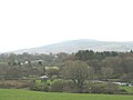
English: Bethel is a village in Gwynedd, Wales. It lies east of Caernarfon on the B4366 road. Bethel Primary School is located in the village. Around 1,000 people is roughly the population in the village. The famous trumpeteer Berwyn Jones, from the Welsh funk band Derwyddon Dr. Gonzo resides here.
village in north Wales .jpg) | |||||
| Upload media | |||||
| Pronunciation audio | |||||
|---|---|---|---|---|---|
| Instance of | |||||
| Location | Gwynedd, Wales | ||||
 | |||||
Media in category "Bethel, Llanddeiniolen"
The following 166 files are in this category, out of 166 total.
-
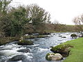
 A bifurcation of the river - geograph.org.uk - 319575.jpg 640 × 480; 157 KB
-

-

-

-

-
 A road haulage depot outside Bethel - geograph.org.uk - 739733.jpg 640 × 293; 43 KB
-
 A SARTU crew heading for home - geograph.org.uk - 491671.jpg 640 × 480; 33 KB
-
-

-
 A wet Sunday near Waen Penisarwaen - geograph.org.uk - 663309.jpg 640 × 365; 43 KB
-
 A whin bordered bridle path - geograph.org.uk - 407230.jpg 640 × 480; 82 KB
-
 Aden from the B4366 - geograph.org.uk - 740274.jpg 640 × 297; 29 KB
-
 Afon Cadnant - geograph.org.uk - 739528.jpg 640 × 480; 151 KB
-

-
 An ancient field boundary - geograph.org.uk - 740131.jpg 640 × 480; 116 KB
-

-
 And Who Are You^ - geograph.org.uk - 739198.jpg 640 × 507; 97 KB
-
 Another view of Braich-y-dinas cottage - geograph.org.uk - 412832.jpg 640 × 480; 167 KB
-
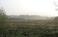
 Bethel village from the bogland - geograph.org.uk - 740331.jpg 640 × 480; 49 KB
-
 Boulders by the edge of the path - geograph.org.uk - 412782.jpg 640 × 480; 147 KB
-
 Bwthyn Dinas Mawr cottage - geograph.org.uk - 412715.jpg 640 × 480; 111 KB
-
 Carreg Goch Farm and bungalow - geograph.org.uk - 764300.jpg 640 × 333; 36 KB
-
 Cartref Nyrsio St Teilo Nursing Home - geograph.org.uk - 360300.jpg 640 × 320; 59 KB
-
 Cattle at Aden Farm - geograph.org.uk - 298543.jpg 640 × 444; 51 KB
-
 Cattle feeding by Bryn Madog Bach - geograph.org.uk - 393611.jpg 640 × 480; 152 KB
-
 Cattle in a clearing in the plantation - geograph.org.uk - 319510.jpg 640 × 480; 111 KB
-
 Ceir Cymru used car sale site - geograph.org.uk - 360898.jpg 640 × 319; 53 KB
-
 Coed Bryn Madog Woodland - geograph.org.uk - 684210.jpg 640 × 480; 88 KB
-
 Coed Madog Woodland - geograph.org.uk - 712764.jpg 640 × 417; 91 KB
-

-
 Craig y Dinas - geograph.org.uk - 737870.jpg 640 × 410; 70 KB
-
 Dinas Mawr - geograph.org.uk - 413199.jpg 640 × 367; 65 KB
-

-

-
 Farmland west of Pont Charlie - geograph.org.uk - 299593.jpg 640 × 379; 71 KB
-
 Fferm Llwynbedw Farm - geograph.org.uk - 298532.jpg 640 × 480; 41 KB
-
 Flood defences for the former railway - geograph.org.uk - 413179.jpg 640 × 480; 154 KB
-
 Flooded banks of Afon Rhythallt - geograph.org.uk - 663592.jpg 640 × 480; 63 KB
-
 Flowery Cottage - geograph.org.uk - 221229.jpg 640 × 480; 110 KB
-
 Gallt Dinas Mawr hill - geograph.org.uk - 412708.jpg 640 × 480; 82 KB
-
-

-
 Glyn Arthur Cottage - geograph.org.uk - 407472.jpg 640 × 400; 53 KB
-
 Gorse infestation of pasture land - geograph.org.uk - 412731.jpg 640 × 480; 99 KB
-
 Grazing land below Ty Newydd - geograph.org.uk - 413805.jpg 640 × 389; 64 KB
-
 Grazing land near Bryn Madog Bach - geograph.org.uk - 393635.jpg 640 × 480; 121 KB
-
-
 Llwyn Madog Cottage - geograph.org.uk - 393693.jpg 640 × 480; 99 KB
-
 Lon Cae Hywel - geograph.org.uk - 413839.jpg 640 × 480; 143 KB
-
-
-
 Neuadd Goffa Bethel Memorial Hall - geograph.org.uk - 360940.jpg 640 × 360; 50 KB
-
 Old National School, Bethel.jpg 640 × 480; 70 KB
-
 Parana pine at Madog Parc - geograph.org.uk - 393598.jpg 480 × 640; 144 KB
-
 Penrhos Cottages - geograph.org.uk - 740783.jpg 640 × 384; 58 KB
-
 Pont Penllyn on a misty morning - geograph.org.uk - 684194.jpg 640 × 409; 66 KB
-

-
 Rough pasture south of Bethel village - geograph.org.uk - 740317.jpg 640 × 480; 71 KB
-
 Ruin of a saw mill. - geograph.org.uk - 343485.jpg 640 × 426; 198 KB
-
 Saron from the east - geograph.org.uk - 360928.jpg 640 × 311; 45 KB
-

-

-

-
 Sheep near Llwynderw - geograph.org.uk - 412725.jpg 640 × 389; 50 KB
-

-

-
 Spare a thought for these lads - geograph.org.uk - 298409.jpg 640 × 480; 35 KB
-

-

-
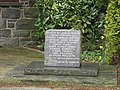
 The Bethel 1939-1945 War Memorial - geograph.org.uk - 739547.jpg 480 × 640; 103 KB
-

-
 The Caernarfon end of Bethel village - geograph.org.uk - 299285.jpg 640 × 307; 33 KB
-

-

-

-
 The Glanrafon path stepping stones - geograph.org.uk - 319567.jpg 640 × 480; 115 KB
-
 The Glanrafon weir - geograph.org.uk - 319555.jpg 640 × 480; 118 KB
-
 The Glanrafon weir - geograph.org.uk - 319578.jpg 640 × 480; 125 KB
-

-

-

-
 The ruins of Braich-y-dinas cottage - geograph.org.uk - 412821.jpg 640 × 480; 169 KB
-

-

-

-
 The wooded southern slope of Dinas Mawr - geograph.org.uk - 413161.jpg 640 × 480; 130 KB
-
 The WWII Memorial at Ysgol Bethel - geograph.org.uk - 739563.jpg 640 × 480; 124 KB
-
 Track through the plantation - geograph.org.uk - 319498.jpg 640 × 480; 142 KB
-
 Traffic Sign at Bethel - geograph.org.uk - 221223.jpg 640 × 480; 76 KB
-

-
 Trees on the eastern slope of the valley - geograph.org.uk - 412643.jpg 640 × 480; 102 KB
-
 Ty Mawr tea room - geograph.org.uk - 117050.jpg 640 × 480; 96 KB
-
 Tyddyn Andrew Uchaf - geograph.org.uk - 360936.jpg 640 × 480; 52 KB
-
 Valley slope above Afon Cadnant - geograph.org.uk - 740128.jpg 640 × 337; 47 KB
-

-

-

-
-

-

-

-

-
 View SSW along the Menaian Platform - geograph.org.uk - 740967.jpg 640 × 392; 40 KB
-

-
 View West along the old LMS trackbed - geograph.org.uk - 278325.jpg 640 × 480; 179 KB
-
 View west towards Bryn Cottages - geograph.org.uk - 740825.jpg 640 × 480; 51 KB
-

-
 Wooded knoll - geograph.org.uk - 413832.jpg 640 × 480; 135 KB
-
 Y Bedol public house - geograph.org.uk - 121263.jpg 640 × 480; 51 KB
-
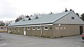
 Ysgol Gynradd Bethel Primary School - geograph.org.uk - 360441.jpg 640 × 415; 65 KB
-

-

-

-
 Acres of ploughed land at Bryn Farm - geograph.org.uk - 764262.jpg 640 × 349; 42 KB
-
 Afon Rhythallt following heavy rain - geograph.org.uk - 663566.jpg 640 × 480; 148 KB
-
 Afon Seiont - geograph.org.uk - 298540.jpg 640 × 480; 46 KB
-
 Afon Seiont from Pont Crawia - geograph.org.uk - 740394.jpg 640 × 480; 103 KB
-
 Afon Seiont in spate - geograph.org.uk - 663536.jpg 640 × 465; 75 KB
-

-

-
 Approaching Erw-Pwll-y-Glo - geograph.org.uk - 298548.jpg 640 × 480; 103 KB
-
 Approaching Pont Charlie from the west - geograph.org.uk - 299288.jpg 640 × 480; 126 KB
-

-

-

-

-
 Bridge over Afon Caledffrwd - geograph.org.uk - 393585.jpg 640 × 480; 120 KB
-
 Bryn Cottages - geograph.org.uk - 739502.jpg 640 × 480; 49 KB
-
 Bryn Cottages from the B4366 - geograph.org.uk - 739515.jpg 640 × 480; 44 KB
-

-

-
 Cegin Arthur Forest - geograph.org.uk - 407435.jpg 640 × 480; 62 KB
-
 Cottages in Stabla - geograph.org.uk - 413188.jpg 640 × 480; 171 KB
-

-
 Early morning at Llyn Padarn - geograph.org.uk - 393733.jpg 640 × 480; 55 KB
-

-
 Fferm Geffylau - Horse Farm, Llanrug - geograph.org.uk - 632037.jpg 640 × 285; 44 KB
-

-

-

-

-
 Houses at Craig-y-dinas, Stabla - geograph.org.uk - 413194.jpg 640 × 480; 87 KB
-
 Improved grassland at Cae Hob Farm - geograph.org.uk - 407226.jpg 640 × 377; 69 KB
-

-
 Lon Stabla - a no through road - geograph.org.uk - 413834.jpg 640 × 480; 93 KB
-
 Lon Stabla Lane - geograph.org.uk - 413519.jpg 640 × 480; 115 KB
-
 Lower end of Llyn Padarn - geograph.org.uk - 536545.jpg 640 × 480; 82 KB
-

-
 New houses on the main road - geograph.org.uk - 360873.jpg 640 × 391; 56 KB
-

-
 Pont Charlie - geograph.org.uk - 299287.jpg 480 × 640; 131 KB
-

-
 Pylon at the Stabla El-sub station - geograph.org.uk - 413206.jpg 480 × 640; 82 KB
-
 Pylon legs and mud - geograph.org.uk - 413209.jpg 480 × 640; 114 KB
-
-
 Ruined wall below Pen Dinas - geograph.org.uk - 407430.jpg 640 × 480; 76 KB
-

-

-

-

-

-

-
 View of the lower end of Llyn Padarn - geograph.org.uk - 393751.jpg 640 × 480; 65 KB
-

-

-
 Ysgol Gynradd, Bethel - geograph.org.uk - 299283.jpg 640 × 234; 38 KB


_-_geograph.org.uk_-_740952.jpg)


