Category:Bessere Unterstützung von Geoinformationen
Jump to navigation
Jump to search
Images from the focus area Geoinformation of the Technical Wishes Team at Wikimedia Germany, including images from the presentation of the focus area in the discovery phase in June 2021.
Media in category "Bessere Unterstützung von Geoinformationen"
The following 66 files are in this category, out of 66 total.
-
 "Artikel in der Nähe"- Funktion in Aktion auf dewiki.png 1,208 × 547; 631 KB
-
 "Ziele in der Nähe entdecken" Button auf Wikivoyage.png 1,002 × 500; 371 KB
-
 "Ziele in der Nähe entdecken" Funktion aktiviert auf Wikivoyage.png 473 × 483; 194 KB
-
 Am häufigsten genannte Probleme.svg 906 × 561; 298 KB
-
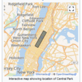
 Artikel in der Nähe (runde Marker) auf einer Kartographer Karte II.jpg 1,038 × 1,194; 459 KB
-
 Artikel in der Nähe (runde Marker) auf einer Kartographer Karte.jpg 465 × 575; 71 KB
-
 Bildschirmaufnahme Interaktive Karte.png 297 × 298; 495 KB
-

-

-
-

-

-
-

-

-

-

-

-

-
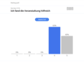
 Community prioritizing features (combined count).svg 799 × 371; 128 KB
-
 Community prioritizing features (combined median).svg 799 × 371; 145 KB
-
 Diagramme Interview-Teilnehmende in Wiki Projekten.jpg 1,440 × 396; 172 KB
-

-
 Explore nearby destinations feature activated on Wikivoyage.png 1,033 × 516; 312 KB
-
 Explore nearby destinations feature on Wikivoyage.png 1,027 × 523; 393 KB
-
 Geopoints mittels einer SPARQL-Anfrage.png 815 × 574; 383 KB
-
 Hast du Kartographer bereits in anderen Wikis verwendet?.svg 764 × 474; 52 KB
-
-
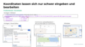 Koordinaten lassen sich nur schwer eingeben und bearbeiten.png 1,600 × 900; 439 KB
-
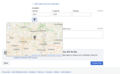 Koordinateneingabe im Upload Wizard auf Commons.png 962 × 594; 282 KB
-
 Median im Vergleich (international vs dewiki).svg 829 × 388; 76 KB
-
 Optionen Tab im Kartographer Dialog des VisualEditors.png 1,400 × 1,336; 165 KB
-
 Options tab in the VisualEditor Kartographer interface.png 699 × 691; 40 KB
-
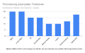 Priorisierung potenzieller Funktionen - Median.svg 644 × 398; 138 KB
-
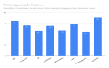 Priorisierung potenzieller Funktionen.svg 863 × 533; 152 KB
-
 Probleme mit Kartographer.png 1,600 × 900; 775 KB
-
 Präsentationsfolien Geoinformationen, Virtuelles Treffen Juni 2021.pdf 1,500 × 843, 64 pages; 5.42 MB
-
 Screenshot Beschreibung auf Commons.png 1,214 × 1,296; 459 KB
-
 Screenshot Commons Structured Data.png 1,654 × 732; 118 KB
-

-

-

-

-
 Screenshot De wiki Kartenwerkstatt.png 996 × 879; 385 KB
-

-
 Screenshot GeoHack.png 1,270 × 940; 644 KB
-
 Screenshot GeoLocator.png 1,262 × 892; 571 KB
-
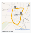
 Screenshot Historische Grenzen Wikipedia.png 252 × 289; 142 KB
-
 Screenshot In der Naehe 2.png 466 × 886; 198 KB
-
 Screenshot In der Naehe.png 991 × 455; 40 KB
-
 Screenshot Kartographer im VisualEditor.png 737 × 961; 496 KB
-
 Screenshot Vorlage auf Commons.png 1,260 × 540; 126 KB
-
 Screenshot Wikidata GeoKoordinaten.png 2,356 × 1,358; 393 KB
-
 Screenshot Wikishootme.png 1,156 × 750; 1.12 MB
-
Search Improvements in Template Wizard.webm 53 s, 1,996 × 1,402; 9.23 MB
-
 Show nearby articles feature in a Kartographer map.png 1,564 × 938; 1.84 MB
-
 Show nearby articles on a Kartographer map - example.jpg 390 × 459; 55 KB
-
 Show nearby articles on a Kartographer map- example II.jpg 403 × 576; 38 KB
-
 Spielorte der Fußball-Weltmeisterschaft 2022 mit Marker-Symbolen.png 360 × 420; 150 KB
-
 Teaser Kartensaison.gif 1,920 × 1,080; 74.24 MB
-
 Top chosen problems.svg 906 × 435; 281 KB
-
Verbesserte Suche im Vorlagenassistenten.webm 50 s, 1,996 × 1,402; 5.55 MB
-
 Was sind Geoinformationen?.png 21,108 × 5,608; 14.84 MB
-
 Where is geoinfo.png 1,600 × 1,149; 217 KB
-
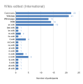 Wikis edited (International).svg 479 × 481; 119 KB
-
 Wo kommen Geoinformationen vor?.png 3,825 × 2,065; 344 KB


_auf_einer_Kartographer_Karte_II.jpg)
_auf_einer_Kartographer_Karte.jpg)


.svg)
.svg)


.svg)


.svg)
