Category:Ben Ledi
Jump to navigation
Jump to search
879m high mountain in Stirling, Scotland, UK  | |||||
| Upload media | |||||
| Instance of | |||||
|---|---|---|---|---|---|
| Location | Stirling, Scotland | ||||
| Mountain range | |||||
| Topographic prominence |
| ||||
| Elevation above sea level |
| ||||
 | |||||
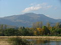
Ben Ledi (Scottish Gaelic: Beinn Leitir) is a mountain in the Trossachs, in the Highlands of Scotland. By road it lies about eight kilometres north-west of Callander, near the village of Kilmahog. It is 879 m high, and is classified as a Corbett and a Marilyn.
Media in category "Ben Ledi"
The following 97 files are in this category, out of 97 total.
-
 A path up Ben Ledi - geograph.org.uk - 1903138.jpg 640 × 480; 80 KB
-
 A path up Ben Ledi - geograph.org.uk - 1931446.jpg 640 × 480; 115 KB
-
 Ben Ledi - geograph.org.uk - 111888.jpg 640 × 392; 54 KB
-
 Ben Ledi - geograph.org.uk - 1896551.jpg 1,024 × 768; 150 KB
-
 Ben Ledi - geograph.org.uk - 1931468.jpg 640 × 359; 72 KB
-
 Ben Ledi - geograph.org.uk - 1968398.jpg 640 × 351; 55 KB
-
 Ben Ledi - geograph.org.uk - 2199617.jpg 640 × 480; 55 KB
-
 Ben Ledi - geograph.org.uk - 243404.jpg 640 × 425; 99 KB
-
 Ben Ledi - geograph.org.uk - 243407.jpg 640 × 368; 69 KB
-
 Ben Ledi - geograph.org.uk - 2721566.jpg 640 × 480; 50 KB
-
 Ben Ledi - geograph.org.uk - 3320000.jpg 1,600 × 1,200; 684 KB
-
 Ben Ledi - North Ridge - geograph.org.uk - 162247.jpg 640 × 427; 106 KB
-
 Ben Ledi - the south ridge - geograph.org.uk - 1931453.jpg 640 × 359; 63 KB
-

-
 Ben Ledi from Kilmahog - geograph.org.uk - 2554313.jpg 2,592 × 1,944; 1.69 MB
-
 Ben Ledi from Kilmahog - geograph.org.uk - 925120.jpg 640 × 425; 58 KB
-
 Ben Ledi from Kilmahog.jpg 640 × 480; 47 KB
-
 Ben Ledi from Meall Reamhar - geograph.org.uk - 2287021.jpg 1,600 × 1,200; 446 KB
-
 Ben Ledi from the Slopes of Ben Vane - geograph.org.uk - 227480.jpg 640 × 425; 61 KB
-
 Ben Ledi from the South - panoramio.jpg 3,008 × 2,000; 2.92 MB
-
 Ben Ledi looking towards Callander - geograph.org.uk - 290673.jpg 640 × 480; 53 KB
-
 Ben Ledi path - geograph.org.uk - 1899137.jpg 640 × 359; 86 KB
-
 Ben Ledi path - geograph.org.uk - 3253449.jpg 640 × 480; 347 KB
-
 Ben Ledi summit - geograph.org.uk - 1652017.jpg 640 × 480; 89 KB
-
 Ben Ledi trig - geograph.org.uk - 3388549.jpg 640 × 480; 39 KB
-
 Ben Ledi, "God's Mountain" - geograph.org.uk - 219798.jpg 640 × 480; 120 KB
-
 Ben Ledi, Above the Tree Line - geograph.org.uk - 219764.jpg 640 × 480; 158 KB
-
 Ben Ledi, trig and cross - geograph.org.uk - 73924.jpg 640 × 480; 144 KB
-
 Ben ledi.jpg 537 × 307; 31 KB
-
 Cornice, Ben Ledi - geograph.org.uk - 470581.jpg 453 × 640; 52 KB
-
 Cross on the top of Ben Ledi, Scotland 02.jpg 4,734 × 3,156; 7.17 MB
-
 Cross on the top of Ben Ledi, Scotland.jpg 4,944 × 3,296; 8.59 MB
-
 Footpath leading to Ben Ledi - geograph.org.uk - 1001115.jpg 640 × 480; 87 KB
-
 Footpath to Ben Ledi - geograph.org.uk - 968797.jpg 480 × 640; 128 KB
-
 Footpath up Ben Ledi - geograph.org.uk - 1001143.jpg 640 × 480; 67 KB
-
 Footpath up Ben Ledi - geograph.org.uk - 1001146.jpg 640 × 480; 62 KB
-

-
 How not to follow the Ben Ledi path - geograph.org.uk - 3388135.jpg 640 × 480; 96 KB
-
 Killmahog, Ben Ledi - geograph.org.uk - 2917153.jpg 640 × 480; 470 KB
-
 Kincardine Bridge - geograph.org.uk - 470323.jpg 640 × 424; 36 KB
-
 Loch Lubnaig from the path to Ben Ledi, Scotland (cropped) P-SCO Panorama.jpg 2,048 × 293; 176 KB
-
 Loch Lubnaig from the path to Ben Ledi, Scotland.jpg 20,997 × 5,039; 59.19 MB
-
 Looking Down from Ben Ledi - geograph.org.uk - 219816.jpg 640 × 480; 140 KB
-

-
 Lower slopes of Ben Ledi - geograph.org.uk - 2925179.jpg 1,024 × 768; 133 KB
-
 Memorial Cross, Ben Ledi - geograph.org.uk - 967323.jpg 640 × 480; 41 KB
-
 Memorial on Ben Ledi - geograph.org.uk - 1896540.jpg 1,024 × 768; 126 KB
-
 Memorial on Ben Ledi - geograph.org.uk - 1931475.jpg 640 × 359; 72 KB
-
 Memorial on Ben Ledi - geograph.org.uk - 3388555.jpg 640 × 480; 48 KB
-
 Mountains north-west of Ben Ledi including Stuc Dhudh or Ardnandave Hill, Scotland.jpg 16,297 × 3,156; 39.67 MB
-
 N Ridge, Ben Ledi - geograph.org.uk - 55362.jpg 640 × 480; 263 KB
-
 North Ridge of Ben Ledi - geograph.org.uk - 4052240.jpg 1,280 × 853; 870 KB
-
 North Ridge of Ben Ledi - geograph.org.uk - 955625.jpg 640 × 480; 76 KB
-
 Old fence, Ben Ledi - geograph.org.uk - 55355.jpg 480 × 640; 127 KB
-
 Old fence-posts, Ben Ledi ridge - geograph.org.uk - 204718.jpg 640 × 478; 79 KB
-
 On the ben Ledi path - geograph.org.uk - 3388121.jpg 640 × 480; 99 KB
-
 On the Side of Ben Ledi - geograph.org.uk - 995567.jpg 640 × 429; 47 KB
-
 On top of Ben Ledi - geograph.org.uk - 219805.jpg 640 × 480; 107 KB
-
 Path on the lower slopes of Ben Ledi - geograph.org.uk - 955971.jpg 640 × 480; 116 KB
-
 Path to Ben Ledi - geograph.org.uk - 1896504.jpg 1,024 × 768; 302 KB
-
 Path up Ben Ledi - geograph.org.uk - 955580.jpg 640 × 480; 65 KB
-
 Ridge of Ben Ledi, Scotland.jpg 4,734 × 3,156; 7.28 MB
-
 Steps on the Ben Ledi path - geograph.org.uk - 3388107.jpg 640 × 480; 123 KB
-
 Stile on the Ben Ledi path - geograph.org.uk - 3388123.jpg 640 × 480; 88 KB
-
 Summit of Ben Ledi - geograph.org.uk - 4052235.jpg 1,280 × 720; 680 KB
-
 Summit, Ben Ledi - geograph.org.uk - 55359.jpg 640 × 480; 225 KB
-
 The Ben Ledi carpark - geograph.org.uk - 3388093.jpg 480 × 640; 113 KB
-
 The north ridge of Ben Ledi - geograph.org.uk - 1937984.jpg 640 × 480; 103 KB
-
 The south ridge of Ben Ledi - geograph.org.uk - 1931461.jpg 640 × 480; 107 KB
-
 The south ridge of Ben Ledi - geograph.org.uk - 1938017.jpg 640 × 359; 99 KB
-
 The summit, Ben Ledi - geograph.org.uk - 1931480.jpg 640 × 480; 114 KB
-
 The Valley of the Storm - Flickr - Neillwphoto.jpg 3,852 × 5,817; 18.34 MB
-
 The West Highlands - geograph.org.uk - 830920.jpg 640 × 480; 55 KB
-
 Toward Ben Ledi - geograph.org.uk - 2220407.jpg 1,600 × 1,200; 337 KB
-
 Trig Point at the summit of Ben Ledi - geograph.org.uk - 972074.jpg 640 × 480; 62 KB
-
 View from Ben Ledi - geograph.org.uk - 2925251.jpg 1,024 × 768; 108 KB
-
 View from Craigforth - geograph.org.uk - 184894.jpg 640 × 478; 107 KB
-
 View from the Ben Ledi Path - geograph.org.uk - 2487272.jpg 3,648 × 2,736; 3.16 MB
-
 View from the Ben Ledi Path - geograph.org.uk - 2487285.jpg 3,648 × 2,736; 3.65 MB
-
 Walking up Ben Ledi - geograph.org.uk - 2670672.jpg 800 × 600; 337 KB
-
 Walking up Ben Ledi - geograph.org.uk - 2670676.jpg 800 × 600; 316 KB
-
 Walking up Ben Ledi - geograph.org.uk - 2670681.jpg 800 × 600; 330 KB
-
 Walking up Ben Ledi - geograph.org.uk - 2670684.jpg 800 × 600; 320 KB
-
 Walking up Ben Ledi - geograph.org.uk - 2670687.jpg 800 × 600; 296 KB
-
 Walking up Ben Ledi - geograph.org.uk - 2670689.jpg 800 × 600; 199 KB
-
 Walking up Ben Ledi - geograph.org.uk - 2670694.jpg 800 × 600; 230 KB
-
 Walking up Ben Ledi - geograph.org.uk - 2670696.jpg 800 × 600; 303 KB
-
 Walking up Ben Ledi - geograph.org.uk - 2670698.jpg 800 × 600; 318 KB
-
 Wind blasted snow, Ben Ledi - geograph.org.uk - 1931474.jpg 640 × 359; 70 KB
-
 Wind sculpted snow, Ben Ledi - geograph.org.uk - 1937992.jpg 640 × 359; 72 KB
-
 Young trees, Ben Ledi - geograph.org.uk - 1903148.jpg 640 × 480; 93 KB
-

-
 Ben Ledi, Descent to North-west - geograph.org.uk - 219830.jpg 640 × 480; 112 KB
-

-
 Brooding Mountain Top - geograph.org.uk - 656657.jpg 640 × 482; 67 KB
-
 Mountain Top - geograph.org.uk - 656644.jpg 640 × 482; 60 KB
-
 Track to Ben Ledi - geograph.org.uk - 162200.jpg 640 × 427; 128 KB


,_RP-F-2001-7-258-11.jpg)


_P-SCO_Panorama.jpg)