Category:Ben Cruachan
Jump to navigation
Jump to search
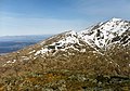
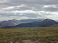
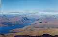
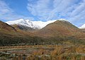
Ben Cruachan (Gaelic: Cruachan) is a mountain in the Southern Highlands of Scotland. It is 1126 m high, listed as a Munro and a Marilyn, and is the highest point in Argyll and Bute.
It gives its name to the Cruachan Dam, and Cruachan Power Station, a pumped-storage hydroelectric power station located in a cavern inside the mountain.
 See also category: Cruachan Dam.
1127m high mountain in Argyll and Bute, Scotland, UK  | |||||
| Upload media | |||||
| Instance of | |||||
|---|---|---|---|---|---|
| Location |
| ||||
| Mountain range | |||||
| Topographic prominence |
| ||||
| Elevation above sea level |
| ||||
| Parent peak | |||||
 | |||||
Subcategories
This category has the following 2 subcategories, out of 2 total.
C
- Cruachan Granite (2 F)
F
Media in category "Ben Cruachan"
The following 60 files are in this category, out of 60 total.
-
 A819 descends to Dalmally - geograph.org.uk - 950989.jpg 640 × 435; 56 KB
-
 A85 towards Taynuilt - geograph.org.uk - 1616393.jpg 640 × 427; 79 KB
-
 Bagh na Dalach - geograph.org.uk - 38187.jpg 640 × 415; 67 KB
-
 Beinn a' Chleibh - geograph.org.uk - 219227.jpg 640 × 478; 115 KB
-
 Beinn a' Chochuill - Flickr - Graham Grinner Lewis.jpg 2,048 × 1,536; 664 KB
-
 Beinn a'Chochuill , Munro No 172 - geograph.org.uk - 80122.jpg 640 × 480; 132 KB
-
 Ben Cruachan & Connel Bridge 02.jpg 4,000 × 3,000; 4.39 MB
-
 Ben Cruachan & Connel Bridge 03.jpg 4,461 × 2,853; 1.15 MB
-
 Ben Cruachan & Connel Bridge.jpg 4,000 × 3,000; 4.34 MB
-
 Ben Cruachan (48144530166).jpg 3,960 × 2,111; 3.15 MB
-

-
 Ben Cruachan , Munro No 31 - geograph.org.uk - 70242.jpg 640 × 480; 212 KB
-
 Ben Cruachan - Flickr - Graham Grinner Lewis (1).jpg 2,048 × 1,536; 663 KB
-
 Ben Cruachan - Flickr - Graham Grinner Lewis.jpg 2,048 × 1,536; 653 KB
-
 Ben Cruachan - geograph.org.uk - 1440625.jpg 640 × 418; 63 KB
-
 Ben Cruachan - geograph.org.uk - 2952671.jpg 1,024 × 576; 142 KB
-
 Ben Cruachan - geograph.org.uk - 3247979.jpg 3,648 × 2,736; 4.69 MB
-
 Ben Cruachan - geograph.org.uk - 602310.jpg 640 × 448; 70 KB
-
 Ben Cruachan - geograph.org.uk - 86054.jpg 640 × 416; 98 KB
-
 Ben Cruachan - geograph.org.uk - 9945.jpg 640 × 443; 81 KB
-
 Ben Cruachan - panoramio (1).jpg 1,028 × 771; 296 KB
-
 Ben Cruachan - panoramio (2).jpg 1,028 × 771; 330 KB
-
 Ben Cruachan - panoramio (3).jpg 1,028 × 771; 292 KB
-
 Ben Cruachan - panoramio.jpg 1,028 × 771; 406 KB
-
 Ben Cruachan dam - panoramio.jpg 1,028 × 771; 262 KB
-
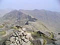
 Ben Cruachan North Ridge cairn - geograph.org.uk - 2878851.jpg 533 × 800; 126 KB
-
 Ben Cruachan summit - geograph.org.uk - 1046279.jpg 640 × 480; 41 KB
-
 Ben Cruachan. - panoramio.jpg 3,869 × 2,225; 6.12 MB
-
 Ben Cruachan.jpg 2,048 × 1,536; 1.26 MB
-
 Cruachan Horseshoe.jpg 5,082 × 1,168; 824 KB
-
 Cruachan horseshoe.jpg 1,128 × 1,015; 170 KB
-
 Cruachan horseshoe2.jpg 1,128 × 693; 103 KB
-
 Cruachan reservoir.jpg 3,264 × 1,952; 1.32 MB
-
 Cruachan ridge - geograph.org.uk - 1227339.jpg 640 × 480; 61 KB
-
 Cruachan.jpg 655 × 491; 99 KB
-
 Drifts, Beinn Eunaich - geograph.org.uk - 125795.jpg 640 × 480; 61 KB
-
 Eas Eunaich - geograph.org.uk - 125638.jpg 640 × 480; 111 KB
-
 East from Cruachan summit - geograph.org.uk - 1281975.jpg 640 × 378; 70 KB
-
 East top of Beinn Eunaich - geograph.org.uk - 126246.jpg 640 × 480; 40 KB
-
 Falls of Cruachan and Loch Awe.JPG 4,392 × 3,146; 7.03 MB
-
 Falls of Cruachan, Ben Cruachan.JPG 4,600 × 3,446; 7.11 MB
-
 Loch Awe - geograph.org.uk - 1736527.jpg 2,816 × 2,112; 3.65 MB
-
 Loch Etive viewed from Ben Cruachan - geograph.org.uk - 178048.jpg 640 × 480; 45 KB
-
 Meal Cuanail - geograph.org.uk - 9942.jpg 640 × 480; 93 KB
-
 Meall Cuanal summit westward. - geograph.org.uk - 1281894.jpg 640 × 348; 49 KB
-
 Nearing the summit of Ben Cruachan - geograph.org.uk - 602121.jpg 447 × 640; 49 KB
-
 Slopes of Ben Cruachan - geograph.org.uk - 10005.jpg 640 × 480; 86 KB
-
 Snow clad Ben Cruachan - geograph.org.uk - 51280.jpg 640 × 488; 55 KB
-
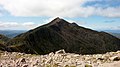
 Stob Dearg - geograph.org.uk - 602124.jpg 457 × 640; 54 KB
-
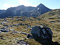
 The summit of Sron an Isean - geograph.org.uk - 86911.jpg 640 × 463; 84 KB
-
 View from Beinn Ime - Flickr - Graham Grinner Lewis.jpg 3,648 × 2,736; 2.57 MB
-
 View from Beinn Narnain - Flickr - Graham Grinner Lewis (2).jpg 3,648 × 2,736; 2.53 MB
-
 View from summit of Beinn a Bhuirdh - geograph.org.uk - 602019.jpg 640 × 448; 106 KB
-
 View of Ben Cruachan from Ardchattan - geograph.org.uk - 107792.jpg 640 × 480; 41 KB
-
 View over Loch Etive towards Ben Chruachan - geograph.org.uk - 1748296.jpg 1,024 × 683; 138 KB
-
 View southwest from Meall nan Eun - geograph.org.uk - 1006185.jpg 800 × 600; 182 KB
-
 View towards Ben Cruachan - geograph.org.uk - 91659.jpg 640 × 480; 102 KB
-
 Drochaid Ghlas - geograph.org.uk - 303224.jpg 640 × 439; 68 KB
-
 View north from summit of Ben Cruachan - geograph.org.uk - 84763.jpg 640 × 410; 70 KB
-
 Wetland and Ben Cruachan. - geograph.org.uk - 125698.jpg 640 × 452; 69 KB


.jpg)
,_UK_Prominent_Peak_nr_12_-_geograph.org.uk_-_913309.jpg)

.jpg)


.jpg)
.jpg)
.jpg)


.jpg)


