Category:Belchamp St Paul
Jump to navigation
Jump to search
English: Belchamp St Paul is a village and civil parish in Essex, England. The village is approximately 5 miles (8 km) west from the town of Sudbury and 23 miles (37 km) north-northeast from the county town and city of Chelmsford. The parish includes the hamlet of Knowl Green.

village in United Kingdom  | |||||
| Upload media | |||||
| Instance of | |||||
|---|---|---|---|---|---|
| Location | Braintree, Essex, East of England, England | ||||
 | |||||
Subcategories
This category has the following 4 subcategories, out of 4 total.
Media in category "Belchamp St Paul"
The following 67 files are in this category, out of 67 total.
-
 Bakers Road - geograph.org.uk - 2671083.jpg 1,024 × 768; 257 KB
-
 Belchamp Grid Substation and radio mast - geograph.org.uk - 3972443.jpg 2,736 × 2,736; 2.2 MB
-
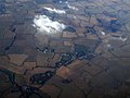 Belchamp St Paul from the air (geograph 3367329).jpg 640 × 480; 105 KB
-
 Belchamp St,Paul (geograph 2671037).jpg 768 × 1,024; 281 KB
-
 Belchamp St,Paul (geograph 2671044).jpg 1,024 × 768; 213 KB
-
 Belchamp St,Paul - geograph.org.uk - 2671097.jpg 1,024 × 768; 290 KB
-
 Belchamp St,Paul Village Sign (geograph 2671060).jpg 768 × 1,024; 169 KB
-
 Bridleway at Hickford Hill - geograph.org.uk - 1972055.jpg 640 × 427; 89 KB
-
 Bridleway to Wakeshall Farm - geograph.org.uk - 1972084.jpg 640 × 427; 61 KB
-
 Bridleway, Stour Valley - geograph.org.uk - 2394384.jpg 640 × 427; 136 KB
-
 Browns Farm - geograph.org.uk - 3124512.jpg 1,024 × 767; 298 KB
-
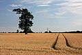
 Cereal crop, Hickford Hill - geograph.org.uk - 5399642.jpg 640 × 480; 81 KB
-
 Cereal crop, Hickford Hill - geograph.org.uk - 5399646.jpg 640 × 480; 53 KB
-
 Clare Road - geograph.org.uk - 2867698.jpg 1,024 × 768; 283 KB
-
 Clare, aerial 2017 (2) - geograph.org.uk - 5536473.jpg 640 × 427; 65 KB
-
 Clare, aerial 2017 - geograph.org.uk - 5536471.jpg 640 × 427; 57 KB
-
 Claredown Farm - geograph.org.uk - 3949582.jpg 3,648 × 2,736; 3.72 MB
-
 Claredown Farm, Clare - geograph.org.uk - 3945816.jpg 3,968 × 2,232; 3.83 MB
-

-
 Country Road - geograph.org.uk - 2670890.jpg 1,024 × 768; 255 KB
-
 Crop field near Shearing Place - geograph.org.uk - 5399698.jpg 640 × 480; 54 KB
-
 Crop field towards the River Stour - geograph.org.uk - 5399638.jpg 640 × 480; 71 KB
-
 Crop Spraying - geograph.org.uk - 3949564.jpg 3,648 × 2,736; 4.09 MB
-
 Cutbush Farm, Belchamp St Paul - geograph.org.uk - 1972101.jpg 640 × 427; 78 KB
-
 Dark Skies - geograph.org.uk - 2671092.jpg 1,024 × 768; 211 KB
-
 Edge of wheat field by Long Lane - geograph.org.uk - 1972243.jpg 640 × 427; 96 KB
-

-

-
 Farmland east of Long Lane - geograph.org.uk - 1972092.jpg 640 × 427; 107 KB
-
 Field Edge at Cutbush Farm Triangulation Pillar - geograph.org.uk - 4567726.jpg 4,000 × 3,000; 4.04 MB
-
 Field margin and aerial - geograph.org.uk - 1972039.jpg 427 × 640; 88 KB
-
 Finger Post - geograph.org.uk - 2670879.jpg 768 × 1,024; 297 KB
-
 Finger Post - geograph.org.uk - 3124822.jpg 768 × 1,024; 296 KB
-
 Five Trees - geograph.org.uk - 2671124.jpg 1,024 × 768; 127 KB
-
 Footbridge over the River Stour - geograph.org.uk - 2393622.jpg 640 × 427; 169 KB
-
 Footpath And Pylon - geograph.org.uk - 2671150.jpg 768 × 1,024; 211 KB
-
 Footpath to Clare - geograph.org.uk - 1972052.jpg 427 × 640; 111 KB
-
 Footpath to Hickford Hill - geograph.org.uk - 1972027.jpg 427 × 640; 103 KB
-
 Footpath to Hickford Hill - geograph.org.uk - 1972031.jpg 427 × 640; 95 KB
-
 Footpath to Hickford Hill - geograph.org.uk - 1972304.jpg 640 × 427; 72 KB
-
 Green and village sign, Belchamp St Pauls (geograph 4359386).jpg 4,320 × 3,240; 3.65 MB
-
 Hickford Hill towards Pentlow - geograph.org.uk - 5399644.jpg 640 × 480; 96 KB
-
 Junction of roads to Pentlow ^ Belchamp - geograph.org.uk - 3972457.jpg 3,648 × 2,736; 2.79 MB
-
 Long Lane (Track) - geograph.org.uk - 4567731.jpg 4,000 × 3,000; 4.53 MB
-
 Long Lane - geograph.org.uk - 2670876.jpg 1,024 × 768; 273 KB
-
 Long Lane, byway to Clare - geograph.org.uk - 1972087.jpg 427 × 640; 120 KB
-
 Minor road towards Belchamp St. Paul - geograph.org.uk - 5399710.jpg 2,848 × 2,136; 1.33 MB
-
 Minor road towards Pentlow - geograph.org.uk - 5399639.jpg 640 × 480; 72 KB
-
 Minor road towards Pentlow - geograph.org.uk - 5399693.jpg 640 × 480; 65 KB
-
 Minor road towards Pentlow - geograph.org.uk - 5399700.jpg 640 × 480; 81 KB
-

-
 Overgrown In the Hedge - geograph.org.uk - 2671104.jpg 1,024 × 768; 288 KB
-
 Park Farm on the road to Ovington - geograph.org.uk - 271241.jpg 640 × 394; 53 KB
-
 Postbox - geograph.org.uk - 3124488.jpg 768 × 1,024; 243 KB
-
 Power Lines - geograph.org.uk - 2671205.jpg 767 × 1,024; 133 KB
-
 Pylon - geograph.org.uk - 2671144.jpg 768 × 1,024; 220 KB
-
 Pylons - geograph.org.uk - 2671172.jpg 768 × 1,024; 150 KB
-
 Road And Footpath Sign Post - geograph.org.uk - 2671263.jpg 1,024 × 768; 357 KB
-
 Road Junction - geograph.org.uk - 3124821.jpg 1,024 × 768; 226 KB
-
 Rolling farmland near Church Street - geograph.org.uk - 1972318.jpg 640 × 427; 85 KB
-
 Sheep - geograph.org.uk - 2670934.jpg 1,024 × 768; 243 KB
-
 Telephone Box - geograph.org.uk - 2671072.jpg 1,024 × 768; 281 KB
-

-
 Village Sign (geograph 2671051).jpg 768 × 1,024; 229 KB
-
 Village sign, Belchamp St Paul (geograph 4359399).jpg 4,320 × 3,240; 4.67 MB
-
-
 Wooden Pylons - geograph.org.uk - 2671204.jpg 1,024 × 768; 102 KB


.jpg)
.jpg)
.jpg)

.jpg)


_-_geograph.org.uk_-_5536473.jpg)


.jpg)


_-_geograph.org.uk_-_4567731.jpg)


.jpg)
.jpg)

