Category:Begbroke
Jump to navigation
Jump to search
village and civil parish in Cherwell district, Oxfordshire, England  | |||||
| Upload media | |||||
| Instance of | |||||
|---|---|---|---|---|---|
| Location | Cherwell, Oxfordshire, South East England, England | ||||
| Population |
| ||||
| Area |
| ||||
| official website | |||||
 | |||||
Subcategories
This category has the following 2 subcategories, out of 2 total.
M
S
- Begbroke Science Park (2 F)
Media in category "Begbroke"
The following 64 files are in this category, out of 64 total.
-

-
-
 A44 approaching Begbroke roundabout - geograph.org.uk - 2378563.jpg 640 × 480; 63 KB
-
 A44 at Begbroke - geograph.org.uk - 3344584.jpg 1,600 × 1,054; 504 KB
-
-
 A44 roundabout at Begbroke - geograph.org.uk - 4851965.jpg 640 × 480; 47 KB
-
 A44 southbound at Campsfield - geograph.org.uk - 4851964.jpg 640 × 480; 38 KB
-
 A44 Woodstock Road - geograph.org.uk - 6237048.jpg 1,024 × 684; 229 KB
-
 A44 Woodstock Road - geograph.org.uk - 6237053.jpg 1,024 × 684; 231 KB
-
 A44 Woodstock Road - geograph.org.uk - 6237055.jpg 1,024 × 684; 346 KB
-
 A44 Woodstock Road at Campsfield - geograph.org.uk - 4537570.jpg 1,024 × 661; 194 KB
-
 Animal pens at Begbrooke Wood - geograph.org.uk - 3381135.jpg 640 × 427; 201 KB
-
 Old Milestone (geograph 6114690).jpg 1,423 × 1,809; 622 KB
-
 Begbroke Crescent - geograph.org.uk - 3344569.jpg 1,600 × 1,190; 427 KB
-
 Begbroke Lane - geograph.org.uk - 5190934.jpg 640 × 480; 65 KB
-
 Begbroke Milestone.jpg 2,000 × 3,000; 2.82 MB
-
 Begbroke Parish Church - geograph.org.uk - 5727761.jpg 3,017 × 2,592; 3.36 MB
-
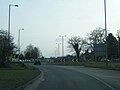
 Begbroke Roundabout on Woodstock Road - geograph.org.uk - 3094222.jpg 1,600 × 1,200; 600 KB
-
 Begbroke RoyalSun BusStop West.jpg 3,000 × 1,800; 2.75 MB
-
 Begbroke RoyalSun.JPG 2,950 × 1,770; 2.3 MB
-
 Begbroke SchoolHouse DateStone.JPG 1,200 × 900; 444 KB
-
 Begbroke SchoolHouse.JPG 2,800 × 2,000; 2.3 MB
-
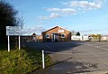 Begbroke Village Hall - geograph.org.uk - 3344565.jpg 1,600 × 1,099; 343 KB
-
 Benchmark on 'Toll Cottage' - geograph.org.uk - 4226920.jpg 683 × 1,024; 274 KB
-
 Benchmark on barn of Hall Farm, Spring Hill Road - geograph.org.uk - 3242392.jpg 683 × 1,024; 301 KB
-
 Benchmark on St Michael's Church - geograph.org.uk - 3242655.jpg 683 × 1,024; 259 KB
-
 Benchmark on The Royal Sun public house - geograph.org.uk - 3242535.jpg 683 × 1,024; 210 KB
-
 Benchmark on ^6 Wolsey Court - geograph.org.uk - 4226650.jpg 683 × 1,024; 261 KB
-
 Bridleway near Hall Farm - geograph.org.uk - 3381110.jpg 640 × 427; 227 KB
-
 Bridleway sign, Begbroke 01.jpg 3,096 × 4,128; 9.76 MB
-
 Bridleway Sign, Begbroke 02.jpg 3,096 × 4,128; 4.88 MB
-

-
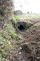 Culverted ditch beside A44 Woodstock Road - geograph.org.uk - 4222700.jpg 683 × 1,024; 355 KB
-
 Culverted ditch beside the A44 (Woodstock Road) - geograph.org.uk - 3242591.jpg 1,024 × 683; 221 KB
-
 Derelict Site, Begbroke - geograph.org.uk - 5727737.jpg 3,813 × 2,517; 3.56 MB
-
 Entrance to property near Hall Farm - geograph.org.uk - 3381119.jpg 640 × 427; 174 KB
-
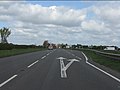
 Full speed ahead - geograph.org.uk - 2378570.jpg 640 × 480; 56 KB
-
 Gate to Spring Hill - geograph.org.uk - 1473521.jpg 640 × 427; 64 KB
-
 Hall Farm barn on Spring Hill Road - geograph.org.uk - 3242403.jpg 1,024 × 683; 262 KB
-
 Harvested field near Begbroke - geograph.org.uk - 1385855.jpg 640 × 426; 97 KB
-
 Hedging in the Churchyard - geograph.org.uk - 5727727.jpg 3,714 × 2,592; 4.29 MB
-
 Houses on Wolsey Court - geograph.org.uk - 4226712.jpg 1,024 × 683; 211 KB
-
 Institute of Advanced Technology - geograph.org.uk - 3733874.jpg 1,600 × 1,123; 418 KB
-
 Nos. 2, 4 ^ 6 Wolsey Court - geograph.org.uk - 4222680.jpg 662 × 1,024; 156 KB
-
 Oak - geograph.org.uk - 3381133.jpg 640 × 492; 253 KB
-
 Pasture at Hall Farm - geograph.org.uk - 3381126.jpg 640 × 428; 221 KB
-
 Path from Rowel Brook - geograph.org.uk - 5190941.jpg 640 × 480; 76 KB
-
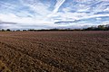 Ploughed field near Begbroke - geograph.org.uk - 3345591.jpg 5,472 × 3,648; 2.35 MB
-
 Public footpath to Bladon - geograph.org.uk - 1473527.jpg 640 × 427; 81 KB
-
 Radar Oxford Airport - geograph.org.uk - 6075669.jpg 640 × 480; 78 KB
-
 Risin Sun, Begbroke - geograph.org.uk - 130989.jpg 640 × 437; 64 KB
-
 Shakespeare's Way - geograph.org.uk - 4764387.jpg 640 × 480; 108 KB
-
 St Michael's Church - geograph.org.uk - 3242686.jpg 1,024 × 683; 259 KB
-

-
 The approach to Begbroke on the A44 - geograph.org.uk - 3242470.jpg 1,024 × 683; 217 KB
-
 The Farmhouse, Begbroke Science Park - geograph.org.uk - 3723565.jpg 1,600 × 1,321; 538 KB
-
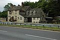 The Royal Sun, Begbroke - geograph.org.uk - 1386410.jpg 640 × 426; 87 KB
-
 The Royal Sun, Woodstock Road - geograph.org.uk - 3242572.jpg 1,024 × 683; 200 KB
-
 Track to Parker's Farm - geograph.org.uk - 3733868.jpg 1,600 × 1,200; 611 KB
-
 Track to Spring Hill - geograph.org.uk - 1473531.jpg 640 × 427; 69 KB
-
 Woodstock Road at the junction of Langford Lane - geograph.org.uk - 6239360.jpg 1,860 × 1,182; 1.03 MB
-
 Woodstock Road at the lights for Oxford Airport - geograph.org.uk - 3094255.jpg 1,600 × 1,200; 586 KB
-
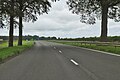
 Woodstock Road near Begbroke - geograph.org.uk - 3742708.jpg 1,500 × 999; 105 KB
-
 Woodstock Road, Begbroke - geograph.org.uk - 6239356.jpg 1,840 × 1,148; 1.14 MB


.jpg)


_-_geograph.org.uk_-_3242591.jpg)


