Category:Beeford
Jump to navigation
Jump to search
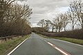
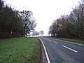
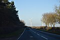
English: Beeford is a village and civil parish in the East Riding of Yorkshire, England. It is situated on the A165 road midway between Beverley and Bridlington where the B1249 road crosses it.
village in Yorkshire, England  | |||||
| Upload media | |||||
| Instance of | |||||
|---|---|---|---|---|---|
| Location | East Riding of Yorkshire, Yorkshire and the Humber, England | ||||
 | |||||
Subcategories
This category has the following 2 subcategories, out of 2 total.
B
- St Leonard's Church, Beeford (6 F)
P
- Pitwherry Drain (3 F)
Media in category "Beeford"
The following 200 files are in this category, out of 213 total.
(previous page) (next page)-
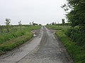
 A bend in Bridlington Road (A165) - geograph.org.uk - 4819036.jpg 640 × 480; 50 KB
-
 A165 and wind turbine - geograph.org.uk - 5317485.jpg 2,815 × 1,979; 2.26 MB
-
 A165 at Beeford looking north - geograph.org.uk - 1483359.jpg 640 × 480; 67 KB
-
 A165 Bridlington Road - geograph.org.uk - 5317481.jpg 2,826 × 1,889; 2.97 MB
-
 A165 Bridlington Road near East Springs Bridge - geograph.org.uk - 4995046.jpg 2,172 × 1,534; 1.23 MB
-
 A165 Bridlington Road toward Lissett Bridge - geograph.org.uk - 4995027.jpg 2,096 × 1,388; 948 KB
-
 A165 entering Beeford - geograph.org.uk - 5317472.jpg 2,723 × 1,835; 1.94 MB
-
 A165 junction with Dunnington Lane - geograph.org.uk - 5317469.jpg 2,648 × 1,824; 2.07 MB
-
 A165 South of Beeford - geograph.org.uk - 1281175.jpg 640 × 480; 67 KB
-
 A165 Towards Beeford - geograph.org.uk - 1307918.jpg 640 × 480; 71 KB
-
 A165 Towards Beverley - geograph.org.uk - 1307974.jpg 640 × 480; 53 KB
-
 A165 towards Bridlington - geograph.org.uk - 4818965.jpg 640 × 480; 84 KB
-
 A165 towards Bridlington - geograph.org.uk - 4818982.jpg 640 × 480; 63 KB
-
 A165 towards Bridlington - geograph.org.uk - 4819009.jpg 640 × 480; 69 KB
-
 A165 towards Bridlington - geograph.org.uk - 4819021.jpg 640 × 480; 72 KB
-
 A165 towards Bridlington - geograph.org.uk - 4819048.jpg 640 × 444; 47 KB
-

-

-
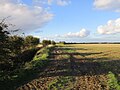
 Arable fields west of Foston Lane - geograph.org.uk - 6088218.jpg 4,608 × 3,456; 3.77 MB
-
 Autumnal Trees beside the A165 - geograph.org.uk - 287814.jpg 640 × 456; 129 KB
-
 Barmston Main Drain - geograph.org.uk - 4819059.jpg 640 × 458; 42 KB
-
 Beeford - geograph.org.uk - 100563.jpg 640 × 427; 87 KB
-
 Beeford - geograph.org.uk - 73577.jpg 640 × 480; 99 KB
-
 Beeford - geograph.org.uk - 73579.jpg 640 × 480; 88 KB
-
 Beeford chapel.jpg 3,264 × 2,448; 1.88 MB
-

-
 Beeford Cricket Club pavilion - geograph.org.uk - 1483924.jpg 640 × 480; 85 KB
-
 Beeford Cricket Pavilion, Beeford - geograph.org.uk - 6142346.jpg 1,600 × 1,065; 534 KB
-
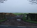
 Beeford Crossroads - geograph.org.uk - 6134235.jpg 1,600 × 1,065; 532 KB
-
 Beeford Footpath - geograph.org.uk - 252324.jpg 640 × 480; 130 KB
-
 Beeford Manor House.jpg 640 × 480; 87 KB
-
 Beeford Methodist Church (1) - geograph.org.uk - 3063353.jpg 3,072 × 2,304; 1.72 MB
-
 Beeford Methodist Church (2) - geograph.org.uk - 3063367.jpg 640 × 480; 65 KB
-
 Beeford Methodist Church - geograph.org.uk - 5994876.jpg 1,024 × 768; 112 KB
-
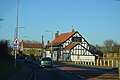
 Beeford Post Office - geograph.org.uk - 4812826.jpg 640 × 480; 67 KB
-
 Beeford Post Office - geograph.org.uk - 4812830.jpg 2,560 × 1,860; 528 KB
-
 Beeford Store and Post Office - geograph.org.uk - 1222542.jpg 640 × 427; 312 KB
-
 Beeford Telephone Exchange - geograph.org.uk - 3063396.jpg 3,072 × 2,304; 1.77 MB
-
 Beeford UK parish locator map.svg 1,425 × 1,107; 1.68 MB
-
 Beeford village sign - geograph.org.uk - 4818954.jpg 640 × 480; 82 KB
-
 Beeford west end - geograph.org.uk - 1481720.jpg 640 × 480; 87 KB
-
-
 Bend in Bridlington Road (A165) - geograph.org.uk - 4818987.jpg 640 × 480; 60 KB
-
 Bend, A165 - geograph.org.uk - 5358650.jpg 640 × 426; 36 KB
-
 Beverley Rd, A165 - geograph.org.uk - 5358654.jpg 640 × 426; 36 KB
-
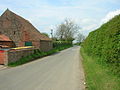
 Beverley Road (A165), Beeford - geograph.org.uk - 4817835.jpg 640 × 480; 66 KB
-
 Breeze Lane, Beeford - geograph.org.uk - 6133377.jpg 1,600 × 1,065; 572 KB
-
 Breeze Lane, Beeford - geograph.org.uk - 6133378.jpg 1,600 × 1,065; 587 KB
-
 Bridlington Rd, A165 - geograph.org.uk - 5358664.jpg 640 × 426; 47 KB
-
 Bridlington Road (A165) - geograph.org.uk - 4818960.jpg 640 × 480; 75 KB
-
 Bridlington Road (A165) - geograph.org.uk - 4818964.jpg 640 × 480; 83 KB
-
 Bridlington Road (A165) - geograph.org.uk - 4818998.jpg 640 × 480; 71 KB
-
 Bridlington Road (A165) - geograph.org.uk - 4819005.jpg 640 × 480; 69 KB
-
 Bridlington Road (A165) - geograph.org.uk - 4819017.jpg 640 × 480; 83 KB
-
 Bridlington Road (A165) - geograph.org.uk - 4819028.jpg 640 × 480; 73 KB
-
 Bridlington Road (A165) - geograph.org.uk - 4819044.jpg 640 × 480; 50 KB
-
 Bridlington Road toward Lissett - geograph.org.uk - 4995005.jpg 2,054 × 1,242; 868 KB
-
 Bridlington Road, Beeford - geograph.org.uk - 6231819.jpg 1,870 × 1,202; 1.17 MB
-
 Bus shelter, Beeford - geograph.org.uk - 5994872.jpg 1,024 × 768; 237 KB
-
 Caravan Sales Centre, Beeford - geograph.org.uk - 1281172.jpg 640 × 480; 64 KB
-
 Caravan Site, Beeford - geograph.org.uk - 1281032.jpg 640 × 480; 72 KB
-
 Church Lane, Beeford - geograph.org.uk - 5994869.jpg 1,024 × 768; 144 KB
-
 Church Lane, Beeford - geograph.org.uk - 6133380.jpg 1,600 × 1,065; 475 KB
-
 Church of St Leonard, Beeford - geograph.org.uk - 4381152.jpg 640 × 427; 221 KB
-
 Close up, Elizabeth II postbox on Main Street, Beeford - geograph.org.uk - 5646359.jpg 1,035 × 1,991; 423 KB
-
 Conversation over the fence, Beeford - geograph.org.uk - 4393163.jpg 640 × 571; 193 KB
-
 Cottage on Main Street, Beeford - geograph.org.uk - 4393147.jpg 640 × 479; 196 KB
-
 Cow Grange - geograph.org.uk - 4817826.jpg 640 × 480; 100 KB
-
 Crop field and hedgerow - geograph.org.uk - 4817829.jpg 640 × 480; 58 KB
-

-

-

-

-

-

-
-
 Development land, Beeford - geograph.org.uk - 5994871.jpg 1,024 × 768; 158 KB
-
 Dunnington Lane towards Dunnington - geograph.org.uk - 2206216.jpg 800 × 600; 248 KB
-
 Dunnington Lane, near Beeford - geograph.org.uk - 4381289.jpg 640 × 427; 191 KB
-
 Dunnington Lane, near Beeford - geograph.org.uk - 4381296.jpg 640 × 422; 211 KB
-
 East of Foston on the Wolds - geograph.org.uk - 4394807.jpg 640 × 469; 210 KB
-
 Elizabeth II postbox on Main Street, Beeford - geograph.org.uk - 5646358.jpg 2,848 × 2,136; 1.15 MB
-
 Elizabeth II postbox, Beeford Post Office - geograph.org.uk - 4812823.jpg 1,268 × 2,436; 622 KB
-
 Entering Beeford - geograph.org.uk - 4817833.jpg 640 × 480; 70 KB
-
 Entering Beeford on Bridlington Road - geograph.org.uk - 6234716.jpg 1,892 × 1,236; 1.37 MB
-
 Entering Beeford, A165 - geograph.org.uk - 5358656.jpg 640 × 426; 59 KB
-
 Entrance to Beeford Grange - geograph.org.uk - 4819025.jpg 640 × 401; 93 KB
-
 Farm buildings on North Frodingham Road - geograph.org.uk - 2305784.jpg 800 × 600; 141 KB
-
 Farm buildings, Beeford Grange - geograph.org.uk - 4819031.jpg 640 × 411; 71 KB
-
 Farm track off Dunnington Lane - geograph.org.uk - 5560463.jpg 1,024 × 768; 251 KB
-
 Farm Track off the A165 - geograph.org.uk - 1327004.jpg 640 × 480; 84 KB
-
 Farm track off the B1249 - geograph.org.uk - 4817825.jpg 640 × 480; 59 KB
-
 Farm Track South of Beeford - geograph.org.uk - 1281063.jpg 640 × 480; 49 KB
-
 Farmland and buildings - geograph.org.uk - 1483911.jpg 640 × 480; 64 KB
-
 Farmland at TA133528 - geograph.org.uk - 63481.jpg 640 × 480; 122 KB
-

-

-
 Farmland South of Beeford - geograph.org.uk - 1281076.jpg 640 × 480; 54 KB
-

-
 Farmland to the south of Beeford - geograph.org.uk - 2748040.jpg 800 × 600; 135 KB
-
 Farmland West of Dunnington Grange - geograph.org.uk - 1308023.jpg 640 × 480; 88 KB
-
 Farmland West of Moor Grange Farm - geograph.org.uk - 1326999.jpg 640 × 480; 76 KB
-
 Farmland, Hunger Hills - geograph.org.uk - 4818995.jpg 640 × 480; 68 KB
-
 Field Drain, Lissett Bridge - geograph.org.uk - 1307449.jpg 640 × 480; 68 KB
-
 Field Drain, West of Lissett Bridge - geograph.org.uk - 1307468.jpg 640 × 480; 78 KB
-
 Field edge footpath toward Foston on the Wolds - geograph.org.uk - 6088238.jpg 4,608 × 3,456; 4.43 MB
-

-

-
 Field entrance off Skipsea Road (B1249) - geograph.org.uk - 4817831.jpg 640 × 480; 123 KB
-
 Field off Bridlington Road (A165) - geograph.org.uk - 4819012.jpg 640 × 480; 49 KB
-
 Fish and chips shop, Beeford - geograph.org.uk - 6134233.jpg 1,600 × 1,065; 622 KB
-
 Footbridge over Old Howe (drain) - geograph.org.uk - 6088242.jpg 4,608 × 3,456; 4.95 MB
-
 Footpath on the left to Foston on the Wolds - geograph.org.uk - 6088232.jpg 4,608 × 3,456; 3.49 MB
-
 Footpath SE of Beeford - geograph.org.uk - 252325.jpg 640 × 480; 108 KB
-
 Footpath to Beeford - geograph.org.uk - 4817828.jpg 640 × 480; 81 KB
-
 Fosten Lane south to Beeford - geograph.org.uk - 6088201.jpg 4,608 × 3,456; 4.61 MB
-

-
 Garth House, Beeford - geograph.org.uk - 6133375.jpg 1,600 × 1,065; 625 KB
-
-
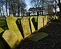 Gravestones, Beeford churchyard - geograph.org.uk - 4381147.jpg 640 × 516; 225 KB
-
 Great Wall Chinese Restaurant - geograph.org.uk - 6134226.jpg 1,600 × 1,065; 800 KB
-
 Great Wall Chinese Restaurant, Beeford - geograph.org.uk - 5317476.jpg 3,008 × 2,000; 704 KB
-
 Great Wall Restaurant, Beeford - geograph.org.uk - 5358659.jpg 640 × 426; 50 KB
-
 Hall Entrance - geograph.org.uk - 287790.jpg 640 × 480; 153 KB
-
 Harrison's Butchers, Rectory Lane, Beeford - geograph.org.uk - 5994844.jpg 1,024 × 768; 163 KB
-
 Heading north from Beeford - geograph.org.uk - 4818952.jpg 640 × 480; 73 KB
-

-
 House on Bridlington Road, Beeford - geograph.org.uk - 6231820.jpg 1,908 × 1,264; 1.34 MB
-

-
 Houses on Bridlington Road, Beeford - geograph.org.uk - 6134229.jpg 1,600 × 1,065; 695 KB
-
 Inholms Farm - geograph.org.uk - 73580.jpg 640 × 480; 93 KB
-
 Inholms Farm, Beeford - geograph.org.uk - 5994419.jpg 1,024 × 768; 143 KB
-
 Lissett Bridge - geograph.org.uk - 1307461.jpg 640 × 480; 105 KB
-
 Lissett Bridge - geograph.org.uk - 154267.jpg 640 × 480; 112 KB
-
 Looking to Westfield Farm - geograph.org.uk - 82748.jpg 640 × 480; 115 KB
-
 Main Street, Beeford - geograph.org.uk - 1484173.jpg 640 × 480; 91 KB
-
 Main Street, Beeford - geograph.org.uk - 2206703.jpg 800 × 600; 241 KB
-
 Main Street, Beeford - geograph.org.uk - 2434121.jpg 1,024 × 768; 216 KB
-
 Main Street, Beeford - geograph.org.uk - 5646361.jpg 2,848 × 2,136; 1.47 MB
-
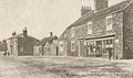
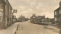 Main Street, Beeford 1900 (archive ref PO-1-10-7) (30383272511).jpg 675 × 377; 74 KB
-
 Maize crop at Beeford - geograph.org.uk - 1483421.jpg 640 × 480; 76 KB
-
 Minor Road Towards Dunnington - geograph.org.uk - 1307981.jpg 640 × 480; 73 KB
-
 Minor Road Towards Dunnington - geograph.org.uk - 1307999.jpg 640 × 480; 50 KB
-
 Minor Road Towards Westfield Farm - geograph.org.uk - 1281025.jpg 640 × 480; 82 KB
-
 Moor Grange - geograph.org.uk - 114745.jpg 640 × 480; 168 KB
-
 Muddy field on the edge of Beeford - geograph.org.uk - 5994873.jpg 1,024 × 768; 144 KB
-
 Muddy track, Bowbutts - geograph.org.uk - 5560460.jpg 1,024 × 768; 188 KB
-
 Near Dunnington - geograph.org.uk - 63497.jpg 640 × 480; 95 KB
-
 New house on Skipsea Road (B1249) - geograph.org.uk - 4817832.jpg 640 × 480; 73 KB
-

-
 North Frodingham Road, Beeford - geograph.org.uk - 4393426.jpg 640 × 427; 181 KB
-
 Old and new - geograph.org.uk - 1483944.jpg 640 × 480; 66 KB
-
 Old Howe Drain - geograph.org.uk - 1325356.jpg 640 × 480; 94 KB
-
 Old Howe Lane - geograph.org.uk - 1325358.jpg 640 × 480; 108 KB
-
 Old Howe Lane towards Beeford - geograph.org.uk - 2206690.jpg 800 × 600; 290 KB
-
 Parklands, Beeford - geograph.org.uk - 5994417.jpg 1,024 × 768; 106 KB
-
 Path leading to Breeze Lane, Beeford - geograph.org.uk - 6133344.jpg 1,600 × 1,065; 961 KB
-
 Path leading to Breeze Lane, Beeford - geograph.org.uk - 6133374.jpg 1,600 × 1,065; 467 KB
-
 Path leading to Woodhouse Farm - geograph.org.uk - 6142354.jpg 1,600 × 1,065; 698 KB
-
 Path leading to Woodhouse Farm - geograph.org.uk - 6142496.jpg 1,600 × 1,065; 528 KB
-
 Path leading to Woodhouse Farm - geograph.org.uk - 6142498.jpg 1,600 × 1,065; 574 KB
-
 Path off Skipsea Road, Beeford - geograph.org.uk - 6133341.jpg 1,600 × 1,065; 643 KB
-
 Pitwherry Drain north of Beeford - geograph.org.uk - 6142501.jpg 1,600 × 1,065; 517 KB
-
 Ploughed field off Dunnington Lane - geograph.org.uk - 5560470.jpg 1,024 × 768; 220 KB
-
 Pond in the Church Garden, Beeford - geograph.org.uk - 5994850.jpg 1,024 × 768; 304 KB
-
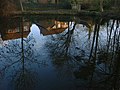 Pond Reflections - geograph.org.uk - 1511836.jpg 640 × 480; 99 KB
-
 Rectory Lane, Beeford - geograph.org.uk - 6142342.jpg 1,600 × 1,065; 620 KB
-
 Sign for the Tiger public house, Beeford - geograph.org.uk - 4817837.jpg 1,253 × 1,730; 542 KB
-
 Skipsea Road (B1249) - geograph.org.uk - 4817827.jpg 640 × 480; 78 KB
-
 Skipsea Road (B1249) - geograph.org.uk - 4817830.jpg 640 × 480; 55 KB
-
 Skipsea Road (B1249), Beeford - geograph.org.uk - 4817834.jpg 640 × 480; 75 KB
-
 Skipton Road, Beeford - geograph.org.uk - 2199494.jpg 800 × 600; 170 KB
-
 Southfield Farm - geograph.org.uk - 1307965.jpg 640 × 480; 88 KB
-
 Southfield Farm, Beeford - geograph.org.uk - 4381298.jpg 640 × 427; 212 KB
-
 St Leonard's Church, Beeford - geograph.org.uk - 2604126.jpg 1,280 × 960; 353 KB
-
 St Leonard's Church, Beeford - geograph.org.uk - 4381304.jpg 640 × 427; 181 KB
-
 St Leonard's Church, Beeford - geograph.org.uk - 6142150.jpg 1,600 × 1,065; 559 KB
-
 St. Leonard's church Beeford - geograph.org.uk - 5994864.jpg 1,024 × 768; 182 KB
-

-
 The A165 - geograph.org.uk - 287813.jpg 640 × 480; 117 KB
-

-
 The A165 south of Beeford - geograph.org.uk - 4381300.jpg 640 × 451; 208 KB
-
 The A165 towards Beeford - geograph.org.uk - 2206212.jpg 800 × 600; 238 KB
-
 The Beeford snowmen - geograph.org.uk - 2751143.jpg 800 × 600; 234 KB
-

-
 The Pitwherry Drain - geograph.org.uk - 4818991.jpg 640 × 480; 74 KB
-
 The Post Office in Beeford - geograph.org.uk - 2411542.jpg 3,648 × 2,736; 2.04 MB
-
 The Tiger - geograph.org.uk - 1484153.jpg 640 × 480; 64 KB
-
 The Tiger public house, Beeford - geograph.org.uk - 4817836.jpg 640 × 409; 47 KB
-
 The Tiger public house, Beeford - geograph.org.uk - 4817838.jpg 640 × 480; 53 KB
-
 The Tiger, Beeford - geograph.org.uk - 1222543.jpg 640 × 427; 333 KB
-
 The Tiger, Beeford - geograph.org.uk - 1281091.jpg 640 × 480; 58 KB
-
 The Tiger, Beeford - geograph.org.uk - 5358658.jpg 640 × 444; 52 KB
-
 The Tiger, Beeford - geograph.org.uk - 6134237.jpg 1,600 × 1,065; 590 KB
-
 The Yorkshire Rose - geograph.org.uk - 1307954.jpg 640 × 480; 72 KB
-
 The Yorkshire Rose Beeford.jpg 640 × 439; 310 KB
-
 The Yorkshire Rose, Beeford - geograph.org.uk - 2751146.jpg 800 × 600; 223 KB
-
 The Yorkshire Rose, Beeford - geograph.org.uk - 2751148.jpg 600 × 800; 189 KB
-
 Track into Village - geograph.org.uk - 1737690.jpg 2,816 × 2,112; 2.83 MB
-
 Track to Beeford Grange Farm - geograph.org.uk - 1307923.jpg 640 × 480; 127 KB
_-_geograph.org.uk_-_4819036.jpg)


_-_geograph.org.uk_-_4819054.jpg)


_-_geograph.org.uk_-_3063353.jpg)
_-_geograph.org.uk_-_3063367.jpg)


_(25566389874).jpg)
_-_geograph.org.uk_-_4818987.jpg)


,_Beeford_-_geograph.org.uk_-_4817835.jpg)


_-_geograph.org.uk_-_4818960.jpg)
_-_geograph.org.uk_-_4818964.jpg)
_-_geograph.org.uk_-_4818998.jpg)
_-_geograph.org.uk_-_4819005.jpg)
_-_geograph.org.uk_-_4819017.jpg)
_-_geograph.org.uk_-_4819028.jpg)
_-_geograph.org.uk_-_4819044.jpg)


_-_geograph.org.uk_-_4819002.jpg)

_-_geograph.org.uk_-_4818973.jpg)
_-_geograph.org.uk_-_4818970.jpg)
_-_geograph.org.uk_-_4819046.jpg)


_-_geograph.org.uk_-_4819058.jpg)


_-_geograph.org.uk_-_4819018.jpg)
_-_geograph.org.uk_-_4819040.jpg)
_-_geograph.org.uk_-_4817831.jpg)
_-_geograph.org.uk_-_4819012.jpg)

_-_geograph.org.uk_-_6088242.jpg)


_-_geograph.org.uk_-_4819034.jpg)


,_Beeford_-_geograph.org.uk_-_4817841.jpg)


_(30383272511).jpg)


_-_geograph.org.uk_-_4817832.jpg)
,_Beeford_-_geograph.org.uk_-_4817842.jpg)


_-_geograph.org.uk_-_4817827.jpg)
_-_geograph.org.uk_-_4817830.jpg)
,_Beeford_-_geograph.org.uk_-_4817834.jpg)


