Category:Beachamwell
Jump to navigation
Jump to search
English: Beachamwell is a village and civil parish in the Breckland district of Norfolk, England. According to the 2001 census it had a population of 334. It is about 10 miles (16 km) east of Downham Market.
village in the United Kingdom  | |||||
| Upload media | |||||
| Instance of | |||||
|---|---|---|---|---|---|
| Location | Breckland, Norfolk, East of England, England | ||||
| Area |
| ||||
| Said to be the same as | Beachamwell (Wikimedia duplicated page, civil parish) | ||||
 | |||||
Subcategories
This category has the following 3 subcategories, out of 3 total.
Media in category "Beachamwell"
The following 200 files are in this category, out of 239 total.
(previous page) (next page)-
 A huge pothole beside the A1122 road - geograph.org.uk - 2162541.jpg 480 × 640; 137 KB
-
 A seat on the green - geograph.org.uk - 1269054.jpg 480 × 640; 111 KB
-
 A1122 Dereham Road westbound - geograph.org.uk - 3634007.jpg 640 × 481; 79 KB
-
 A1122 near Long Plantation - geograph.org.uk - 3634017.jpg 640 × 481; 45 KB
-
 A1122 towards Swaffham - geograph.org.uk - 3081850.jpg 3,456 × 2,304; 1.2 MB
-
 A1122 towards the A47 - geograph.org.uk - 5002447.jpg 2,049 × 1,354; 2.02 MB
-
 A1122 westbound at Swaffham Heath - geograph.org.uk - 3633999.jpg 640 × 481; 103 KB
-
 Animal sheds, Forest Farm - geograph.org.uk - 6030826.jpg 1,600 × 1,198; 346 KB
-
 Animal sheds, Forest Farm - geograph.org.uk - 6030833.jpg 1,600 × 1,190; 412 KB
-

-
 Arable field, Beachamwell Warren - geograph.org.uk - 6020444.jpg 1,600 × 1,200; 344 KB
-
 Barn at Drymere - geograph.org.uk - 5336468.jpg 4,000 × 3,000; 1.47 MB
-
 Beachamwell Post Office - geograph.org.uk - 1269089.jpg 583 × 620; 107 KB
-
 Beachamwell post office - geograph.org.uk - 507332.jpg 640 × 480; 96 KB
-
 Beachamwell Village Hall - geograph.org.uk - 1269059.jpg 640 × 480; 87 KB
-
 Beachamwell village sign - geograph.org.uk - 1269063.jpg 479 × 640; 79 KB
-
 Beachamwell War Memorial - geograph.org.uk - 4522326.jpg 2,328 × 3,294; 1.54 MB
-
 Beachamwell Warren - geograph.org.uk - 669383.jpg 640 × 480; 85 KB
-
 Beachamwell1.jpg 1,418 × 2,000; 1.43 MB
-
 Beech trees, Cockleycley Wood - geograph.org.uk - 5339338.jpg 4,000 × 3,000; 2.3 MB
-
 Brick Kiln Plantation and Warren Belt - geograph.org.uk - 507295.jpg 640 × 480; 92 KB
-
 Bridleway by Cockleycley Wood - geograph.org.uk - 5336307.jpg 4,000 × 3,000; 1.53 MB
-
 Bridleway junction, Warren Farm - geograph.org.uk - 6031602.jpg 1,600 × 1,200; 323 KB
-

-
 Bridleway past outdoor pigs - geograph.org.uk - 6030646.jpg 1,600 × 1,200; 262 KB
-
 Bridleway past outdoor pigs - geograph.org.uk - 6030650.jpg 1,600 × 1,200; 295 KB
-
 Bridleway through Cockleycley Wood - geograph.org.uk - 5336298.jpg 4,000 × 3,000; 1.56 MB
-

-

-
 Bridleway to A1122 - geograph.org.uk - 6020448.jpg 1,600 × 1,200; 348 KB
-
 Bridleway to A1122 - geograph.org.uk - 6020453.jpg 1,600 × 1,200; 365 KB
-
 Bridleway to A1122 - geograph.org.uk - 6030793.jpg 1,600 × 1,200; 329 KB
-
 Bridleway to A1122 - geograph.org.uk - 6030796.jpg 1,600 × 1,200; 308 KB
-
 Bridleway to A1122 - geograph.org.uk - 6030799.jpg 1,600 × 1,200; 320 KB
-
 Bridleway to Beachamwell Warren - geograph.org.uk - 6030805.jpg 1,600 × 1,200; 293 KB
-
 Bridleway to Cockleycley Wood - geograph.org.uk - 6032244.jpg 1,600 × 1,200; 390 KB
-
 Bridleway to Forest Farm - geograph.org.uk - 6030614.jpg 1,600 × 1,245; 432 KB
-
 Bridleway to Forest Farm - geograph.org.uk - 6030832.jpg 1,600 × 1,200; 281 KB
-
 Bridleway to Larch Wood - geograph.org.uk - 6020474.jpg 1,600 × 1,200; 365 KB
-
 Bridleway to Lodge Farm - geograph.org.uk - 6031608.jpg 1,600 × 1,200; 471 KB
-
 Bridleway to Lodge Farm - geograph.org.uk - 6031613.jpg 1,600 × 1,200; 398 KB
-
 Bridleway to Lodge Farm - geograph.org.uk - 6032212.jpg 1,600 × 1,200; 386 KB
-
 Bridleway to Warren Farm - geograph.org.uk - 6031601.jpg 1,600 × 1,200; 268 KB
-
 Bridleway towards Beachamwell - geograph.org.uk - 6030570.jpg 1,600 × 1,244; 359 KB
-
 Bridleway towards Shingham - geograph.org.uk - 6030623.jpg 1,600 × 1,200; 342 KB
-
 Bridleway, Beachamwell Warren - geograph.org.uk - 6020484.jpg 1,600 × 1,200; 439 KB
-

-
 By the lane - geograph.org.uk - 396225.jpg 640 × 480; 114 KB
-
 Car park for Cockleycley Wood - geograph.org.uk - 5336472.jpg 4,000 × 3,000; 1.86 MB
-
 Car park for Drymere Plantation - geograph.org.uk - 5339274.jpg 4,000 × 3,000; 1.4 MB
-

-

-
 Cereal crop, Walter's Sheds - geograph.org.uk - 5433464.jpg 640 × 480; 72 KB
-
 Cleared area, Cockleycley Wood - geograph.org.uk - 6032237.jpg 1,600 × 1,200; 324 KB
-
 Cockleycley Wood - geograph.org.uk - 1670020.jpg 640 × 480; 110 KB
-
 Cottages along The Street - geograph.org.uk - 1269043.jpg 640 × 480; 105 KB
-
 Cows near Lodge Farm - geograph.org.uk - 6031620.jpg 1,600 × 1,200; 331 KB
-
 Crop boundary by Warren Belt - geograph.org.uk - 6030580.jpg 1,600 × 1,235; 340 KB
-
 Crop boundary near Lodge Farm - geograph.org.uk - 6030794.jpg 1,600 × 1,200; 314 KB
-
 Crop field near Beachamwell - geograph.org.uk - 5433476.jpg 640 × 480; 103 KB
-
 Cross tracks 106 - geograph.org.uk - 670546.jpg 640 × 480; 117 KB
-
 Ditch by Nursery Plantation - geograph.org.uk - 6030574.jpg 1,600 × 1,200; 383 KB
-
 Ditch by Warren Belt - geograph.org.uk - 6030585.jpg 1,600 × 1,200; 330 KB
-
 Downhill track - geograph.org.uk - 670541.jpg 640 × 480; 110 KB
-
 Drainage ditch - geograph.org.uk - 670719.jpg 640 × 480; 73 KB
-
 Drymere Plantation - geograph.org.uk - 5339272.jpg 4,000 × 3,000; 2.62 MB
-
 Dumped^ - geograph.org.uk - 518416.jpg 640 × 480; 132 KB
-
 ELS Headland - geograph.org.uk - 396430.jpg 640 × 480; 104 KB
-
 Entering Beachamwell - geograph.org.uk - 5433437.jpg 640 × 480; 82 KB
-
 Fenceline, Beachamwell Warren - geograph.org.uk - 6020488.jpg 1,600 × 1,200; 316 KB
-
 Field and pine shelterbelt - geograph.org.uk - 6020451.jpg 1,600 × 1,200; 367 KB
-
 Field Boundary in TF 7305 - geograph.org.uk - 589540.jpg 640 × 480; 154 KB
-
 Field by Cockleycley Wood - geograph.org.uk - 5336337.jpg 4,000 × 3,000; 1.37 MB
-
 Field edge, Beachamwell Warren - geograph.org.uk - 6020439.jpg 1,600 × 1,252; 398 KB
-

-

-
 Field near Lodge Farm - geograph.org.uk - 6020459.jpg 1,600 × 1,200; 309 KB
-
 Field south of Long Plantation - geograph.org.uk - 2162540.jpg 640 × 480; 145 KB
-
 Footpath by Warren Belt - geograph.org.uk - 6030578.jpg 1,600 × 1,200; 466 KB
-
 Footpath by Wellmere Plantation - geograph.org.uk - 6030589.jpg 1,600 × 1,122; 416 KB
-
 Footpath from Pine Avenue - geograph.org.uk - 5336326.jpg 4,000 × 3,000; 1.83 MB
-
 Footpath from Shingham - geograph.org.uk - 6030633.jpg 1,600 × 1,148; 285 KB
-
 Footpath junction - geograph.org.uk - 669421.jpg 640 × 480; 72 KB
-
 Footpath to Beachamwell - geograph.org.uk - 518408.jpg 640 × 480; 106 KB
-
 Footpath to Beachamwell - geograph.org.uk - 6030583.jpg 1,600 × 1,179; 341 KB
-

-
 Forest Edge Arena - geograph.org.uk - 5336474.jpg 3,681 × 2,569; 739 KB
-
 Forest Edge Arena - geograph.org.uk - 6031600.jpg 1,600 × 1,090; 270 KB
-

-
 Free range pig farming, Beachamwell - geograph.org.uk - 5433470.jpg 640 × 480; 83 KB
-
 Free range pig unit near Beachamwell - geograph.org.uk - 507363.jpg 640 × 480; 77 KB
-
 Game bird cover crop - geograph.org.uk - 6030803.jpg 1,600 × 1,200; 333 KB
-
 Gated footpath - geograph.org.uk - 670708.jpg 640 × 480; 59 KB
-
 Gated road to Long Plantation - geograph.org.uk - 2162482.jpg 640 × 480; 179 KB
-
 Grazing near Murgot's Covert - geograph.org.uk - 5433420.jpg 640 × 480; 77 KB
-
 Green Drove - geograph.org.uk - 396058.jpg 640 × 480; 111 KB
-
 Green Drove - geograph.org.uk - 397745.jpg 640 × 480; 99 KB
-
 Green Drove blocked off - geograph.org.uk - 507279.jpg 640 × 480; 88 KB
-
 Green field boundary - geograph.org.uk - 670697.jpg 480 × 640; 124 KB
-

-
 Hall Barn - geograph.org.uk - 683974.jpg 3,008 × 2,000; 4.02 MB
-

-
 High seat, Swaffham Heath - geograph.org.uk - 5336399.jpg 4,000 × 3,000; 921 KB
-
 Horse paddocks near Beachamwell - geograph.org.uk - 6030571.jpg 1,600 × 1,189; 289 KB
-

-
 House in Shingham - geograph.org.uk - 6030626.jpg 1,600 × 1,200; 367 KB
-
 House on the corner, Beachamwell - geograph.org.uk - 5433439.jpg 640 × 480; 82 KB
-
 K6 Telephone box on village green - geograph.org.uk - 1269051.jpg 480 × 640; 117 KB
-
 Keeping an eye on passing traffic - geograph.org.uk - 507360.jpg 640 × 480; 112 KB
-
 Lane to All Saints - geograph.org.uk - 396243.jpg 640 × 480; 83 KB
-
 Larch Wood - geograph.org.uk - 5433480.jpg 640 × 480; 74 KB
-
 Larch Wood Cottage - geograph.org.uk - 5433481.jpg 640 × 480; 101 KB
-

-
 Log piles in Drymere Plantation - geograph.org.uk - 5339277.jpg 4,000 × 3,000; 1.72 MB
-
 Malthouse Croft - geograph.org.uk - 1269080.jpg 640 × 480; 115 KB
-
 Minor road beside Cockleycley Wood - geograph.org.uk - 5433545.jpg 640 × 480; 106 KB
-
 Minor road towards Beachamwell - geograph.org.uk - 5433465.jpg 640 × 480; 95 KB
-
 Minor road towards Beachamwell - geograph.org.uk - 5433469.jpg 640 × 480; 108 KB
-
 Minor road towards Cockley Cley - geograph.org.uk - 5433553.jpg 640 × 480; 99 KB
-
 Minor road towards Swaffham - geograph.org.uk - 5433478.jpg 640 × 480; 61 KB
-
 Minor road towards Swaffham - geograph.org.uk - 5433542.jpg 640 × 480; 71 KB
-
 Minor road, Beachamwell - geograph.org.uk - 5433474.jpg 640 × 480; 92 KB
-
 More roadside poppies and The Devil's Dyke - geograph.org.uk - 3081861.jpg 3,456 × 2,304; 1.85 MB
-
 Murgot's Covert - geograph.org.uk - 5433434.jpg 640 × 480; 91 KB
-
 Narborough Hill - geograph.org.uk - 396189.jpg 640 × 480; 79 KB
-
 Narborough ROC monitoring post - geograph.org.uk - 936751.jpg 3,008 × 2,000; 3.63 MB
-
 Narford Wood - geograph.org.uk - 6032201.jpg 1,165 × 1,600; 532 KB
-
 New housing by the village green - geograph.org.uk - 1269056.jpg 640 × 480; 96 KB
-

-
 Old Larch Wood - geograph.org.uk - 1670023.jpg 640 × 480; 178 KB
-

-

-
 Outdoor pigs - geograph.org.uk - 6030648.jpg 1,600 × 1,200; 285 KB
-
 Outdoor pigs - geograph.org.uk - 6030651.jpg 1,600 × 1,179; 302 KB
-
 Outdoor pigs, Beachamwell Warren - geograph.org.uk - 6030573.jpg 1,600 × 1,255; 288 KB
-
 Path by Cockleycley Wood - geograph.org.uk - 5336341.jpg 4,000 × 3,000; 2.01 MB
-
 Path skirting Old Larch Wood - geograph.org.uk - 1670033.jpg 640 × 480; 151 KB
-
 Pine Avenue - geograph.org.uk - 1670003.jpg 640 × 480; 153 KB
-
 Pine Avenue - geograph.org.uk - 5336333.jpg 3,767 × 2,638; 1.42 MB
-

-
 Potato field towards Fox Plantation - geograph.org.uk - 5433427.jpg 640 × 480; 74 KB
-
 Prepared field by Pine Avenue - geograph.org.uk - 5336331.jpg 3,594 × 2,560; 671 KB
-
 Prepared field near Cockleycley Wood - geograph.org.uk - 5336323.jpg 4,000 × 3,000; 1.19 MB
-
 Prepared field, Warren Farm - geograph.org.uk - 6031607.jpg 1,600 × 1,200; 266 KB
-
 Prepared field, Warren Farm - geograph.org.uk - 6031611.jpg 2,048 × 1,722; 315 KB
-
 Private track - geograph.org.uk - 2162398.jpg 640 × 480; 169 KB
-

-
 Pub on the corner - geograph.org.uk - 1269069.jpg 620 × 573; 137 KB
-
 Renault Ares tractor.jpg 1,794 × 1,262; 343 KB
-
 Replanted area, Cockleycley Wood - geograph.org.uk - 5336295.jpg 4,000 × 3,000; 1.46 MB
-
 Replanted area, Cockleycley Wood - geograph.org.uk - 5336320.jpg 4,000 × 3,000; 1.73 MB
-
 Replanted area, Cockleycley Wood - geograph.org.uk - 5339301.jpg 4,000 × 3,000; 1.55 MB
-
 Replanted area, Cockleycley Wood - geograph.org.uk - 5339308.jpg 4,000 × 3,000; 1.66 MB
-
 Replanted area, Swaffham Heath - geograph.org.uk - 5336394.jpg 4,000 × 3,000; 1.14 MB
-
 Restored barn, Shingham Farm - geograph.org.uk - 6030598.jpg 1,600 × 1,138; 272 KB
-
 Restored barn, Shingham Farm - geograph.org.uk - 6030600.jpg 1,600 × 1,200; 355 KB
-
 Restricted byway near Lodge Farm - geograph.org.uk - 6031618.jpg 1,600 × 1,173; 266 KB
-
 Restricted byway to Lodge Farm - geograph.org.uk - 6020469.jpg 1,600 × 1,200; 370 KB
-
 Restricted byway towards Lodge Farm - geograph.org.uk - 6032184.jpg 1,600 × 1,152; 340 KB
-
 Restricted byway, Beachamwell Warren - geograph.org.uk - 6020442.jpg 1,600 × 1,190; 304 KB
-
 Restricted byway, Beachamwell Warren - geograph.org.uk - 6020486.jpg 1,600 × 1,200; 304 KB
-
 Restricted byway, Swaffham Heath - geograph.org.uk - 6032189.jpg 1,600 × 1,214; 492 KB
-
 Ride 105 by Gorse Belt - geograph.org.uk - 6030809.jpg 1,600 × 1,200; 314 KB
-
 Ride 105 past Narford Wood - geograph.org.uk - 6020500.jpg 1,600 × 1,200; 320 KB
-
 Ride 106 - geograph.org.uk - 6031615.jpg 1,600 × 1,206; 406 KB
-
 Ride 106 - geograph.org.uk - 6031616.jpg 1,600 × 1,234; 525 KB
-
 Ride 106, Swaffham Heath - geograph.org.uk - 6020464.jpg 1,600 × 1,123; 541 KB
-
 Ride 109 by Pine Avenue - geograph.org.uk - 6031595.jpg 1,600 × 1,323; 302 KB
-
 Ride in Deadman's Plantation - geograph.org.uk - 5336265.jpg 4,000 × 3,000; 1.45 MB
-
 Ridged field - geograph.org.uk - 5336462.jpg 4,000 × 3,000; 1.42 MB
-

-
 Road junction on Murgot's Lane - geograph.org.uk - 5433428.jpg 640 × 480; 74 KB
-

-
 Road to Warren Barn - geograph.org.uk - 396207.jpg 640 × 480; 71 KB
-

-
 Roadside poppies and RAF Marham perimeter - geograph.org.uk - 3081843.jpg 3,456 × 2,304; 1.64 MB
-
 Row of old tree stumps, Cockleycley Wood - geograph.org.uk - 5336316.jpg 4,000 × 3,000; 1.55 MB
-
 Ruin at Shingham Farm - geograph.org.uk - 396258.jpg 640 × 480; 101 KB
-
 Sheep field, Beachamwell Warren - geograph.org.uk - 6020478.jpg 1,600 × 1,200; 405 KB
-
 Sheep in Shingham - geograph.org.uk - 6030629.jpg 1,600 × 1,169; 433 KB
-

-
 Shingham St. Botolph's church - geograph.org.uk - 4345849.jpg 640 × 480; 50 KB
-
 St John's Farm, Beachamwell, Norfolk - geograph.org.uk - 339069.jpg 640 × 470; 133 KB
-
 St John, Beachamwell, Norfolk - geograph.org.uk - 339067.jpg 485 × 640; 104 KB
-
 St John, Beachamwell, Norfolk - geograph.org.uk - 339071.jpg 640 × 465; 101 KB
-
 St. Mary's church Beachamwell - geograph.org.uk - 3914260.jpg 640 × 480; 61 KB
-

-
 Swaffham Heath - geograph.org.uk - 6032193.jpg 1,600 × 1,200; 557 KB
-
 Swaffham Heath - geograph.org.uk - 6032199.jpg 1,600 × 1,200; 545 KB
-
 Temporary speed control camera ahead - geograph.org.uk - 2162490.jpg 640 × 480; 151 KB
-

-
 The Great Danes - geograph.org.uk - 1269066.jpg 640 × 480; 83 KB
-
 The Great Danes - geograph.org.uk - 507329.jpg 640 × 480; 74 KB
-
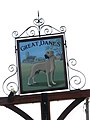 The Great Danes - pub sign - geograph.org.uk - 1269076.jpg 480 × 640; 63 KB
-
 The Lodge - geograph.org.uk - 507336.jpg 640 × 480; 125 KB
-

-

-
 The road to Beachamwell - geograph.org.uk - 1269001.jpg 640 × 480; 111 KB
-

-
 The Street, Beachamwell - geograph.org.uk - 1908189.jpg 640 × 427; 269 KB


_-_geograph.org.uk_-_5411146.jpg)


