Category:Bayerisch Gmain
Jump to navigation
Jump to search
municipality of Germany    | |||||
| Upload media | |||||
| Instance of |
| ||||
|---|---|---|---|---|---|
| Part of |
| ||||
| Location |
| ||||
| Head of government |
| ||||
| Population |
| ||||
| Area |
| ||||
| Elevation above sea level |
| ||||
| official website | |||||
 | |||||
Media in category "Bayerisch Gmain"
The following 20 files are in this category, out of 20 total.
-
 Wappen Bayerisch Gmain.jpg 219 × 247; 44 KB
-
 Wappen von Bayerisch Gmain.svg 696 × 789; 11 KB
-
 Bahnhof Bayerisch Gmain.jpg 2,048 × 1,352; 568 KB
-
 Bayerisch Gmain in BGL.png 293 × 419; 8 KB
-
 Bayrgmain01.jpg 1,707 × 1,221; 2.05 MB
-
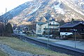 BGmain Bahnhof 01.jpg 1,200 × 803; 241 KB
-
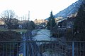 BGmain Bahnhof 02.jpg 1,200 × 803; 178 KB
-
 BGmain Schild Grüss Gott.jpg 803 × 1,200; 314 KB
-
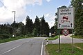
 BGmain Streitbichl.jpg 1,200 × 803; 150 KB
-
 Grossgmain Gmainer Tal.jpg 1,600 × 1,200; 1,023 KB
-
 Hallburg (Bad Reichenhall).PNG 606 × 396; 510 KB
-
 Hallthurmer Berg-Unfallstrecke.JPG 1,400 × 930; 199 KB
-
 Hochplatte-Bayerisch-Gmain.JPG 3,216 × 2,136; 3.19 MB
-
 Kirchholz Orthofoto.jpg 819 × 783; 835 KB
-
 Landschaftsschutzgebiet Ortelbach.JPG 1,400 × 930; 252 KB
-
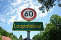 Leopoldstal.jpg 1,200 × 803; 231 KB
-
 REI Beethovenstr.jpg 1,024 × 685; 127 KB
-
 REI Schild Langenfeldstr.jpg 1,024 × 685; 128 KB
-
-
 Werkfoto BBC E 70 21.tif 2,016 × 1,450; 8.4 MB


.PNG)


_-_geograph.org.uk_-_8030.jpg)