Category:Baumgartenbrücke (Brandenburg)
Jump to navigation
Jump to search
| Object location | | View all coordinates using: OpenStreetMap |
|---|
bridge over the Havel in Brandenburg  | |||||
| Upload media | |||||
| Instance of | |||||
|---|---|---|---|---|---|
| Location |
| ||||
| Crosses | |||||
| Inception |
| ||||
 | |||||
Media in category "Baumgartenbrücke (Brandenburg)"
The following 13 files are in this category, out of 13 total.
-
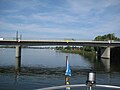
 Baumgartenbrücke 1989.jpg 1,526 × 1,026; 760 KB
-
 Baumgartenbrücke Geltow - panoramio.jpg 2,592 × 1,944; 1.64 MB
-
 Baumgartenbrücke Geltow.jpg 21,192 × 14,355; 18.03 MB
-
 Baumgartenbrücke Januar 2009 (2).JPG 1,984 × 1,488; 711 KB
-
 Baumgartenbrücke von 1827 (Foto 1900).jpg 1,421 × 915; 614 KB
-
 Baumgartenbrücke01.jpg 1,454 × 695; 593 KB
-
 Baumgartenbrücke03.jpg 1,522 × 1,036; 977 KB
-
 FGS Serrahn Queen ENI 04307330 (1) 03.jpg 3,648 × 2,736; 4.76 MB
-
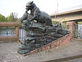 Fischotter Tierfigur.jpg 1,984 × 1,488; 699 KB
-

-
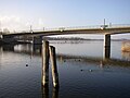
 Schwielowsee-Baumgartenbruecke-01.jpg 1,571 × 1,200; 259 KB
-
 Schwielowsee-Baumgartenbruecke-02.jpg 1,600 × 1,200; 972 KB
-
 Schwielowsee-Baumgartenbruecke-32.jpg 1,022 × 728; 129 KB


.JPG)
.jpg)


_03.jpg)


