Category:Baugruppe Hohenloher Dorf (Freilandmuseum Wackershofen)
Jump to navigation
Jump to search
Deutsch: Kategorie für Bilder und andere Medien zur Baugruppe Hohenloher Dorf im Hohenloher Freilandmuseum Wackershofen.
| Object location | | View all coordinates using: OpenStreetMap |
|---|
Subcategories
This category has the following 24 subcategories, out of 24 total.
A
B
H
K
S
Media in category "Baugruppe Hohenloher Dorf (Freilandmuseum Wackershofen)"
The following 4 files are in this category, out of 4 total.
-
 Hohenloher Freilandmuseum - Baugruppe Hohenloher Dorf - Abendspaziergang der Gänse 1.jpg 5,720 × 4,000; 23.41 MB
-
 Hohenloher Freilandmuseum - Baugruppe Hohenloher Dorf - Platz mit Abendsonne von NW.jpg 5,556 × 2,682; 14.46 MB
-
 Wackershofen freilandmuseum 2018 11.jpg 3,456 × 4,608; 4.03 MB
-
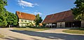
 Wackershofen Freilandmuseum Hohenloher Dorf 20070530.jpg 3,456 × 2,304; 2.19 MB


