Category:Bauernhaus (Wangenstrasse 9, Wanzwil)
Jump to navigation
Jump to search
| Object location | | View all coordinates using: OpenStreetMap |
|---|
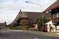
rural residential building in Wanzwil in the canton of Bern, Switzerland _093.JPG) | |||||
| Upload media | |||||
| Instance of | |||||
|---|---|---|---|---|---|
| Part of | |||||
| Location | Wanzwil, Heimenhausen, Oberaargau, Emmental-Oberaargau administrative region, Bern, Switzerland | ||||
| Street address |
| ||||
| Heritage designation |
| ||||
| Inception |
| ||||
 | |||||
Media in category "Bauernhaus (Wangenstrasse 9, Wanzwil)"
This category contains only the following file.
-
 2011-11-30-Mezlando (Foto Dietrich Michael Weidmann) 093.JPG 3,872 × 2,592; 3.53 MB