Category:Battle of Leyte Gulf maps
Jump to navigation
Jump to search
Media in category "Battle of Leyte Gulf maps"
The following 26 files are in this category, out of 26 total.
-
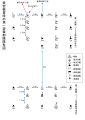 10.23艦隊陣形.svg 842 × 1,191; 181 KB
-
 10.24艦隊陣形.svg 595 × 842; 100 KB
-
 10.25サマール沖海戦後艦隊陣形.svg 747 × 777; 3.98 MB
-
 10月25日2S・2YB陣形図.svg 1,191 × 842; 93 KB
-
 1944.10.24 小沢艦隊陣形(訂正).svg 516 × 729; 50 KB
-
 1944.10.25 小沢艦隊陣形(訂正).svg 516 × 729; 49 KB
-
 Annotated map of Battle of Leyte Gulf.png 1,020 × 1,483; 1.83 MB
-
 Contemporary map of the Battle of Leyte Gulf 1944.png 651 × 744; 424 KB
-
 Leyte map annotated.jpg 1,001 × 1,454; 251 KB
-
 Leyte Map Overlay - NARA - 50925970.jpg 2,048 × 2,976; 2.47 MB
-
 Map of Battle of Leyte Gulf.jpg 1,000 × 1,454; 184 KB
-
 Samar.jpg 1,414 × 2,013; 2.18 MB
-
 Surigao Strait.jpg 1,000 × 1,493; 200 KB
-
 The Western Pacific, New Guinea, And The Philippine Islands.jpg 1,260 × 970; 215 KB
-
 サマール沖敵情報告.svg 595 × 516; 255 KB
-
 サマール沖海戦図.pdf 3,506 × 2,479; 225 KB
-
 サマール沖海戦図.svg 2,140 × 1,587; 203 KB
-
 サマール沖海戦図3.svg 1,684 × 1,191; 495 KB
-
 スリガオ海峡夜戦図.pdf 2,479 × 3,506; 5.73 MB
-
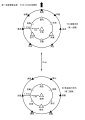
 スリガオ海峡夜戦図.svg 1,587 × 2,245; 126 KB
-
 レイテ沖海戦図A2.pdf 2,479 × 3,506; 406 KB
-
 レイテ沖海戦図A2.svg 1,587 × 2,245; 439 KB
-
 レイテ沖海戦図A3.svg 1,684 × 2,381; 1.94 MB
-
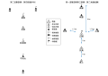
 小沢艦隊陣形10.24.svg 516 × 729; 9 KB
-
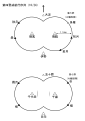
 小沢艦隊陣形10.25.svg 516 × 729; 8 KB
-
 10月23日栗田艦隊隊形.svg 842 × 1,191; 181 KB


