Category:Barrow, Lancashire
Jump to navigation
Jump to search
English: Barrow is a village in the Ribble Valley district in Lancashire, England, situated between Whalley and Clitheroe and bypassed by the A59. It has a Primary school, a Chinese Chip Shop, a Business park, a McDonald's, a Co-operative Food and a park. The village is well served by local bus routes, giving direct access to many parts of Lancashire.
village and civil parish in Ribble Valley, Lancashire, UK  | |||||
| Upload media | |||||
| Instance of | |||||
|---|---|---|---|---|---|
| Location | Ribble Valley, Lancashire, North West England, England | ||||
| Different from | |||||
 | |||||
Media in category "Barrow, Lancashire"
The following 93 files are in this category, out of 93 total.
-

-
 "Mondo" Barrow - geograph.org.uk - 530406.jpg 640 × 480; 131 KB
-
 2 Miles to Clitheroe - geograph.org.uk - 5132932.jpg 640 × 455; 82 KB
-
 A Track West of Barrow - geograph.org.uk - 1829830.jpg 2,816 × 2,112; 2.59 MB
-
 A59 - geograph.org.uk - 1201079.jpg 640 × 480; 79 KB
-
 A59 eastbound nearing Clitheroe turn - geograph.org.uk - 4246580.jpg 640 × 481; 35 KB
-
 A59 from a bridge near Barrow - geograph.org.uk - 4083838.jpg 4,000 × 2,783; 4.21 MB
-
 A59 nears Whiteacre Lane overbridge - geograph.org.uk - 4246574.jpg 640 × 481; 55 KB
-

-
-
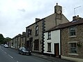
 Abbey Terrace, Barrow - geograph.org.uk - 2695138.jpg 640 × 480; 116 KB
-
 Approaching Barrow - geograph.org.uk - 4996877.jpg 1,280 × 958; 784 KB
-
 Barn at Barrow Gardens - geograph.org.uk - 4002784.jpg 4,000 × 3,000; 4.37 MB
-
 Barrow - geograph.org.uk - 33489.jpg 640 × 577; 104 KB
-
 Barrow - geograph.org.uk - 4459892.jpg 5,060 × 2,854; 2.02 MB
-
 Barrow Bridge - geograph.org.uk - 2695128.jpg 640 × 480; 174 KB
-
 Barrow Brook - geograph.org.uk - 2695116.jpg 480 × 640; 110 KB
-
 Barrow Brook - geograph.org.uk - 2695126.jpg 640 × 480; 211 KB
-
 Barrow Gardens - geograph.org.uk - 5132941.jpg 640 × 480; 109 KB
-
-
 Catlow Terrace, Barrow - geograph.org.uk - 2695132.jpg 640 × 480; 99 KB
-
 Chorlton Terrace, Barrow - geograph.org.uk - 2695135.jpg 640 × 480; 114 KB
-
 Clitheroe Golf Club - geograph.org.uk - 4464208.jpg 4,783 × 3,122; 1.78 MB
-
 Clitheroe Golf Club, Whalley Road - geograph.org.uk - 4628132.jpg 640 × 480; 437 KB
-
 Cockerill Terrace, Barrow - geograph.org.uk - 2695139.jpg 640 × 480; 114 KB
-
 Entering Barrow - geograph.org.uk - 5132919.jpg 640 × 480; 69 KB
-
 Ex St Lukes Mission Church - geograph.org.uk - 408357.jpg 640 × 426; 138 KB
-
 Filling Station , Barrow nr Whalley - geograph.org.uk - 58911.jpg 640 × 427; 132 KB
-
 Fishery, Barrow, nr Whalley - geograph.org.uk - 58927.jpg 640 × 427; 102 KB
-
 Fishing lake east of Barrow - geograph.org.uk - 4529781.jpg 1,600 × 1,200; 412 KB
-
 Footpath beside the A671 near Barrow Gardens - geograph.org.uk - 4529851.jpg 1,600 × 1,200; 1.02 MB
-
 Footpath near Barrow - geograph.org.uk - 4083842.jpg 4,000 × 3,000; 6.97 MB
-
 Footpath through farmland - geograph.org.uk - 4083843.jpg 4,000 × 3,000; 6.26 MB
-
 George VI postbox on Whalley Road, Barrow - geograph.org.uk - 5135132.jpg 896 × 1,907; 283 KB
-
 Grazing east of Whalley Road - geograph.org.uk - 5132933.jpg 640 × 480; 52 KB
-
 Grazing horses - geograph.org.uk - 4083866.jpg 4,000 × 3,000; 5.97 MB
-
 Grazing, Barrow - geograph.org.uk - 5132927.jpg 640 × 480; 54 KB
-
 Hawthorn Farm, Barrow - geograph.org.uk - 4529857.jpg 1,600 × 1,200; 657 KB
-
 House on Whalley Road - geograph.org.uk - 5132917.jpg 640 × 480; 69 KB
-
 Houses in Barrow - geograph.org.uk - 5132921.jpg 640 × 480; 58 KB
-
 Houses on Whalley Road, Barrow - geograph.org.uk - 5135137.jpg 640 × 480; 63 KB
-
 Jollies Memorial Church, Barrow - geograph.org.uk - 1201075.jpg 640 × 480; 69 KB
-
 Jollies Memorial, Barrow - Congregational - geograph.org.uk - 2789948.jpg 1,280 × 960; 190 KB
-

-
 Milestone - geograph.org.uk - 1351576.jpg 640 × 480; 107 KB
-
 Milestone - geograph.org.uk - 1351579.jpg 640 × 480; 115 KB
-
 Milestone north of Barrow - geograph.org.uk - 4529853.jpg 1,600 × 1,200; 525 KB
-
 Mill Brook Place, Barrow - geograph.org.uk - 2695134.jpg 640 × 480; 103 KB
-
 Mill Lodge A59 Barrow - geograph.org.uk - 1887995.jpg 3,264 × 2,448; 2.24 MB
-

-

-

-
-
-

-
 Oaklea Gardens, Barrow - geograph.org.uk - 2695112.jpg 640 × 480; 101 KB
-

-
 Ordnance Survey Flush Bracket G3379 - geograph.org.uk - 4006440.jpg 4,000 × 3,000; 2.87 MB
-
 Ordnance Survey Flush Bracket G3380 - geograph.org.uk - 4006472.jpg 4,000 × 3,000; 3.98 MB
-
 OS Benchmark on Barrow Bridge - geograph.org.uk - 2695131.jpg 480 × 640; 115 KB
-
 Pendle Garage, Barrow - geograph.org.uk - 1201071.jpg 640 × 478; 65 KB
-
 Pendle View Fisheries - geograph.org.uk - 1832219.jpg 2,816 × 2,112; 1.26 MB
-
 Pendle View Fisheries - geograph.org.uk - 2244645.jpg 640 × 480; 102 KB
-
 Pendle View Fisheries - geograph.org.uk - 2244647.jpg 640 × 480; 97 KB
-
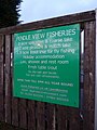 Pendle View Fisheries, Sign - geograph.org.uk - 2244649.jpg 480 × 640; 74 KB
-
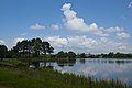 Pendle View fishery - geograph.org.uk - 4036151.jpg 4,592 × 3,056; 6.58 MB
-
 Pendle View fishery - geograph.org.uk - 4038301.jpg 4,271 × 2,842; 7.23 MB
-
 Pond nr Barrow, Whalley - geograph.org.uk - 58914.jpg 640 × 427; 113 KB
-

-
 Rough pasture at Brook House Farm - geograph.org.uk - 4083870.jpg 4,000 × 3,000; 6.96 MB
-
 Roundabout on the A59 - geograph.org.uk - 2244637.jpg 640 × 480; 97 KB
-
 Roundabout with Services on the A59 - geograph.org.uk - 3019241.jpg 3,411 × 2,276; 2.21 MB
-

-
 Sign - geograph.org.uk - 530407.jpg 480 × 640; 127 KB
-
 Sign for the Bay Horse Inn, Barrow - geograph.org.uk - 5132924.jpg 485 × 640; 50 KB
-

-
 The 59 near Whiteacre Lane Bridge - geograph.org.uk - 4502059.jpg 2,000 × 1,547; 758 KB
-
 The A59 near the A671 turnoff - geograph.org.uk - 4502085.jpg 2,000 × 1,500; 413 KB
-
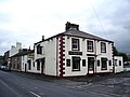
 The Bay Horse Inn, Barrow - geograph.org.uk - 5132923.jpg 640 × 480; 58 KB
-
 The Bay Horse, Barrow - geograph.org.uk - 531411.jpg 640 × 480; 163 KB
-
 The Eagle at Barrow - geograph.org.uk - 1201059.jpg 640 × 480; 76 KB
-
 The Eagle at Barrow, Sign - geograph.org.uk - 1201062.jpg 640 × 480; 91 KB
-
 The Eagle at Barrow, Sign - geograph.org.uk - 1201064.jpg 479 × 640; 68 KB
-
 The King Charles - geograph.org.uk - 531404.jpg 640 × 480; 138 KB
-
 The Old A59 in Barrow - geograph.org.uk - 1829842.jpg 2,816 × 2,112; 1.8 MB
-

-
 The road junction at Barrow Gardens - geograph.org.uk - 4036490.jpg 640 × 426; 114 KB
-
 Whalley Road - geograph.org.uk - 5132937.jpg 640 × 480; 70 KB
-
 Whalley Road - geograph.org.uk - 5132942.jpg 640 × 480; 66 KB
-
 Whalley Road, Barrow - geograph.org.uk - 2695031.jpg 640 × 480; 106 KB
-
 Whalley Road, Barrow - geograph.org.uk - 2695107.jpg 640 × 480; 125 KB
-
 Whalley Road, Barrow - geograph.org.uk - 2695114.jpg 640 × 480; 111 KB
-
 Whiteacre Lane Bridge - geograph.org.uk - 3019080.jpg 4,288 × 3,216; 3.72 MB
_The_Printworks,_Ribble_Valley_Enterprise_Park,_Hey_Road,_Barrow,_Clitheroe,_Lancashire_BB7_9WD_-_geograph.org.uk_-_2390215.jpg)


