Category:Barkway
Jump to navigation
Jump to search
English: Barkway is a long-established village and civil parish in the North Hertfordshire district of Hertfordshire, England, about five miles south-east of Royston,35 miles from London and 15 miles from the centre of Cambridge.
village and civil parish in the North Hertfordshire district of Hertfordshire, England  Le panneau d'entrée de Barkway. | |||||
| Upload media | |||||
| Instance of | |||||
|---|---|---|---|---|---|
| Location | North Hertfordshire, Hertfordshire, East of England, England | ||||
| Said to be the same as | Barkway (Wikimedia duplicated page, civil parish) | ||||
| official website | |||||
 | |||||
Subcategories
This category has the following 7 subcategories, out of 7 total.
9
B
- Barkway Chalk Pit (6 F)
- Barkway Hoard (4 F)
M
N
- Newsells (1 F)
S
- Stallibrass Almshouses (4 F)
T
Media in category "Barkway"
The following 114 files are in this category, out of 114 total.
-
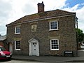
 130 High Street, Barkway 2020-09-02.jpg 3,241 × 2,161; 2.65 MB
-
 21 High Street, Barkway 2020-09-02.jpg 2,152 × 2,152; 1.43 MB
-
 68 and 74 High Street, Barkway 2020-09-02.jpg 3,053 × 2,729; 2.98 MB
-
 76 High Street, Barkway 2020-09-02.jpg 3,883 × 2,395; 3.56 MB
-
 83 High Street, Barkway 2020-09-02.jpg 3,163 × 1,779; 2.05 MB
-

-
 Ashtree Cottage, Barkway 2020-09-02.jpg 3,310 × 2,207; 2.5 MB
-
 Barkway - geograph.org.uk - 894.jpg 640 × 480; 75 KB
-
 Barkway Chapel - geograph.org.uk - 5072773.jpg 1,449 × 1,600; 594 KB
-
 Barkway High Street in late October - geograph.org.uk - 5953259.jpg 1,024 × 1,024; 1.32 MB
-
 Barkway High Street, red brick - geograph.org.uk - 5953650.jpg 1,024 × 1,024; 1.24 MB
-
 Barkway village sign and pond - geograph.org.uk - 1380716.jpg 480 × 640; 135 KB
-
 Barkway, a bend in High Street - geograph.org.uk - 5953254.jpg 1,024 × 768; 901 KB
-
 Barkway, along Church Lane - geograph.org.uk - 5953627.jpg 819 × 1,024; 1.29 MB
-
 Barkway, Church Lane - geograph.org.uk - 5953269.jpg 819 × 1,024; 1.67 MB
-
 Barkway, Church Lane and High Street - geograph.org.uk - 5953264.jpg 819 × 1,024; 867 KB
-
 Barkway, footpaths to Reed - geograph.org.uk - 5953541.jpg 1,024 × 731; 867 KB
-
 Barkway, High Street - listed buildings - geograph.org.uk - 5953210.jpg 1,024 × 819; 1.01 MB
-
 Barkway, High Street and Church Lane - geograph.org.uk - 5953635.jpg 1,024 × 1,024; 1.09 MB
-
 Barkway, St Mary Magdalene - geograph.org.uk - 5953572.jpg 1,024 × 1,024; 1.22 MB
-

-
 Barkway, stables and shadows - geograph.org.uk - 5953622.jpg 819 × 1,024; 1.41 MB
-
 Barkway, the north end of High Street - geograph.org.uk - 5953249.jpg 1,024 × 819; 989 KB
-
 Barkway, up High Street - geograph.org.uk - 5953256.jpg 1,024 × 768; 875 KB
-
 Barkway, Wagon Wash, Church Lane - geograph.org.uk - 5953585.jpg 1,024 × 768; 1.32 MB
-
 Barley field - geograph.org.uk - 5879902.jpg 1,600 × 1,178; 429 KB
-
 Barley field - geograph.org.uk - 5879904.jpg 1,600 × 1,200; 481 KB
-
 Berg Cottage, Barkway 2020-09-02.jpg 3,852 × 2,167; 3.16 MB
-
 Biggin Hill, Barkway - geograph.org.uk - 5586221.jpg 2,048 × 1,536; 1.48 MB
-
 Bogmoor Road - geograph.org.uk - 215142.jpg 640 × 441; 98 KB
-
 Bogmoor Road - geograph.org.uk - 4738638.jpg 640 × 480; 131 KB
-
 Bogmoor Road at Pinner's Cross - geograph.org.uk - 5881168.jpg 1,600 × 1,200; 398 KB
-
 Bonds Crescent, Barkway - geograph.org.uk - 5582112.jpg 2,032 × 1,514; 775 KB
-
 Bridleway by stud farm - geograph.org.uk - 5881347.jpg 1,600 × 1,200; 539 KB
-
 Bridleway to Barkway - geograph.org.uk - 5881342.jpg 1,600 × 1,200; 555 KB
-
 Bridleway to Barkway - geograph.org.uk - 5881350.jpg 1,600 × 1,200; 521 KB
-
 Bridleway to Rokey Wood - geograph.org.uk - 5878939.jpg 1,600 × 1,260; 438 KB
-
 Bridleway to Whiteley Hill - geograph.org.uk - 4210269.jpg 1,600 × 1,200; 851 KB
-
 Byway and highway junction - geograph.org.uk - 5881203.jpg 1,600 × 1,200; 431 KB
-
 Cows near Barkway - geograph.org.uk - 5878934.jpg 1,600 × 1,154; 376 KB
-
 Dead tree near Newsells - geograph.org.uk - 5881325.jpg 1,600 × 1,126; 320 KB
-
 Fern Cottage, Barkway 2020-09-02.jpg 1,585 × 2,113; 1.3 MB
-
 Field at Newsells Farm - geograph.org.uk - 5881337.jpg 1,600 × 1,119; 363 KB
-
 Field by Biggin Hill, Barkway - geograph.org.uk - 5586220.jpg 2,048 × 1,536; 1.47 MB
-
 Field near Barkway - geograph.org.uk - 5878961.jpg 1,600 × 1,200; 533 KB
-
 Footpath past dead tree - geograph.org.uk - 5878964.jpg 1,600 × 1,238; 364 KB
-
 Footpath past Rushingwells - geograph.org.uk - 5879025.jpg 1,600 × 1,125; 317 KB
-
 Footpath through phacelia - geograph.org.uk - 5878970.jpg 1,600 × 1,200; 529 KB
-
 Footpath to Smith's End - geograph.org.uk - 5879894.jpg 1,600 × 1,186; 452 KB
-
 Footpath to Smith's End - geograph.org.uk - 5879908.jpg 1,600 × 1,200; 582 KB
-
 Former village bath house - geograph.org.uk - 5674656.jpg 2,592 × 1,944; 941 KB
-
 GOC Barley 038 77 High Street, Barkway (9038798807).jpg 3,747 × 2,818; 3.29 MB
-
 GOC Barley 041 The Retreat, Barkway (9038800279).jpg 4,288 × 3,216; 4.01 MB
-
 GOC Barley 042 88 High Street, Barkway (9047293341).jpg 3,797 × 2,851; 3.54 MB
-
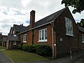 GOC Barley 043 Barkway VA Church of England First School (9047296205).jpg 4,288 × 3,216; 4.02 MB
-
 GOC Barley 045 Barkway village sign (9049533446).jpg 4,288 × 3,216; 4.63 MB
-
 GOC Barley 049 The Gables, Barkway (9049535670).jpg 3,135 × 2,358; 3.2 MB
-
 GOC Barley 050 Old Forge, Barkway (9057595600).jpg 4,288 × 3,216; 4.25 MB
-
 GOC Barley 051 47 and 49 High Street, Barkway (9055375357).jpg 3,577 × 2,680; 4.28 MB
-
 GOC Barley 052 Building in Barkway (9055378675).jpg 3,645 × 2,736; 3.49 MB
-
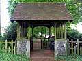 GOC Barley 053 Lych gate, Church of St Mary Magdelene, Barkway (9057604874).jpg 3,803 × 2,857; 3.02 MB
-
 GOC Barley 057 Manor Farm House, Barkway (9064021919).jpg 2,858 × 2,144; 1.78 MB
-
 GOC Barley 064 Telecommunication mast (9075327650).jpg 4,288 × 3,216; 4.62 MB
-
 Graveyard, St Mary Magdalene, Barkway - geograph.org.uk - 3777946.jpg 4,320 × 3,240; 5.41 MB
-
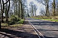 Heading for Barkway on the B1368 - geograph.org.uk - 2869162.jpg 640 × 425; 115 KB
-
 High Street, Barkway - geograph.org.uk - 4738633.jpg 640 × 480; 131 KB
-
 High Street, Barkway - geograph.org.uk - 5881361.jpg 1,600 × 1,200; 359 KB
-
 High Street, Barkway - geograph.org.uk - 5881365.jpg 1,600 × 1,200; 254 KB
-
 Land acquired for housing, Barkway - geograph.org.uk - 5881356.jpg 1,600 × 1,053; 290 KB
-
 London Road entering Barkway - geograph.org.uk - 6216066.jpg 1,864 × 1,188; 1.79 MB
-
 Mast near to Barkway - geograph.org.uk - 3446092.jpg 4,320 × 3,240; 3.74 MB
-
 Newsells Farm - geograph.org.uk - 5881265.jpg 1,600 × 1,200; 478 KB
-
 Newsells Farm - geograph.org.uk - 5881320.jpg 1,600 × 1,200; 398 KB
-
 Newsells war memorial - geograph.org.uk - 5881316.jpg 1,600 × 1,240; 662 KB
-
 Not the footpath - geograph.org.uk - 4210266.jpg 1,600 × 1,170; 680 KB
-
 Odd sign at Newsells Park stud - geograph.org.uk - 4210268.jpg 1,600 × 1,200; 487 KB
-
 Old Forge, Barkway 1 2020-09-02.jpg 3,936 × 1,640; 2.49 MB
-
 Old Forge, Barkway 2 2020-09-02.jpg 3,873 × 2,179; 3.74 MB
-
 Old milestone in autumn leaves - geograph.org.uk - 3777948.jpg 4,320 × 3,240; 6.84 MB
-
 Old Toll House by High Street, Barkway (geograph 6115066).jpg 640 × 490; 123 KB
-
 Park Farm, Nuthampstead - geograph.org.uk - 5462096.jpg 3,264 × 2,448; 3.41 MB
-
 Permissive path at Newells Farm Stud - geograph.org.uk - 4210277.jpg 1,600 × 1,200; 663 KB
-
 Pink house on High Street, Barkway - geograph.org.uk - 5586224.jpg 2,048 × 1,536; 1.49 MB
-
 Public footpath near Barkway - geograph.org.uk - 5878929.jpg 1,600 × 1,200; 603 KB
-
 Radio mast, Barkway - geograph.org.uk - 4738630.jpg 480 × 640; 99 KB
-
 Restricted byway to Barkway - geograph.org.uk - 5878944.jpg 1,600 × 1,284; 598 KB
-
 Road to Newsells - geograph.org.uk - 4738623.jpg 640 × 480; 157 KB
-
 Short permissive path - geograph.org.uk - 5878954.jpg 1,600 × 1,197; 501 KB
-
 Solar farm near Barkway - geograph.org.uk - 5878948.jpg 1,600 × 1,183; 459 KB
-
 St Mary Magdalene, Barkway - geograph.org.uk - 3777945.jpg 4,320 × 3,240; 3.47 MB
-
 St Mary Magdalene, Barkway - Monument - geograph.org.uk - 2294515.jpg 730 × 1,000; 141 KB
-
 St Mary Magdalene, Barkway - Monument detail - geograph.org.uk - 2294517.jpg 1,000 × 666; 152 KB
-
-
-

-
 Tesla Roadster - geograph.org.uk - 5879029.jpg 1,600 × 1,190; 468 KB
-
 Thatched cottage, Barkway (geograph 5073289).jpg 1,126 × 1,600; 609 KB
-
 Thatched house, Barkway - geograph.org.uk - 5073277.jpg 1,600 × 1,200; 488 KB
-

-
 The centre of Barkway - geograph.org.uk - 5586223.jpg 2,048 × 1,536; 1.28 MB
-
 The Coach House, Barkway 2020-09-02.jpg 1,673 × 1,673; 992 KB
-
 The Tally Ho pub, Barkway - geograph.org.uk - 3777938.jpg 4,320 × 3,240; 5.01 MB
-
 The Tally Ho pub, Barkway - geograph.org.uk - 5586222.jpg 1,930 × 1,362; 713 KB
-
 Track to Newsells - geograph.org.uk - 5881262.jpg 1,600 × 1,200; 371 KB
-
 Track to Newsells - geograph.org.uk - 5881301.jpg 1,200 × 1,600; 431 KB
-
 Valley Barn, Newells Park Stud - geograph.org.uk - 4210275.jpg 1,600 × 1,200; 704 KB
-
 War memorial, Barkway - geograph.org.uk - 5881358.jpg 1,242 × 1,600; 496 KB
-
 Your guess is as good as mine - geograph.org.uk - 4210272.jpg 1,600 × 1,200; 803 KB
-
 Communications tower near Reed - geograph.org.uk - 268986.jpg 640 × 480; 35 KB
-
 Earls Wood - geograph.org.uk - 502014.jpg 640 × 427; 157 KB
-
 MOD Mast - geograph.org.uk - 48974.jpg 640 × 427; 34 KB
-

-
 Sheepwash Grove, Nuthampstead - geograph.org.uk - 494233.jpg 640 × 480; 99 KB
-


.jpg)
.jpg)
.jpg)
.jpg)
.jpg)
.jpg)
.jpg)
.jpg)
.jpg)
.jpg)
.jpg)
.jpg)


.jpg)


.jpg)


