Category:Barden, Craven
Jump to navigation
Jump to search
civil parish in the Craven district of North Yorkshire, England  | |||||
| Upload media | |||||
| Instance of | |||||
|---|---|---|---|---|---|
| Location | Craven, North Yorkshire, Yorkshire and the Humber, England | ||||
| Different from | |||||
 | |||||
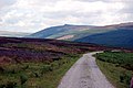
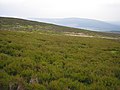
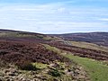
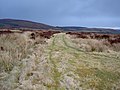
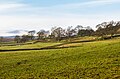
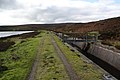
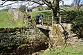
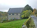
English: Barden is a village and civil parish in the Craven district of North Yorkshire, England. The village is by the River Wharfe and is in Wharfedale in the Yorkshire Dales. The parish includes Barden Fell. Above the village Barden Moor has been access land since the 1970s, and is popular with walkers, having two scenic 19th century reservoirs.
Subcategories
This category has the following 9 subcategories, out of 9 total.
B
- Barden Aqueduct Bridge (20 F)
- Barden Bridge (38 F)
- Barden Tower (35 F)
G
- Grey Mare Stone (3 F)
H
- Howgill, North Yorkshire (7 F)
P
- Priest's House, Barden (3 F)
S
- The Strid (57 F)
U
- Upper Barden Reservoir (11 F)
V
Media in category "Barden, Craven"
The following 200 files are in this category, out of 541 total.
(previous page) (next page)-
 A "high" footpath - geograph.org.uk - 1835061.jpg 4,592 × 3,056; 4.91 MB
-
 A footbridge over Posforth Gill - geograph.org.uk - 2509631.jpg 4,592 × 3,056; 7.45 MB
-
 A good path to Lord's Seat - geograph.org.uk - 1761975.jpg 4,592 × 3,056; 2.91 MB
-
 A grouse butt near Folly Top - geograph.org.uk - 1772833.jpg 4,592 × 3,056; 3.3 MB
-
 A silver birch with Simon's Seat beyond - geograph.org.uk - 1822032.jpg 4,592 × 3,056; 4.52 MB
-
 A View from Simon's Seat - geograph.org.uk - 2562531.jpg 4,320 × 3,240; 4.32 MB
-
 A Wharfedale view - geograph.org.uk - 3155086.jpg 3,264 × 2,448; 1.91 MB
-
 A wind shattered tree - geograph.org.uk - 1835136.jpg 4,592 × 3,056; 6.14 MB
-
 Above Howgill - geograph.org.uk - 5154765.jpg 1,920 × 1,280; 513 KB
-
 Above Howgill - geograph.org.uk - 5154948.jpg 1,920 × 1,280; 534 KB
-
 Above the River Wharfe - geograph.org.uk - 5651845.jpg 662 × 1,000; 819 KB
-
 Access Lane to Howgill - geograph.org.uk - 2558262.jpg 4,320 × 3,240; 5.12 MB
-
 Across the River - geograph.org.uk - 3261777.jpg 3,008 × 2,000; 718 KB
-
 Across the Wharfe - geograph.org.uk - 3820350.jpg 3,240 × 3,508; 1.47 MB
-
 Across the Wharfe - geograph.org.uk - 5357364.jpg 2,048 × 1,536; 837 KB
-
 Across the Wharfe towards Low Hall - geograph.org.uk - 3820331.jpg 4,320 × 2,862; 1.85 MB
-
 Air Shaft at Hare Head Side - geograph.org.uk - 4080573.jpg 1,600 × 1,064; 1.03 MB
-
 Air shaft in field on NW side of road to Barden - geograph.org.uk - 5971786.jpg 1,024 × 683; 139 KB
-
 Alongside the River Wharfe - geograph.org.uk - 5651848.jpg 1,000 × 662; 756 KB
-
 An old barn at High Laithe with Simon's Seat beyond - geograph.org.uk - 1772472.jpg 4,592 × 3,056; 3.22 MB
-
 An unnamed beck but a position fix nevertheless - geograph.org.uk - 1772820.jpg 4,592 × 3,056; 4.25 MB
-
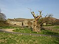
 Ancient Apple Tree - geograph.org.uk - 5154961.jpg 1,920 × 1,280; 544 KB
-
 Another of many grouse butts near Folly Top - geograph.org.uk - 1772837.jpg 2,816 × 2,112; 3.16 MB
-
 Anyone any idea what these are for^ - geograph.org.uk - 5354045.jpg 640 × 427; 477 KB
-
 Approaching Little Simon's Seat - geograph.org.uk - 2562588.jpg 4,320 × 3,240; 3.02 MB
-
 Approaching Lord's Seat - geograph.org.uk - 2562574.jpg 4,320 × 3,240; 3.97 MB
-
 Aqueduct - geograph.org.uk - 5154832.jpg 1,920 × 1,280; 559 KB
-
 Aqueduct over River Wharfe - geograph.org.uk - 5625366.jpg 1,500 × 1,125; 2.15 MB
-
 Aqueduct, Green Thorn Hill - geograph.org.uk - 5358445.jpg 1,271 × 760; 302 KB
-
 B6160 at Intake Plantation - geograph.org.uk - 5417879.jpg 640 × 480; 67 KB
-
 B6160 near Hole House - geograph.org.uk - 5417887.jpg 640 × 481; 90 KB
-
 B6160 near Low House - geograph.org.uk - 5417892.jpg 640 × 481; 76 KB
-
 B6160 north of Barden Tower - geograph.org.uk - 1554691.jpg 480 × 640; 103 KB
-
 B6160 The Scale - geograph.org.uk - 5417896.jpg 640 × 481; 52 KB
-
 Barden Beck - geograph.org.uk - 3169898.jpg 3,872 × 2,592; 6.36 MB
-
 Barden Beck - geograph.org.uk - 3254398.jpg 4,608 × 3,072; 2.88 MB
-
 Barden Broad Park - geograph.org.uk - 3254363.jpg 4,608 × 3,072; 1.65 MB
-
 Barden Broad Park - geograph.org.uk - 3254367.jpg 4,608 × 3,072; 1.63 MB
-
 Barden Broad Park - geograph.org.uk - 3254456.jpg 3,008 × 2,000; 760 KB
-
 Barden Broad Park - geograph.org.uk - 3254470.jpg 4,608 × 3,072; 1.51 MB
-
 Barden Broad Park - geograph.org.uk - 4130418.jpg 1,600 × 1,112; 365 KB
-
 Barden Fell - geograph.org.uk - 4130433.jpg 1,598 × 1,071; 285 KB
-
 Barden Moor - geograph.org.uk - 193269.jpg 640 × 480; 112 KB
-
 Barden Moor - geograph.org.uk - 3254378.jpg 4,608 × 3,072; 1.47 MB
-
 Barden Road near Eller Carr Hill - geograph.org.uk - 6103953.jpg 1,024 × 683; 294 KB
-
 Barden Scale - River Wharfe - geograph.org.uk - 1160518.jpg 640 × 428; 93 KB
-
 Barden, Craven.jpg 640 × 480; 78 KB
-
 Beech near the Old Oak Seat - geograph.org.uk - 5356735.jpg 2,035 × 3,039; 1.41 MB
-
 Benchmark on stone in wall of Barden Road - geograph.org.uk - 6103885.jpg 1,024 × 683; 298 KB
-
 Bighead - geograph.org.uk - 2630382.jpg 1,600 × 1,200; 456 KB
-
 Boundary Stone beside Stone Wall - geograph.org.uk - 3947473.jpg 4,000 × 3,000; 3.14 MB
-
 Boundary stone on Barden Moor - geograph.org.uk - 4364537.jpg 3,776 × 2,520; 4.09 MB
-
 Boundary stone on Barden Moor - geograph.org.uk - 4365771.jpg 3,776 × 2,520; 4.23 MB
-
 Boundary stone on Barden Moor - geograph.org.uk - 4365778.jpg 3,776 × 2,520; 3.9 MB
-
 Boundary Stone, Embsay Moor - geograph.org.uk - 5354002.jpg 640 × 427; 128 KB
-
 Boundary wall, Laund Pasture Plantation - geograph.org.uk - 5354064.jpg 640 × 427; 121 KB
-
 Brass Castle - geograph.org.uk - 2251084.jpg 1,600 × 1,200; 511 KB
-
 Bridleway at Hare Head Side - geograph.org.uk - 2843050.jpg 3,264 × 2,448; 1.93 MB
-
 Bridleway on Hare Head Side - geograph.org.uk - 5826004.jpg 5,184 × 3,456; 6.07 MB
-
 Broad Park Bridge - geograph.org.uk - 3947452.jpg 4,000 × 3,000; 3.7 MB
-
 Bull Coppy Wood - geograph.org.uk - 5240259.jpg 1,520 × 1,887; 864 KB
-
 Cabins at Haugh Mill - geograph.org.uk - 5864939.jpg 1,600 × 1,200; 581 KB
-
 Cairn indicating the route of a path through the heather - geograph.org.uk - 3947470.jpg 4,000 × 3,000; 2.73 MB
-
 Canoeists on the River Wharfe - geograph.org.uk - 3188142.jpg 3,008 × 2,000; 5.03 MB
-
 Caravan to let, Haugh Mill Farm - geograph.org.uk - 4716716.jpg 3,776 × 2,520; 4.35 MB
-
 Carncliff Crag - geograph.org.uk - 2935091.jpg 3,872 × 2,592; 4.79 MB
-
 Carncliff Crag from Carncliff Top - geograph.org.uk - 2508953.jpg 4,592 × 3,056; 6.53 MB
-
 Carncliff Top - geograph.org.uk - 2508860.jpg 4,592 × 3,056; 7.1 MB
-
 Carncliff Top from Carncliff Crag - geograph.org.uk - 2508818.jpg 3,041 × 2,583; 7.66 MB
-
 Channel beside Upper Barden Reservoir - geograph.org.uk - 2347701.jpg 4,320 × 3,240; 5.65 MB
-
 Civy Sike - geograph.org.uk - 1773116.jpg 1,600 × 1,200; 563 KB
-
 Civy Sike - geograph.org.uk - 1773146.jpg 1,600 × 1,200; 404 KB
-
 Cloven Crag - geograph.org.uk - 2508600.jpg 4,592 × 3,056; 5.59 MB
-
 Clover flowers - geograph.org.uk - 3686404.jpg 640 × 480; 245 KB
-
 Cony Warren - geograph.org.uk - 2558272.jpg 4,320 × 3,240; 3.38 MB
-
 Dalehead Farm - geograph.org.uk - 1050500.jpg 640 × 417; 79 KB
-
 Dales Way footpath near Gamsworth - geograph.org.uk - 1474599.jpg 640 × 480; 156 KB
-
 Dales Way near Holme House - geograph.org.uk - 5357762.jpg 3,061 × 1,969; 1.45 MB
-

-

-

-

-

-

-
-

-

-

-

-

-

-

-

-

-

-

-

-

-

-

-

-

-

-

-

-

-

-

-
 Descent into The Valley of Desolation - geograph.org.uk - 5862504.jpg 1,600 × 1,063; 539 KB
-
 Dipper by the Wharfe - geograph.org.uk - 5238674.jpg 1,757 × 1,059; 667 KB
-
 Discarded shotgun cartridge - geograph.org.uk - 1820454.jpg 2,272 × 1,704; 1.1 MB
-
 Eastwood Head Farm - geograph.org.uk - 1050492.jpg 640 × 453; 87 KB
-

-
 Estate Vehicles - geograph.org.uk - 5154955.jpg 1,920 × 1,280; 532 KB
-
 Evidence that the river in spate is far less placid - geograph.org.uk - 1762023.jpg 4,592 × 3,056; 4.89 MB
-
 Excavations and waterworks by Upper Barden Reservoir - geograph.org.uk - 3172984.jpg 3,872 × 2,592; 4.61 MB
-
 Farmland around Barden Road, towards Black Hill - geograph.org.uk - 5667461.jpg 1,600 × 1,200; 444 KB
-
 Farmland near Barden Tower, towards the River Wharfe - geograph.org.uk - 5667455.jpg 1,600 × 1,200; 480 KB
-
 Field at Barden - geograph.org.uk - 2024041.jpg 640 × 480; 179 KB
-
 Fields above the River Wharfe - geograph.org.uk - 5651219.jpg 1,000 × 662; 833 KB
-
 Fields and moorland above the Wharfe - geograph.org.uk - 5356822.jpg 2,232 × 1,260; 665 KB
-
 Fields in the Wharfe valley - geograph.org.uk - 5357933.jpg 3,072 × 2,048; 1.04 MB
-
 Flooded depression - geograph.org.uk - 5651871.jpg 1,000 × 662; 607 KB
-
 Fly Fishing in the River Wharfe - geograph.org.uk - 3579381.jpg 3,428 × 2,673; 3.4 MB
-
 Folly Top - geograph.org.uk - 2381554.jpg 4,320 × 3,240; 4.8 MB
-
 Footbridge by Upper Barden Reservoir - geograph.org.uk - 2347672.jpg 4,320 × 3,240; 5.13 MB
-
 Footbridge by Upper Barden Reservoir - geograph.org.uk - 3171936.jpg 3,872 × 2,592; 4.11 MB
-
 Footbridge in Strid Wood - geograph.org.uk - 3686400.jpg 640 × 480; 148 KB
-
 Footbridge over Blands Beck - geograph.org.uk - 2936105.jpg 3,872 × 2,592; 7.05 MB
-
 Footbridge over Fir Beck - geograph.org.uk - 3509631.jpg 4,320 × 3,240; 5.75 MB
-
 Footbridge over Posforth Gill - geograph.org.uk - 2986448.jpg 4,320 × 3,240; 5.05 MB
-
 Footpath - geograph.org.uk - 5649152.jpg 1,000 × 662; 888 KB
-
 Footpath above The Strid - geograph.org.uk - 5648120.jpg 1,000 × 662; 1.06 MB
-
 Footpath following the wall of Lower Fell Plantation - geograph.org.uk - 5121863.jpg 1,600 × 1,200; 401 KB
-
 Footpath gate above Dalehead Farm - geograph.org.uk - 5227757.jpg 5,184 × 3,888; 4.91 MB
-
 Footpath junction above Barden Brook - geograph.org.uk - 3167837.jpg 3,872 × 2,592; 5.1 MB
-
 Footpath junction by Upper Barden Reservoir - geograph.org.uk - 3171820.jpg 3,872 × 2,592; 5.1 MB
-
 Footpath through Strid Wood - geograph.org.uk - 5651159.jpg 662 × 1,000; 1.13 MB
-
 Ford on Barden Beck - geograph.org.uk - 5095153.jpg 1,440 × 960; 2 MB
-
 Ford on Long Band Flat - geograph.org.uk - 5095154.jpg 1,440 × 960; 2.22 MB
-
 Former Methodist Chapel - geograph.org.uk - 1554686.jpg 640 × 480; 79 KB
-
 Former Methodist Chapel - geograph.org.uk - 1554688.jpg 640 × 480; 84 KB
-
 Former Methodist Chapel, Porch - geograph.org.uk - 1554689.jpg 480 × 640; 110 KB
-
 Gamsworth - geograph.org.uk - 2437739.jpg 1,600 × 1,063; 361 KB
-
 Gamsworth - geograph.org.uk - 2986204.jpg 4,320 × 3,240; 5.01 MB
-
 Gamsworth Farm - geograph.org.uk - 1050461.jpg 640 × 426; 84 KB
-
 Gamsworth Farm, Wharfedale - geograph.org.uk - 3759549.jpg 1,024 × 681; 303 KB
-
 Gamsworth farm. - geograph.org.uk - 4709611.jpg 640 × 480; 38 KB
-
 Gate above the Valley of Desolation - geograph.org.uk - 2933952.jpg 3,872 × 2,592; 7.06 MB
-
 Gate and wall above the Wharfe - geograph.org.uk - 5239732.jpg 3,072 × 2,048; 1.43 MB
-
 Gate on Hare Head Side - geograph.org.uk - 3167795.jpg 3,872 × 2,592; 5.11 MB
-
 Gate on Hare Head Side Revisited - geograph.org.uk - 5825997.jpg 5,184 × 3,456; 6.31 MB
-
 Gateway near Broad Park House - geograph.org.uk - 3169816.jpg 3,872 × 2,592; 4.29 MB
-
 Gateway, Strid Wood - geograph.org.uk - 5356761.jpg 3,072 × 2,048; 1.49 MB
-
 Geese - geograph.org.uk - 1772978.jpg 1,024 × 681; 87 KB
-
 Gill Beck - geograph.org.uk - 2381122.jpg 4,320 × 3,240; 7.03 MB
-
 Gill Beck Ford - geograph.org.uk - 5095158.jpg 1,440 × 960; 2.09 MB
-
 Gill Beck from the bridge - geograph.org.uk - 1772444.jpg 3,056 × 4,592; 5.82 MB
-
 Grazing pastures overlooked by Simon's Seat - geograph.org.uk - 1835021.jpg 4,592 × 3,056; 4.06 MB
-
 Great Agill Beck - geograph.org.uk - 1050517.jpg 640 × 465; 155 KB
-
 Great Agill Beck - geograph.org.uk - 2560214.jpg 4,320 × 3,240; 5.64 MB
-
 Great Agill Beck - geograph.org.uk - 2935026.jpg 3,872 × 2,592; 5.14 MB
-
 Great Agill Beck - geograph.org.uk - 5354066.jpg 640 × 427; 97 KB
-
 Great Agill Beck - geograph.org.uk - 5409634.jpg 640 × 427; 113 KB
-
 Great Agill Bottom - geograph.org.uk - 2509256.jpg 4,592 × 3,056; 5.17 MB
-
 Green Thorn Hill - geograph.org.uk - 5358563.jpg 3,064 × 1,823; 1.36 MB
-
 Grey Dagger Caterpillar - geograph.org.uk - 1472697.jpg 640 × 480; 51 KB
-
 Grouse Butt above Gill Beck - geograph.org.uk - 2381546.jpg 4,320 × 3,240; 5.83 MB
-
 Grouse Butt No 12 on Barden Moor - geograph.org.uk - 3856524.jpg 640 × 480; 50 KB
-
 Grouse food - geograph.org.uk - 2934990.jpg 3,872 × 2,592; 6.44 MB
-
 Grouse sticking its head up - geograph.org.uk - 2935020.jpg 3,872 × 2,592; 4.16 MB
-
 Hare Head Side - geograph.org.uk - 2843043.jpg 3,256 × 1,823; 1.24 MB
-
 Hare Head Side - geograph.org.uk - 3167780.jpg 3,872 × 2,592; 5.11 MB
-
 Harrison's Ford Seat - geograph.org.uk - 4966117.jpg 4,000 × 3,000; 4.4 MB
-
 Harrison's Ford Seat - geograph.org.uk - 5649154.jpg 1,000 × 662; 1,009 KB
-
 Haugh Bridge near Appletreewick - geograph.org.uk - 4168983.jpg 2,668 × 1,997; 3.53 MB
-
 Haugh Mill Farm - geograph.org.uk - 3004414.jpg 2,048 × 1,536; 617 KB
-
 Heather burning on Barden Moor - geograph.org.uk - 1761965.jpg 4,592 × 3,056; 2.94 MB
-
 Heather burning on Barden Moor - geograph.org.uk - 1762004.jpg 4,592 × 3,056; 3.15 MB
-
 Heather moorland on Green Thorn Hill - geograph.org.uk - 5237759.jpg 3,072 × 2,048; 1.84 MB
-
 Holme House Farm - geograph.org.uk - 2932778.jpg 3,872 × 2,592; 4.37 MB
-
 Holme House Farm - geograph.org.uk - 3686437.jpg 640 × 480; 94 KB
-
 Holme House Farm - geograph.org.uk - 5240114.jpg 2,975 × 1,977; 1.59 MB
-
 Holme House Farm - geograph.org.uk - 5240315.jpg 2,048 × 1,536; 749 KB
-
 Holme House, Barden.jpg 6,000 × 4,000; 1.63 MB
-
 House below Sartree Crag - geograph.org.uk - 2932907.jpg 3,872 × 2,592; 3.8 MB
-
 How Beck - geograph.org.uk - 5154769.jpg 1,920 × 1,280; 554 KB
-
 How welcoming^ - geograph.org.uk - 2509032.jpg 4,503 × 2,997; 6.11 MB
-
 Howgill Caravan Site - geograph.org.uk - 4545930.jpg 1,024 × 682; 177 KB
-
 Howgill Lane - geograph.org.uk - 1761414.jpg 4,592 × 3,056; 4.87 MB
-
 Howgill Lane off Stangs Lane - geograph.org.uk - 3759528.jpg 1,024 × 681; 388 KB
-
 Hutchen Gill - geograph.org.uk - 3178253.jpg 3,872 × 2,592; 4.43 MB
-
 Hutchen Gill - geograph.org.uk - 5354013.jpg 640 × 427; 76 KB
-

-
 Improved path southwest of Simons Seat - geograph.org.uk - 5121879.jpg 1,600 × 1,200; 330 KB
-
 Intake Plantation Lay-by - geograph.org.uk - 887525.jpg 640 × 480; 87 KB
-

-
 Lane by the Wharfe - geograph.org.uk - 3000581.jpg 4,000 × 3,000; 6.11 MB
-
-
 Logging in the Intake Plantation - geograph.org.uk - 822910.jpg 640 × 480; 98 KB


_-_geograph.org.uk_-_4176065.jpg)
_-_geograph.org.uk_-_4176076.jpg)
_-_geograph.org.uk_-_4176080.jpg)
_-_geograph.org.uk_-_4176082.jpg)
_-_geograph.org.uk_-_4176084.jpg)
_-_geograph.org.uk_-_4176086.jpg)
_-_geograph.org.uk_-_4176090.jpg)
_-_geograph.org.uk_-_4176094.jpg)
_-_geograph.org.uk_-_4176097.jpg)
_-_geograph.org.uk_-_4176103.jpg)
_-_geograph.org.uk_-_4176371.jpg)
_-_geograph.org.uk_-_4176377.jpg)
_-_geograph.org.uk_-_4176383.jpg)
_-_geograph.org.uk_-_4176386.jpg)
_-_geograph.org.uk_-_4176391.jpg)
_-_geograph.org.uk_-_4176400.jpg)
_-_geograph.org.uk_-_4176410.jpg)
_-_geograph.org.uk_-_4176411.jpg)
_-_geograph.org.uk_-_4176413.jpg)
_-_geograph.org.uk_-_4176427.jpg)
_-_geograph.org.uk_-_4176434.jpg)
_-_geograph.org.uk_-_4176448.jpg)
_-_geograph.org.uk_-_4176449.jpg)
_-_geograph.org.uk_-_4176456.jpg)
_-_geograph.org.uk_-_4176462.jpg)
_-_geograph.org.uk_-_4176464.jpg)
_-_geograph.org.uk_-_4176616.jpg)
_-_geograph.org.uk_-_4178199.jpg)
_-_geograph.org.uk_-_4178220.jpg)


