Category:Bamfurlong, Greater Manchester
Jump to navigation
Jump to search
village in Greater Manchester, England, United Kingdom ,_Bamfurlong_(geograph_2818380).jpg) | |||||
| Upload media | |||||
| Instance of | |||||
|---|---|---|---|---|---|
| Location | Wigan, Greater Manchester, North West England, England | ||||
 | |||||
Media in category "Bamfurlong, Greater Manchester"
The following 36 files are in this category, out of 36 total.
-
 Access - geograph.org.uk - 534487.jpg 640 × 480; 195 KB
-
 Bamfurlong Police Station, Bryn Gates Lane - geograph.org.uk - 5287845.jpg 1,024 × 768; 139 KB
-
 Bamfurlong Post Office (geograph 2818390).jpg 640 × 480; 484 KB
-
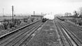 Bamfurlong station - remains, WCML geograph-2714971-by-Ben-Brooksbank.jpg 2,391 × 1,331; 934 KB
-
 Bolton Road Pumps and Substation, Bamfurlong - geograph.org.uk - 5287787.jpg 1,024 × 768; 345 KB
-
 Bolton Road, Bamfurlong (geograph 3387731).jpg 640 × 480; 61 KB
-
 Bryn Hall Pub, Bryn Gates - geograph.org.uk - 5287797.jpg 1,024 × 768; 213 KB
-
 Bryn Hall, Bryn Gates - geograph.org.uk - 3611084.jpg 800 × 451; 183 KB
-
 David's Corner Shop, Bryn Gates - geograph.org.uk - 5826334.jpg 1,024 × 768; 178 KB
-
 David's Shop and Lily Lane - geograph.org.uk - 925310.jpg 640 × 438; 141 KB
-

-
 Farmland North of Bryn Gates Lane, Bamfurlong - geograph.org.uk - 5287855.jpg 1,024 × 768; 217 KB
-
 Footpath between Bryn Hall Farm and Bamfurlong - geograph.org.uk - 5289625.jpg 1,024 × 768; 211 KB
-
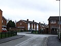
 Housing, newer and older - geograph.org.uk - 3611087.jpg 800 × 451; 170 KB
-
-
 Land Off Bryn Gates Land, Bamfurlong - geograph.org.uk - 5287841.jpg 1,024 × 768; 191 KB
-
 Lily Lane (A58), Bamfurlong (geograph 2818380).jpg 640 × 427; 342 KB
-
 Lily Lane canal bridge at Bamfurlong - geograph.org.uk - 2097093.jpg 1,600 × 1,198; 502 KB
-
 Lily Lane, A58, Bamfurlong - geograph.org.uk - 3611092.jpg 800 × 451; 180 KB
-
 Lily Lane, Bamfurlong (A58) (geograph 3334352).jpg 640 × 480; 63 KB
-
 Methodist Church, Bamfurlong - geograph.org.uk - 3334350.jpg 640 × 480; 60 KB
-
 Misty Morning - geograph.org.uk - 2091836.jpg 800 × 600; 25 KB
-
 Old Pub near Bryn Gates - geograph.org.uk - 1427294.jpg 640 × 480; 82 KB
-
 Path between Bryn Hall Farm and Bamfurlong - geograph.org.uk - 5289641.jpg 1,024 × 768; 240 KB
-
 Pond and path - geograph.org.uk - 922552.jpg 640 × 429; 215 KB
-
 Pond North of Enid Place, Bamfurlong - geograph.org.uk - 5289652.jpg 818 × 1,024; 361 KB
-
 Public Footpath - geograph.org.uk - 922547.jpg 640 × 426; 168 KB
-
 Public Footpath - geograph.org.uk - 922555.jpg 640 × 426; 117 KB
-
 Railway heading north, Bamfurlong - geograph.org.uk - 3334353.jpg 640 × 480; 81 KB
-
 Rear of Winstanley Road, Bamfurlong - geograph.org.uk - 5289647.jpg 1,024 × 771; 129 KB
-
 Sandhills alongside Aye Brook - geograph.org.uk - 2091764.jpg 1,000 × 751; 287 KB
-
 Terraced houses, Bamfurlong - geograph.org.uk - 3611098.jpg 800 × 451; 195 KB
-
 Tin tabernacle - geograph.org.uk - 83145.jpg 640 × 426; 86 KB
-

-
 West Coast Main Line from Lily lane road bridge - geograph.org.uk - 2044725.jpg 1,600 × 1,092; 352 KB
-
 Want to run a pub^ - geograph.org.uk - 83141.jpg 640 × 421; 104 KB


.jpg)


.jpg)


_(geograph_3334352).jpg)


