Category:Ballona Creek
Jump to navigation
Jump to search
stream in Los Angeles County, California, United States of America  | |||||
| Upload media | |||||
| Instance of | |||||
|---|---|---|---|---|---|
| Location | Los Angeles County, California, Pacific States Region | ||||
| Length |
| ||||
| Mouth of the watercourse | |||||
 | |||||
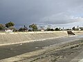
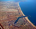
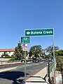
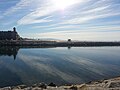
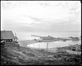
English: The Ballona Creek — a 9 miles (14 km) long waterway in the west-central and Westside regions of Los Angeles County, Southern California.
- The creek drains the northwestern Los Angeles Basin to its mouth on Santa Monica Bay.
- The watershed extends from the Santa Monica Mountains on the north, the Harbor Freeway (110) on the east, and the Baldwin Hills range on the south. It flows through west-central Los Angeles, Culver City, the Del Rey district, and Playa Vista — with its estuary and mouth between Marina del Rey and Playa del Rey at the Pacific Ocean.
Subcategories
This category has the following 3 subcategories, out of 3 total.
Media in category "Ballona Creek"
The following 101 files are in this category, out of 101 total.
-
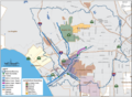 Ballona watershed.png 839 × 616; 299 KB
-
 La Ballona KAP 7.jpg 3,072 × 2,048; 2.35 MB
-
 PlayadelRey-1902.jpg 1,153 × 400; 55 KB
-
-
-
 Above ground origin point of Ballona Creek near Venice Boulevard and Cochran Avenue.jpg 4,032 × 3,024; 4.98 MB
-
 Adams Channel enters Ballona Creek.jpg 3,024 × 4,032; 2.42 MB
-
 Along Ballona Creek - Culver City - Los Angeles - California - USA (46257214325).jpg 3,648 × 2,736; 2.7 MB
-
 Ballona Creek 2023 March 01.jpg 3,024 × 3,024; 2.93 MB
-
 Ballona Creek 2023 March 02.jpg 4,032 × 3,024; 4.56 MB
-
 Ballona Creek 2023 March 03.jpg 2,330 × 2,330; 2.52 MB
-
 Ballona Creek Bike Path 2013-12-25 11.16.00.jpg 3,264 × 2,448; 2.88 MB
-
 Ballona Creek channel with palm trees silhouetted at sunrise.jpg 1,536 × 2,048; 610 KB
-
 Ballona Creek Channelization - After, Annotated.jpg 5,120 × 3,738; 13.01 MB
-
 Ballona Creek Channelization - After.jpg 5,120 × 3,738; 12.98 MB
-
 Ballona Creek Channelization - Before, Annotated.jpg 5,120 × 3,738; 12.59 MB
-
 Ballona Creek Channelization Titled - Before.jpg 5,120 × 3,738; 12.55 MB
-
 Ballona Creek looking east toward Playa Vista.jpg 3,468 × 1,951; 2.85 MB
-
 Ballona Creek MDR.jpg 1,150 × 647; 262 KB
-
 Ballona Creek Mid-City Greenway.jpg 3,811 × 2,547; 3.05 MB
-
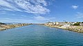 Ballona Creek near the river mouth.jpg 4,032 × 2,268; 2.38 MB
-
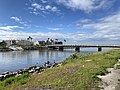
 Ballona Creek Pedestrian Bridge (2004), Culver City.jpg 3,511 × 2,788; 3.65 MB
-
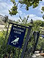 Ballona Creek sign with bird silhouette.jpg 3,024 × 4,032; 4.85 MB
-
 Ballona Creek tide gate.jpg 4,032 × 3,024; 4.15 MB
-
 Ballona creek vegetation.jpg 4,032 × 3,024; 4.29 MB
-
 Ballona Creek Washington Boulevard crossing.jpg 3,024 × 4,032; 3.57 MB
-
 Ballona Creek west of Lincoln Boulevard.jpg 3,024 × 4,032; 3.47 MB
-
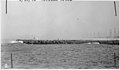
 Ballona Creek. Hole Sta. 13, south levee. - NARA - 295297.jpg 3,000 × 1,751; 494 KB
-
 Ballona Creek. View of north levee from south levee. - NARA - 295298.jpg 3,000 × 1,755; 348 KB
-
 Ballona Creek. View of north levee from south levee. - NARA - 295299.jpg 3,000 × 1,753; 330 KB
-
 Ballona Creek. View of north levee from south levee. - NARA - 295299.tif 3,000 × 1,753; 5.02 MB
-
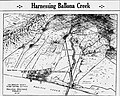 Ballona Drainage Project September 1934.jpg 1,655 × 1,324; 846 KB
-
 Ballona Greenway.jpg 1,536 × 2,048; 1.49 MB
-
 Ballona historic watershed 1900.jpg 750 × 750; 323 KB
-
 Ballona Lagoon Marine Preserve Trail.jpg 4,032 × 3,024; 2.46 MB
-
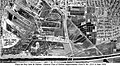
 Ballona Wetlands and Howard Hughes' Land Farmers October 01, 1962.jpg 3,830 × 2,363; 5.83 MB
-
 Ballona Wetlands.jpg 3,208 × 2,672; 2.07 MB
-
 Ballona-Centinela.jpg 2,048 × 1,010; 709 KB
-
 Ballonacreekmidcityfrombaldwinhills.png 898 × 1,274; 1.67 MB
-
 BCR 52 survey marker United States Army Corps of Engineers.jpg 2,688 × 4,032; 3.88 MB
-
 Benedict Canyon Creek Channel.jpg 3,024 × 4,032; 4.88 MB
-
 Burnside Avenue crossing of Ballona Creek.jpg 4,032 × 3,024; 2.84 MB
-
 CLEANUP of 1942 Ballona Creek. View of north levee from south levee. - NARA - 295299.jpg 2,869 × 1,483; 1.04 MB
-
 Confluence of Sepulveda Creek and Ballona Creek.jpg 1,701 × 1,701; 959 KB
-
 East end of Ballona Creek.jpg 4,032 × 3,024; 2.7 MB
-
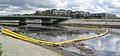 Floating barrier on Ballona Creek.jpg 4,082 × 1,902; 2.34 MB
-
-

-
 Guashna village recognition, Tongva populated place, Southern California.jpg 3,024 × 4,032; 5.57 MB
-
 Hauser Boulevard crossing of Ballona Creek.jpg 3,283 × 2,189; 2.93 MB
-
 Interceptor Original 007.jpg 4,032 × 3,024; 2.64 MB
-

-
 Los Angeles westlos batch upload 2023-03-27.jpg 4,032 × 3,024; 2.62 MB
-
 Los Angeles westlos batch upload 2023-03-28.jpg 4,032 × 3,024; 2.85 MB
-
 Marina Del Rey Looking South.jpg 2,216 × 1,808; 889 KB
-
 MarinaDelRey-1890.jpg 800 × 479; 103 KB
-
 Mid-City Neighborhood planter decoration at Burnside Avenue Crossing of Ballona Creek.jpg 4,032 × 3,024; 5.74 MB
-
 Milton Green Street Park access to Ballona Creek bike path.jpg 3,024 × 4,032; 4.95 MB
-
 Multilingual sign warning of contaminated fish in Ballona Creek.jpg 4,032 × 3,024; 4.7 MB
-
 Ocean Drive Gate, Ballona Creek Bike Path.jpg 4,032 × 3,024; 2.79 MB
-
 Oil wells on what is now Marina Peninsula neighborhood 1942 (cropped).jpg 1,063 × 796; 330 KB
-
 Oil wells on what is now Marina Peninsula neighborhood 1942.jpg 1,064 × 1,064; 365 KB
-
 Our Sea Side Resorts Tell s Retreat.jpg 1,068 × 2,806; 334 KB
-
 Pacific Avenue Bridge, Marina Del Rey South Jetty to Playa Del Rey.jpg 4,032 × 3,024; 3.72 MB
-
 Pacific Electric Santa Monica Air Line abandoned railway bridge.jpg 4,032 × 3,024; 3.54 MB
-
 Park to Playa Trail directional sign to Ballona Creek.jpg 3,024 × 4,032; 2.57 MB
-
 Park to Playa Trail map.jpg 3,024 × 4,032; 3.97 MB
-
 Playa del Rey beach from Ballona Creek Bike Path 2013-12-25 11.16.45.jpg 3,264 × 2,448; 2.25 MB
-
 Playa del rey beach from Ballona Creek Bike Path 2013-12-25 11.17.26.jpg 3,264 × 2,448; 2.03 MB
-
-
 Playa del Rey Motordrome Location on USGS Map CA Venice 301113 1934 24000 geo.jpg 5,120 × 3,745; 12.02 MB
-
 Playa del Rey Motordrome Location Relative to Channelized Ballona Creek.jpg 5,120 × 3,745; 13.64 MB
-
 Playa del Rey Motordrome Precise Location, Railroad Tracks.jpg 5,120 × 3,321; 9.21 MB
-
 PlayadelRey-1907.jpg 828 × 400; 61 KB
-
 Port Ballona advertisement 1887.jpg 947 × 704; 261 KB
-
 Pylons from former rail bridge of Redondo Beach via Playa del Rey.jpg 4,032 × 3,024; 2.19 MB
-
 Rancho la Ballona diseños.jpg 1,290 × 745; 374 KB
-
 Sepulveda Creek entering Ballona Creek 2023 March 01.jpg 4,032 × 3,024; 3.92 MB
-
 Sepulveda Creek entering Ballona Creek 2023 March 02.jpg 4,032 × 3,024; 4.93 MB
-
 Site of General Plan of Harbor Improvement Playa del Rey Inlet & Harbor, May 1, 1960.jpg 5,714 × 3,124; 9.63 MB
-
 Stream in Brookside Los Angeles.jpg 3,210 × 2,382; 3.41 MB
-
 Street vendor along Culver Boulevard Median, crossing Sepulveda Creek.jpg 2,370 × 2,396; 1.52 MB
-
 The Duck Pond at Playa del Rey (cropped).jpg 1,839 × 1,337; 2.28 MB
-
 The Duck Pond at Playa del Rey.jpg 2,560 × 1,858; 3.8 MB
-
 Three bridges over Ballona Creek.jpg 3,024 × 4,032; 3.24 MB
-
 Thurman Avenue crossing of Ballona Creek.jpg 4,032 × 3,024; 2.74 MB
-
 Unchannelized Ballona Creek February 27, 1935.jpg 5,120 × 4,046; 14.97 MB
-
 Venice quadrangle topo USGS 1923.jpg 2,777 × 1,561; 2.05 MB
-

-

-

-

-
-
 Ballona Creek. Crack at station 11-50 south levee. - NARA - 295302.jpg 1,751 × 3,000; 400 KB
-
 Ballona Creek. Crack in south levee at Sta. 12-10. - NARA - 295300.jpg 1,754 × 3,000; 473 KB
-

-
-
 Watersheds of Los Angeles County, California.jpg 1,594 × 1,197; 672 KB
-
 West Adams storm drain construction 1926 Los Angeles Post Record.jpg 4,173 × 3,545; 5.58 MB
-
 Речка Баллона Крик - panoramio.jpg 3,648 × 2,736; 5.01 MB
-


.jpg)


,_Culver_City.jpg)


.jpg)


.jpg)


.jpg)


),_sheet_25_(1437).jpg)