Category:Balgreen tram stop
Jump to navigation
Jump to search
| Object location | | View all coordinates using: OpenStreetMap |
|---|
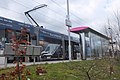
tramp stop in City of Edinburgh, Scotland, UK .jpg) | |||||
| Upload media | |||||
| Instance of | |||||
|---|---|---|---|---|---|
| Location | Edinburgh, City of Edinburgh, Scotland | ||||
| Transport network | |||||
| Connecting line |
| ||||
| Adjacent station |
| ||||
| Replaces | |||||
 | |||||
Media in category "Balgreen tram stop"
The following 9 files are in this category, out of 9 total.
-
 Balgreen tram stop (geograph 3806652).jpg 3,264 × 2,448; 2.73 MB
-
 Tram at the Balgreen stop, Edinburgh (geograph 5712610).jpg 1,600 × 1,066; 387 KB
-
 Balgreen Tram Stop - geograph.org.uk - 5145475.jpg 5,312 × 2,988; 4.69 MB
-
 Balgreen tram stop - geograph.org.uk - 6288741.jpg 1,024 × 683; 249 KB
-

-
 Jenners Depository from Balgreen tram stop - geograph.org.uk - 3806665.jpg 3,264 × 2,448; 3.93 MB
-
 Map of Balgreen tram stop (OSM standard, zoom 16).jpg 531 × 437; 50 KB
-
 Map of Balgreen tram stop (OSM standard, zoom 17).jpg 516 × 434; 39 KB
-
 Tram lines, Balgreen - geograph.org.uk - 6288743.jpg 1,024 × 683; 273 KB
.jpg)


.jpg)
.jpg)
