Category:Bala, Gwynedd
Jump to navigation
Jump to search
Български: 300px|мини|Изглед от главната улица на Бала
Brezhoneg: Ur gêr vihan eo Y Bala e Gwynedd, e-kichen al lenn Tegid en hanternoz Bro-Gembre war an hent A494, etre Dolgellau ha Llangollen. N'eus nemet ur straed vras enni. 80% a dud a ra gantar c'hembraeg.
Cymraeg: Mae'r Bala yn dref fechan yng Ngwynedd (cyn ad-drefnu llywodraeth leol roedd hi yn yr hen Sir Feirionydd); cyfeirnod OS: SH 92515 36708. Does dim ond un stryd fawr yn y dref. Mae'r dref ar yr A494, rhwng Dolgellau (18 milltir i'r de-orllewin) a Llangollen (22 milltir i'r dwyrain).
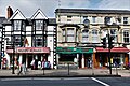
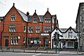
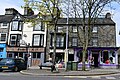
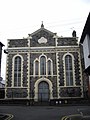
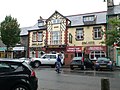
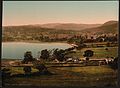
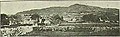
English: Bala (in Welsh, Y Bala) is a market town in Gwynedd, Wales, and formerly an urban district of the historic county of Merionethshire. It lies at the north end of Bala Lake (Llyn Tegid), 17 miles (27 km) north-east of Dolgellau, with a population (2001 census) of 1,980. It is little more than one wide street, Stryd Fawr (Welsh for 'Big Street' but more usually translated as 'High Street'). The main street and its shops can be quite busy in the summer months with many tourists.
Norsk bokmål: Bala er en markedsby i Gwynedd i det nordlige Wales, ved nordenden av Balasjøen, omkring 27 km nordøst for Dolgellau. Befolkningstallet er ca. 1980 (2001). Byen består ikke av så mye mer enn en bred gate, Stryd Fawr (walisisk for « stor gate», på engelsk gjerne kalt «High Street»).
market town and community in Gwynedd, Wales _Mehefin_(June)_2023_01.jpg)  | |||||
| Upload media | |||||
| Instance of | |||||
|---|---|---|---|---|---|
| Located in protected area | |||||
| Location | Gwynedd, Wales | ||||
| Population |
| ||||
| Area |
| ||||
 | |||||
Subcategories
This category has the following 16 subcategories, out of 16 total.
A
- Aerial images of Bala (27 F)
B
- Bala (New) railway station (5 F)
- Bala Town Hall (2 F)
C
- Christ Church, Bala (31 F)
- Coleg y Bala (6 F)
- Cywain Centre (11 F)
E
- English Chapel, Bala (8 F)
G
- Gateway of Rhiwlas Hall (4 F)
R
- River Dee at Bala (3 F)
S
T
Media in category "Bala, Gwynedd"
The following 200 files are in this category, out of 232 total.
(previous page) (next page)-
 11, Arenig Street, Bala.jpg 1,944 × 2,592; 2.7 MB
-
 13, Arenig Street, Bala.jpg 1,944 × 2,592; 2.7 MB
-
 15, Arenig Street, Bala.jpg 1,813 × 2,434; 2.66 MB
-
 5, Arenig Street., Bala.jpg 1,661 × 2,343; 1.78 MB
-
 A building site in Stryd y Fron - geograph.org.uk - 478751.jpg 640 × 372; 61 KB
-
 A campsite in Bala - geograph.org.uk - 1237648.jpg 640 × 480; 83 KB
-
 A horse (Hughes, Bala) (8491973602).jpg 595 × 428; 60 KB
-
 A view along Llyn Tegid-Lake Bala. - geograph.org.uk - 4820124.jpg 640 × 480; 116 KB
-
 A4212 north of Bala - geograph.org.uk - 5306785.jpg 640 × 480; 127 KB
-
 Ackroyd's, Bala - geograph.org.uk - 2030155.jpg 640 × 429; 70 KB
-

-
 An old building near Y Bala ? Pantymarch NLW3362832.jpg 594 × 420; 68 KB
-
 An old building near Y Bala ? Pantymarch NLW3362833.jpg 595 × 424; 45 KB
-
 Ankle Deep (7520827784).jpg 2,736 × 3,648; 5.71 MB
-
 Ap Iwan group, Y Bala NLW3364619.jpg 425 × 597; 44 KB
-
 Arans, Cadair and Bala Lake From Orddu (7627979772).jpg 3,648 × 1,811; 4.52 MB
-
 Arans, Tegid and Cadair (7260376292).jpg 3,648 × 1,944; 4.01 MB
-
 Arenigs (7260363652).jpg 3,648 × 1,699; 3.09 MB
-
 Arenigs From Garnedd Fawr (7627972270).jpg 3,500 × 1,751; 3.55 MB
-
 Arran House, Bala - geograph.org.uk - 6025147.jpg 1,280 × 1,036; 1.04 MB
-
 Aykroyd & Sons, Clothing Factory (Former Workhouse) (2) (geograph 4548016).jpg 1,600 × 1,064; 365 KB
-
 Aykroyd ^ Sons, Clothing Factory (Former Workhouse) (3) - geograph.org.uk - 4548040.jpg 1,600 × 1,064; 358 KB
-
 Aykroyd ^ Sons, Clothing Factory (Former Workhouse) - geograph.org.uk - 4548014.jpg 1,600 × 1,064; 400 KB
-
 Bala Beast Market - geograph.org.uk - 2031951.jpg 640 × 478; 44 KB
-
 Bala football field - geograph.org.uk - 2030866.jpg 640 × 480; 60 KB
-
 Bala High Street corner of Tegid Street, Siop (shop) Ria - geograph.org.uk - 6158330.jpg 7,168 × 4,778; 7.1 MB
-

-
 Bala High Street, Craft Cymru and Star Kebab House - geograph.org.uk - 6158398.jpg 6,989 × 4,659; 6.22 MB
-
 Bala High Street, Craft Cymru outdoor display - geograph.org.uk - 6158542.jpg 7,297 × 4,865; 5.8 MB
-
 Bala High Street, HSBC bank and Tan yr Hall gallery - geograph.org.uk - 6158384.jpg 4,950 × 3,300; 2.9 MB
-
 Bala High Street, Souvenir shop display - geograph.org.uk - 6158547.jpg 6,805 × 4,536; 4.9 MB
-
 Bala High Street, The Plas Yn Dre inn - geograph.org.uk - 6158323.jpg 5,883 × 3,923; 4.34 MB
-
 Bala High Street, The Tan yr Hall gallery - geograph.org.uk - 6158389.jpg 6,729 × 4,487; 5.62 MB
-
 Bala High Street, The White Lion Royal Hotel - geograph.org.uk - 6158316.jpg 7,318 × 4,879; 5.54 MB
-

-
 Bala High Street, Two shops - geograph.org.uk - 6158374.jpg 6,394 × 4,263; 5.72 MB
-
 Bala High Street, Y Badell Aur fish and chip shop - geograph.org.uk - 6158527.jpg 4,953 × 3,302; 2.61 MB
-
 Bala High Street, Y Badell Aur fish and chip shop menu board - geograph.org.uk - 6158528.jpg 4,522 × 3,015; 2.29 MB
-
-
 Bala High Street, Y Gwyniad - geograph.org.uk - 6158530.jpg 6,037 × 4,025; 4.4 MB
-
 Bala High Street- The White Lion Royal Hotel (geograph 6158318).jpg 5,812 × 3,874; 3.49 MB
-
 Bala High Street.jpg 640 × 480; 312 KB
-
 Bala Mill Falls - geograph.org.uk - 1231649.jpg 640 × 512; 100 KB
-
 Bala rooftops - geograph.org.uk - 2004525.jpg 640 × 480; 59 KB
-
 Bala To Llanfor Footpath (7520835638).jpg 2,470 × 1,784; 2.7 MB
-
 Bala, three pink sails - geograph.org.uk - 3917999.jpg 480 × 640; 107 KB
-
 Bala....Mari Jones - geograph.org.uk - 408421.jpg 640 × 426; 107 KB
-
 Bedd John Jones 02.jpg 2,048 × 1,232; 1.68 MB
-
 Blocked field gate by A4212 - geograph.org.uk - 4475787.jpg 640 × 480; 140 KB
-
 Bluebells (7260370466).jpg 3,648 × 2,736; 7.73 MB
-
 Boats at Bala Lake - geograph.org.uk - 3463554.jpg 1,600 × 1,200; 470 KB
-
 Bodiwan, Bala - geograph.org.uk - 573344.jpg 640 × 507; 145 KB
-
 Bodiwan, Y Bala (8286322297).jpg 602 × 446; 58 KB
-
 Bridge at Bala - geograph.org.uk - 1227052.jpg 640 × 480; 363 KB
-
 Canolfan Bro Tegid - geograph.org.uk - 2031924.jpg 480 × 640; 56 KB
-
 Capel yr Annibynwyr, Bala - geograph.org.uk - 2559851.jpg 3,000 × 4,000; 2.08 MB
-
 Capel yr Annibynwyr, Y Bala (geograph 6025288).jpg 945 × 910; 646 KB
-
 Catholic church, Bala - geograph.org.uk - 2092942.jpg 3,872 × 2,592; 4.54 MB
-
 Cattle Grid at Cadair Benllyn - geograph.org.uk - 133203.jpg 640 × 480; 74 KB
-
 Coleg y Bala - geograph.org.uk - 2559823.jpg 4,000 × 3,000; 1.67 MB
-
 Colourful houses, Bala - geograph.org.uk - 2559798.jpg 4,000 × 3,000; 2.04 MB
-
 Commemorative plaque for Michael D. Jones - geograph.org.uk - 573337.jpg 640 × 480; 134 KB
-
 Congregational Chapel, Bala - geograph.org.uk - 1425959.jpg 426 × 640; 65 KB
-
 Congregational Chapel, Bala - geograph.org.uk - 1843067.jpg 480 × 640; 70 KB
-
 Congregational chapel, Y Bala NLW3361341.jpg 462 × 590; 62 KB
-
 Corsygedol Avenue, Barmouth NLW3361582.jpg 458 × 607; 89 KB
-
 Craig y Fron - geograph.org.uk - 4179443.jpg 3,600 × 2,400; 3.8 MB
-
 Croeso Y Bala - geograph.org.uk - 799864.jpg 640 × 426; 35 KB
-
 Dee Valley Sunshine (7520832740).jpg 3,648 × 2,447; 4.83 MB
-
 Derlwyn, 3, Arenig Street, Bala.jpg 1,944 × 2,592; 2.29 MB
-
 Dolydd, 9, Arenig Street, Bala.jpg 1,944 × 2,592; 2.18 MB
-
 Draper's shop, High Street, Bala - geograph.org.uk - 1772896.jpg 640 × 480; 106 KB
-
 DV 27 No.26.Bala port from Garneddwen.png 1,539 × 939; 4.14 MB
-

-
 Fair in Bala (8182125308).jpg 603 × 433; 57 KB
-
 Ffynnon Beuno, Bala - geograph.org.uk - 2041621.jpg 640 × 480; 88 KB
-
 Former Barclays Bank, Bala (geograph 6523423).jpg 1,024 × 768; 1.26 MB
-
 Former chapel, now a gift and coffee shop - geograph.org.uk - 2092956.jpg 3,662 × 2,494; 2.83 MB
-
 Golygfa uwchben Y Bala - A view above Bala - geograph.org.uk - 4160843.jpg 3,600 × 2,400; 3.78 MB
-
 Gwesty Plas Coch Hotel - geograph.org.uk - 573366.jpg 640 × 480; 99 KB
-
 Gwesty'r Plas Coch, Bala - geograph.org.uk - 2031914.jpg 640 × 480; 91 KB
-
 Heol Arenig, Bala - geograph.org.uk - 2030878.jpg 640 × 480; 63 KB
-

-
 Heol y Castell, Bala - geograph.org.uk - 2031904.jpg 512 × 640; 83 KB
-
 High St, Bala - geograph.org.uk - 2559857.jpg 4,000 × 3,000; 1.67 MB
-
 High Street, Bala - geograph.org.uk - 4835472.jpg 6,000 × 4,000; 4.23 MB
-
 Houses in Bala - geograph.org.uk - 1426173.jpg 640 × 426; 71 KB
-
 Houses in Heol Aran, Bala - geograph.org.uk - 2559884.jpg 4,000 × 3,000; 1.57 MB
-
 Houses on Arenig Street, Bala - geograph.org.uk - 2031940.jpg 640 × 480; 78 KB
-
 In Bala - geograph.org.uk - 2417189.jpg 2,560 × 1,920; 602 KB
-
 In memory of Bala Railway Station - geograph.org.uk - 1342911.jpg 375 × 640; 51 KB
-
 Independent Chapel.jpg 6,000 × 4,000; 10.61 MB
-
 Ironmonger's shop, Tegid Street, Bala - geograph.org.uk - 1772892.jpg 640 × 480; 101 KB
-
 Kayaks waiting for Customers - geograph.org.uk - 2041610.jpg 640 × 455; 58 KB
-
 Lenticular Cloud Over The Carneddau (7627983464).jpg 3,648 × 2,354; 4.88 MB
-
 Maes Tegid - geograph-471720.jpg 640 × 480; 81 KB
-
 Maes Tegid.jpg 3,999 × 2,999; 1.56 MB
-
 Modurdry'R Henblas Garage, Bala - geograph.org.uk - 1426176.jpg 640 × 426; 65 KB
-
 Modurdy Henblas - geograph.org.uk - 1843073.jpg 480 × 640; 83 KB
-
 Morning Break (7628004040).jpg 3,648 × 2,392; 5.92 MB
-
 Morning mist lifting at Bala - geograph.org.uk - 3157937.jpg 480 × 640; 72 KB
-
 Moving The Stock (7260381520).jpg 3,648 × 1,792; 5.45 MB
-
 Narrow street in Bala - geograph.org.uk - 2559910.jpg 4,000 × 3,000; 1.72 MB
-
 Neuadd Buddug (2) - geograph.org.uk - 4544243.jpg 1,600 × 1,064; 303 KB
-
 Neuadd Buddug (geograph 4544197).jpg 1,600 × 1,064; 308 KB
-
 Neuadd Treftadaeth Y Plase - geograph.org.uk - 2032533.jpg 640 × 480; 69 KB
-
 Neuadd y Cyfnod Manylun.JPG 3,648 × 2,736; 2.82 MB
-
 Neuadd y Cyfnod, Bala - geograph.org.uk - 2032502.jpg 640 × 480; 60 KB
-
 Neuadd y Cyfnod, Bala - geograph.org.uk - 432755.jpg 640 × 480; 132 KB
-
 New Shop, Bala - geograph.org.uk - 2004537.jpg 640 × 480; 60 KB
-
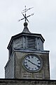 Old Court Clock and weathervane - geograph.org.uk - 6024373.jpg 1,280 × 1,919; 1.2 MB
-
 Old railway line^ - geograph.org.uk - 1227060.jpg 640 × 480; 431 KB
-
 Ordnance Survey 1GL Bolt - geograph.org.uk - 4414051.jpg 640 × 480; 97 KB
-
 Ordnance Survey 1GL Bolt - geograph.org.uk - 5186441.jpg 476 × 640; 112 KB
-
 Ordnance Survey Flush Bracket (S0436) - geograph.org.uk - 4414050.jpg 480 × 640; 114 KB
-
 Ordnance Survey One-Inch Sheet 117 Bala & Welshpool, Published 1947.jpg 10,907 × 12,776; 18.42 MB
-
 Ordnance Survey One-Inch Sheet 117 Bala & Welshpool, Published 1963.jpg 8,270 × 9,878; 13.45 MB
-
 Ordnance Survey One-Inch Sheet 50 Bala, Published 1921.jpg 11,828 × 8,844; 11.92 MB
-
 Ordnance Survey Sheet SH 93 Bala, Published 1953.jpg 7,187 × 7,800; 6.42 MB
-

-
 Our Lady of Fatima Catholic Church, Signage - geograph.org.uk - 6024507.jpg 1,280 × 651; 606 KB
-
 Our Lady of Fatima, Bala - geograph.org.uk - 2030231.jpg 640 × 480; 103 KB
-
 Our Lady of Fatima, Bala - geograph.org.uk - 2030237.jpg 480 × 640; 84 KB
-
 Our Lady of Fatima, Bala - geograph.org.uk - 6024497.jpg 1,280 × 1,055; 1.01 MB
-
 Plac hen Athrofa'r Annibynwyr, 1842-1869.jpg 6,000 × 4,000; 12.04 MB
-
 Plaques in Bala to Thomas Charles and Mari Jones.jpg 3,024 × 4,032; 2.21 MB
-
 Plas Coch Hotel - Bala - geograph.org.uk - 1810604.jpg 4,224 × 3,168; 2.21 MB
-
 Plas Coch Hotel, Bala - geograph.org.uk - 1426189.jpg 640 × 426; 67 KB
-
 Plas yn Dre.JPG 3,648 × 2,048; 1.87 MB
-
 Plas yr Acre, Tegid Street - geograph.org.uk - 462986.jpg 640 × 463; 94 KB
-
 Plas-yn-Dre, Including Railings to Forecourt.jpg 6,000 × 4,000; 11.04 MB
-
 Plas-yn-dre, Y Bala (the old home of Simon Llwyd) NLW3364035.jpg 516 × 463; 48 KB
-
 Plas-yn-Dre.jpg 6,000 × 4,000; 10.9 MB
-
 Pont y Bala - geograph.org.uk - 3132531.jpg 640 × 427; 82 KB
-
 Pont y Bala - geograph.org.uk - 463714.jpg 640 × 388; 57 KB
-
 Quiet resting place on Bronydd Fron Feuno (Bala Golf Club) - geograph.org.uk - 4678572.jpg 5,312 × 2,988; 4.44 MB
-
 Reflections on Bala lake - geograph.org.uk - 3556602.jpg 1,024 × 829; 79 KB
-
 Revd Evan Peter, Bala NLW3365209.jpg 359 × 545; 29 KB
-
 Roadside Petrol Station - geograph.org.uk - 553834.jpg 640 × 480; 66 KB
-
 Ronville, 7, Arenig Street, Bala.jpg 1,692 × 2,391; 2.2 MB
-
 Rosedale, 1, Arenig Street, Bala, Gwynedd.jpg 1,795 × 2,440; 2.22 MB
-
 Signs on Arran House - geograph.org.uk - 6025154.jpg 1,280 × 2,547; 2.16 MB
-
 Single File (7627976096).jpg 3,222 × 2,359; 5.03 MB
-

-
 Stone buildings in Bala - geograph.org.uk - 2004541.jpg 480 × 640; 81 KB
-
 Stone Circle At Bala - geograph.org.uk - 188136.jpg 640 × 480; 54 KB
-
 Stone cottages in Heol y Domen, Bala - geograph.org.uk - 2559921.jpg 4,000 × 3,000; 1.73 MB
-
 Stryd Fawr y Bala.jpg 1,424 × 1,088; 331 KB
-

-
 Tafarn y Llew Gwyn 1.JPG 3,648 × 2,048; 1.86 MB
-
 Texaco petrol filling station, Bala - geograph.org.uk - 1425940.jpg 640 × 426; 61 KB
-
 The A494 entering Bala - geograph.org.uk - 1427406.jpg 640 × 426; 82 KB
-
 The Arans and Bala (7628012522).jpg 3,588 × 2,523; 5.21 MB
-
 The Arans Beyond Llyn Maen Bras (7627965320).jpg 3,648 × 2,523; 4.95 MB
-
 The Arans From Above Bala (7260359098).jpg 3,648 × 2,736; 5.84 MB
-
 The Aykroyd Aran Factory, High Street - geograph.org.uk - 475400.jpg 640 × 480; 86 KB
-
 The Berwyns From Orddu (7627987810).jpg 3,648 × 2,390; 5.75 MB
-
 The Castle Mound, Bala - geograph.org.uk - 2553264.jpg 3,000 × 4,000; 2.51 MB
-

-
 The chapel with no name - geograph.org.uk - 478303.jpg 640 × 457; 100 KB
-
 The Former Bala Union Workhouse - geograph.org.uk - 5294349.jpg 1,600 × 1,200; 458 KB
-
 The gable end of Neuadd y Cyfnod - geograph.org.uk - 2032512.jpg 480 × 640; 104 KB
-
 The Goat Inn, Bala (7542470362).jpg 497 × 478; 63 KB
-
 The Goat, Bala (geograph 2032524).jpg 640 × 480; 86 KB
-
 The Goat, Bala - geograph.org.uk - 1425949.jpg 640 × 426; 74 KB
-

-
 The main entrance to Ysgol y Berwyn - geograph.org.uk - 465136.jpg 640 × 400; 53 KB
-
 The Ship, Bala - geograph.org.uk - 2031920.jpg 640 × 480; 66 KB
-
 The Ship, Bala - geograph.org.uk - 4835481.jpg 6,000 × 4,000; 7.62 MB
-

-
 The War Memorial in Bala - geograph.org.uk - 4820160.jpg 5,184 × 3,888; 6.07 MB
-
 The White Lion Royal Hotel, Y Bala NLW3361256.jpg 601 × 455; 58 KB
-
 Tomen y Bala - geograph.org.uk - 1843056.jpg 480 × 640; 106 KB
-
 Tomen y Bala - geograph.org.uk - 1843058.jpg 480 × 640; 70 KB
-
 Tomen y Bala - geograph.org.uk - 2134566.jpg 2,592 × 1,944; 1.35 MB
-
 Tomen y Bala - geograph.org.uk - 3129603.jpg 640 × 480; 72 KB
-
 Tomen y Bala - geograph.org.uk - 5294321.jpg 1,600 × 1,200; 413 KB
-
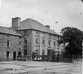
 Town and lake, Bala, Wales-LCCN2001703413.jpg 3,409 × 2,494; 2.37 MB
-
 Town and lake, Bala, Wales-LCCN2001703413.tif 3,409 × 2,494; 24.33 MB
-
 Tre'r Bala.jpg 1,376 × 1,008; 258 KB
-
 Tro Trwy'r Gogledd (page 104 crop).jpg 825 × 456; 54 KB
-
 Tro Trwy'r Gogledd (page 111 crop).jpg 1,137 × 984; 249 KB
-
 Tro Trwy'r Gogledd (page 122 crop).jpg 815 × 319; 43 KB
-
 Tro Trwy'r Gogledd (page 131 crop).jpg 1,248 × 943; 144 KB
-
 Tro Trwy'r Gogledd (page 132 crop).jpg 837 × 518; 64 KB
-
 Tro Trwy'r Gogledd (page 15 crop).jpg 1,212 × 940; 190 KB
-
 Tro Trwy'r Gogledd (page 16 crop).jpg 834 × 488; 58 KB
-
 Tro Trwy'r Gogledd (page 25 crop).jpg 1,247 × 932; 147 KB
-
 Tro Trwy'r Gogledd (page 35 crop).jpg 1,239 × 916; 135 KB
-
 Tro Trwy'r Gogledd (page 5 crop).jpg 1,239 × 932; 186 KB
-
 Tro Trwy'r Gogledd (page 54 crop).jpg 840 × 258; 43 KB
-
 Tro Trwy'r Gogledd (page 63 crop).jpg 1,233 × 879; 153 KB
-
 Tro Trwy'r Gogledd (page 84 crop).jpg 826 × 324; 54 KB
-
 Tro Trwy'r Gogledd (page 93 crop).jpg 1,235 × 923; 134 KB
-
 Tro Trwy'r Gogledd.pdf 747 × 939, 143 pages; 11.15 MB
-
 Unusual gateway Maes-hir farm - geograph.org.uk - 750290.jpg 640 × 480; 109 KB
-
 Urdd National Eisteddfod, Bala 1954.jpg 586 × 455; 41 KB
-
 View from Tommen Y Bala (1129361).jpg 1,000 × 719; 212 KB
-

-
 Wales Gwynedd Community Bala map.svg 512 × 524; 983 KB


_(8491973602).jpg)


.jpg)

.jpg)
.jpg)
.jpg)
.jpg)

_(2)_(geograph_4548016).jpg)
_(3)_-_geograph.org.uk_-_4548040.jpg)
_-_geograph.org.uk_-_4548014.jpg)


_Ria_-_geograph.org.uk_-_6158330.jpg)


.jpg)


.jpg)


.jpg)


.jpg)


.jpg)


.jpg)


.jpg)

.jpg)


.jpg)


.jpg)

.jpg)

_-_geograph.org.uk_-_4544243.jpg)
.jpg)


_-_geograph.org.uk_-_4414050.jpg)


_NLW3364035.jpg)


_-_geograph.org.uk_-_4678572.jpg)


.jpg)


_-_geograph.org.uk_-_4678558.jpg)


.jpg)
.jpg)
.jpg)

.jpg)


.jpg)
.jpg)


.jpg)
.jpg)
.jpg)
.jpg)
.jpg)
.jpg)
.jpg)
.jpg)
.jpg)
.jpg)
.jpg)


.jpg)
_-_geograph.org.uk_-_4678545.jpg)
.jpg)
.jpg)
.jpg)