Category:Bahnhof Bochum-Langendreer
Jump to navigation
Jump to search
| Object location | | View all coordinates using: OpenStreetMap |
|---|

Rhine-Ruhr S-Bahn station  | |||||
| Upload media | |||||
| Instance of |
| ||||
|---|---|---|---|---|---|
| Part of | |||||
| Location | Bochum, Arnsberg Government Region, North Rhine-Westphalia, Germany | ||||
| Street address |
| ||||
| Architectural style | |||||
| Operator | |||||
| Inception |
| ||||
| Date of official opening |
| ||||
| official website | |||||
 | |||||
Media in category "Bahnhof Bochum-Langendreer"
The following 21 files are in this category, out of 21 total.
-
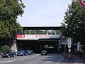 Bahnhof Bochum Langendreer.jpg 1,600 × 1,200; 952 KB
-
 Bahnhofsschild Bochum Langendreer 190219.jpg 1,928 × 1,085; 475 KB
-
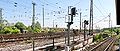 Bf Bochum-Langendreer Rangierfelder Ost.jpg 5,444 × 2,292; 3.15 MB
-
 Bochum Langendreer - Hauptstraße - Bahnhof Bochum-Langendreer 01 ies.jpg 5,616 × 3,744; 7.25 MB
-
 Bochum Langendreer - Hauptstraße - Bahnhof Bochum-Langendreer 02 ies.jpg 5,616 × 3,744; 10.98 MB
-
 Bochum Langendreer - Hauptstraße - Bahnhof Bochum-Langendreer 03 ies.jpg 5,616 × 3,744; 6.85 MB
-
 Bochum Langendreer - Hauptstraße - Bahnhof Bochum-Langendreer 04 ies.jpg 5,616 × 3,744; 7.55 MB
-
 Bochum Langendreer - Hauptstraße - Bahnhof Bochum-Langendreer 05 ies.jpg 5,616 × 3,744; 6.21 MB
-
 Bochum Langendreer - Hauptstraße - Bahnhof Bochum-Langendreer 06 ies.jpg 5,616 × 3,744; 11.45 MB
-
 Bochum Langendreer - Hauptstraße - Bahnhof Bochum-Langendreer 07 ies.jpg 5,616 × 3,744; 11.77 MB
-
 Bochum Langendreer - Hauptstraße - Bahnhof Bochum-Langendreer 08 ies.jpg 3,744 × 5,616; 10.96 MB
-
 Bochum Langendreer - Hauptstraße - Bahnhof Bochum-Langendreer 09 ies.jpg 5,616 × 3,744; 10.18 MB
-
 Bochum Langendreer - Hauptstraße - Bahnhof Bochum-Langendreer 10 ies.jpg 5,616 × 3,744; 9.59 MB
-
 DB Saads.jpg 1,628 × 2,420; 680 KB
-
 J33 301 Bf Langendreer S, ET 506.jpg 5,934 × 3,956; 4.52 MB
-
 J33 302 Bf Langendreer S, ET 506.jpg 5,600 × 3,733; 4.36 MB
-
 J33 304 Bf Langendreer S, ET 506.jpg 5,604 × 3,736; 5.05 MB
-
 J33 356 Bf Bo-Langendreer Bogestra, ET 116.jpg 5,661 × 3,774; 3.95 MB
-
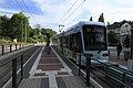
 Straßenbahnhaltestelle vor dem Haltepunkt Bochum-Langendreer.jpg 4,854 × 2,415; 1.87 MB
-
 TW 105 in Langendreer Bf.jpg 4,528 × 3,328; 9.7 MB
-
 TW 110 in Langendreer Bf.jpg 4,512 × 3,336; 9.66 MB


Categories:
- Train stations in Bochum
- Langendreer
- Hauptstraße (Bochum)
- S-Bahn Rhein-Ruhr stations
- Dortmund–Duisburg railway line
- Stadtbahn Rhein-Ruhr stations
- Stadtbahn Rhein-Ruhr stations by name
- Interchange stations of Stadtbahn Rhein-Ruhr
- Art Nouveau train stations
- Osterath–Dortmund Süd railway line
- S1 (S-Bahn Rhein-Ruhr)