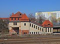
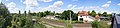
Category:Bahnhof Berlin-Pankow-Heinersdorf
Jump to navigation
Jump to search
| Object location | | View all coordinates using: OpenStreetMap |
|---|

Station of the S-Bahn Berlin, Germany  | |||||
| Upload media | |||||
| Instance of | |||||
|---|---|---|---|---|---|
| Part of | |||||
| Named after | |||||
| Location | Pankow, Berlin, Germany | ||||
| Architectural style | |||||
| Transport network | |||||
| Architect |
| ||||
| Owned by | |||||
| Operator | |||||
| Has part(s) |
| ||||
| Date of official opening |
| ||||
| Elevation above sea level |
| ||||
| Connecting line | |||||
| Adjacent station |
| ||||
| Interchange station |
| ||||
| official website | |||||
 | |||||
This is the category of the Berliner Kulturdenkmal (cultural monument) with the ID 09050600 (Wikidata)
|
Subcategories
This category has only the following subcategory.
S
Media in category "Bahnhof Berlin-Pankow-Heinersdorf"
The following 68 files are in this category, out of 68 total.
-
 Abandoned City Buildings (Unsplash).jpg 4,896 × 3,264; 9.33 MB
-
 Bahnhof - panoramio (22).jpg 2,832 × 2,128; 1.25 MB
-
 Bahnhof Pankow-Heinersdorf - alter Zugang.jpg 5,184 × 3,456; 4.51 MB
-
 Bahnhof Pankow-Heinersdorf 01279.JPG 4,912 × 3,264; 6.97 MB
-
 Bahnhof Pankow-Heinersdorf 01280.JPG 4,912 × 3,264; 6.94 MB
-
 Bahnhof Pankow-Heinersdorf 01281.JPG 4,912 × 3,264; 7.22 MB
-
 Bahnhof Pankow-Heinersdorf 01282.JPG 4,912 × 3,264; 7.25 MB
-
 Bahnhof Pankow-Heinersdorf 01285.JPG 4,912 × 3,264; 7.5 MB
-
 Bahnhof Pankow-Heinersdorf 01286.JPG 4,912 × 3,264; 7.22 MB
-
 Bahnhof Pankow-Heinersdorf 1278.JPG 4,912 × 3,264; 7.84 MB
-
 Bahnhofshalle - panoramio (1).jpg 2,832 × 2,128; 2.06 MB
-
 Berlin - S-Bahnhof Pankow-Heinersdorf (13456322635).jpg 4,096 × 2,683; 5.52 MB
-
 Berlin - S-Bahnhof Pankow-Heinersdorf (13456335955).jpg 3,072 × 4,096; 5.7 MB
-
 Berlin - S-Bahnhof Pankow-Heinersdorf (13456395145).jpg 2,973 × 4,037; 6.22 MB
-
 Berlin - S-Bahnhof Pankow-Heinersdorf (13456424905).jpg 4,096 × 3,072; 6.95 MB
-
 Berlin - S-Bahnhof Pankow-Heinersdorf (13456450565).jpg 4,096 × 3,072; 5.42 MB
-
 Berlin - S-Bahnhof Pankow-Heinersdorf (13456496693).jpg 3,027 × 4,030; 5.94 MB
-
 Berlin - S-Bahnhof Pankow-Heinersdorf (13456553163).jpg 3,072 × 4,096; 5.09 MB
-
 Berlin - S-Bahnhof Pankow-Heinersdorf (13456667354).jpg 3,072 × 4,096; 2.5 MB
-
 Berlin - S-Bahnhof Pankow-Heinersdorf (13456709714).jpg 4,042 × 3,008; 6.6 MB
-
 Berlin - S-Bahnhof Pankow-Heinersdorf (13456724614).jpg 3,027 × 4,050; 5.94 MB
-
 Berlin - S-Bahnhof Pankow-Heinersdorf (13456767284).jpg 4,096 × 3,072; 5.73 MB
-
 Berlin - S-Bahnhof Pankow-Heinersdorf - Linien S2,S8 (6807820376).jpg 3,000 × 4,000; 2.35 MB
-
 Berlin - S-Bahnhof Pankow-Heinersdorf - Linien S2,S8 (6807827614).jpg 4,000 × 3,000; 2.63 MB
-
 Berlin - S-Bahnhof Pankow-Heinersdorf - Linien S2,S8 (6807830864).jpg 4,000 × 3,000; 2.37 MB
-
 Berlin - S-Bahnhof Pankow-Heinersdorf - Linien S2,S8 (6807834254).jpg 4,000 × 3,000; 2.56 MB
-
 Berlin - S-Bahnhof Pankow-Heinersdorf - Linien S2,S8 (6807847716).jpg 3,000 × 4,000; 2.58 MB
-
 Berlin - S-Bahnhof Pankow-Heinersdorf - Linien S2,S8 (6807850858).jpg 4,000 × 3,000; 2.31 MB
-
 Berlin - S-Bahnhof Pankow-Heinersdorf - Linien S2,S8 (6807856422).jpg 4,000 × 3,000; 2.34 MB
-
 Berlin - S-Bahnhof Pankow-Heinersdorf - Linien S2,S8 (6807862666).jpg 4,000 × 3,000; 2.21 MB
-
 Berlin - S-Bahnhof Pankow-Heinersdorf - Linien S2,S8 (6807865876).jpg 3,000 × 4,000; 2.55 MB
-
 Berlin - S-Bahnhof Pankow-Heinersdorf - Linien S2,S8 (6807868758).jpg 3,000 × 4,000; 2.34 MB
-
 Berlin - S-Bahnhof Pankow-Heinersdorf - Linien S2,S8 (6807871794).jpg 3,000 × 4,000; 2.3 MB
-
 Berlin - S-Bahnhof Pankow-Heinersdorf - Linien S2,S8 (6807875076).jpg 4,000 × 3,000; 2.54 MB
-
 Berlin - S-Bahnhof Pankow-Heinersdorf - Linien S2,S8 (6807884814).jpg 3,000 × 4,000; 2.33 MB
-
 Berlin - S-Bahnhof Pankow-Heinersdorf - Linien S2,S8 (6953923827).jpg 4,000 × 3,000; 2.34 MB
-
 Berlin - S-Bahnhof Pankow-Heinersdorf - Linien S2,S8 (6953927091).jpg 3,000 × 4,000; 2.39 MB
-
 Berlin - S-Bahnhof Pankow-Heinersdorf - Linien S2,S8 (6953934085).jpg 4,000 × 3,000; 2.5 MB
-
 Berlin - S-Bahnhof Pankow-Heinersdorf - Linien S2,S8 (6953947761).jpg 3,000 × 4,000; 2.42 MB
-
 Berlin - S-Bahnhof Pankow-Heinersdorf - Linien S2,S8 (6953950963).jpg 4,000 × 3,000; 2.46 MB
-
 Berlin - S-Bahnhof Pankow-Heinersdorf - Linien S2,S8 (6953954283).jpg 3,000 × 4,000; 2.5 MB
-
 Berlin - S-Bahnhof Pankow-Heinersdorf - Linien S2,S8 (6953969691).jpg 4,000 × 3,000; 2.46 MB
-
 Berlin - S-Bahnhof Pankow-Heinersdorf - Linien S2,S8 (6953988103).jpg 3,000 × 4,000; 2.31 MB
-
 Berlin - S-Bahnhof Pankow-Heinersdorf - Linien S2,S8 (6953991791).jpg 4,000 × 3,000; 2.36 MB
-
 Berlin S-Bahn Bhf Pankow-Heinersdorf (S08 0321).jpg 5,899 × 3,931; 8.05 MB
-
 Durchgang verboten - DB.jpg 5,184 × 3,456; 4.93 MB
-
 Fenster - panoramio (9).jpg 2,832 × 2,128; 1.24 MB
-
 Fenster 1 - panoramio.jpg 2,832 × 2,128; 1.71 MB
-
 Fenster 2 - panoramio.jpg 2,832 × 2,128; 1.94 MB
-
 Op de Drehscheibe van Pankow Lokschuppen.JPG 4,592 × 3,056; 6.28 MB
-
 Pankow Lokschuppen bebossing.JPG 4,592 × 3,056; 8.16 MB
-
 Pankow Lokschuppen close up.JPG 4,592 × 3,056; 5.16 MB
-
 Pankow Lokschuppen dak.JPG 4,592 × 3,056; 6.81 MB
-
 Pankow Lokschuppen gezien vanaf Bahnhof Berlin-Pankow-Heinersdorf.JPG 4,592 × 3,056; 5.78 MB
-
 Pankow Lokschuppen gezien vanaf de brug van Pankow-Heinersdorf.JPG 4,592 × 3,056; 5.94 MB
-
 Pankow Lokschuppen van binnen.JPG 4,592 × 3,056; 4.5 MB
-
 Pankow Lokschuppen van de binnenkant (hoofdgedeelte).JPG 4,592 × 3,056; 4.88 MB
-
 Pankow Lokschuppen zijkant.JPG 4,592 × 3,056; 8.72 MB
-
 Pankow Lokschuppen.jpg 1,980 × 1,350; 499 KB
-
 Pankow Prenzlauerpromenade Heinersdorf S-Bahn.jpg 3,609 × 2,684; 3.56 MB
-
 Pankow-Heinersdorf (5303492142).jpg 2,999 × 1,962; 1.73 MB
-
 Panorama Bahnhof Pankow-Heinersdorf.jpg 8,603 × 2,000; 5.62 MB
-
 Rotes Signal - Pankow-Heinersdorf.jpg 3,456 × 5,184; 4.33 MB
-
 S-bahn richting Bahnhof Berlin-Pankow-Heinersdorf.JPG 4,592 × 3,056; 7.41 MB
-
 S-Bahnhof Pankow-Heinersdorf, Berlin.jpg 1,080 × 1,080; 426 KB
-
 Timeline - panoramio.jpg 2,128 × 2,832; 1.58 MB
-
 Vergessen - panoramio.jpg 2,832 × 2,128; 2.03 MB
-
 Winter (4318789266).jpg 2,834 × 1,886; 596 KB
.jpg)
.jpg)


.jpg)
.jpg)
.jpg)
.jpg)
.jpg)
.jpg)
.jpg)
.jpg)
.jpg)
.jpg)
.jpg)
.jpg)
.jpg)
.jpg)
.jpg)
.jpg)
.jpg)
.jpg)
.jpg)
.jpg)
.jpg)
.jpg)
.jpg)
.jpg)
.jpg)
.jpg)
.jpg)
.jpg)
.jpg)
.jpg)
.jpg)
.jpg)
.jpg)
.jpg)
.jpg)

.jpg)


.JPG)


.jpg)


.jpg)
Categories:
- Cultural heritage monuments in Berlin-Pankow
- Train stations in Berlin-Pankow
- S-Bahn stations in Berlin
- Train stations at Berlin–Szczecin railway line
- Railway stations opened in 1893
- Stations at line S2 (Berlin S-Bahn)
- Pasewalker Straße (Berlin-Pankow)
- Prenzlauer Promenade (Berlin-Pankow)
- Stations at line S8 (Berlin S-Bahn)